Showing posts with label flowers. Show all posts

Thursday, February 11, 2021

Winter Hike in Powhatan State Park

 I've hiked a number of times in the last few months at Powhatan State Park, about a 40 minute drive from my home.  I hiked a 7.5 mile loop yesterday, and decided to write about it.  The loop was hiked clockwise, starting and ending at the red circle, where a picnic shelter and bathrooms are located on the drive in.


This trail - actually about 5 or 6 different trails - goes through open areas,

as well as forests.

About a half mile of my route went along the James River, where I came across these

raccoon tracks in the mud.  I saw plenty of deer tracks as well.

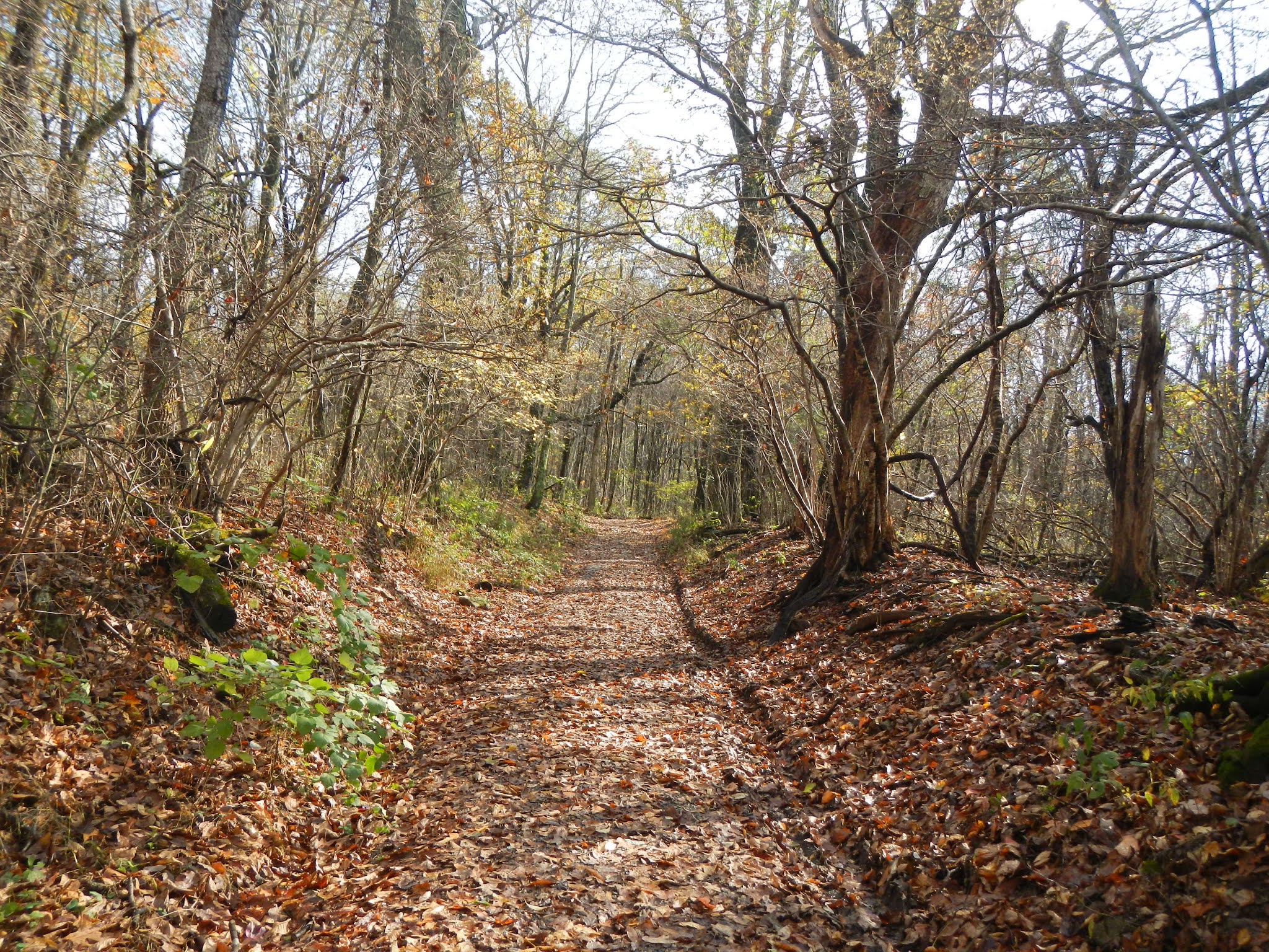
Moving up from the river, the trail goes through thick hardwood forest.

Fungi are hard at work breaking down dead wood and returning its elements and molecules to the ecosystem.

It's always a bit sad to see small graveyards in the forest.

I saw and heard a number of birds, including downy woodpecker, pileated woodpecker, red-bellied woodpecker, red-tailed hawk, red-shouldered hawk, white-breasted nuthatch, blue jay, Carolina chickadee, Carolina wren, and mourning dove.  The only one I managed to get a photo of was this turkey vulture.

I really like the nuthatches.  I could not get a good photo, so I did a sketch of the white-breasted nuthatch.

Moving back into forest for the last couple of miles of the hike, I crossed this stream using the logs.  The park service should put in a bridge.

This trail is named the Pine Trail.  Can you guess why?

In this stand of trees were a number of dead pine with all the bark missing.  These snags become important wildlife habitat for a variety of creatures, starting with woodpeckers excavating cavities and hunting for insects.

Trails in the state parks are very well marked.

The Cabin Trail leaves the Pine Trail and drops sharply to a forest bottom with a nice stream running through it (with a nice, fairly new bridge to cross the stream).

Upstream a bit, I found this great skunk cabbage flower blooming.  This plant is one of the earliest plants to flower in the woods.  They are always found in wet areas, and generate their own heat to bloom in mid-winter.  The grown plant is very pungent, but a number of animals, such as deer and bear, eat the shoots when they are young.  Many kinds of animals also eat the seeds.

About a mile from the end of the hike is the remains of a cabin, which gives this trail its name.

I always enjoy the trails in this park.  I was supposed to join a group for a hike but slept so poorly that I didn't get up to join them.  Instead, doing this hike solo turned out to be a good alternative.


Wednesday, November 11, 2020

Back in Shenandoah

 It's taken me nearly six months to get past my gall bladder issues, but I finally got my gallbladder out the end of September and started doing some easy and short hikes a couple of weeks later.  About 10 days ago, I felt like I could handle a basic hike in Shenandoah, so I hiked about five miles, most of it on the Gasline Fire Road.  This was a new trail to me, and so it counts towards my SNP 500 quest which got rudely suspended last March after I had coronary stents placed.

I don't think that I will post every hike here, at least not the very short ones, but I will try to keep my blog going now that I am back on the trails.  I've only hiked about 65 miles this entire year!

When I got to the park, it was pouring.  My radar app had showed a band of rain that looked like my hiking area would be on the border of it, but the rain area moved westward just enough to give a soaking and steady rain.  So, I hung out in my car and relaxed for about an hour waiting to the rain to pass, which it did.  Here are some photos from the Gasline hike:

This being an old fire road, the going was pretty easy.  I lost and gained about 700 feet over about 2.3 miles each way.


There was some kind of a weather station party way down the hike.

Now and again, I had some partial views, but most of the hike was through forest.

More nice, easy walking ahead of me, although the fall foliage was about a week past peak.


Near my turn around point, I had to wade across this stream.  There was nothing to cross on, but I was prepared and had brought my water shoes.


The water is cold in November, but I only had to hike another 500 feet or so to the park boundary, then I got to turn around, cross back over, and put my boots back on.

On the hike back up, the skies were beginning to clear up.

Sassafras leaves are so pretty in the fall.

One doesn't see many flowers in November, but this common self heal was blooming.


After getting back to my car, I ate lunch, and then drove a mile or so to my next hike, the Bucks Elbow Fire Road.  This is a very short hike, about 0.3 miles out and back.  It's a pleasant fire road with maybe 100 feet of elevation gain from the parking lot.

Shenandoah National Park boundary, my second of the day.

It feels good to be hiking again!  What a year!

Wednesday, August 26, 2020

Updating my Nature Journal

 Nearly four years ago, a friend of mine with Virginia Master Naturalists gave a short "class" on keeping a nature journal.  The class gave us a journal with about 60 or so pages, and a set of 12 watercolor pencils.  I started writing in it, and although I'd not drawn anything since elementary school art class (just after the Civil War), I tried a few sketches of birds and plants.  These were mediocre at best, dreadful at worst, and I kind of put the journal aside, more or less for three years.  I did, however, make written observations from time to time.

With the pandemic and my forced quarantine for health reasons, my friend said "why don't you try again?"  She brought me some more stuff, and I finally got to the point in July where I wasn't feeling sick and in pain pretty much constantly, so I opened up the journal and started adding drawings.  My first sketch was a blackberry plant in my backyard that the catbirds and robins loved to eat from, and it turned out pretty good (well, my opinion.)  It's the first thing I tried to draw in three years, plus I did it on my birthday!


I went back to my Shenandoah experiences and did a few sketches of things I encountered while hiking.  And I also added many entries and sketches of things I see in my backyard.  Bottom line - in just about a month, I had filled the final 1/3 of the journal (it had taken me 3.5 years to do the first two thirds), and I've started a second nature journal, one that is not only larger with 100 pages to fill, but each page is nearly twice the size as those in my first one.

So I thought I'd share a few of the sketches I made of things I saw while hiking, mostly in Shenandoah National Park.

Here is a fungus (Heartrot fungus) that I saw on a rotten log in the park while leading Road Scholar hikes last July.


While leading Road Scholar hikes in July and October, I saw various insects on milkweed plants, and sketched them in late July.

I also had enjoyed finding a monarch caterpillar in October on one of the hikes, and had seen a monarch on a milkweed flower in the July hikes, so I decided to sketch the life cycle of the monarch butterfly.


During the October hikes, I was delighted to find not only some small American chestnut trees, but also some chestnuts.  This tree was once the most common tree in the southern Appalachians until the Chinese blight wiped them out.  One in three trees was once a chestnut.  I also saw a bumblebee getting a late nectar snack from a thistle.  So I added these to my nature journal.


Finally, for now from Shenandoah, a couple of springs ago, I was hiking in the park with very few signs of spring at higher elevations, but at the lower elevations, I saw a dwarf iris in bloom with a wintergreen just next to it.  So I added these to the journal where I had written about that hike.

Several years ago, I took my granddaughter backpacking in Michigan.  I'd made a few sketches of the forest and lake in the field, but decided to add this sketch last month of some painted turtles on a log near our campsite.


Monday, March 23, 2020

Oh, What a Beautiful Moorman (River)!

About two weeks ago, I set out to complete hiking on the Moorman River Trail in Shenandoah.  The trail is about 9.5 miles long and runs along the eastern side of the park, following the North Fork and the South Fork of the Moorman River, a beautiful small river with waterfalls and trout.  I'd hiked part of it in a couple of earlier hikes, but wanted to complete it.  My original goal had been to do about a 20 mile circuit and camp out along the river.  However, about a mile of this trail would have been through private property, and I had heard that the owners had posted their land, so I decided to do the remaining miles as two out-and-back day hikes.  Each hike was about 2 - 2.5 miles, each way, for a total distance of about 9 miles.

Here's a map.  I started and ended at the purple circle, the Sugar Hollow Reservoir.  The North Fork, which I did first) involved hiking north (pink arrows), and the South Fork involved hiking south (sky blue arrows).  You can see the Appalachian Trail marked to the west.  That would have been part of the longer 20 mile loop, and was the same portion of the AT that I had hiked with the group just a few days earlier.

Hiking the two trails both involved multiple river crossings.  Most of these could be rock-hopped, but in a couple of spots, it looked like I would be setting myself up for a potential fall, so I waded.  Here is the first crossing, on the North Fork:

The trail was very pleasant.  I saw a few hikers, a few moms or couples with their kids doing a casual hike, and a number of anglers trying to catch the wily brook trout.

Here is the second river crossing, just a hundred yards or so after the first.

And here is the third crossing point, which I decided to wade for safety reasons.  It was quite cold, and of course, I waded it going back as well.


My goal was to reach Big Branch Falls, which I had approached from the north a couple of years ago.  There is a water slide at this point.

And there is a beautiful waterfall...

And a deep pool that would be great for a swim on a hot summer day.

Here is another view of the waterfall.

From here, I back-tracked to my car.  When I had arrived, about 9:00, the parking lot was already filling up, but there was plenty of space left to park.  Now, not so much.  People were parking all over the place!  I started hiking south.  Like the earlier hike, this would involve about 2 - 2.5 miles each way and 400-500 feet of climbing, and several stream crossings, including wading one time.  At the beginning, I climbed steeply for a while and had this view of the South Fork Moorman River through the forest.

Along the trail were some old homesite ruins.  I always reflect on what their lives must have been like - incredibly difficult, I would imagine, but hopefully with some joy along the way.

Look at the quality of the work in this stone wall, which must have been part of a cabin or out-building at some point.

By walking steeply down from the trail, I reached this small cascade and swimming hole.  Someone told me that it is called "Blue Hole."  It was a pleasant day, but not pleasant enough to be tempted to take a swim.

This trail was very easy to hike.

Spring is early this year, as noted by all the wildflowers on March 8.


When I got back to my car, the parking lot - and the road  coming in along the reservoir - were jammed full of cars.  I could barely get my car out.  On the two hour drive home, I stated making plans for my next hikes.  I was thinking that in one really long day, I could complete the remaining trail miles in the Southern District of the park.  But life has a way of interfering , as I learned a couple of days later.  Did you ever hear the saying "If you want to make God laugh, tell Him your plans?"

More about that next time.