Showing posts with label national parks. Show all posts

Wednesday, November 11, 2020

Back in Shenandoah

 It's taken me nearly six months to get past my gall bladder issues, but I finally got my gallbladder out the end of September and started doing some easy and short hikes a couple of weeks later.  About 10 days ago, I felt like I could handle a basic hike in Shenandoah, so I hiked about five miles, most of it on the Gasline Fire Road.  This was a new trail to me, and so it counts towards my SNP 500 quest which got rudely suspended last March after I had coronary stents placed.

I don't think that I will post every hike here, at least not the very short ones, but I will try to keep my blog going now that I am back on the trails.  I've only hiked about 65 miles this entire year!

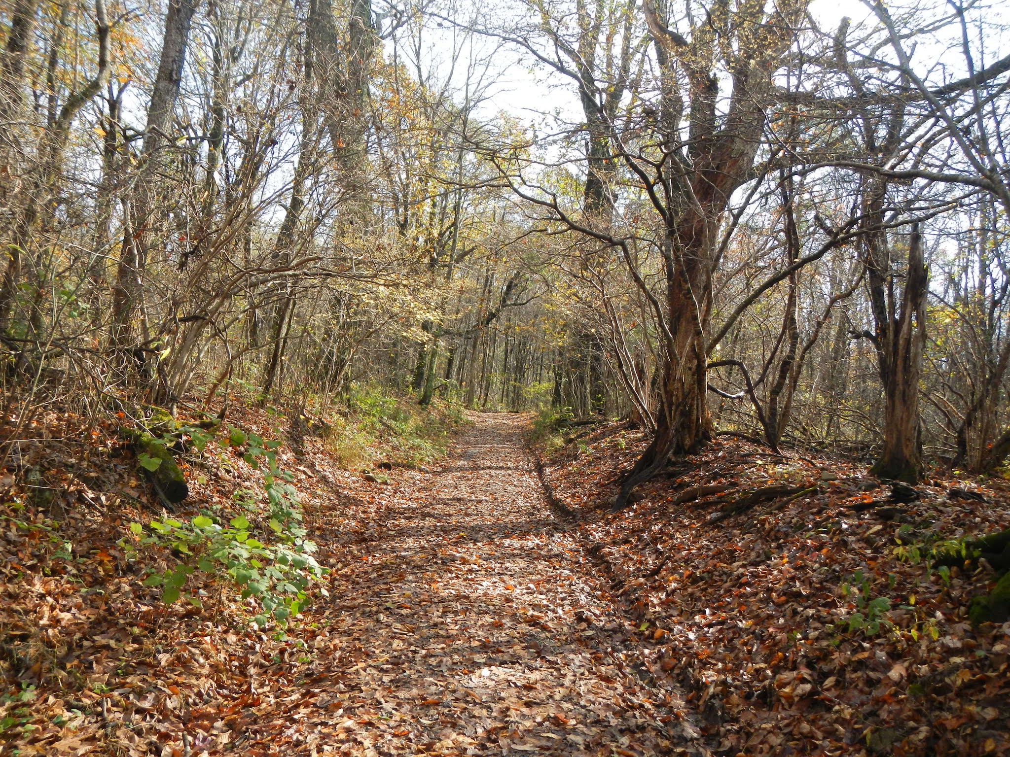
When I got to the park, it was pouring.  My radar app had showed a band of rain that looked like my hiking area would be on the border of it, but the rain area moved westward just enough to give a soaking and steady rain.  So, I hung out in my car and relaxed for about an hour waiting to the rain to pass, which it did.  Here are some photos from the Gasline hike:

This being an old fire road, the going was pretty easy.  I lost and gained about 700 feet over about 2.3 miles each way.


There was some kind of a weather station party way down the hike.

Now and again, I had some partial views, but most of the hike was through forest.

More nice, easy walking ahead of me, although the fall foliage was about a week past peak.


Near my turn around point, I had to wade across this stream.  There was nothing to cross on, but I was prepared and had brought my water shoes.


The water is cold in November, but I only had to hike another 500 feet or so to the park boundary, then I got to turn around, cross back over, and put my boots back on.

On the hike back up, the skies were beginning to clear up.

Sassafras leaves are so pretty in the fall.

One doesn't see many flowers in November, but this common self heal was blooming.


After getting back to my car, I ate lunch, and then drove a mile or so to my next hike, the Bucks Elbow Fire Road.  This is a very short hike, about 0.3 miles out and back.  It's a pleasant fire road with maybe 100 feet of elevation gain from the parking lot.

Shenandoah National Park boundary, my second of the day.

It feels good to be hiking again!  What a year!

Monday, December 9, 2019

Four Hikes, and a Bear

I'm always happy to hit the trails in the mountains, but last Tuesday, I was a little less excited than usual.  My goal was strictly to hike several short trails to check them off my SNP 500 list.  None of them seemed overly amazing - they were all short sections, out and back, repeating the same ground each time.  Here are the trails I hiked, for a total of about 10 miles, with a loss and gain of 1,800 - 2,000 feet:

Eaton Hollow
Simmons Gap Fire Road West (Beldor Road)
Pinefield Hut
Browns Gap Fire Road (east of Doyles River)

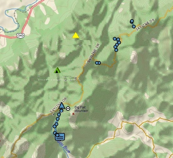
On this track, they are located in order north to south to give an idea of their locations, all in the Southern District of Shenandoah National Park:


Yet, despite my lack of enthusiasm, each of these four little hikes yielded a good memory.  On Eaton Hollow, I hiked to a cool PATC camp building.  On the Simmons Gap hike, I encountered two ladies hiking and had an enjoyable chat.  On the hike to the hut, I enjoyed a nice lunch break at a picnic table.  And on the Browns Gap hike, I encountered a bear close up, my first great look at a bear in a long time.

The Eaton Hollow hike was about a half mile each way.  There was a nice view right at the start, followed by a mostly gentle descent to the camp area:

At the turn-around point, I reached the Schairer Trail Center of the Potomac Appalachian Trail Club (PATC).  I don't know what they do here, but doesn't it look inviting?

Here is the view from the front porch:

This photo gives a good idea of the setting.

Next, I drove a few miles south to Simmons Gap, where these three deer gave me a look over.

I started hiking downhill along the fire road, heading west.

On the way back up, against all expectations, I met two ladies hiking down.  I'll call them K and S.  Why in the world was anyone else on this trail on a cold Tuesday morning?  Well, the logical explanation is that they were also attempting to hike every trail in the park, and that was the case.  We had a very nice chat. K wore a cap with the pink breast cancer symbol, so I asked if she was a survivor, which she was.  I told her that I was a 17 year Hodgkin's lymphoma survivor, and she said that her husband has non-Hodgkin's lymphoma.  I told her about walking the 3-Day 60 mile Susan Komen walk in 2011 (in memory of my sister, Ann, who died from breast cancer that year), and also about doing marathons and half-marathons for Team in Training to raise money for blood cancer research.  And we also talked about hiking in the park, and working towards the SNP 500.  I think K was getting pretty close to finishing, and S - while not doing the formal miles - likes to help her and hike with her.  I still have about 200 miles to go.  I enjoyed meeting fellow hikers out there and getting to talk.  They were the only people I saw all day.

Next, I drove south a bit and hiked the short distance into the Pinefield Hut, a perfect spot for lunch.

Finally, there was time for one last hike, the east side of the Browns Gap Fire Road.  I'd been by this spot at least a dozen times on my Doyles River hikes, including exactly a week ago with my friend Doug.  I left my car at the Doyles River trailhead, and dropped almost 700 feet like a stone to get to the fire road junction,

this time turning east instead of west.  The trail went almost two miles from here and dropped another 500 feet, although at a more pleasant pace.

Could there be a bear in this cave?  Maybe.  Did I stick my head in there to find out?  No., I did not!

 This was a very pleasant old road to hike along.

On one side was the steep Doyles River Valley.  I could hear the falls far below, and even crossed the Doyles River - easily rock hopped - as it flowed over the fire road.

I got some nice views across the valley at times.

The end of the road at the park boundary!  Check off one more trail towards the SNP 500.

On the hike back up, I got a treat.  I was trying to send my wife a message on the inReach but it was not going through.  So on that steep section, near the junction of the trail to the Doyles River Cabin, I stopped to get the message sent.  While I was stopped, I heard the sound of an animal in the leaves.  Squirrel?  No, something larger.  I waited and waited, and suddenly, there was a young bear about 100 feet off the trail.  I spent a while there, trying to get a good look for a photo.  Most of the time, he was partially hidden behind vegetation, but eventually, I got some good shots.  He was cautious but not fearful.  Up through the woods by the cabin, I could hear two men calling a dog and the dog barking.  The bear didn't seem concerned, and eventually ran across the trail about 50 feet from me and headed up towards the cabin.  Hopefully, he was not getting food from a human source.  This bear looked to me to be a second year cub, meaning his mom had recently kicked him out and he was having to make his own way in the world for the first time.  Seeing a bear is always a thrill!  This was my first sighting since June, and my first while hiking solo in several years.  If I hadn't stopped at that exact spot to send the message, I never would have seen this animal.


What a fun day in the mountains!  Meet some wonderful hikers and have a nice chat, and see a bear!  And check off about 4 more miles towards my SNP 500!  I'd call that a pretty good day!

Thursday, December 6, 2018

Two Shenandoah Hikes

I've done a fair amount of hiking since August, but was amazed to realize that I had not hiked in Shenandoah National Park since August 4!  Time to rectify that, and add a few miles to my "SNP 500" quest, so I hiked a couple areas that I had never been to.  The weather was cool but not cold, and the trails were clear.  The southern part of the park has been hammered by ice and wind storms, the Skyline Drive there was closed, and trees are down all over, but the central part of the park is fine right now.  Here is where I hiked:

The blue arrow points to the Skyline Drive in the central third of the park.  I entered at Route 33 (Swift Run Gap), and did a section of the Appalachian Trail and the Saddleback Mountain Trail (red circle) and a trail called the Meadows School Trail (blue circle).  The first hike was about 8 miles total, and the latter was 1.5 miles each way for a total of 3 miles.  My SNP 500 goal is now below 300 miles to go.  Unfortunately, my inReach is not producing a clear track map right now for some reason, so I am not showing the tracks for the hikes - they are inaccurate.

The trees are now totally bare.  This is the Appalachian Trail near Swift Run Gap.  Along the hike, I saw a pileated woodpecker and a white-breasted nuthatch.  Other than that, there was little wildlife to be seen or heard for most of the hike.

One thing I like about this time of the year is that you can see a long way through the woods, and even distant views.

I hiked to Route 33 at Swift Run Gap, then turned around.  It was a pretty easy hike, maybe losing and gaining about 700 feet over about four miles each way.

The Saddleback Mountain Trail leaves the AT and runs east of that mountain.  I ran into two women doing a day hike in this area, but they were the only people I saw over more than 11 miles of hiking this past Monday.

A short distance before joining the AT again, I came on this locked shelter.  The Potomac Appalachian Trail Club uses this to camp out when doing trail maintenance in this area.

The shelter is locked but I saw no harm in having hot chocolate and lunch here.  I got water from the spring, got out my Jetboil stove, and made a nice, hot drink.  Nothing like hot chocolate on a chilly day up in the mountains.  I saw a deer moving through the forest, and shortly after I started hiking again, two nice does ran right across the trail in front of me.  They were too quick for me to snag a photo, but that was okay, because an even more interesting wildlife encounter was ahead.

After getting back to the car at the South River Falls Picnic Area, I headed north on the Skyline Drive for about 5-6 miles for the next hike.  Ahead on the road, I saw a black animal in the middle of the road.  No doubt what it was, so I slowed down - I always go the speed limit of 35 in the park so I am less likely to kill an animal, but I see lots of people doing 50-55 - and got my camera ready.  As I pulled up, the small bear, which appeared to be a yearling, left the road and climbed up on the stone wall along the side.  It looked right at me!

Then, it turned and jumped off the wall on the other side.  It was small enough that I couldn't see it at that point.

The Meadows School Trail really doesn't have anything remarkable to recommend hiking it, other than I have to hike every trail and fire road in the park to earn my patch, so it seemed like a good day to just check this trail off the list.  It was 1.5 miles downhill about 900 feet, then 1.5 miles back uphill to the car.  Nothing special, other than any day we are healthy and alive, and out in the mountains is special.

This trail is not super-well maintained.  Note the deep ruts from storm runoff.  As a footnote, I brought my river shoes today and had no problem rock-hopping the few streams that I encountered, unlike my other recent hikes here where I was always having to wade across something, usually without my river shoes.

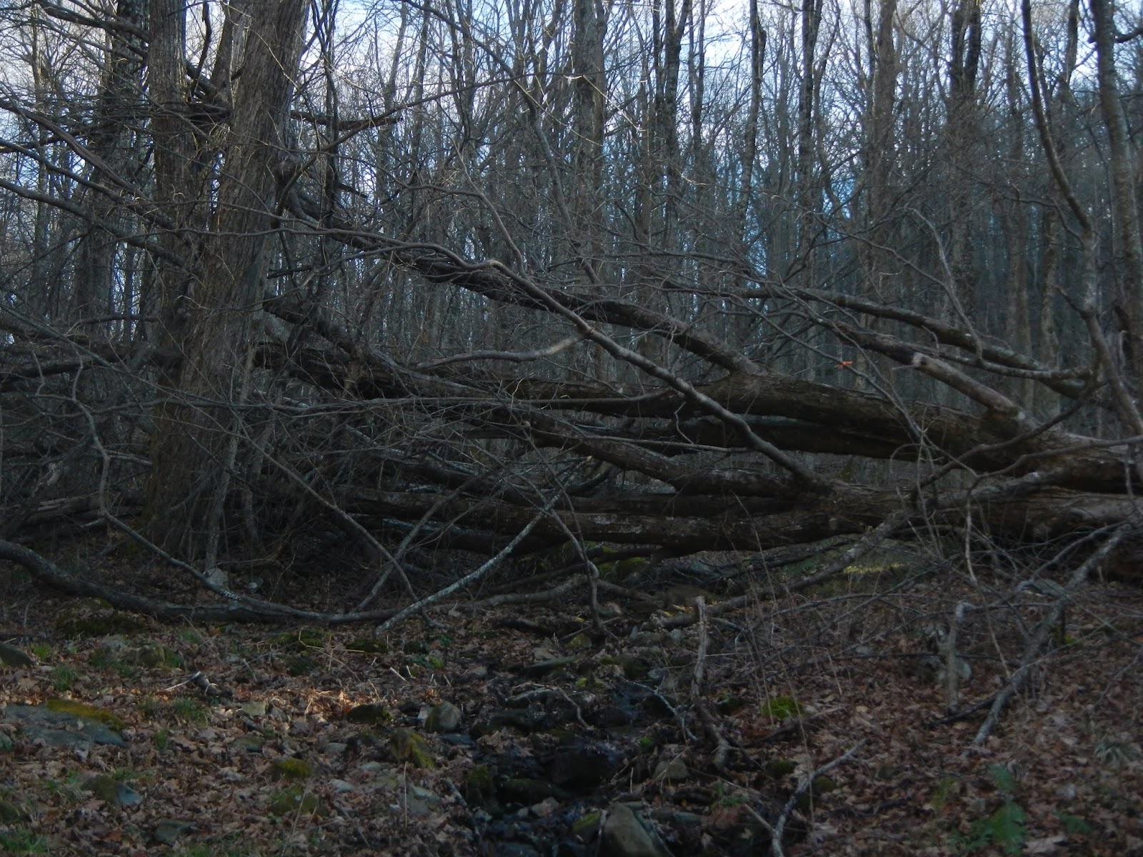
This large tree blocked the trail.  I made my way around it, as going over it would have been difficult.

Back on the Skyline Drive, I paused to admire the view of the Shenandoah Valley before heading for home.

It felt great to be back in Shenandoah National Park again.  This is likely my last hike of the year here.

Tuesday, October 9, 2018

If I Ever Get to Isle Royale Again...

I may never get back to Isle Royale National Park again.  It took me over 40 years to get back after my first visit, it is hard to get to, and there are many other places to see and trails to hike.  But if I am ever fortunate enough to get back to this amazing place, what would I do differently?

Planning - I'd probably plan at least one extra day if I were traveling by air.  I missed my flight home when the ferry couldn't make the run out to get us because of a gale.  I'd also throw a little extra food - Kind bars, trail mix, dried fruit - into the kit in case I got delayed on island.  But I'd only need to do that if I were going in late September or October when they close the stores.  In the main season, if you end up at Windigo or Rock Harbor for the ferry, there will be stores that are open.

Camping - I'd be less concerned with getting a shelter.  I'd probably take my two man tent to have a little room.  I'd make sure to camp at least one night at Moskey Basin, and there, I would shoot for one of the shelters.  I might also try to get to Lane Cove, which was on the list but didn't work out.

Food storage - Would I bring my bear canister again?  I am not sure.  The park service recommends them.  The squirrels are aggressive but we never saw a fox in camp.  Hanging one's food is out - it's like a red squirrel dinner invitation.  In the shelters, the food seems safe.  In a tent, I am not so sure, as both squirrels and mice can chew through a tent.  None of my companions had a single problem but we mostly stayed in shelters.

Night Sky - I'd probably pick a clear night and stay up really late at least once looking at the stars.  If I were really lucky and had the open view to the north, maybe seeing the Northern Lights could happen.

Route - I'd camp on some of the inland lakes, and I would spend more time on the Greenstone Ridge Trail.  If possible, I'd catch the boat to Hidden Lake and see that and Lookout Louise, and hike back to Rock Harbor.  I'd also look into a route that would get me to Windigo, and catch the Voyageur back to Rock Harbor.

Time of Year - I'd give up on seeing the fall foliage.  I think to do that, you have to go at the very end of the season, using the ferry from Minnesota.  I might consider August because the ferry from Copper Harbor runs every day.  I'd probably avoid June because the black flies must be horrendous up here.  May would be cold and wet but the wildlife sightings could be amazing.

Family - I'd love to bring my granddaughter and her mother here.  If so, I'd probably do a 3-4 night trip, with one or two days at a remote site and the rest at Rock Harbor.  Two days remote would give the ability to hike into an area, like Three Mile, with full packs and then spend a day relaxing and day hiking with light packs.  I'd probably only bring food for the overnight part, and buy food for the meals in Rock Harbor at the camp store.

Isle Royale is an amazing and magical place.  If you love nature, hiking, and the outdoors, I suggest that you find a way to get there.  If you hate camping or backpacking, go at a time when the lodge is open and stay there.

Leaving Isle Royale

On the 22nd, we arose and got the news that the ferry from Copper Harbor was coming over to drop off passengers, and would immediately load up and go back.  Normally, it stays on island about 3 hours.  Everyone needed to be ready by 11:00 for an expected 11:30 arrival.  So we all packed up after breakfast.  I bought a clean shirt at the store, which was open once again.  At least I would have one clean thing to wear back after wearing the same shirt and trousers for eight straight days.

We try to keep a clean camp, but inevitably, small pieces of food find the ground, and when they do, the clean up crew is always alert.  The Isle Royale red squirrel is actually a separate sub-species.  It is less red and smaller than its mainland cousins.  I wonder how this little species of squirrel got all the way out here?  Must have floated on something to colonize the island.

Before the ship came, we got some photos taken at the welcome display.


Right on schedule, the ferry arrived.  I think that everyone was happy to see it.  Weather would be worsening again late in the afternoon, so they wanted to make the trip back while seas were 3-5 feet rather than 8 feet later.


The ride back took 4 hours and was plenty rough enough.  We all took anti-seasickness medication.  No one attempted to go out on the bow - it was too rough.  This shot is off the stern, Isle Royale fading in the distance.

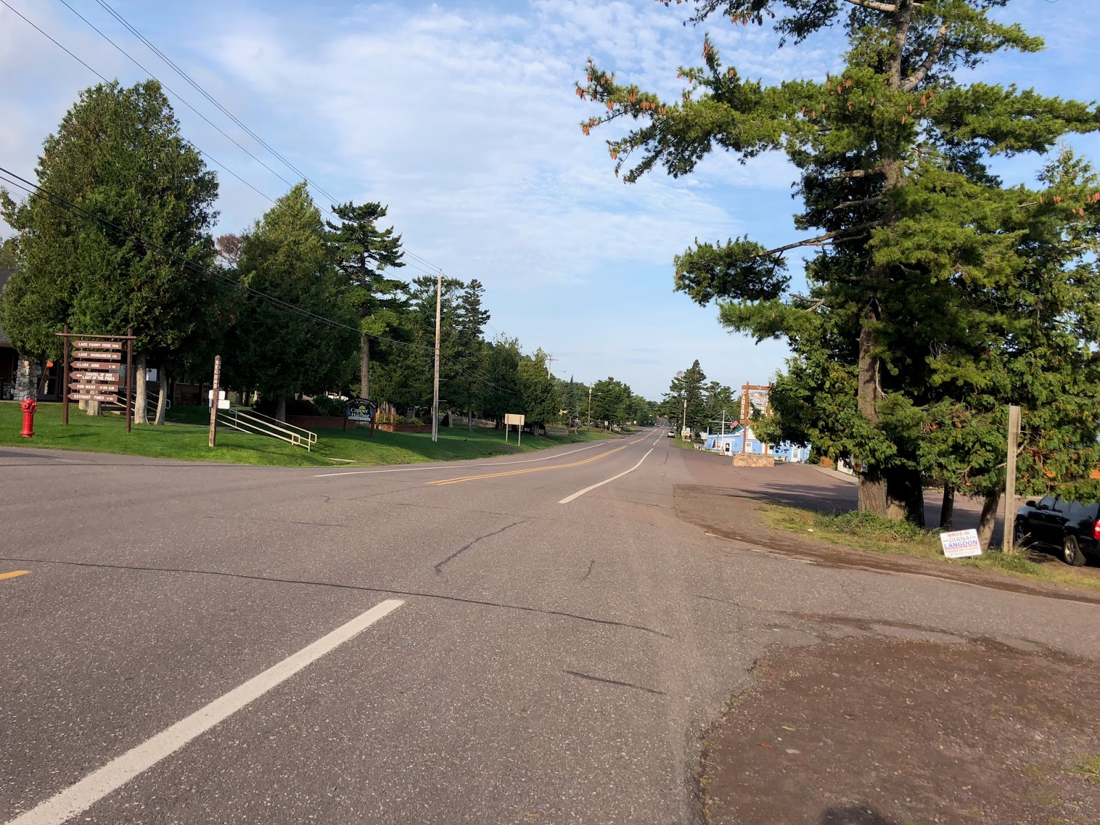
Back in Copper Harbor, we all enjoyed showers - my, did that feel good - and had dinner together.  Then Rick told me that someone had told him about a laundromat about a half mile or so down the street, which we found.  Once we found it, we walked back, got our filthy clothing, and returned to it.  If we had been flying out Sunday, I might not have bothered.  Most of my hiking clothing should not be machine dried, so I hung them to dry overnight back in the chalet.

Sunday morning, after a great breakfast of pancakes at the Pines Restaurant, I went to mass at Our Lady of the Pines. It is a lovely log church.


We'd all hoped to go for a hike on the trails around town, but it was a drizzly day, so a few of us went to a micro brew - check out the flight board in the shape of the Upper Peninsula of Michigan.

This friendly guy came over to say hello in the bar.

The weather continued to be poor for the day, so we all just kind of holed up and watched football and other TV shows, took a walk around town for some ice cream, went out for pizza, and then retired to our various lodgings.  The next morning, after breakfast, we battled Copper Harbor's brutal Monday morning rush hour.  I also visited the little town museum again.


After our shuttle to the airport by noon, we spent the next 12 hours getting back to Richmond.  Ironically, the Sunday flight out of Houghton had been cancelled due to weather, so if we had managed to get on it, we would not be leaving until Tuesday at the earliest, as Monday's flight was 100% booked.  Also ironically, the Monday ferry to Isle Royale was cancelled due to lake conditions.  After not even being late all summer, the Isle Royale Queen had to cancel two voyages in a row.

I had a great trip to a wonderful national park, but was so happy to get home about 12:30 AM Tuesday.

Prior story - bonus day on Isle Royale
Next story - If I ever get back....