Showing posts with label urban. Show all posts

Tuesday, April 16, 2019

Richmond Slave Trail

Last Tuesday (April 9), I joined the group for the Old Dominion AT Club for another walk downtown, this time to cover part of the Richmond Slave Trail.  For a description of the entire trail, go to this older blog post.

For this hike, we focused on the part of the trail along the James River.  By the way, the expression "sold down the river?"  The river is the James, and the place was here.  Human beings in Virginia were sold by their owners to plantations way down south for many reasons - to earn a quick buck, because they were no longer needed, to get rid of a child of the plantation owner - along with their mother - to punish someone who was not fully cooperating.  Hard to believe, but all true.

Here is our track, about 5.4 miles.  To do the route, we did part of the same trail twice, more or less.  We started and ended at the circle (left) and followed the direction indicated by the arrows - across the Potterfield Bridge, down the Canal Walk, across the Mayo Bridge, down the Slave Trail to the site of the Manchester Docks, reversing this section a bit closer to the river, and back to the start on the Flood Wall Trail.


Here are some pictures from the hike:

Richmond from the Potterfield Bridge:

Black vultures - we saw dozens of these large birds - on a rocky island in the river.

Much of the trail is urban, but this part was more of a path through woods.

Virginia bluebells.

View of the city from the Flood Wall trail, on which we hiked to get back to the starting point.

History is fascinating to me.  In this case, it is also tragic and awful.  The terrible events that the Richmond Slave Trail remembers actually happened, right here in the Land of the Free.  Best that we not forget about it.

Thursday, April 11, 2019

Two RVA Trails

Once again, I am well behind posting about hikes.  I now have six undocumented hikes, although I may not post them all.  Two that I will post occurred several Tuesdays ago, 3/19 and 4/2.  One of my hiking groups, the Old Dominion Appalachian Trail Club, does a fast hike every Tuesday in the spring for about six or eight weeks.  They are downtown along the trails by the James River.  We hike from 8-10, and do about six miles.  Lisa does a great job organizing and leading these hikes.  Don't be late, as we step off at 8:00 promptly.  On the 19th, we hiked the Buttermilk Springs Trail, and on the 2nd, we hiked to Texas Beach. for a total of 12.5 miles for the two hikes.

Here is the track of each hike, Buttermilk Springs (purple arrow) on the south side of the James, and Texas Beach (orange arrow) on the north side:

We had a group of seven for the hike.

This map shows some of the trails in the James River Park System.  The James, specifically the fall line in the river, is why there is a big city at this location, so it's appropriate that people value and enjoy the river, and also treat it more kindly than in years past, when it was an open industrial and residential sewer.

Here, a couple of the crew cross a bridge over a creek.

There is a bit of up and down along this trail, although no long climbs or descents.

One guy called this "Whale Rock," and you can see why - massive and shaped like a whale.  I am keeping it from tumbling down the ravine here.

When we reached the Nickel Bridge, we descended and returned on a trail closer to the river.  One could also cross the bridge and return on the North Bank Trail, making about a 7 mile loop.

We didn't see a Sasquatch, but after seeing this sign, we were on high alert for the rest of the hike.

Rapids in a side branch of the river's main channel.

Just before getting back, we had a nice overview of the river.

For the Texas Beach hike, we crossed the Potterfield Bridge and headed up the North Bank Trail, then branched onto the Texas Beach Trail, turning around at the Nickel Bridge and returning on the same trails.  I only took a few photos.

Most of the hike had river views.

Texas Beach - no idea how the name came about.

Violets are a sure sign of spring in these parts!

Heading back into the urban zone of the hike.

These Tuesday hikes are a great way to get the day started, get the blood pumping, and hang out with a good bunch of folks while seeing a bit of nature.

Friday, June 20, 2014

Stirling, Scotland Walk-About

Time to finish up my posts about my walks and hikes in Scotland.  This walk took place on May 24.

After seeing the William Wallace Monument, we wanted to visit the famous Bannockburn Battlefield, but it turned out that there was a big parade on the way and traffic would be impossible.  So instead, the lassies decided to relax at the motel, and the laddies decided to walk about Stirling for a couple of hours.  It was mostly urban but we also found a nice park along the way, high up in this hilly city and near the Stirling Castle that we had spent the morning touring.

We parked at a car park near the train station, crossed the river on the tall pedestrian bridge, and started walking along the streets of Olde Stirling.


Here is another view of the Wallace Monument in the distance, several miles as the crow flies.

After walking through the city for a good ways, we came on a wild looking and inviting city park, and began hiking some of the trails.  There were a few people about, mostly young lovers - ah, is there anything like being young and in love in the spring time? - and one very friendly border collie.

We spied these cannon high up on a hill, and decided to walk up.  I thought that the beheading stone might be in that general area, and wanted to see it (but not try it out).

As we walked along the trail, my brother-in-law said "Do you smell that minty smell?"  The edges of the path were thick with the plant shown below, and I decided to rub it between my thumb and forefinger to release the minty odor.  Big mistake!  In a split second, my fingers felt as if I had touched a red-hot stove!  They hurt for a good 12 hours and didn't feel right for 24 hours.  This turns out to be stinging nettle.  My brother-in-law, who was reaching for the plant, was thankful that I was a little bit quicker than he was.

At the top of the hill, near the pair of cannon, was the beheading stone.  It is no longer in use.

Here is a panoramic view of Stirling - the new part to the left - from the top of the hill in the park.

The cannon stand silent guard on the hilltop.

As we looped back towards the old part of the city through the park, we caught a view of Stirling Castle.

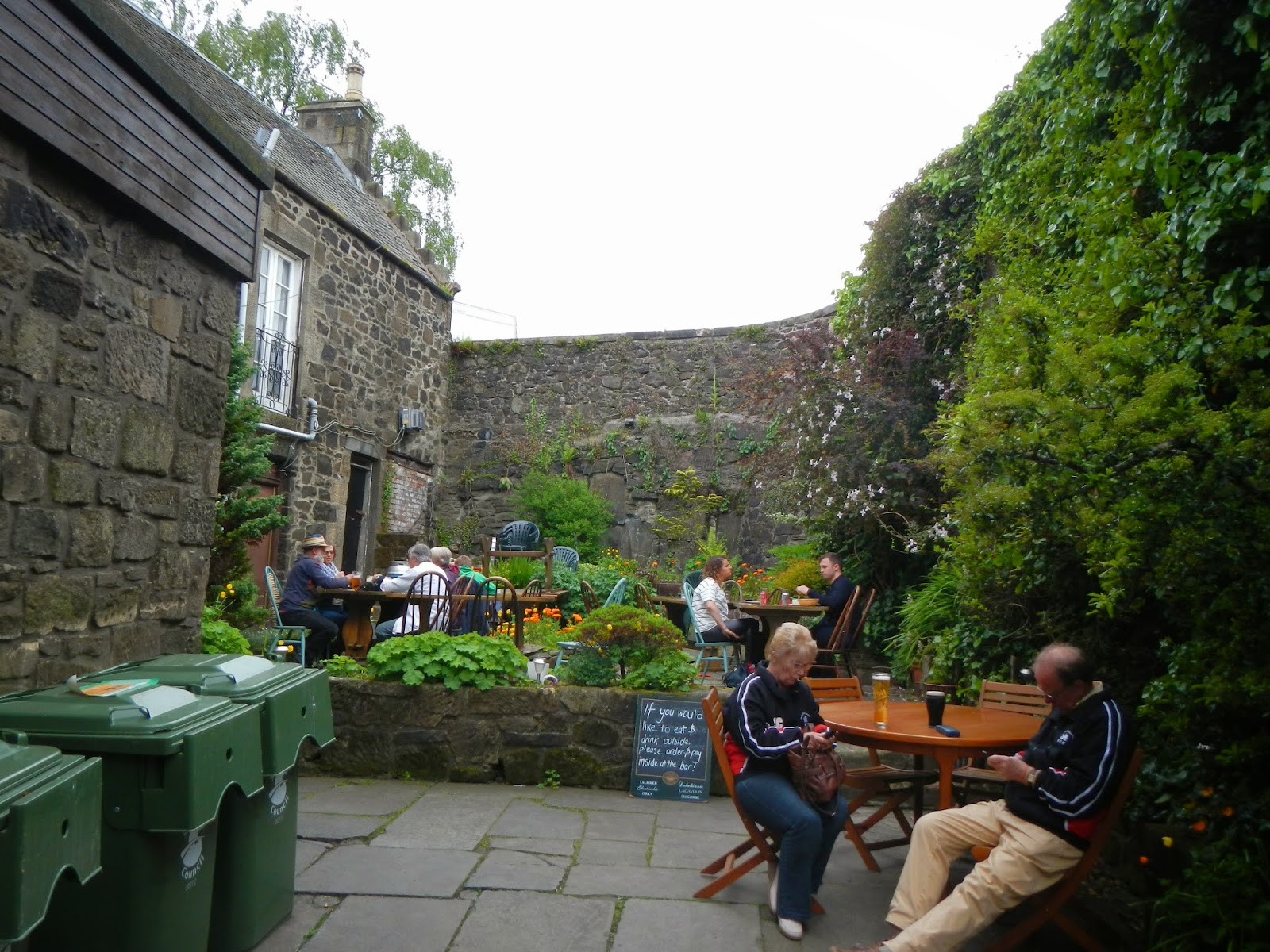
Later that evening, we had dinner at this restaurant.  The courtyard looks so inviting, but it was raining later on.  I tried to convince my brother-in-law to have an ale at several places along our walk - with me buying - but he declined, saying that he would have a Guinness with dinner.

As we returned to the city and headed back towards the train station and the car park, we came along another pair of old cannon.

The next day, we would be leaving Bonnie Scotland to head home to the US of A.  It had been a great trip, but I wish we had had more time there.  Still, we packed a lot into our eight days in this lovely and friendly country.  I hope someday to return.

Thursday, June 5, 2014

Arthur's Seat, Edinburgh, Scotland

Well, when I was in Edinburgh on May 23rd, you know that I would have to hike up to Arthur's Seat, a volcanic plug with spectacular views.  So after touring Edinburgh Castle and having afternoon high tea, and with decent weather for good views from the top, my brother-in-law Tom and I headed down the Royal Mile to gain the trailhead.  If it had been raining, I probably would not have done this, because the reward from the top of the 830 foot peak are great views.  But still, how often do you get the chance to hike up a point sharing your name?

Using the DeLorme InReach SE that my friend Chip loaned me for this trip, I was able to map my approximate track (in light blue).  See the arrow to the left?  It points to Edinburgh Castle, which is amazing.  From there, Tom and I marched a nice straight line, in light blue, down the "Royal Mile" before reaching the jump-off point to the trails up Arthur's Seat.  The arrow on the right points to Holyrood Palace, the official residence of the British monarch in Scotland.  It is often open for tours, but not on that day.  Apparently, some royalty or other was in residence that day, as the gates were shut and security was very tight.  Our route up Arthur's Seat was more or less in a clockwise direction from there.

Silly me - at the start of our hike, I thought that this was the top.  There was a line of people heading up that trail, so we picked the "road less traveled," the trail to the left.  No matter which way we went, there were lots of people.  This is a place for great views but not for solitude!


After walking for a while up the path, we found that this is the top.  It took about 40 minutes of steady uphill walking to reach the top, including a brief stop at a ruined chapel.

This is all that is left of the Saint Anthony's Chapel.  In 1426, the Pope gave money for the repair of this chapel.  Looks like it might be time again for some repairs, eh?

Near the ruins of the chapel, Arthur's Seat still looms hundreds of feet above us.  The yellow flowering shrub is gorse, I believe.


I think this bird is a hooded crow.  We do not have them in the "States."

Here is a panoramic view looking back towards the lower hills and the bay.  We are starting to get the first of some great views.

We hiked up some more, and at this point, we are getting closer to the top.

Up, up, up....

Before we know it, after a final push over rocks and steep trails, we were at the somewhat crowded top.  Great views of Edinburgh presented themselves as a reward for the hike up.

This is a panorama from the top.  Fabulous views!

Art(hur) at the top of Arthur's Seat on a very windy day!

We mostly did a different route down.  Here is a nice view of Holyrood Palace on the way down.

For being in a big city, this area had a lot of ruggedness to it.

Here, we look back towards the summit of Arthur's Seat from a kind of saddle ....

... with a panoramic view taken shortly after that.

As we got lower and lower, we eventually joined the trail we had come up on.  Looking back up that trail, you can see a distance view of the ruins for Saint Anthony's Chapel.

 I enjoyed my hike up to Arthur's Seat, a little bit of wildness in cosmopolitan and modern Edinburgh.

Saturday, May 10, 2014

Three Lake Park

I had yesterday (Friday) off, and all week, I planned to go up to Shenandoah National Park to take a hike.  Thursday night, as I lay in bed getting ready to drift off, it suddenly hit me that I had forgotten to pick up my packet for Saturday's race for the cure!  So I altered my plans a lot Friday.  I took care of some chores, including getting my race packet.  But I still made time for a hike at a local park, Three Lakes Park.  My route on this very warm day was maybe 2.5 miles, and I walked around each of the three ponds, such as this one.
This painted turtle was enjoying getting some rays on his perch.
The park has an excellent nature center that includes a very large aquarium.  It is good for all ages, but especially for kids.
My walk was largely over at this point.  You can see a bridge crossing a stream with one of the ponds behind that.  It was a very pleasant walk.  Very few people were there on a work day and a school day.
Since I was a boy, I always like coming across sassafras in the woods.
This skink was one of several that I saw on this stretch of the trail.  They are pretty cool, and hard to get a good look at.
My little trek was not as grand as my original plans, but you know, any time spent walking in a pleasant woods is time well spent, and I didn't have to drive two hours or so each way.  SNP will be there for another hike, one where I do my advance planning and don't forget something else.