Showing posts with label wildlife. Show all posts

Friday, February 19, 2021

Some Bird Sketches from Hikes

 While deciding whether to continue the blog, I thought that I would post a few sketches from birds seen on hikes in the last couple of months.

Ring-necked duck (Dutch Gap Conservation Area)


White-throated sparrow (Echo Lake Park)

Brown creeper (Echo Lake Park)

Golden-crowned kinglet (Dutch Gap Conservation Area)

Hooded merganser (Echo Lake Park)


Saturday, August 29, 2020

Nature Journal - Junco

 Since posting the other day about my nature journal, I added a page for some dark-eyed junco observations that I made last summer while leading June and July Road Scholar hikes.  Juncos live year round in Shenandoah, but are only found here in the winter.  I like these cheerful little "snowbirds," and am always happy to encounter them.  Finding the nest while leading the hike was a big thrill - everyone enjoyed getting a look at a bird nest with eggs.  Here is what I wrote yesterday and today in my journal about the Shenandoah juncos.


Tuesday, February 18, 2020

Counting the Birds

Every year, the Cornell University Laboratory of Ornithology coordinates the Great Backyard Bird Count.  This year, it went from Friday the 14th through Monday the 17th.  You can record birds as little or as much as you wish, and in your backyard or anywhere else.  I did backyard counts, as well as counts in five other areas.  Although these all involved some hiking, I really only kept track of the mileage for my hiking records on the last hike, which was Monday at Dutch Gap Conservation Area.  I hiked 6.2 miles there, and I probably hiked close to another six miles or so at the other four sites.

I saw and/or heard 51 separate species, including this beautiful pileated woodpecker.  You can scroll down past the species list to see some more photos.  Count data is entered in eBird.


The six areas, and the species counts are:

Around home - 18 species
Ginter Botanical Gardens - 11 species
Three Lakes Park - 14 species
Gaines Mills Battlefield - 15 species
Malvern Hill Battlefield (Crewes Channel) - 27 species
Dutch Gap Conservation Area - 41 species

Here is a list of the 51 species of birds I saw and/or heard during the four days of the count:

Double-crested cormorant
Great blue heron
Canada goose
Wood duck
Mallard
Ring-Necked duck
Northern shoveler
Gadwall
Hooded merganser
Green-winged teal
Turkey vulture
Black vulture
Cooper's hawk
Red-shouldered hawk
Bald eagle
American kestrel
Killdeer
Mourning dove
Barred owl
Belted kingfisher
Red-bellied woodpecker
Downy woodpecker
Northern flicker
Pileated woodpecker
Eastern phoebe
Blue jay
American crow
Fish crow
Tree swallow
Tufted titmouse
Carolina chickadee
Carolina wren
Golden-crowned kinglet
Ruby-crowned kinglet
Eastern bluebird
American robin
Hermit thrush
Northern mockingbird
European starling
Yellow-rumped warbler
Pine warbler
Northern cardinal
Eastern towhee
Field sparrow
White-throated sparrow
Song sparrow
Eastern meadowlark
Red-winged blackbird
Common grackle
Dark-eyed junco
American goldfinch

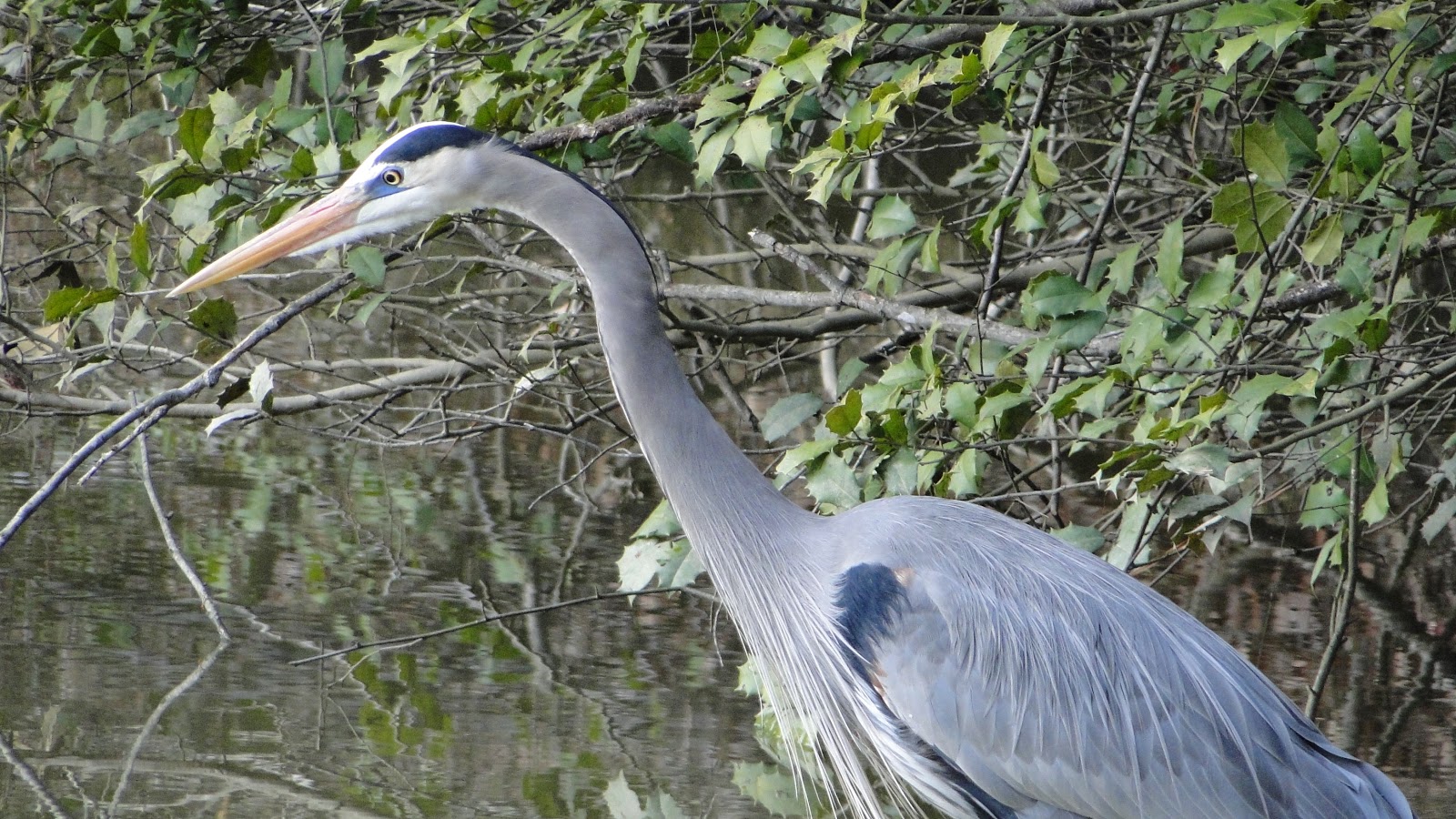
Here are some pictures of some of the birds I saw, and some of the natural features on my birding hikes, starting with this great blue heron at Three Lakes Park:


Nearby, was this group of double-crested cormorants.

At Gaines Mill, it looks like spring is in the air.

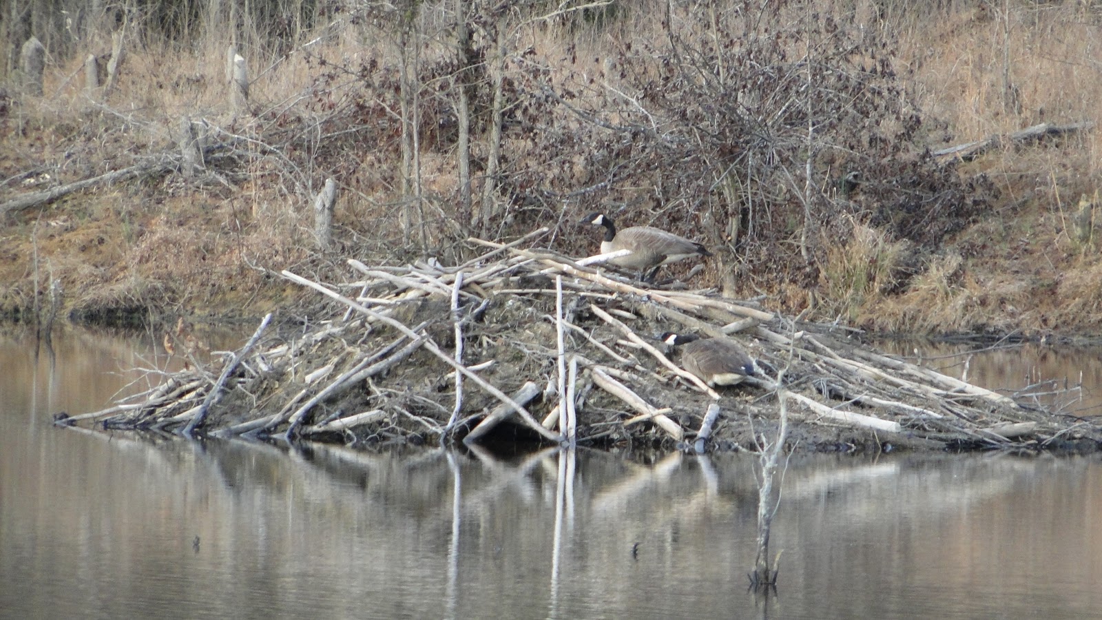
At Crewes Channel at the Malvern Hill Battlefield, while I didn't see any beaver, they were surely in evidence, and seemingly had been very busy.


The rest of these are from Dutch Gap...

Canada goose

The trees are well into bud all over, even though it's just mid-February.

Dutch Gap has a wide variety of habitats, including seasonally flooded swamps like this one.

The ducks on the left are gadwalls.  I am not sure about the one on the right.

Northern cardinal

Northern mockingbird

A pair of northern shovelers.  The drakes are so beautiful!

Ring-necked ducks - I love the yellow eye!

Birds are in terrible trouble in North America and all over the world, unfortunately.  Participating in citizen science projects such as the Great Backyard Bird Count can help scientists gain valuable information about bird populations and trends.

Monday, December 9, 2019

Four Hikes, and a Bear

I'm always happy to hit the trails in the mountains, but last Tuesday, I was a little less excited than usual.  My goal was strictly to hike several short trails to check them off my SNP 500 list.  None of them seemed overly amazing - they were all short sections, out and back, repeating the same ground each time.  Here are the trails I hiked, for a total of about 10 miles, with a loss and gain of 1,800 - 2,000 feet:

Eaton Hollow
Simmons Gap Fire Road West (Beldor Road)
Pinefield Hut
Browns Gap Fire Road (east of Doyles River)

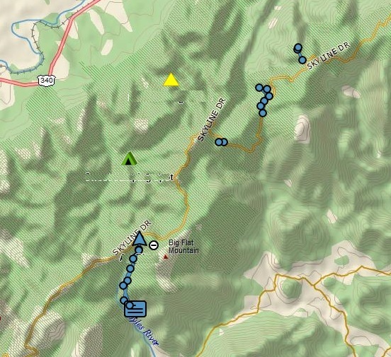
On this track, they are located in order north to south to give an idea of their locations, all in the Southern District of Shenandoah National Park:


Yet, despite my lack of enthusiasm, each of these four little hikes yielded a good memory.  On Eaton Hollow, I hiked to a cool PATC camp building.  On the Simmons Gap hike, I encountered two ladies hiking and had an enjoyable chat.  On the hike to the hut, I enjoyed a nice lunch break at a picnic table.  And on the Browns Gap hike, I encountered a bear close up, my first great look at a bear in a long time.

The Eaton Hollow hike was about a half mile each way.  There was a nice view right at the start, followed by a mostly gentle descent to the camp area:

At the turn-around point, I reached the Schairer Trail Center of the Potomac Appalachian Trail Club (PATC).  I don't know what they do here, but doesn't it look inviting?

Here is the view from the front porch:

This photo gives a good idea of the setting.

Next, I drove a few miles south to Simmons Gap, where these three deer gave me a look over.

I started hiking downhill along the fire road, heading west.

On the way back up, against all expectations, I met two ladies hiking down.  I'll call them K and S.  Why in the world was anyone else on this trail on a cold Tuesday morning?  Well, the logical explanation is that they were also attempting to hike every trail in the park, and that was the case.  We had a very nice chat. K wore a cap with the pink breast cancer symbol, so I asked if she was a survivor, which she was.  I told her that I was a 17 year Hodgkin's lymphoma survivor, and she said that her husband has non-Hodgkin's lymphoma.  I told her about walking the 3-Day 60 mile Susan Komen walk in 2011 (in memory of my sister, Ann, who died from breast cancer that year), and also about doing marathons and half-marathons for Team in Training to raise money for blood cancer research.  And we also talked about hiking in the park, and working towards the SNP 500.  I think K was getting pretty close to finishing, and S - while not doing the formal miles - likes to help her and hike with her.  I still have about 200 miles to go.  I enjoyed meeting fellow hikers out there and getting to talk.  They were the only people I saw all day.

Next, I drove south a bit and hiked the short distance into the Pinefield Hut, a perfect spot for lunch.

Finally, there was time for one last hike, the east side of the Browns Gap Fire Road.  I'd been by this spot at least a dozen times on my Doyles River hikes, including exactly a week ago with my friend Doug.  I left my car at the Doyles River trailhead, and dropped almost 700 feet like a stone to get to the fire road junction,

this time turning east instead of west.  The trail went almost two miles from here and dropped another 500 feet, although at a more pleasant pace.

Could there be a bear in this cave?  Maybe.  Did I stick my head in there to find out?  No., I did not!

 This was a very pleasant old road to hike along.

On one side was the steep Doyles River Valley.  I could hear the falls far below, and even crossed the Doyles River - easily rock hopped - as it flowed over the fire road.

I got some nice views across the valley at times.

The end of the road at the park boundary!  Check off one more trail towards the SNP 500.

On the hike back up, I got a treat.  I was trying to send my wife a message on the inReach but it was not going through.  So on that steep section, near the junction of the trail to the Doyles River Cabin, I stopped to get the message sent.  While I was stopped, I heard the sound of an animal in the leaves.  Squirrel?  No, something larger.  I waited and waited, and suddenly, there was a young bear about 100 feet off the trail.  I spent a while there, trying to get a good look for a photo.  Most of the time, he was partially hidden behind vegetation, but eventually, I got some good shots.  He was cautious but not fearful.  Up through the woods by the cabin, I could hear two men calling a dog and the dog barking.  The bear didn't seem concerned, and eventually ran across the trail about 50 feet from me and headed up towards the cabin.  Hopefully, he was not getting food from a human source.  This bear looked to me to be a second year cub, meaning his mom had recently kicked him out and he was having to make his own way in the world for the first time.  Seeing a bear is always a thrill!  This was my first sighting since June, and my first while hiking solo in several years.  If I hadn't stopped at that exact spot to send the message, I never would have seen this animal.


What a fun day in the mountains!  Meet some wonderful hikers and have a nice chat, and see a bear!  And check off about 4 more miles towards my SNP 500!  I'd call that a pretty good day!

Tuesday, September 24, 2019

Hooooo are you?

I was in Greenville, SC on family business but took a little walk on the Swamp Rabbit Trail.  Ahead of me, a large bird flew across the trail, and landed in a tree just off the trail.  When I got close, it was still there - a beautiful barred owl.  I pulled out my mobile phone and took some photos.  He didn't call, but they have a very distinctive call - who cooks for you?  Who cooks for you-all?


Tuesday, June 18, 2019

Are the Grayson Highlands Fabulous? Roger That!

The Grayson Highlands, in Southwest Virginia, include our state's highest terrain.  Mount Rogers, at 5,729 feet, is the highest point in the east north of the Smoky Mountains until the White Mountains of New Hampshire.  Not only is it beautiful up there, but the vegetation is closer to that of southern Canada than it is to the rest of Virginia, and there are wild ponies, which makes it truly unique.  This time of year, the mares are foaling, and there were little ones all over the place.


I'd been in this area twice in the last seven years, and felt it was time to get back.  Maybe I could catch the rhododendron bloom!  So I put together a group for a three day hike in that area, including a hike to the top of Virginia's roof: spruce and fir covered Mount Rogers.  Seven of us ended up going on the hike.  Here are the other six at the trailhead in Grayson Highlands State Park.


This shows the track of the 15+ miles hike, essentially a big loop and hiking in a clockwise direction.  We started Thursday at the purple star to the south, and hiked up to Rhododendron Gap, camping at the red circle.  Once we set up camp, we hiked west to summit Mount Rogers (pink circle) and got water at a spring about a mile from camp.  On Friday, we broke camp and headed northeast over Pine Mountain, arriving at Wilson Creek for a second night of camping out (blue circle).  Saturday morning, we hiked just 2.5 miles back to the cars and got ready for the long drive home.

Where to start?  The scenery in this area is often spectacular.  The ponies eat continually and keep the high ridges as open country, almost as if it's above tree line.  So this gives a lot of gorgeous open views.


And the ponies themselves are a big draw, especially the foals - which are really cute!


Here is the seven - eight if you count Brody, who used four wheel drive to get over the tough parts - of us partway through the first afternoon of hiking.  We came from five different areas of Maryland, Virginia, and North Carolina, believe it or not.  We had never hiked together before, and three of the group had never been backpacking!

Yours truly, pony in the background.  The ponies are semi-wild.  They are tolerant of humans but need to be treated like any wild animal.  Don't touch or feed them.  They will kick, and they will bite.

Here were the only Rhododendrons still in bloom!

Morgan heading up through "Fat Man's Squeeze."

Once we set up camp, we headed towards Mount Rogers.  There are simply gorgeous views along the way.

Here are my companions on the summit of Mount Rogers, the highest point in Virginia.

There is not much a view from up there.  It is covered in Fraser fir and red spruce.

On the way back, I filtered six liters of water at the Thomas Knob spring.  Here, Raja filters water for his night.

We had a great campsite, plenty of open space for multiple tents.  But it was chilly and very windy.  Temperatures in the night were in the 30's.  It's been raining up there for days - we lucked out and only had dry weather - and any wood we found was wet.  We couldn't sustain a campfire, so we talked about great campfires we had known in the past.  The cold and wind, and lack of a fire, resulted in an early bedtime for most of us.

Here is a satellite view of our trek up Mount Rogers: camping area (red circle), the summit (pink circle), and Thomas Knob spring (blue arrow).  Note the open ground to the south.  Without the ponies, it would look more like the forested area north of our track.

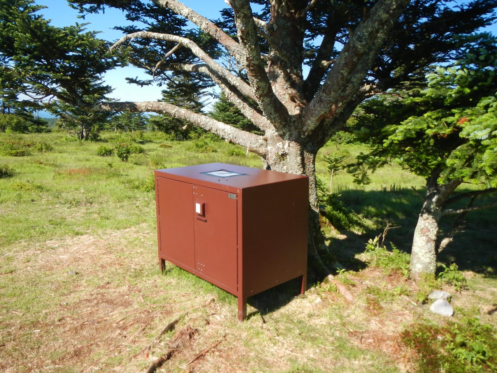
About 300 feet from camp was a nice bear box to put our food in.  We didn't see a single bear, but kept hearing how aggressive they are around there about food.

In the morning, a large group of wild ponies was gathered near the bear box.

 Here is another group photo.  No, the land is not sloped like that.  The camera was on my pack, which was clearly at an angle.

Friday was a delightful day of hiking!  The weather was fabulous - sunny and cool but not chilly, and greatly diminished winds.  We only had about 6.5 miles to cover, and most of it was downhill with no steep uphill sections.

Just past Rhododendron Gap (and its non-blooming rhododendrons) is this huge rock sticking upwards.  Allen bravely climbed to the top, reporting amazing views to be had:

I give you the Griswold Family Christmas Tree:

We had two possible routes today - one going through more open country, the other going through more forested country.  Guess which we chose?


After more wild ponies - this is my fourth time here, and I think I saw more ponies than on the other three combined - and....

a relaxing lunch break at the scales,

we arrived where I had planned on camping on Wilson Creek, just before the park boundary.

We ate dinner, and Morgan got a great campfire going, which we enjoyed well past "Hiker Midnight" (9PM).


Wilson Creek lulled us to sleep with its wonderful sounds, and

provided all of the cold, clear drinking water one could want just a stone's throw from our tents.

A couple of the group needed to get home by 5PM Saturday, so we hit the trail by 8:30 and only paused for a quick photo or two.  Morgan, Rudy, and I are tired but happy,

as we enjoy the final views before reaching our cars and getting back to civilization.

This was my third time backpacking here since 2012, and it has been a charmed three trips - perfect weather - well, okay, a little chilly at times - every single day, good companions to hike with, beautiful scenery, and interesting animals.  If you are into hiking, then this is a fabulous place to see!