Sunday, November 6, 2016

Black Rocks

A week or so after the Hickory Hollow hike, I hiked at Dutch Gap again.  I've posted about that hike so many times that I won't write about it this time, because I didn't see anything unusual.  But two weeks ago, my wife Mary, my step-sister Cora, and I spent the day together driving up the Skyline Drive.  As part of that, we took a short hike into Black Rocks for the great scenery.  I thought I would put out a couple photos.  I'd not been there since this backpacking trip five years ago.

This woolly bear caterpillar was booking it when we got to the trail head.

Views of Furnace and Austin Mountains from Black Rocks.  I backpacked down in there five years ago.

The mountain on the right is Trayfoot Mountain, also part of my 2011 backpacking trip.

Dead trees like this are vital to woodpeckers and other wildlife.

Okay, now I am only two hikes behind in my blogging!

Hiking Hickory Hollow

I've not posted in a month, but that is not because I've not been hiking.  I've gone hiking four times since then, and just didn't get posts written, which I plan on rectifying today and tomorrow.  Here is the first of them, a mellow hike in the Hickory Hollow Natural Area in the Northern Neck part of northeastern Virginia on October 7.  Being a natural area, I'd hoped to see and photograph the wildlife that Hickory Hollow holds, so I hiked with my binoculars and my heavier camera around my neck - not very comfortable.  I really didn't see any noteworthy creatures, but I enjoyed the hiking and saw some interesting mushrooms.  I really liked the sign at the trail head - it not only showed trail maps, but shows some artistic flair as well:


Here is a track of my 3.2 mile hike.  The topo map is not very interesting so I am showing a satellite view.  The Red Arrow marks my starting and ending point, the yellow arrow shows the direction of travel (counter-clockwise), and the yellow circle shows the interesting swamp that I got to.

The natural area is mostly deciduous forest, with some evergreens.  There are a number of trails, each color coded, and the terrain is pretty level.  It was a warm and humid day, but still always a good day to be out in the woods.

This is Indian pipe, a strange and ghostly flower.  Can you see the tiny green bee near the top of the tallest one?

I saw a wide variety of mushrooms while walking along.  Here are some examples.


I reached a swamp formed by the Western Branch of the Corrotoman River, and poked around there a bit, enjoying the interesting plants, flowers, and insects.


Here was an unexpected sight in the swamp - Old Glory flying from a tree!

Later on the hike, a totally different tree, I pondered if maybe there is a screech owl that makes this hole its cozy home.  I have screech owls on the brain since being serenaded a week ago at Goose Creek State Park in North Carolina.

I enjoyed reading about this man and his good works.  It is nice to remember people who made a difference after they are gone.

I'd like to get back here and explore this area further.  Other than hearing some birds - Carolina chickadee, blue jay, and red-bellied woodpecker - and seeing a couple of salamanders and a frog, I didn't see any wildlife to speak of.  But I enjoyed exploring a new area.  I didn't see another soul while hiking here for a couple of hours.

Saturday, October 8, 2016

A Short Swamp Walk

Last Sunday, before we left Goose Creek State Park in North Carolina, we took a short walk on a wooden walkway through a thick swamp.  Carlton and Libby had hiked this the day before and saw tree frogs and anole lizards.  It was a great place to slowly explore and look for critters, of which we saw a few - birds and reptiles and amphibians.  We walked for about 45 - 60 minutes, very slowly, probably only covering about a mile of walking.

The trail was called the Palmetto Trail, and it went right through the swamp.

This southern leopard frog was one of many that we saw.

Cattails in a marshy area.

This fungus is called witch's butter.  Does it look like something you would like to spread on your pancakes?  Not me!

This is a palmetto and you can see it has a bumper crop of berries, which are eaten by a wide variety of wildlife.

We studied this snake for a while.  We wondered if it were a cottonmouth, but a close up photo of its head that Carlton took did not reveal pits that vipers use to sense the heat of their prey.  The same photo, when compared to pictures, made us believe that it is a nonvenomous banded water snake.

Again, I am very glad we didn't risk it going out to Shackleford Banks and instead enjoyed camping out and exploring in Goose Creek State Park to salvage our trip.

Friday, October 7, 2016

When Plan A Fails, Go to Plan B!

Exactly a week ago, at this time (5:15AM) I got on the road to pick up my friend Carlton and his 10 year old daughter Libby.  We were headed to Beaufort, NC to do two nights of backpacking out on Shackleford Banks.  Because there is no fresh water there, we were carrying about 7 gallons of water between us.  We had greatly anticipated this trip for two months!  But we forgot to include Mother Nature in our plans!

We got to Beaufort just after noon, and just after that, the skies opened.  Thunder roared, lightening flashed, drenching rains poured.  We ducked into a restaurant for lunch, checking the radar app on our phones continually.  It showed a long line of thunderstorms headed right over the island stretching back to Savannah, GA!  After talking with the boat company, the National Park Service (Shackleford Banks is part of Cape Lookout National Seashore), and my spouse, we finally gave up our plan at about 2:45 and checked into a motel.  We got in a little hiking at Croatan National Forest, had dinner, and went to bed, getting up early to find - more thunderstorms!  It looked like steady rain there at least until the afternoon, and more storms coming in for the evening, overnight, and Sunday.

So using Google on my phone, we came up with a plan B - Goose Creek State Park about 60 miles to the north of where we had spent the night.  We headed there right away, hoping that maybe we could get a campsite, of which there are only 14.  And we were in luck, because there were still two sites open.  The map below shows the location - the red arrow shows our original destination, and the star shows where we ended up.  You can see the Outer Banks, including Cape Hatteras, to the east of Goose Creek.


It was a delightful park.  The campsites were spacious and also widely spaced, and in an open grove of tall longleaf pines.  The gravel pad was plenty big enough for our two tents, and we had a picnic table and fire pit.  There was a very nice outhouse nearby, and pumps for water (although we never needed it with all the water that we brought with us).  And the weather was generally good - warm and muggy, but dry, other than a couple hours of rain Saturday afternoon, and a thunderstorm in the night.

Here is Libby in front of their tent.  My tiny tent is behind this one:

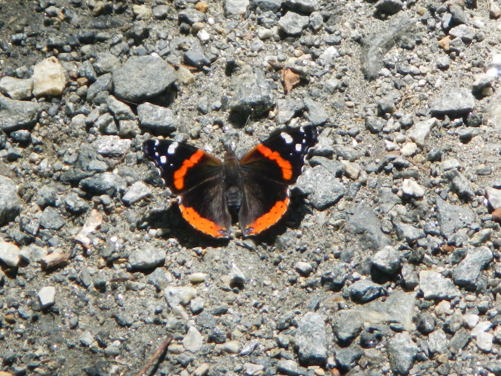
We spent most of the day hiking and exploring.  We hiked a total of about eight miles - a short loop near the campground, and a longer loop through the rest of the park through forests, swamps, and by marshes and rivers.  The mosquitoes were fierce at times, but the birding was great.  The map below shows my track.  The campground is on the far left.    The arrows show the direction of travel - clockwise - for the longer hike.  Coming back in the steady rain, and Libby and Carlton having stopped hiking with me when Libby got tired, I ended up walking along the road when a section of the trail was totally flooded by deep water in a swamp.  There was no way around without wading.

Here are photos of the many sights along the way, starting with a pretty - but likely poisonous - mushroom.

Here is a view of Flatty Creek on our first short hike.

This bracket fungus reminded me of burnished wood.  I thought it was beautiful.

Carlton knows enough mushrooms that you are probably not going to die or go hungry if you follow his advice.  This one is called Hen of the Woods, and is a delicacy.

I can't remember if this one is edible or not.

The park has great interfaces between the forests and rivers.  I think that this is the Pamlico River.

I can't remember what this is, but Carlton said not to eat it.  However....

This one is the Old Man of the Woods, and is very good to eat.  Just cut off the gills.

Here is what it looks like cut open in a cross-section.  It's hard to see, but the color is changing and it is turning black.

Lots of open pine forests in this area.

Here is another view of the river.

Southern leopard frog, which we saw all over the place.

Edible or not?  I don't know, but it didn't look that appealing.

More of the pine forest that once was a huge industry for naval stores (pitch, pine tar).

A short boardwalk got me over this swamp, covered with duck weed.  I heard a very large animal crashing and splashing through one of these swamps, likely a deer or bear.

Here is a pretty wild flower.

I got though this section of widely flooded trail with dry feet by walking carefully along the slippery logs.  Later, there was a section that was so deeply flooded that there was no getting around it.

No idea if this one is edible or not.  The bad thing about mushroom identification is that there is a very high penalty for being wrong if you eat them.

We sat out the rest of the rain storm back in camp, ate dinner, and got a fire going.  As it turned dark, we got a real treat - three different screech owls calling in the night, and a male and female great horned owl calling back and forth.  The owls called for about 20 minutes, and we were enthralled as we listened to them.  In the morning, we did a little walking - here is a sunrise view at Flatty Creek -

and here you can see the contrail from a jet reflected in the creek.

Then we ate breakfast, packed up, and did one last hike on the way out.  Because this post is so long, I will create a separate post for that hike.

Well, Plan A didn't work out, and that was very disappointing.  But we were able to come up with a great plan B to visit a really cool place with amazing birding and habitats, and comfortable camping.  So, no complaints!


Wednesday, September 14, 2016

Rose River Falls

Last Friday, I had the day off and it was going to be a little cooler in the mountains, so I headed to Shenandoah National Park to hike the Rose River Falls loop - actually, more of a lollipop than a loop, strictly speaking.  It is 6.5 miles and passes by two nice waterfalls: Dark Hollows and Rose River.  It's my first hike back up there since running into the bear, and I carried bear spray with me this time, since I was alone.

This hike is a good workout, and as I inexplicably forgot my trekking poles at home, it was harder than usual on my knees and hips, especially the steep downhill sections.  And my right ankle still hurts a lot, so I just went at my own pace and did the best I could.  I would have held a group up for sure.  Here is a track of the loop, arrows showing that I hiked counter-clockwise.  The Rose River Falls is marked by a purple star.

Other than the waterfalls, there is not a whole lot of scenery on the hike - it is mainly a walk in the woods.  I kept alert for wildlife, and saw a number of animals of the smaller, less spectacular types.  I thought of doing a "What am I?" for a change, but the animals that I saw were small and hard to identify.

Here are some photos along the way of my trek, starting with the first hints of fall:


I am not sure what this flowering shrub is, but I call it pretty:

Maybe not as pretty is this orb weaver.  I don't know the species, but its rear legs reminded me of candy canes.

I felt really bad for this baby cedar waxwing along the side of the trail.  It should be in a nest with parents.  I hope very much that its parents were around somewhere, but saw no sign of them.

This is Dark Hollow Falls.  It is only about 3/4 mile from the trail head, and you have to drop 500 feet from there to get here.

I don't know if this waterfall has a name or not.  It was a short way below Dark Hollow Falls.

This little fellow is a white-spotted slimy salamander.

There are two parts to the Rose River Falls.  The Upper Falls, shown here, drops about 25 feet.  The light was not right for a great photo.  See the log in the upper left?  I watched a young man walk out on it, rocks behind him and shallow pool in front, and dive in.  I was convinced that he would break his neck, because the pool could not be five or six feet deep at its deepest spot.  But he was okay.  The Lower Falls drops about 40 feet but is supposed to be quite steep and dangerous to reach, so I passed.

After a sharp climb from the falls, I reached a mellow woods road that dropped gradually for a mile or so back to just below Dark Hollow Falls.  From there, it was the steep slog back to my car.

Along the Dark Hollow Fire Road, I spotted this red admiral, and

this red-spotted purple.  (The red spots are not really apparent with this one).

Here is one more wildflower that I need to identify.  Pretty!

The last wildlife of the hike was this red-backed salamander.

Great hike!  Pretty forests and waterfalls, and lots of interesting animals, even if they were on the small side.  I hope that the poor little cedar waxwing will be all right.  By the way, it is against the law to collect animals in national parks unless you have a special permit, plus I had no way to carry the little bird safely.