Wednesday, September 25, 2019

Halfway There!

A year or two ago, I started keeping track of which trails I have hiked in Shenandoah National Park, with the aim of hiking them all eventually.  With a couple of hikes over the last week and a half, I've completed half the miles in the park.  263 down, 248 to go!  When I complete them all, I earn a patch, the SNP 500 patch.

I hiked on September 14 and September 22, concentrating on the Appalachian Trail (and a few offshoot trails) in the northern most part of the southern district: Swift Run Gap to Simmons Gap.  The arrow shows the turnaround point of the first hike and the starting point of the second hike at Smith Roach Gap.  These hikes were out and back, covering mostly the same ground coming and going.  So while I only got credit for about 12 or so miles against the park total, I hiked about 22 or 23 miles.


Here is the elevation profile of the first hike, going over Hightop Mountain, an 1,100 foot climb on the way out and a 900 foot climb on the way back.  My friend Doug and I hiked this together.

My second hike had this profile, starting at the gap on the right (Smith Roach Gap) and turning around at Simmons Gap.  I gained and lost about 1,800 feet on this hike, which I did solo.

The weather on the two hikes was totally different.  On the first one, it was foggy, misty and cool.  The second one was in total sunshine with highs close to 82.  Neither hike had good views, but the view from Hightop Mountain would have been very nice without the fog.

These two hikes were only my second and third hikes in the mountains since the July Road Scholars hikes, so I was out of shape and struggled a bit on the climbs.  Here are a few photos from the first hike, done in the fog and mist.

Doug hikes up the trail to Hightop Mountain.


In SNP, concrete posts mark every trail junction with information about how far, with the direction, other points are.

Mature yellow birch, more typically found in northern hardwood forests.

We had lunch at the Hightop Shelter.

Even in the afternoon, the fog continued.

Hightop Mountain summit.

We crossed over Hightop in the morning and again in the afternoon.  This is the view in the afternoon, which was a lot better than the morning view.

The second hike, from Smith Roach Gap to Simmons Gap, was solo.  I've hiked 275 miles this year, and before this hike, only 33 of them were by myself.  This hike made it 45.  I prefer hiking with others, but now and then, I like getting out by myself.  This is especially true if I am a little out of shape, because I can go at my own pace and stop for pictures or to study something.

It was a nice, warm day on the AT - note the lack of fog.  I saw a lot of hikers on this day, including a number of backpackers.

This butterfly is a comma.

On both hikes, we noted lots of hickory nut shells.  There appears to be a bumper crop, good for squirrels and bears.

I've not identified this, but I liked the purple color.

And I liked the muted colors in this fungus on a tree.

This hike had one nice view, looking northwest, about a half mile south on the AT from Powell Gap.

I enjoyed hiking in the mountains again, although I clearly could be in lots better shape.  We saw minimal wildlife - squirrels and chipmunks - although a woman hiking north on our first hike had just seen two bears about a half mile from us near Hightop Mountain.  The birds are mostly finished calling, although I saw a raven, and heard pileated, red-bellied, and downy woodpeckers, as well as a barred owl.  Stream levels are really low - unlike last year.

This is my last hike for another 10 days, when I go back to SNP for a weeks to lead more Road Scholars hikes.

Tuesday, September 24, 2019

Hooooo are you?

I was in Greenville, SC on family business but took a little walk on the Swamp Rabbit Trail.  Ahead of me, a large bird flew across the trail, and landed in a tree just off the trail.  When I got close, it was still there - a beautiful barred owl.  I pulled out my mobile phone and took some photos.  He didn't call, but they have a very distinctive call - who cooks for you?  Who cooks for you-all?


Wednesday, August 21, 2019

Scholars on the Road

While I mull over what I will do with this blog, I think that I will write a post about a fairly unique set of hikes.  This opportunity kind of fell into my lap, but the bottom line is that I was asked to lead hikes in Shenandoah National Park for about a week in June and July for the Road Scholar program.  I really enjoyed this.  My general duties were to (1) lead a hike each day of a distance from 4.5 to 9.5 miles (2) make sure that my participants - up to a dozen at a time - were safe, stayed together, and didn't get lost (3) answer as many questions as I could - birds, wildlife, history, flowers, general plants, geology (4) interact with the hikers and keep them engaged and involved and included (5) give a talk one night to the participants (my talk was on common wildlife - mammals, birds, reptiles, and amphibians - of the park.)  In return, I got to go hiking every day, got a room at Big Meadows Lodge for the week, got three squares a day, and got paid some money.  Plus I got to enjoy the company of some really fun and wonderful people from all over the place!

The hikes were led by two of us.  Each day, one of us lead a shorter hike and one of us led a longer hike, and we switched every day.  The hikes were in the Big Meadows area, generally along the Appalachian Trail, but we threw in a bonus hike or two along the way.  The general schedule was: Monday - Big Meadows Falls loop; Tuesday - Hike from Lewis Mountain north on the Appalachian Trail until either Bootens Gap or Milam Gap; Wednesday - hike north along the AT from either Fishers Gap (longer) or Hawksbill Gap (shorter) to Stony Man; Thursday - Camp Rapidan (a 4.5 mile out and back or an 8 mile loop).  Here is a high level view of the trails.  The arrow points to the general location of the Big Meadows Lodge:


For the two weeks, I hiked about 30 miles each four day session.  We had wonderful weather almost all of the time, even in July.  98% of the people were great and a lot of fun to be with.  I'll be going back in October for one more week.  In June, the wildflowers and birds were great, and in July, we continued with great wildflowers and also butterflies.  Here are some photos from the two weeks:

JUNE -

Bumblebee approaching flowers

Fly poison, so named because earlier settlers ground the toxic plant parts and mixed them with surag water to poison flies in their cabins.

Dark Hollow Falls

Cave family cemetery in the park

View from Bear Fence Mountain

View from Hawksbill, the highest point in the park:

Views from Stony Man, the second highest point in the park:


"The Creel," one of the cabins at President Herbert Hoover's camp:

Cottontail rabbit:

Sunset from Big Meadows Lodge:

JULY:

Dark-eyed junco nest on ground in the base of a hollow tree:

Monarch:

Question mark:

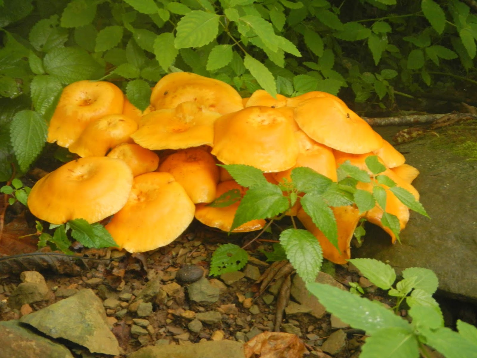
Unidentified mushrooms

Syrphid fly on flower:

Eastern tiger swallowtail:

Silver-spotted skipper:

Dark form female, and male, eastern tiger swallowtails:

Orange fungus on dead log:

Indian Peace Pipe:

Turk's cap lilies:

Beetles on milkweed:

Turk's cap lily:

Yellow and green:

White-tailed deer:

Yours truly on Little Stony Man cliffs:

The sun sets on the week:

Polyphemus Moth:

I enjoyed my two weeks helping to lead hikes for the Road Scholar program.  It was great fun with wonderful folks on beautiful hikes.  I look forward to going back in early October.

Thursday, August 8, 2019

Future of this Blog

In a word - undecided.  I've done a fair amount of hiking since my last post, especially leading two Road Scholars groups - one in June and one in July - for a week of hiking in Shenandoah National Park.  And I went for a hike with a group yesterday up in the Blue Ridge.  But I haven't been motivated to write posts on these yet, and my computer is having problems connecting to the internet (I'm writing this on an iMac, which I have limited experience with and knowledge of).

So I need to think some more about the blog's future.  Keep on?  Only post really great hikes? Pull the plug?  Not sure.

Tuesday, June 18, 2019

Are the Grayson Highlands Fabulous? Roger That!

The Grayson Highlands, in Southwest Virginia, include our state's highest terrain.  Mount Rogers, at 5,729 feet, is the highest point in the east north of the Smoky Mountains until the White Mountains of New Hampshire.  Not only is it beautiful up there, but the vegetation is closer to that of southern Canada than it is to the rest of Virginia, and there are wild ponies, which makes it truly unique.  This time of year, the mares are foaling, and there were little ones all over the place.


I'd been in this area twice in the last seven years, and felt it was time to get back.  Maybe I could catch the rhododendron bloom!  So I put together a group for a three day hike in that area, including a hike to the top of Virginia's roof: spruce and fir covered Mount Rogers.  Seven of us ended up going on the hike.  Here are the other six at the trailhead in Grayson Highlands State Park.


This shows the track of the 15+ miles hike, essentially a big loop and hiking in a clockwise direction.  We started Thursday at the purple star to the south, and hiked up to Rhododendron Gap, camping at the red circle.  Once we set up camp, we hiked west to summit Mount Rogers (pink circle) and got water at a spring about a mile from camp.  On Friday, we broke camp and headed northeast over Pine Mountain, arriving at Wilson Creek for a second night of camping out (blue circle).  Saturday morning, we hiked just 2.5 miles back to the cars and got ready for the long drive home.

Where to start?  The scenery in this area is often spectacular.  The ponies eat continually and keep the high ridges as open country, almost as if it's above tree line.  So this gives a lot of gorgeous open views.


And the ponies themselves are a big draw, especially the foals - which are really cute!


Here is the seven - eight if you count Brody, who used four wheel drive to get over the tough parts - of us partway through the first afternoon of hiking.  We came from five different areas of Maryland, Virginia, and North Carolina, believe it or not.  We had never hiked together before, and three of the group had never been backpacking!

Yours truly, pony in the background.  The ponies are semi-wild.  They are tolerant of humans but need to be treated like any wild animal.  Don't touch or feed them.  They will kick, and they will bite.

Here were the only Rhododendrons still in bloom!

Morgan heading up through "Fat Man's Squeeze."

Once we set up camp, we headed towards Mount Rogers.  There are simply gorgeous views along the way.

Here are my companions on the summit of Mount Rogers, the highest point in Virginia.

There is not much a view from up there.  It is covered in Fraser fir and red spruce.

On the way back, I filtered six liters of water at the Thomas Knob spring.  Here, Raja filters water for his night.

We had a great campsite, plenty of open space for multiple tents.  But it was chilly and very windy.  Temperatures in the night were in the 30's.  It's been raining up there for days - we lucked out and only had dry weather - and any wood we found was wet.  We couldn't sustain a campfire, so we talked about great campfires we had known in the past.  The cold and wind, and lack of a fire, resulted in an early bedtime for most of us.

Here is a satellite view of our trek up Mount Rogers: camping area (red circle), the summit (pink circle), and Thomas Knob spring (blue arrow).  Note the open ground to the south.  Without the ponies, it would look more like the forested area north of our track.

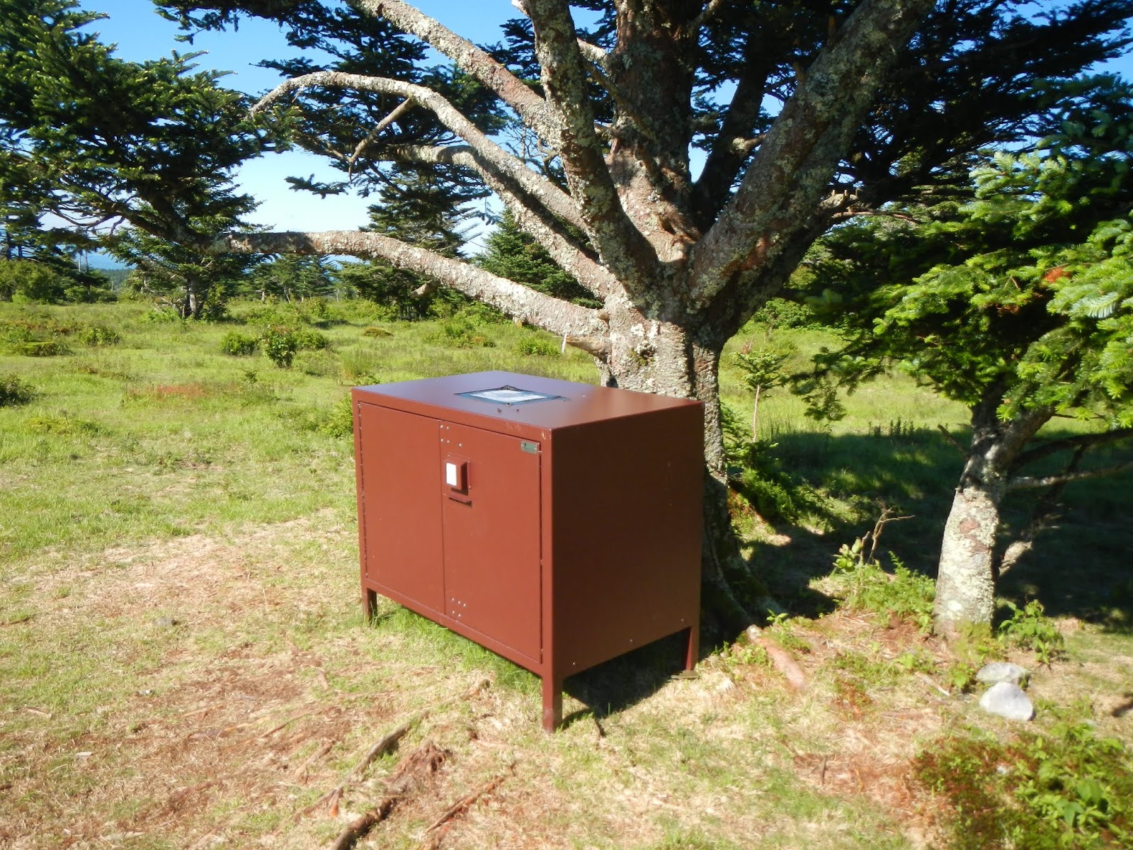
About 300 feet from camp was a nice bear box to put our food in.  We didn't see a single bear, but kept hearing how aggressive they are around there about food.

In the morning, a large group of wild ponies was gathered near the bear box.

 Here is another group photo.  No, the land is not sloped like that.  The camera was on my pack, which was clearly at an angle.

Friday was a delightful day of hiking!  The weather was fabulous - sunny and cool but not chilly, and greatly diminished winds.  We only had about 6.5 miles to cover, and most of it was downhill with no steep uphill sections.

Just past Rhododendron Gap (and its non-blooming rhododendrons) is this huge rock sticking upwards.  Allen bravely climbed to the top, reporting amazing views to be had:

I give you the Griswold Family Christmas Tree:

We had two possible routes today - one going through more open country, the other going through more forested country.  Guess which we chose?


After more wild ponies - this is my fourth time here, and I think I saw more ponies than on the other three combined - and....

a relaxing lunch break at the scales,

we arrived where I had planned on camping on Wilson Creek, just before the park boundary.

We ate dinner, and Morgan got a great campfire going, which we enjoyed well past "Hiker Midnight" (9PM).


Wilson Creek lulled us to sleep with its wonderful sounds, and

provided all of the cold, clear drinking water one could want just a stone's throw from our tents.

A couple of the group needed to get home by 5PM Saturday, so we hit the trail by 8:30 and only paused for a quick photo or two.  Morgan, Rudy, and I are tired but happy,

as we enjoy the final views before reaching our cars and getting back to civilization.

This was my third time backpacking here since 2012, and it has been a charmed three trips - perfect weather - well, okay, a little chilly at times - every single day, good companions to hike with, beautiful scenery, and interesting animals.  If you are into hiking, then this is a fabulous place to see!