Monday, September 10, 2012

Ever Been Lost?

Back in my sailing days, so long ago it barely seems possible, when I sailed my 23 foot sloop off the unforgiving Coast of Maine, I heard the following:  There are three kinds of sailors: those that have run aground, those that are about to run aground, and those that lie.  I was the first type of sailor.  I'd had the boat less than a year when I misinterpreted a chart and slammed the boat's keel into one of Maine's many treacherous underwater granite ledges.  I never did it again. Came close now and again, though.

But I wonder if the same applies to hikers?  Are there three kinds of hikers: those that have gotten lost, those that are about to get lost, and those that lie about getting lost?  So I thought it would be fun to put a poll out there on the subject.  I've not done a poll in a good long while, so what the heck?

Even such a luminary as Daniel Boone could get lost, although he had a slightly different take on his experiences in the trackless wilderness of Virginia and Kentucky.  When asked if he had ever gotten lost, the intrepid outdoorsman reportedly said, "No, but I was bewildered for three days once."

Me?  I've never been lost in the woods.  Nor have I ventured into trackless wilderness.  I've probably been bewildered for a bit now and then, of course.  And maybe I am in that second group of hikers: those that are about to be lost.  But that is why I carry a compass and a topographic map, and also my trusty GPS (something that didn't exist when I would sail the "Snowbird" in Casco Bay).

How 'bout you?  Ever been lost?  Ever been bewildered for three days?

Friday, August 24, 2012

A Short Hike to a Beautiful Spot

On late Friday afternoon, my daughter-in-law Sarah and I hiked to Pyramid Point in Sleeping Bear Dunes National Lake Shore on the Eastern shore of mighty Lake Michigan. I had last been here three July’s ago, the day before my 58th birthday, and nearly died (figuratively) when I went down to the lake shore and then had to clamber the 260 vertical feet back out over the soft sand cliffs. This time, there was no such foolishness on my part. I had learned my lesson, and just peacefully and non-aerobically admired the incredible views. This map shows the location of this spot, in reference to my Wednesday hike on the Leelanau Peninsula.

This spot is one of the more remote ones in this beautiful lake shore (to read about the legend of Sleeping Bear Dunes, go to my post of three years ago.) But it is also popular, so there is not tremendous solitude here, plus it is only about a kilometer walk each way from the parking lot to this spot. This map shows the track I took as an out and back, including a short side trip by myself ( Sarah had a headache and went back to the car) through the forest. On this side hike, I saw a shrew but that was it for wildlife on the entire two mile hike.  The starting and ending point is at the arrow.

The views from the cliffs extend over Lake Michigan and past the North and South Manitou Islands. These would both be great places to do overnight hikes to some day. Being islands far out in a huge lake, they are not easy to get to. Even on cloudy days, the views are great at from Pyramid Point’s cliffs. Being high up, there is a moderate climb to reach this spot, as shown on the elevation profile:

Here are some more photos of the hike. At the end, as a bonus, I threw in a couple of pictures I took Wednesday evening from Good Harbor Beach of the sun setting next to Pyramid Point.

South Manitou Island is in the upper right of the photo, far out in Lake Michigan.
 A Great Lakes freighter heads north, perhaps towards the Mackinaw Straits.
 260 feet below us, and feeling nearly vertical when you are down there and climbing back, a narrow beach abuts the lake.
The hike to Pyramid Point passes through beautiful northern woodlands,

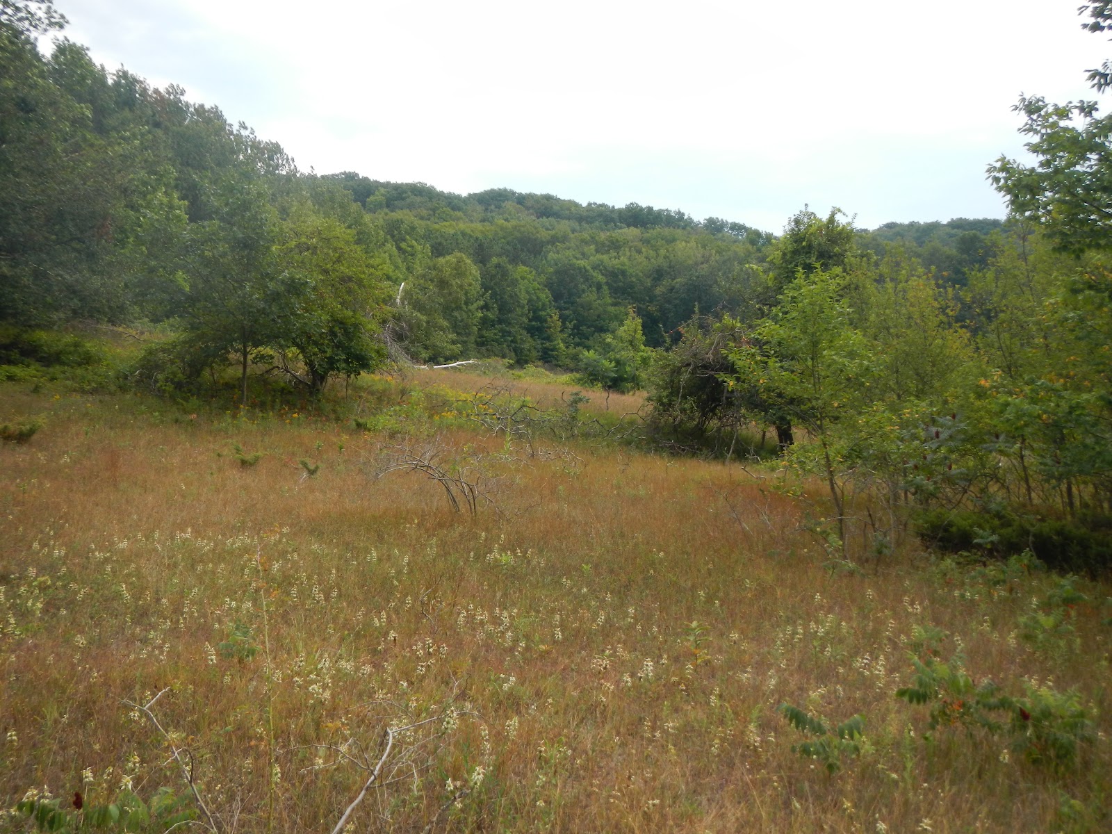
 as well as past a pleasant open meadow.
Two nights before, we watched the sun set behind Pyramid Point from Good Harbor Beach.


Wednesday, August 22, 2012

Hiking on Michigan's "Pinky"

If one looks at a map of Michigan's Lower Peninsula, it can look a bit like someones right hand, palm forward, facing you.  A thumb on the lower right; the index, middle, and ring fingers lumped together; and the little finger.  Last week, on Wednesday, I got up early and took a five mile hike near the "fingernail" of that "pinky," hiking the Mud Lake Trail in Leelanau State Park (purple arrow in the map below).  It was a blast, and it was also my fifth new place to hike this year towards my goal of 10.

This hike was very pretty, mostly in a northern hardwood and spruce forest reminiscent of Maine.  There were also some great view of Lake Michigan, and some partial views of Mud Lake.  I saw a few chipmunks and a jet-black squirrel, and heard an annoyed red squirrel sounding his displeasure.

Here are some photos, starting with a map of my route (starting and ending at the purple circle on the bottom of the map, and moving clockwise - with two side excursions for views of Lake Michigan).

 You can see from the elevation profile that this is a pretty easy hike, with some ups and downs but nothing extreme.  The total elevation gain is only about 600 feet, spread out over five miles.
 From the dark forest of northern trees, take a view more steps, and ...
 ... you are rewarded with expansive views of Cathead Bay on Lake Michigan.
 Here is a panoramic view from this same point.  Click the image for a better view.
 I love walking in the northern forests.  It is a nice change from the mid-Atlantic's also beautiful - but in a different way - forests
 For one thing, we don't have white birch to speak of in Virginia.  It is one of my favorite trees.

Saturday, August 18, 2012

On Walking

Obviously, I love to hike, but I also get a lot of pleasure from just plain walking. Running – well, that seems to be a love – hate relationship, or maybe a like – dislike relationship is more accurate. With my knee pain ever since this past winter, I am not running right now. But I am walking.  Not as fast as I used to before I was running and when I could turn out 13.5 minute miles for 26.2 miles.  But still, at a decent clip.

Getting up early and walking is difficult on my new work schedule with longer work days. I do it when I can, even if it is just for a short walk. And going for a walk at lunch is something I generally don’t do this time of year in the hot Virginia days. Why, I’d return to work a sodden mess! But even at work, I find ways to walk a bit. I take the stairs instead of the elevator. When you work on the seventh floor, and routinely have meetings on the 14th and 15th floors, it adds up. I’ll walk over to see someone rather than calling or instant messaging. And at home, unless I have a lot to buy, I will walk the half mile each way to the grocery store.

I turned 61 just over a month ago. A few days later, we went to Pittsburgh and I also replaced the battery on my trusty pedometer. I decided that it would be kind of cool to see how many steps I take before my next birthday, so I am tracking that. So far, just shy of the first month of counting, I am a little bit below 400,000 steps. With cooler weather approaching, I will hope to be walking at lunch again – my short 30 minute lunch break – but also maybe after work a bit. And hopefully, I will get out for some more hiking. I still have six more new places in 2012 to reach my goal.

Sunday, August 5, 2012

A New Goal for 2012

I hadn't set a lot of goals for this year.  One I did establish was to run the Shamrock Half Marathon last March in Virginia Beach.  I wanted to do this as a 10 year cancer survivor, and also as a 60 year old.  Hey, I may be slow, but I bet less than 5% of 60 year olds can do a half marathon.  And I bet the percentage of 60 year old cancer survivors who can run a half marathon is even smaller.  I had another goal of doing a marathon this year, my fourth ever, but the knee pain I experienced in my left knee all through training this past winter and continuing after the Shamrock has convinced me that the goal of being able to walk at the end of the year trumps my goal of doing another marathon anytime soon.  Even so, I felt pangs when I was out walking today and ran into a neighbor who excitedly told me that she had signed on to run the Richmond Marathon in November - her first!

But the other day, I thought of a pretty cool goal for myself, one that I am excited about.  I want to, as a 10 year cancer survivor, hike 10 new trails- or at the least, places I have not been into for at least 10 years - by the end of the year.  To count, it has to be a real hike, not just a walk (like my Pittsburgh trip), and has to be at least five miles long (which rules out my hike in Pocahontas State Park earlier this year).  I'll also consider bike rides in the great outdoors or kayaking - but I have to use my own muscles for it to count.  I don't own a bike at this point, or a kayak, by the way.

I'm off to a good start with four new hikes this year so far:

Beach Church Rock - a wonderful hike Shenandoah National Park, with the bonus of seeing two black bears
St. Mary's Falls - a rugged and scenic hike in the George Washington National Forest
Sky Meadows State Park - beautiful scenery in the Blue Ridge foothills in Northwest Virginia
James River State Park - I didn't see another person on the trails of this park during my nine-miler this past Friday.

So, stay tuned!

Saturday, August 4, 2012

Hiking in James River State Park

Yesterday, I had the day off because of my flexible schedule that I finally have that gives me every other Friday off during two week periods where there is not a holiday.  It is great leaving work Thursday afternoon realizing that I have a three day weekend ahead.

So given a day off to myself, I decided to go hiking in James River State Park, a place that I have never been before.  It seemed appropriate, as 20 years ago on that date I started my job at the Department of Conservation and Recreation, which manages our wonderful state park system.  This park is on a bend of the beautiful James River about 95 miles driving from my house.  The James forms in the Appalachian Mountains where the Jackson and Cowpasture Rivers meet, and it is the longest river in the State.  It flows only in Virginia, and eventually meets several other rivers to form Hampton Roads, which joins the lower Chesapeake Bay.

The park is on a section of the James which looks fairly shallow under normal conditions.  It is not terribly wide there, maybe 100 meters.  I walked a loop of these trails: River, Cabell, Branch, and Running Creek.  I hiked 8.8 miles but it would have been closer to eight if I hadn't missed a couple spots, one because I went the wrong way for a short distance, the other because the map I used didn't reflect what was on the ground.  The trails are very well marked, other than the one intersection, and it was a really nice walk with some up and down, but not with the aerobic workout of Sky Meadows earlier this week.

I walked through a wide variety of habitats and trail conditions - tall, dewy grass that soaked my boots, full son, mixed open areas and forest, and dense forests.  There was also a nice nature trail on the way that looped around a small pond that I walked around.  I didn't see a lot of wildlife, but did spot a kingfisher, a great blue heron, a cottontail, and a number of gray squirrels.  I also heard tree frogs calling but couldn't find the well-disguised little beasts, and I heard a bobwhite quail eastern wood peewee singing out their names.

Here is a map showing my route, starting and ending at the purple arrow in the lower left.  I walked clockwise from there.  The red arrow shows where I went the wrong way for a short distance, and the red circle shows where I walked back and forth several minutes trying to find the trail I wanted to end up on (Running Creek).
 Here is the elevation profile of the hike.  There was only a difference of about 300 feet elevation between the high and low points of the hike, but there is enough up and down that I gained and lost about 1,200 feet during the hike.

Here are some photos from my hike on what normally would be a work day, but instead was a hot and humid day spent joyfully outdoors.

This section of the River Trail had tall, wet grass but was pleasant to walk through, although the sun was hot.
 The James River flows along, still a couple of hundred miles from Hampton Roads.
 This small wetland was where I saw the great blue heron and kingfisher.  An interpretive sign said that there is lots of beaver activity here, but I didn't see any of the large rodents.
 Speaking of rodents - well, technically lagomorphs - this cottontail allowed his or her photo but then got spooked and made a spectacular leap into the woods.
 We are in the foothills of the Appalachians here, as you can see in this view from the trail.
 You've heard of the "Bridge to Nowhere" in Alaska, of course.  Well, I guess this is Virginia's version.
 The Tye River joins the James at this point, flowing from the mountains from the northwest and joining the James at a right angle.  This looks peaceful, but on August 19, 1969, the remains of Hurricane Camille stalled over this area and dumped 27 inches of rain in about three hours.  The James actually flowed up the Tye for eight miles!  The flooding drowned animals up in trees and flash floods during the middle of the night killed over 150 people, many of whom were never found.

If there was less haze you would be able to see The Priest, site of my backing trip in 2010 and about 20-25 miles from here as the crow flies, just over the ridge to the right of the Tie River.  It was about 70 degrees cooler on the day that I did that hike.
 A train loaded with coal from West Virginia and headed to Europe (the coal, not the train) crosses the railroad bridge over the Tye River.  In  a couple of hours, this train will be rambling through Richmond right past my favorite lunch spot.
 The trail headed through this pleasant pine forest about a mile or so before I got back to the car.
 I enjoyed the beauty of this flower, but the bumblebee inside enjoyed the nectar and pollen.
 It would be hard to miss the eye-catching color of these trumpet flowers.
 Near the end of my hike, I spied these colorful mushrooms in the path.

Monday, July 30, 2012

Sky Meadows State Park

One of the things I want to do this year, my tenth since surviving lymphoma, is to hike in some new places.  I did that nearly two months ago at Bear Church Rock.  Yesterday, I made it to another one: Sky Meadows State Park in Northwest Virginia.  It is a place that I have wanted to get to for a while, and when it was posted as a Meet-up, I signed on for this day hike.  150 years ago, great armies moved back and forth here to fight some of the bloodiest battles in American history nearby.  Their campfires would have lit up the night skies.  Today, everything here is peaceful and bucolic, the way it should be.

This hike covered about 8 miles, carefully plotted out by our hike leader, Marc.  He did a great job organizing things and getting us to the trail head just after 11AM.  We cobbled together a circuit hike with these trails: Gap Run; Snowden Interpretive; South Ridge; North Ridge; Appalachian; Old Appalachian; Appalachian again; Ambassador; Piedmont Overlook; and Gap Run.  This map shows where we went, starting and ending at the purple arrow, and moving clockwise for the most part.

Although this is not a super-strenuous hike, there was plenty of elevation gain and loss, and on the hot, humid day, my clothes would not have been more wet had I jumped in a stream (of which there were none).  We gained and lost nearly 1,800 feet.  Note - click on the wide photos to see the entire image.

One thing I've noticed after every hike in mountainous terrain this year is that my left knee pain returned.  This pain started in the winter as I trained for the Shamrock Half Marathon, and despite not running since March and doing a lot of PT work, it will not go away.  Part of me wonders if my marathon and half-marathon days are all in the past.  But you know, 10 years ago, I was getting some pretty nasty chemotherapy, so by comparison, a little knee pain here and there is not so bad.

Here are some pictures of this fun and very scenic hike, as we rambled through forests and open meadows, watching colorful butterflies flit about.

Sky Meadows has beautiful views across the many open areas, such as this panorama from South Ridge.

Here is our mighty Meet-up group of seven hikers this day.
Meadows and mountains...
A plantation and manor house used to be on this site.  It burned down in 1913.
Historic and scenic Harper's Ferry W.V. is just a two or three day hike north from here up the Appalachian Trail.
About 70% of our eight mile hike was in heavy mid-Atlantic forest.
This beautiful section of the Ambassador Trail was in a transition zone from the meadows to the forest.
Views across a meadow.
The Virginia Piedmont (from French for "feet of the mountains") from a Sky Meadows ridge.
Panorama looking towards the east.

Saturday, July 28, 2012

Rambling Around the Steel City

Like a phoenix rising from the flames, smoke, and ashes of heavy industry, the city of Pittsburgh has undergone a rebirth.  This one city produced more steel during World War II than all of the Axis nations combined, but Pittsburgh was also known for heavy air and water pollution.  Since the steel industry's decline, this metropolis in Western Pennsylvania is experiencing a renaissance into the financial and service industries, as well as tourism.

Although I didn't hike in Pittsburgh, I did walk for about 22 miles in my two and half days there last weekend, and I saw a lot of the local sights.  Here are some photos to prove it.

The Carnegie Museum of Natural History had excellent collections of geology and gems,
 prehistoric life, and other collections.
 We also enjoyed the Carnegie Museum of Art:
 Hometown Pirates hero Roberto Clemente is memorialized outside of PNC Park,
 where we saw the Pirates defeat the Marlins Saturday night.
 After the game, we were treated to nice views of the city at night as we walked back across the Roberto Clemente bridge, shown here in the foreground.
 I walked for miles along the riverfront.  Pittsburgh has 70 miles of riverfront and over 400 bridges, including the Roberto Clemente Bridge.
 A short distance away is the Rachel Carson bridge, dedicated to someone that I have admired for a long time.
 There is also some good public art in the city.  Based on the paucity of taxis I saw, this business man might still be waiting.
 As we walked across the Fort Pitt Bridge, you can see why Pittsburgh is here.  Originally called the Forks of the Ohio, the Monongahela River (foreground) and Allegheny River (behind the point) join to form the Ohio River, which joins the mighty Mississippi at Cairo, Illinois.
 We walked a goodly amount to ride the Duquesne Incline up Mount Washington for magnificent views of Pittsburgh.
 Heinz Field is directly across the Ohio from the Duquesne Incline.  As a Philadelphia Eagles fan, I am rarely going to cheer for the Steelers, who play here.  But as winners of six Super Bowls (six more than the Eagles have won), I do have to give them grudging respect.
 Click the photo to see the full panorama from Mount Washington.  The Allegheny River is on the left, the Monongahela in the right foreground.  The point (now Point State Park) used to contain Fort Duquesne of the French until the English captured it in the French and Indian (Seven Years) War.  Then, Fort Pitt was built here and the city gradually grew up and spread from there.  I wonder what George Washington would think if he could see this?
 The Fort Pitt Blockhouse is the oldest surviving building in Pittsburgh.  It has double rows of musket ports to guard the advances of the now gone Fort Pitt from Indian attacks.  After the French were defeated, horrific wars and revenge killings between the Indians and Americans continued in Western Pennsylvania for a good many years, including during the Revolutionary War.  The excellent Fort Pitt Museum, a stone's throw from the blockhouse, tells this story - among others - really well.
 The World War II Submarine USS Requin is now a museum.  I wonder if it is constructed from Pittsburgh steel?  We got close to it during a one hour scenic river cruise on Pittsburgh's three rivers.
 Here is view of the Point with Pittsburgh rising behind it from the cruise boat.  The Allegheny River is on the left.