
What is orienteering? Well, you find your way with a map and, if needed, a magnetic compass. Leave the GPS behind, which would be cheating. The FUMA Orienteering Club had four courses, and I choose the second easiest, being pretty new to it. Maybe I should have stepped up and tried for a harder one. This didn't seem as difficult as the first time I did orienteering in 2013. The goal is to locate a number of points, each marked by a numbered flag with a paper punch. You punch your sheet of paper - there is a distinctive pattern for each punch - to prove that you actually found the objective - and you are timed. So it can be looked on as a competition if one wishes. In my case, I just wanted to enjoy a walk in the woods and fields, and locate all of my flags, of which there were 12.
The topographic map is pretty detailed, with each flag location marked with a number and a circle, the course essentially following a circuit hike of a couple of miles. The distance turned out to be 2.9 miles in my case, including some detours and a bit of wandering trying to find a few of the flags.
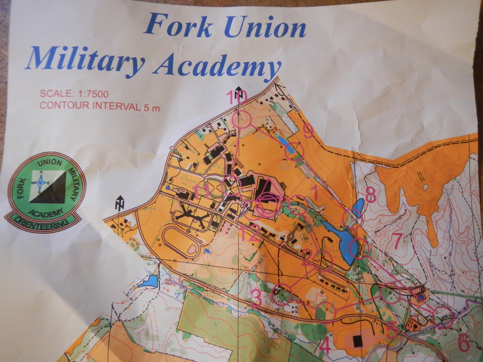
Here is a close up showing where flags #1 and #2 on the course that I did were located, and also #12 at the end:

Does this look like Virginia to you? Not to me! The snow cover was pretty much uniform, and was just a few inches deep, having compressed considerably over the last few days. Temperatures were in the low or mid-twenties during my walk, and have rarely been above 25-35 for the past 12 days.

This was one of the prettiest spots during the entire orienteering course, with a lovely little stream flowing along.

Here is an example of a marker, each of which has a number that you compare with the list on the back of your map to make sure that you are at the right one - since it is easy to get confused, and there are four different levels of course to cover. Note the hole punch hanging under the bag. This flag was in the middle of soggy little wetland.

This is actually a small lake, totally frozen over. We don't see a lot of this down this way, but when temperatures stay below freezing most of a time for a while, the laws of physics are going to be obeyed.

I enjoyed being outside in the fresh air today, and working on something challenging. As it turned out, I only needed to use my compass a couple of times, because the map was so detailed. I don't know if the snow made this easier or more difficult. It made walking harder, but at the same time, there were lots of tracks that sometimes gave directional clues. In any event, it was a fun and somewhat challenging way to start the 2015 hiking season out. My goal is to hike 200 miles this year, so I still have 197.1 to go!


