Saturday, March 12, 2016

Dismal, No; Fun and Interesting, Yes!

One of my hiking goals for the last couple of years is to lead some hikes, and as part of that, get more active in the local hiking group, the Old Dominion Appalachian Trail Club (ODATC).  Yesterday, my day off, I took some action towards that goal by leading a group ODATC hike on the Washington Ditch Trail in the Great Dismal Swamp.  This trail goes to Lake Drummond, one of only two natural lakes in Virginia.  This large (3,100 acres) lake was likely formed by either a meteor impact or by a long burning huge wild fire in a deep peat deposit.  Four of us hiked this together yesterday.  It was a great group of people to spend a day out together in a place that was far from dismal.


The hike was an out-and-back, with a total distance of 10.2 miles.  The pathway was level, smooth, and dry, even though there was wet swamp all around us.  Near the trailhead, there is an interesting "boardwalk" pathway that goes through the swamp, and it is well worth taking.

We saw a fair amount of wildlife: turtles (common snapping turtle, red-bellied slider, and yellow-bellied slider); black vultures; pileated woodpeckers; a large cottonmouth; double-crested cormorant; three unknown ducks; great blue heron; several groups of butterflies; and some kind of a carnivore from a distance.  We think the latter was a bobcat, as it appeared to have (through binoculars) a cat-like face, short ears, and no prominent tail, but we couldn't rule out a grey fox.  We decided bobcat, 90%.  My last hike here, three years ago, I saw this animal - but not this time.

There are many other pathways to explore in what is left of this large swamp, much of which has be drained and converted to housing developments, farms, and woodlots.  The part that remains (113,000 acres plus the lake) is a national wildlife refuge and "contains some of the most important wildlife habitat in the mid-Atlantic region."  The Washington Ditch trail is a straight shot to the lake, and is very pleasant and interesting.  Water is always to one's right walking to the lake, and quite often on the left was well.  There are large stands of cypress and other water tolerant trees the entire way.

Here are a bunch of photos from our never-dismal hike, starting with Jeff, Jo Lee, and Aseeyah at the start of the hike.


This hike has some historic significance as well as great natural history.  George Washington did the original survey work for a canal here.

This is typical of the swamplands along the pathway.

A raccoon passed this way and left its tracks.

Spring flowers, such as this violet, are beginning to bloom here.

This group of butterflies, which I believe are zebra swallowtails, were clustered on some animal scat.  There were also a few tiger swallowtails that came in to the cluster at times.

We saw many turtles, like this yellow-bellied slider, catching some rays on this day with temperatures in the mid-Seventies (F).

Along the hike, we found many pieces of wood that had been cut by beaver and stripped clean of bark, one of their major food sources.  And near Lake Drummond, we saw a beaver lodge.

Lake Drummond, one of Virginia's two natural lakes.

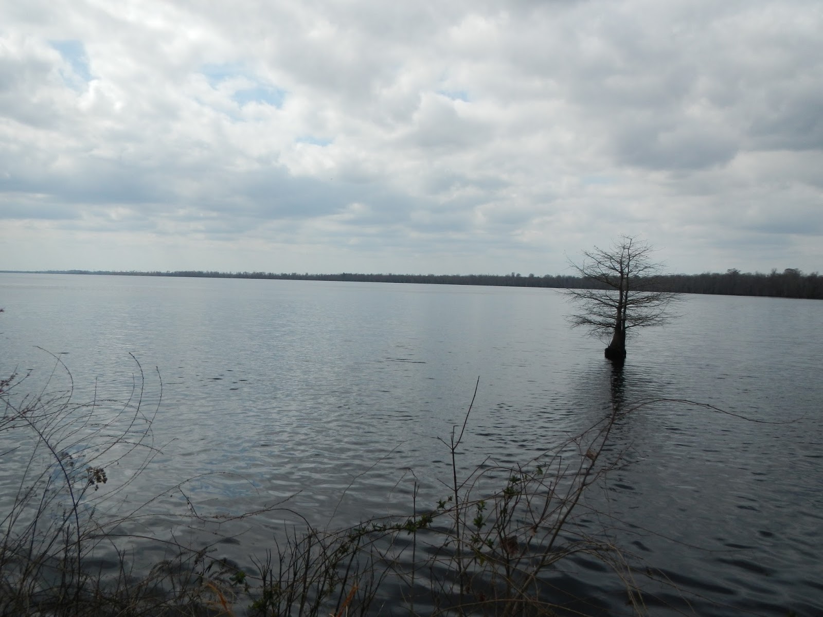
The lake water looks a bit like weak tea from the tannic acid.

We saw this large water moccasin (cottonmouth) near the lake shore.  Although we were just feet away, it was not aggressive - nor were we.  With binoculars, we could see the "pit" on its snout, which makes it a member of the pit vipers.

Swamps were once considered wastelands, but we now know that they are very important ecologically. Plus, they are just plain interesting.


Cypress "knees" are part of the root system of the cypress, and are believe to help anchor the tree's shallow roots in a wet environment and perhaps aid in the oxygenation of the tree's roots.
We all agreed that this was a fun day hike, and beat working (for those who still work).  Aseeyah thought that it would be great to come back here for a night hike to explore the swamp after dark, which would be very cool with headlamps or even in a bright full moon.  And she and I thought that coming here a couple of times a month year round and taking careful note of the changes would be a great natural history study (she and I are both studying in the Virginia Naturalist program).

Sunday, March 6, 2016

Austin Mountain Fire Road

Today, nine of us with the Old Dominion Appalachian Trail Club got together for a nice, moderate hike up and back the Austin Mountain Fire Road in Shenandoah National Park.  Thanks, Jenni, for organizing and leading the hike.


This was 5.5 miles each way, all uphill on the way up and all downhill on the way back, for a total elevation gain of perhaps 1,500 feet.  Being a fire road rather than a trail, the surface was very easy to walk on, and we were able to hike several abreast and chat, always a pleasure up in the mountains.  Here is the route we took.  You can see that the fire road goes up through a gap between Austin and Furnace Mountains, ending at Brown's Gap on the Skyline Drive.  Some notes: we started and ended at the red arrow.  We had lunch up on the Skyline Drive at the red star.  The purple arrow marks Austin Mountain and the orange arrow marks Furnace Mountain.  There is a great little backpacking trip of three days through this area.  To see photos and and accounts from my backpacking trek here in 2011, go here.


Here are a few more photos from this fun day of hiking back in the mountains.  In this one, some of our group stroll along the flat section that dominates the first mile of the hike.


Back on my 2011 trip, my buddy Hawkeye and I camped our first night around here.  I remember that it was hard to find a good campsite and that it was quite cold that first night, about 18 degrees F.

Here are the other eight of us (other than yours truly) on our lunch break up at Brown's Gap.  We were there about 20 minutes, and only a half dozen or so cars went by in that time.  We would do "the wave" as they approached.

Here is a view of Furnace Mountain high above us.  There is a great view point at the top.

It does not get any easier in the mountains than a fire road. This one is exceptionally well maintained.

And here is Austin Mountain high above.  I don't remember great views from near the top, but there was lots of broken rock to hike over.

We didn't see much wildlife: one white-breasted nuthatch to be exact.  And I heard a pileated woodpecker.  But it was a great day in the woods, and my painful knee and ankle held up reasonably well - since the trail was so smooth.  I lead a group hike the end of this week to the Great Dismal Swamp, and so will be back out on the trail really soon.