On "Black Friday," the day after Thanksgiving, most people head to the malls. Not me! I followed REI's advice and went for a hike - in the Great Dismal Swamp in Southeastern Virginia. I want to lead another hike for the Old Dominion Appalachian Trail Club there and was scouting out the hike. I hiked in the NW portion of what is left of the swamp, which is a fraction of its original size due to development. My goal was to do a circuit along the dike trails, or "ditches" as they are called. The ditches were dug mainly by slave labor.
Now they are no longer maintained but allow for the slow flow of water along them, and there are foot / bicycle paths running along their lengths to some extent. My route was in the Jericho Ditch area, specially along Lynn Ditch to Middle Ditch. However, Middle Ditch was so choked with thick vegetation after about a mile that I turned back.
Here are the images of my track, starting at the circle and turning back at the arrow. I hiked for a total of just over 10 miles.
Here is a satellite image of the hike. You can see the development just outside the swamp. You don't want to venture off the paths here. It would be a miserable and dangerous slog through the swamp.
Early in the hike, I ran into three men bicycling with three dogs running along, and then a solitary hiker. They were the only people I saw until I was nearly back at the car. People tend to park and go for short walks here. The hiker was returning and showed me a photo of a bear paw print that he had taken. I thought that was pretty cool, and wondered if I would be lucky enough to see a bear - at a little distance this time!
The paths along the ditches are straight as arrows here.
This is what Lynn Ditch looks like.
I liked the reflection of the shrub in the water.
This large pine tree stood alone by Middle Ditch.
So, for a while, Middle Ditch was just fine, and I wondered would it would be like to complete the circuit. I was carefully keeping track of each turn and the distances so I could lead the hike appropriately. Here is what it looked like for the first 3/4 mile,
then it started slowly getting more and more choked with vegetation -
and finally, it was like this: essentially impassible.
So, I reluctantly turned around and made the loop hike an "out and back." I'm glad I learned this before I led a group here, which is the whole idea behind doing a hike yourself before making it a group hike.
Right as I turned around, I saw this interesting little animal. It did not move away as I got closer, seemingly secure in its camouflage. A naturalist friend tells me that is is a Long-headed toothpick grasshopper!
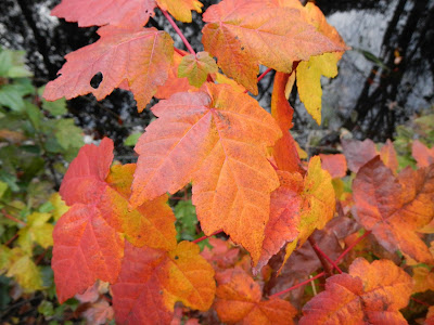
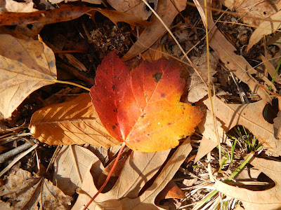
Fall was still in the air in late November, as in evidence by these lovely leaves:
This was my third hike in the Great Dismal Swamp, and even though I don't enjoy hiking with binoculars around my neck, I've learned to do so here because I tend to see animals at a distance in the straight pathways. The first time, it was a group of four river otters. The second time, it was a bobcat - or perhaps a fox, but our group voted bobcat. And this time, as I headed back up along the Lynn Ditch, I spotted a dark spot in the path a long ways away - maybe 1/3 kilometer or so. I glassed it, and it was a black bear! I used the extreme zoom in my camera to get a photo, and then slowly walked towards it.
The bear did not seem to have detected me. It moved back and forth across the path, like it was investigating food sources. At times, it would stop that behavior and walk towards me. Eventually, I was able to get a better shot (this is still digitally zoomed).
After about 10 minutes, the bear was still well over 100 meters away, and it must have detected me, because it moved off the path and disappeared. It would have had to swim across the ditch. When I got to that point in the trail, there was no evidence that I could detect that a bear had ever been there, much less a few minutes before. While not as exciting as
my last bear encounter, I prefer this type - from a bit of a distance.
I am always grateful to see wildlife, and hiking in this area has never disappointed me. On the way out, I passed a pair of turkey vultures high up in a tree.
Maybe the malls were crowded and even a little dismal on Black Friday, but Black Bear Friday in the Great Dismal Swamp was anything but! I'll have to go back soon to scout another trip so I can choose the best one for the ODATC.


