Saturday, February 25, 2017

The (Swamp) Path Less Taken?

I had Friday off, and I wanted to scout out one more hike in the Great Dismal Swamp.  I am leading a hike there next weekend, and there was one more route in the northwest part of the swamp

that I could check out.  It must be the path less taken, because I saw not a soul during the entire 9.7 mile hike.  I didn't see any spectacular wildlife, but there were lots of turtles, and I tabulated 14 species of bird on eBird (wood duck, great blue heron, turkey vulture, red-shouldered hawk, mourning dove, barred owl, red-bellied woodpecker, pileated woodpecker, blue jay, Carolina chickadee, tufted titmouse, American robin, gray catbird, and eastern towhee).

Here is the track, essentially a big rectangle with an out and back portion.  I hiked the rectangle counter-clockwise, starting and ending at the Jericho Ditch parking area (red circle).  The first leg of the rectangle, and the out and back portion, is the Hudnell Ditch Trail.  The short leg going north is the New Ditch Trail, and the top of the rectangle heading west is the Williamson Ditch Trail.  The final short leg, heading south, is the Jericho Ditch Trail.

I've marked the distances of each leg.  The out and back portion was actually 1.65 miles but I rounded up.  At that point, the trail is no longer maintained, and it becomes thick with vegetation.  Can you spell "ticks?"  So I turned back.  You could do a hike of just over six miles by just walking the rectangle.

Hiking in the Great Dismal Swamp is always fascinating.  But for this route, there is almost always thick vegetation between the pathway and the water that lines both sides of the track.  So you usually can't see the water.  You can hear turtles, ducks, and other wildlife diving into the water or taking flight as you walk along, but you can't see them (usually).  So that was one thing I didn't like about this hike.

One of the first things that I saw was these four turtles, yellow bellied sliders or red cooters, I think, catching rays on this very spring-like February day.

Speaking of spring, here is one more sign.  Spring has come very early to these parts of Virginia.  It is actually kind of crazy.  We have had 8 days this month in Richmond where the temperatures have gotten above 70, which is unheard of.

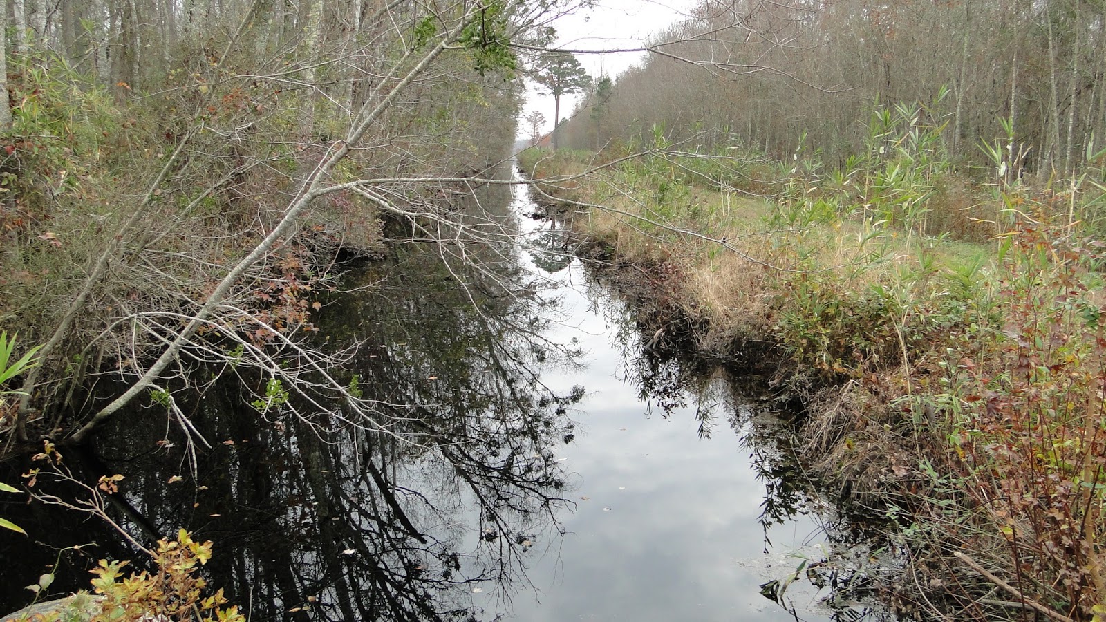
On each side of the pathway is a strip of water, but at least in this part of the swamp, the vegetation is so thick that you can hardly ever see it.

Along the way, I saw some butterflies, like this question mark, and this tiny hairstreak:


Remember that 1.65 mile out-and-back spur?  Here is what the trail looks like as you walk along:

and here is what the trail looks like at the turn-around point.

I reversed course and got back to the southeast corner of the rectangle, and had a lunch break.  While there, I spotted a log in the water with six turtles on it, and crept up for a photo.  All of them plopped into the water except this one brave one.  I am having trouble identifying him:

Another creature I found was this salamander, which I think is a southern dusky salamander.  I found a total of three salamanders on the hike.

When I got to the junction of the Williamson Ditch and Jericho Lane trails, with less than a mile to go, I got a surprise.  The trail was totally cut out.  At first I thought I would have to wade through the muddy ditch, but there was one dry area, so I slide down, walked across, and clambered up the other side.

Beats wading across something like this, eh?

This is the first hike (out of five total) that I've done in the Great Dismal Swamp where I didn't see at least one of these - otter, bobcat, or black bear - although I did see lots of bear and coyote scat.  But I still saw plenty of wildlife, and enjoyed a gorgeous spring day well away from the office.

Wednesday, February 1, 2017

Scouting the Swamp

I want to lead another hike into the Great Dismal Swamp, and so my first hike of 2017 was a scouting trip to find a good route.  Alas, the hike I took is not one I would lead a group on.  After 3.6 miles, the route was flooded and overgrown, and I turned back.  But I still had a good day outside, and even saw an otter early in the hike.

The last time I was here, I started the hike from the same point.  But two months ago, I was hiking on Lynn Ditch, and this time I went down Jericho Ditch.  Here is a map showing the location, in the Northwest part of the Swamp.

And this shows my track along Jericho Ditch, starting and returning to the blue arrow.  If you venture off the path, you are going to get soaked, tied up in dense vegetation, and possibly lost.  I did not venture off the path.

My hike was not very eventful, but it was good to be outside.  I did see the otter, and a couple of birds, and lots of bear scat.  I walked down the pathway, encountered the flooded area, and gave up and turned back.  I was walking about 3 hours, or maybe a bit less.  Most of the time, the path looks like this, with water on each side.


Less than a mile into the hike was this little structure, which reminded me of a bus stop. I wonder if it were some kind of bird banding station?  There is a big birding festival here in April.  I saw the otter very close to this point.

At my turnaround point was this old abandoned fire tower.

At that point was a large group of turkey vultures.

There was bear scat like this all along the trail.  Clearly, bears were not hibernating in this part of the world.  Unlike my last trip here, I didn't see a bear.

I've ruled out taking a group on this hike.  It was too short.  But I do have another area to scout out on my next foray in this area, so we will see what that is like soon enough.  It sure felt good to be out in the woods again.

Wednesday, December 28, 2016

Westmoreland's "Woodpecker Woods"

On Friday, December 16 - a very cold day - I did a four mile hike in Westmoreland State Park, mostly along the Turkey Neck Trail.  But I am going to call it "Woodpecker Woods," because I saw five different kinds of woodpecker - downy, pileated, red-bellied, red-headed, and flicker.  I like hiking in almost any kind of weather, including the cold, although I could have used an extra layer at times.  The high temperature there was about 27 F.

Here is the route of my hike, starting and ending at the blue triangle, and hiking counter-clockwise:


And here is a satellite view of the area, along with my route.  Note the forested wetland along the eastern-most part of the hike.

Most of the park is fairly mature hardwood forest, with lots of beech.

This looks like a field but is actually a wetland of some type.  It was not real wet at this particular time.

This part had some standing water.

The park borders the Potomac River, and for part of it, has dramatic sandy cliffs.  Fossil shark teeth are often found here.  The area was closed because of the risk of the cliffs collapsing.  Getting buried alive was not in my plans for the day, so I chose to follow the rules on the sign.

I saw this little group of buffleheads (a type of duck) in the river near the cliffs.


This was a fun hike and I saw a lot of birds, and even a couple of mammals, enough to write a "What am I?" post or two later.  It's been over a decade since I hiked here, but I'll be back for sure, next time with a better camera to get animal photos.

Saturday, December 17, 2016

Black Bear Friday

On "Black Friday," the day after Thanksgiving, most people head to the malls.  Not me!  I followed REI's advice and went for a hike - in the Great Dismal Swamp in Southeastern Virginia. I want to lead another hike for the Old Dominion Appalachian Trail Club there and was scouting out the hike.  I hiked in the NW portion of what is left of the swamp, which is a fraction of its original size due to development.  My goal was to do a circuit along the dike trails, or "ditches" as they are called.  The ditches were dug mainly by slave labor.


Now they are no longer maintained but allow for the slow flow of water along them, and there are foot / bicycle paths running along their lengths to some extent.  My route was in the Jericho Ditch area, specially along Lynn Ditch to Middle Ditch.  However, Middle Ditch was so choked with thick vegetation after about a mile that I turned back.

Here are the images of my track, starting at the circle and turning back at the arrow.  I hiked for a total of just over 10 miles.

Here is a satellite image of the hike.  You can see the development just outside the swamp.  You don't want to venture off the paths here.  It would be a miserable and dangerous slog through the swamp.

Early in the hike, I ran into three men bicycling with three dogs running along, and then a solitary hiker.  They were the only people I saw until I was nearly back at the car.  People tend to park and go for short walks here.  The hiker was returning and showed me a photo of a bear paw print that he had taken.  I thought that was pretty cool, and wondered if I would be lucky enough to see a bear - at a little distance this time!

The paths along the ditches are straight as arrows here.

This is what Lynn Ditch looks like.

I liked the reflection of the shrub in the water.

This large pine tree stood alone by Middle Ditch.

So, for a while, Middle Ditch was just fine, and I wondered would it would be like to complete the circuit.  I was carefully keeping track of each turn and the distances so I could lead the hike appropriately.  Here is what it looked like for the first 3/4 mile,

then it started slowly getting more and more choked with vegetation -

and finally, it was like this: essentially impassible.

So, I reluctantly turned around and made the loop hike an "out and back."  I'm glad I learned this before I led a group here, which is the whole idea behind doing a hike yourself before making it a group hike.

Right as I turned around, I saw this interesting little animal.  It did not move away as I got closer, seemingly secure in its camouflage.  A naturalist friend tells me that is is a Long-headed toothpick grasshopper!

Fall was still in the air in late November, as in evidence by these lovely leaves:

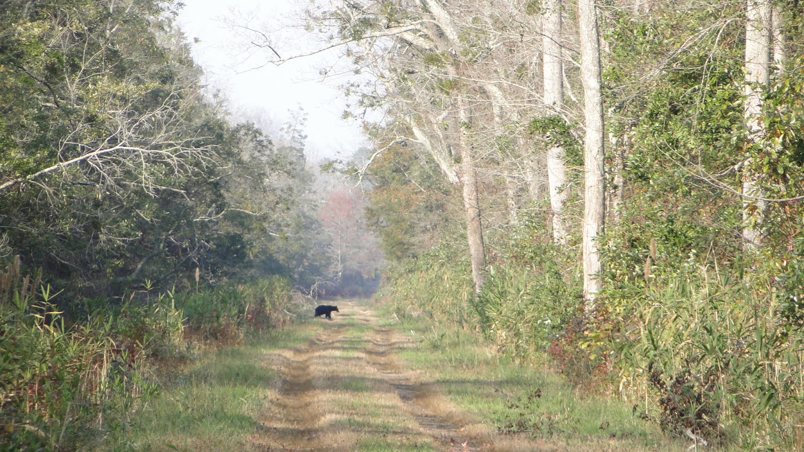
This was my third hike in the Great Dismal Swamp, and even though I don't enjoy hiking with binoculars around my neck, I've learned to do so here because I tend to see animals at a distance in the straight pathways.  The first time, it was a group of four river otters.  The second time, it was a bobcat - or perhaps a fox, but our group voted bobcat.  And this time, as I headed back up along the Lynn Ditch, I spotted a dark spot in the path a long ways away - maybe 1/3 kilometer or so.  I glassed it, and it was a black bear!  I used the extreme zoom in my camera to get a photo, and then slowly walked towards it.

The bear did not seem to have detected me.  It moved back and forth across the path, like it was investigating food sources.  At times, it would stop that behavior and walk towards me.  Eventually, I was able to get a better shot (this is still digitally zoomed).

After about 10 minutes, the bear was still well over 100 meters away, and it must have detected me, because it moved off the path and disappeared.  It would have had to swim across the ditch.  When I got to that point in the trail, there was no evidence that I could detect that a bear had ever been there, much less a few minutes before.  While not as exciting as my last bear encounter, I prefer this type - from a bit of a distance.

I am always grateful to see wildlife, and hiking in this area has never disappointed me.  On the way out, I passed a pair of turkey vultures high up in a tree.


Maybe the malls were crowded and even a little dismal on Black Friday, but Black Bear Friday in the Great Dismal Swamp was anything but!  I'll have to go back soon to scout another trip so I can choose the best one for the ODATC.

Thursday, December 8, 2016

A Short Fall Hike

Well, now I am two hikes behind again, so time to get cracking.  This hike, to Cumberland Marsh Natural Area, occurred on November 18.  My original intentions were to do a 10 mile mountain hike. Everything was packed and ready to go.  The day was perfect.  But I got up, looked at the sports page, and realized that my college team - Villanova Wildcats - were playing basketball on TV that Friday afternoon.  So after some deliberations, I decided to have the best of both worlds - a fall hike and basketball!

Cumberland Marsh is a beautiful stretch of the Pamunkey River and surrounding forest.  The last time I went, it was warm weather and I was besieged by deer flies and some ticks.  It was cooler this time, and I didn't have that experience.  I photographed some birds for my iNaturalist project, and just took a short, slow walk of a couple miles.  I saw a mature bald eagle, and that was the highlight.

At the start of the hike is a short boardwalk with a view of the river.  I'd hoped to see some ducks but didn't.  You can also canoe and kayak here.

 I saw two nice butterflies - this variegated fritillary and...

this buckeye.

Fall was still very much in evidence here three weeks ago.


I sometimes like to look at individual leaves, and I found these to be rather striking:


My hike was too short, and I was tempted to stay, but I had not gone to the mountains for a reason, so I went home to watch the Wildcats take care of business against the Demon Deacons of Wake Forest on TV.

My next hike was a week after this one, on "Black Friday."  But I am going to call it "Black Bear Friday!"