Friday, June 14, 2013

Getting Out to Shackleford Banks

Saturday morning, June 8.
In my last post, I gave a summary of my backpacking trip on Shackleford Banks.  But to hike on an island, first you have to get out there.  In our case we took a boat out, using Island Ferry Adventures in Beaufort, North Carolina.

First though, we got up and got packed in our hotel in New Bern, had a decent breakfast, and got on the road by about 7:15.  On the way out of the hotel, I admired one of the New Bern bears.  There are 49 of them, I think, scattered around the city.

When we got to Beaufort, in what should have been plenty of time for the 9AM boat, we found out that it was very difficult in this waterfront town to buy bait and fishing licenses.  That took us more than an hour, and we made the 10:00 boat with minutes to spare.  We were on our way to our remote destination!  No, none of these were our boats, but we saw this view from the flat bottomed boat as we left the scenic harbor:

Chris and Carlton were perhaps watching bottle-nose dolphins here.  We saw at least 6-8 of them, one of them swimming incredibly fast.

We had to hang on at times.  The ride was fast and rough, and the spray from the waves broke heavily over the boat.  By the time we got to Shackleford Banks 20 minutes later, I was soaked.  You can see in this photo how soaked the right side of my shirt and pants - the side facing the bow of the boat - got during the short ride!

The boat, with its flat bottom, simply pulled up on the beach at the bow, and we stepped on to the sand.  There were plenty of people going out for day trips - the 9:00 boat was nearly full - but we were the only ones we saw backpacking out there.  It was exciting to set foot on the sandy west end of the island after so much planning and thinking about it.

It was time to start hiking to find a suitable campsite.  The map below shows the hikes I went on during the time we were out there.

The red track on the left was the hike - about three miles - to our campsite.  The small blue loop in the middle was a 1.5 mile hike later that day, and the purple track to the right was a 4.35 mile out and back (for a total of about 8.7 miles) on Sunday to see what some of the rest of the island was like.  On Monday, we repeated the red track in the opposite direction to catch the boat.  And of course, not shown on the map are the many, many shorter walks to beachcomb, explore, and look for horses.

Of course, I will describe each of those hikes, and more, in later posts.

Tuesday, June 11, 2013

Shackleford Banks Trip - Overview

I had a marvelous time backpacking three days on Shackleford Banks, part of Cape Lookout National Seashore in North Carolina.  I'll be writing a number of posts about the trip, and have something like 200 photos to comb through, but I'll make this overview my first post.

My two compadres and I drove down Friday evening, going right through Tropical Storm Andrea, and finding a motel in New Bern.  It took us nearly an hour to find a hotel.  We wanted two beds plus a rollaway or a pull-out sofa, and the best we could do was a king and a pull-out.  What would women do?  I bet most of them would sleep two in the big bed and the third would take the pull-out, but men just are not going to do that.  Just about the time we had resigned ourselves to one of us sleeping on the floor, we found a great place at a reasonable price with the two beds and the sleeper sofa.  Hurrah!

We drove to Beaufort, NC in the morning and took the 10:00 boat over.  My pack weighed about 55 pounds: roughly 7.5 pounds for the pack and empty water containers, 14.5 pounds of camping gear like my tent and sleeping pad, 28 pounds of water and Gatorade, and 5 pounds of food.  I needed help just to put the pack on my back!  But the good news was, that after the boat dropped us off on the west end of the nine mile long island, we would only hike 3-4 miles with the full pack weight before making camp.  And when Chris suggested making camp at 3 miles about one mile in, he got no arguments from Carlton or me.

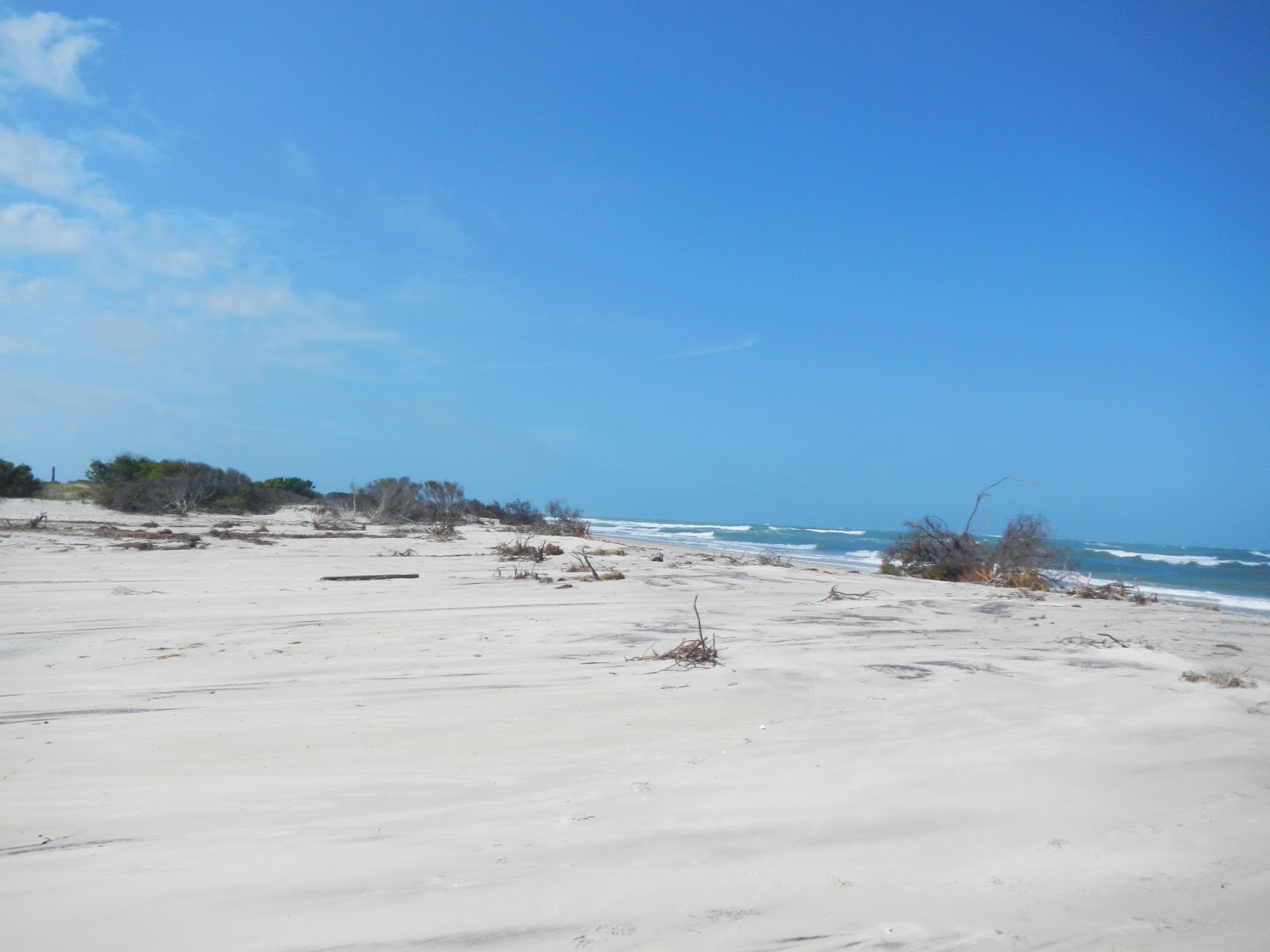
Shackleford Banks is a truly beautiful and interesting island.  No one lives there, and there is no drinking water - unless you can desalinate it.  There seemed to be four major zones moving from south to north: a beautiful and wild nine mile Atlantic Ocean beach with a pronounced dune system,

a broad area of undulating dunes and hummocks covered in coarse grasses, with occasional flat grassy areas,
a dense maritime forest,
and a wetland fringe with some beach at times bordering on the sound.
So, what did we do for the two full days and one partial morning that we were on this amazing island?  We explored, hiked, beach combed, fished, searched for wild horses, relaxed a little, and looked for wildlife.  There is no shade - the forest would be very shady but loaded with ticks - and the sun was oppressive at times.  My clothing was continually damp, either from sweat, the humidity in the air, or both.  It never got below about 75, with very high humidity, and so I am glad I didn't bother with a sleeping bag.  Day time highs - in the shade if there had been shade - would have been about 86, but it was much hotter than that in the sun.  I wore long sleeves, long pants, and my Tilly hat, and although these may have been warm, they gave me good sun protection.  I also applied sunscreen to my exposed skin about 3 times a day, and did not get burned despite continually being out in the sun.

I walked and walked and walked, and then, I walked some more.  On Saturday and Sunday alone, I took over 84,000 steps according to my pedometer.  Assuming 2,300 steps per mile for an average, that would translate to nearly 37 miles in the two days.  A lot of those miles was looking for great seashells, and did I find some good ones!

Twice, we were able to find wild horses, of which there are over 100 on the island.  These animals are descendants of Spanish horses that survived shipwrecks in the 1600's.  They are wild animals but also will tolerate humans as long as you don't approach them directly.
And when you are camping at the beach, is there anything better than sitting out in the (relative) coolness of the evening as the sun sets, listening to the rhythm of the pounding surf?
Well, that is a summary of my little adventure.  If it whetted your appetite for more, more will be coming over the next week, because I have a lot more to share with you.

Monday, June 10, 2013

Heading to Shackleford Banks!

If you carefully worked through all of my clues, you may have figured out my destination for my little adventure: Shackleford Banks, a nine mile long uninhabited barrier island that is the southern-most part of Cape Lookout National Seashore. Uninhabited, that is, except for 100 wild horses, many birds, an occasional loggerhead turtle, and millions of biting insects. There is no water that is drinkable by humans. There are brackish ponds that the horses drink from, but they are too saline for us. So we each will be carrying about 28 pounds of water and Gatorade, which should last us the 50 hours we will be on the island.

The original plan was to go Friday morning and come home Sunday, but the "Andrea"changed that. We have to take a boat over and back, and they were not going to be running Friday. So instead, we will catch a boat over about 9AM Saturday and come back to the mainland about noon Monday. That should give us time to explore all nine miles of the island, and its many ecological zones: maritime forest, “ghost” forest, wetlands, dunes, and beach. Depending on the biting flies and mosquitoes, we may end up being on the beach a lot. There is supposed to be spectacular seashells here, and so I will be looking hard for those. We may also try a little fishing in the surf, and hopefully some star-gazing at night. And if we are incredibly fortunate, maybe we will see a female loggerhead coming up to nest late one night.

Once the boat drops us off, I see us hiking no more than 2-4 miles with our heavy packs. We’ll find a good campsite, set up our tents, and leave the drinking water (most of it) and food behind as we explore. My pack weight will go from about 54 pounds to maybe 15 at this point. Because of the heavy amounts of water we need to each bring, we are carrying minimal gear – no sleeping bags, for example, and no rain gear. The lows are expected to be about 75 and the highs 85. So my sleeping bag liner should be good enough to sleep in, and a little emergency rain jacket should do if a sudden downpour comes up. We are carrying one stove and one first aid kit among the three of us. None of us plans on cooking anything other than an instant meal in a bag, so we won’t have to carry precious water to wash dishes. I am bringing a warm fleece and an emergency “space blanket,” just in case. And there is no need to carry a water filter, as there is no fresh water to filter - although, I would not be surprised to find some fresh water pools after the soaking rain of last Friday.

I will be bringing my camera, GPS, and binoculars, of course. I hope to see some great wildlife, collect some cool shells, and take some nice photos while I am out there those three days, so look for some updates later this week.

Tuesday, June 4, 2013

"Life List"

As I plan my own little adventure later this month (here are 10 clues to figure out where I am going), I am awestruck with a book that I just finished about Phoebe Snetsinger. The book is “Life List” by Olivia Gentile, and I highly recommend it. It is a fascinating and well-written read about an truly amazing, if obsessed, woman.

Who was Phoebe Snetsinger? Well, only the first person known to have seen 8,000 of the world’s bird species. In fact, she ended up seeing something like 8,700 different species. And this was after first getting interested in birds at age 33 when she was shown a Blackburnian warbler by a friend. Along the way, she traveled all over the world, trekked to the most remote and difficult places one can imagine, saw incredible things and thousands of beautiful birds, endured inconceivable hardships, and experienced a few truly horrific things. She also lived for something like 18 years after being told that she would be dead in less than a year from melanoma, and she virtually walked away from her marriage. For most years after her diagnosis, she ended up traveling to see birds five to seven months of each year.

If you have any interest in birds and the natural world, and in the human spirit, I’d encourage you to read this excellent book.

Monday, May 27, 2013

Scratching a 17 Year Itch

In June of 1996, I accepted a job with a new company.  Although the job was in Richmond, the company was headquartered in Alexandria, Virginia, which is near Washington, DC.  They needed me to come up for the day before I started to fill out paperwork and get taken out to lunch, so I took a day off from my then current job to do so.  It was a nice day, so I threw some hiking basics in the car, and on the way back, I stopped at Prince William Forest Park (near Quantico, Virginia) for a hike of a few miles.

The hike itself was very nice, but what struck me was the cicadas!  As it turned out, the 17 year brood had morphed into adults and were everywhere!  The sound was deafening.  They were all over the trees, flying through the air, zipping past my head.  It was fascinating but a little creepy too, to have these large insects buzzing past.  But I made a decision that I would come back in 17 years once again.  I quickly did the math in my head, and came up with 2013.  Guess what?  It is now 2013, so yesterday, on a simply gorgeous day, I went back.

There were lots and lots of cicadas.  I could hear them everywhere as I hiked a 7.5 mile circuit, and I saw some.  The holes where they emerged from the ground were all along the trail.  But what I didn't see was them flying past, wings buzzing with tremendous sound.  So that was a little disappointing.  Maybe that would happen in June.  Here is the map of my route, hiked clockwise as shown by the arrows, and the elevation profile.  It is not a difficult hike, and is very pleasant.  I hiked mainly on the Turkey Run Ridge Trail (west side of the map) and the North Valley Trail (east side), connecting on the Mary Bird Branch and Lake Quantico Cascades Trails.


The hike is through very pleasant forestland and much of it is along two streams.  Other than cicadas and many butterflies, I didn't see much wildlife.  I heard a pileated woodpecker hammering away, and I saw a young northern fence lizard - very difficult to spot these - and a yellow billed cockoo.  I was thinking that the cockoo would make a great "what am I?" and I was maneuvering for a photo when a couple of hikers came by me and scared him away.

I am so glad that I lived these 17 years to come back here, surviving cancer along the way.  Think of it - the animals I saw yesterday were new life in 1996!  I saw their parents.  For 17 years, they lived under the ground by the billions.  Many of them died in that time.  Human babies born the same year are now going to be seniors in high school!  16 springs and summers passed by, and they stayed under ground.  And then somehow, on the 17th spring, it was time to mature, tunnel out of the earth, climb a tree, and shed their exoskeleton.  They will live a few weeks as adults, feeding hungry creatures all over the forest.  The luckiest will breed, lay their eggs, and then die.  I know that a lot of people think they are disgusting, and even had a couple of folks tell me they wouldn't mind if they all just disappeared, but I see it as a simply amazing biological phenomina, one with few equals.  My guess is that cicadas, and other insects, will still be on this earth when we humans have come to the end of our time.

I reflected yesterday that I have a decent shot, better than a coin flip, of seeing the children of these insects.  But my chances of me seeing their grandchildren is pretty remote.  I hope I can come back in 2030 and say to them, "Hey!  I knew your mom and dad!"  But life is uncertain, and I am just happy I got back their yesterday.  Here are a few photos from my hike.

Green was the dominant color yesterday.  It is my favorite color, so I was fine with that.

About as big around as a pencil eraser, these holes were everywhere I looked as I hiked along.  They are where the 17 year old cicadas tunneled out of the ground.
I liked the blue in this butterfly.
A lot of the hike was along two pleasant streams, some with small cascades.  The mountain laurel was in bloom during my hike.
There was lots of mature forest along the way.
This little northern fence lizard was just a couple of inches long, and difficult to spot.
Pyrite mining was once conducted here.  This shows a reclaimed mine site.
The stars of the show, and the reason I came here yesterday!  I saw these guys parents.  If I am very lucky, I'll still be walking this earth to see their children in 17 years.  And if I am fortunate beyond any reason, I will see their grandchildren!

Wednesday, May 22, 2013

Clues For My Next Adventure

I've worked out my next little mini-adventure, and am planning my gear for the trip.  I'm going later in June for three days and am planning this with two other guys.  It will be a fun - but at times difficult - trip.

I thought I would put out a new clue every 1-3 days and see if folks can hone in on where I might be going.  I'll update this post every few days with the next clue.

Clue # 1.  I'll be in the Tar Heel State, and hiking to a place where I have never been before.  This means that this trip will count towards three of my hiking goals for 2013: hike 10 places I have never been; go backpacking at least twice; and hike in a state I didn't hike in during 2012.

Clue # 2.  The Tar Heel State, and its neighbor to the west, the Volunteer State, have the highest mountains on the east coast of the USA.  Go on a multi-day hike in those mountains, and you will gain and lose thousands of feet of elevation.  But for my destination, although I'll be hiking some 20 miles, my elevation gain and loss will be measured in dozens of feet, not thousands.

Clue # 3.  I always bring a map and compass when I backpack.  But in this case, they are not necessary, and I won't bring them along.  Even though the area I am going to, managed by the National Park Services, is about 2,500 acres and has no marked trails, it would be impossible to get lost.  I will still bring my GPS so that I can mark our campsite if we explore at night and so I can map where I have been to show on this blog later.

Clue # 4.  Water, water everywhere, but not a drop to drink.  We'll literally be surrounded by water, but there is no drinkable water (by humans) where we are going.  Each of us will carry our own water for any drinking or cleaning up, thus, cooking will be at a minimum on this pack trip.  I will carry 12 or 13 liters of water, which will translate to 26 - 28 pounds.

Clue # 5. Unless you walk on water - I don't, even without a heavy pack - a boat is the only way to get where we are going.  You can take a kayak if you are experienced enough to handle potentially rough weather.  I am not, so I'll be arriving and departing by water taxi: $25 round trip but well worth it.

Clue # 6.  Based on satellite images of this area, it looks like there is a well defined sandy beach for its length to the south, running west to east.  Behind this, there is an area of dunes.  Behind this is an area of what appears to me to be a mixture of meadow and open lands and low trees.  And finally, to the north, there is another coastal zone, probably muddy, backing up to a sound.

Okay, so if you have followed these clues, you are probably thinking - correctly, I should add - an island.  But which island?  Here are some more clues...

Clue # 7. There are no humans living on the island, even seasonally.  With no drinking water, that would be tough.  As far as I know, the only structures on the island are a boat dock and an outhouse near the boat dock, on the islands western end.  This is where the boat we are using to get out there will drop us off.

Clue # 8.  Despite no humans, the island is not uninhabited.  There are about 100 wild horses living on it.  They are believed to be descendants of horses that came ashore in the 1600's from Spanish shipwrecks.  They have adapted to drink from ponds of brackish water that humans cannot tolerate.

Clue # 9. I would have to be amazingly fortunate, but there is a chance that if I up late one night, I could see a loggerhead sea turtle returning from the sea to get the next generation started.

Clue # 10.  My final clue is this satellite image of the island.

Saturday, May 18, 2013

Outer Banks Beach Combing

It does not take much to make me feel happy.  One thing that will do it for sure- put me a nice place to walk with interesting things to see.  Are there many better places than the beach?  So last weekend, when we were in the Outer Banks of North Carolina around Duck, I walked for miles and miles over five days.  Walks at dawn.  Walks in the middle of the day.  Walks in the late afternoon and early evening.  Even a walk in the dark of night.  I enjoyed every one of them, and thought I would show some photos of things I saw. 

As far as living animals, pelicans, sanderlings, gulls, and some dolphins were the most abundant sightings.  Unfortunately, most of the animals I got to photograph were dead.

The beach there in Duck is beautiful and, this time of year, not crowded at all.
I love loons, and it was sad to see such a powerful swimmer and diver dead on the beach.  I wondered if it got caught in a storm at sea and drowned.
I saw the remains of about four spider crabs on the beach.  One was quite large, but I didn't have my camera with me.
I am not sure what this crab is, but I found about a half dozen of them, alive but stranded on the beach.  I would pick them up and put them in the water.  Two were females with a large mass of eggs attached to the underside of their shells.
I would call this a puffer fish, but there is probably a better name.
I found two dead stingrays.  I wonder if they washed ashore and died, or were caught by fisherman and left to die?
This pretty little (about an inch across) shell with the purplish - cranberry blotches is a calico scallop.  I had never seen one before.
I collected a number of nice shells, but especially liked these (along with the one above):
My beach combing ended last Monday with a walk on the beach at sunrise:

Monday, May 13, 2013

Currituck Beach Lighthouse and Corolla Village

We spent several days in North Carolina, along the Outer Banks, and I walked many, many miles.  Some of it was around Currituck Beach Light and the area around it, including historic Corolla Village.  It was interesting to see this area.  I started by climbing Currituck Beach Lighthouse for some great views at the top.

Some of the 200+ steps one needs to climb to get to the top.
Here is a panorama looking south and west from the platform near the top of the lighthouse.  The wind was roaring at a steady 30 knots.
Here is a bird's eye view of some of the buildings on the property from the lighthouse.
There are great views from all directions.  This one looks west towards Currituck Sound.
And this is the view to the north.  Far away, but within view, is Back Bay National Wildlife Refuge.  It has been nearly three months since I took my "final" hike there.  I definitely miss that place!

After touring the light, we headed around Corolla Village.  It must have been an isolated and difficult way of life when this village was the main town in this area.  Some of the buildings were built in the 1880's.  The schoolhouse, recently used for education once again, was built in the 1890's.

I would have loved to go in the chapel, but it was closed and locked up.  It had a lovely stained glass window featuring a pelican and her chicks.

While walking along, we came upon this turtle.  She started digging a nest with her hind feet a few moments later, and we left her in peace.

Even when the eggs hatch, baby turtles face a difficult life.  I found this dead one a little while later in a parking lot.  He reached a curve, which would be as insurmountable as a mountain to a baby turtle.  According to my field guide, this is a baby slider, but the map does not show them in this part of North Carolina.
We walked along a nature trail through wetlands,

visited the Outer Banks Center for Wildlife Education, and then, we toured the beautifully restored Whalehead Club, built in 1922.  At was the winter home of Mr. and Mrs. Edward Knight.

Funny story - this extremely wealthy couple, unmarried at the time, both loved to duck hunt.  Duck, goose, and swan hunting was the rage among many wealthy people, and this part of North Carolina was the place to come for it.  At one point, the waterfowl were so thick that people called them "smoke."  So the Knights petitioned to join one of the many duck hunting clubs.  They were denied.  First, they were unmarried yet traveling together.  Second, the club members didn't want a woman in their midst.  So Mr. Knight didn't get mad, he got even.  He bought the 2,000 acres that the club leased for hunting, and evicted them.  Then, they built their beautiful home - something like 20,000 square feet, I think - on a prime spot on the acreage.  It is well worth a tour, and the Art Nouveau architecture and furnishings are very interesting.

We ended our three hour visit by walking past the restored boathouse for the Whalehead Club, with a nice view of the lighthouse in the background.

Friday, April 19, 2013

A Stroll on the Richmond Liberty Trail

You've heard about the newly marked Richmond Liberty Trail, right?  What do you say we walk it today, just you and me?  Come on!

The Richmond Liberty Trail is not a true trail, but an urban walk along city streets and, for a little bit, canals.  It is a 6.2 mile walk according to the official information, but as we will learn later from my very accurate GPS, we'll end up walking nearly 7.5 miles.  We'll see lots of Richmond's historic sites and neighborhoods along the way.  Part of the Liberty Trail joins the Richmond Slave Trail, which is described here in my walk of about a year ago.  Some of my other blog posts that either intersect the Liberty Trail or can be reached from it are these:  Black History Walk, the James River, walking to Great Shiplock Park, viewing the great blue heron rookery, hiking around Belle Island, Give me Liberty or Give me a Hike, historic Tredegar Iron Works, and hiking the Buttermilk Springs Trail.  So you can see that there are a lot of nice walks in Virginia's capital city that are in or connect to the downtown.

You won't need hiking boots, just a good pair of shoes for our hike.  The weather looks very warm and potentially stormy today, so bring a good hat - we'll need to stay alert.  Oh, and pack some water and a lunch.  Ready?  Let's go!

We park along 5th Street near Tredegar, marked on the map by the purple arrow in the lower left of the photo, and start heading up the steep hill, walking the route more or less in a clockwise.  It's already very windy, and you laugh as my hat nearly blows off!

Within feet, we come to a freshly painted "trail marker" on the sidewalk.  These will be spaced every 100 feet or so and will guide us for the entire route.


At 5th and Franklin, I suggest a quick visit to Liverpool by popping in to the always-welcoming Penny Lane Pub.  Surely we have some time for Shepperd's pie and a cold Newcastle brown ale.  You remind me that we only just started our walk, and that we have lunch packed.  Ah, another time!

Shortly, we pass by the historic Kent-Valentine house.  They obviously lived in grandeur in their times.  Then we make our way towards Jackson - Ward, a historically African-American part of the city.
There, we go by the Black History Museum of Virginia.  We both wish there was time for a visit, but the "trail" beckons.
Along the way, we will see many historical and informative markers, such as this one about Quality Row, a section of Jackson Ward where more affluent blacks lived.
As we leave downtown, we pass by the historic Carpenter Theater, now part of Richmond Center Stage, and main home to the Richmond Symphony Orchestra and a performing arts venue for many other groups.  Hey, The Virginia Opera will be performing "The Marriage of Figaro" by Wolfgang Mozart next weekend.  Wanna go?  You remind me that opera is not your cup of tea, although you have never really seen one.  I suggest trying this one - if you end up not liking this masterpiece, you probably won't like any opera.  But chances are you will like it.  To me, it is 3 hours of musical heaven, and very, very funny to boot.  I was once convinced that I didn't like opera, until I found that I do like much of it.
Along Marshall Street, we pass the home of John Marshall, the fourth chief justice of the US Supreme Court.  We must take the tour sometime!
As we approach the Court End section of Richmond, bustling with actively from VCU's huge medical center, we decide to take a break on a quiet bench to drink some water and eat lunch - peanut butter and orange marmalade for me, Swiss cheese and baked ham for you.  "Pardonnez -moi, monsieur, mais avez-vous un poupon gris?" you ask with a smile.  "C'est dommage, mais non.  I don't usually carry Grey Poupon mustard on a hike," I reply.  We finish lunch and walk by the White House of the Confederacy, now a museum that is furnished as when Jefferson Davis lived there.

Just a few feet away is the Museum of the Confederacy, which is excellent.  Whether you think the Confederacy was a great or a terrible idea, this fine museum is worth a visit.  Outside, an anchor from the CSS Virginia is on display.  Good luck lifting it!

A young woman sits on the curb, face down in her hands, clearly weeping.  Given the hospital right there, I imagine she just got some bad news about a loved one.  We feel badly for her.

We head along the route towards the State Capital.  The first thing we see there is the wonderful Virginia Civil Rights Monument, which commemorates the end of "separate but equal" and full civil rights for all, regardless of race.

Patrick Henry may have said "Give me liberty, or give me death," but it was George Washington who risked death to make liberty happen.

We marvel at the lovely spring colors,
As we pass by the capital building - designed by none other than Thomas Jefferson - and the historic bell tower.

I am two blocks from the office at this point, but not even remotely tempted to go there on my day off, so we keep walking.  At Franklin and 15th, we come to the Reconciliation Memorial.  There are identical statues in Liverpool and Benin, which were legs in the evil triangle of the slave trade.

We make a little detour to see the site of the infamous Lumpkin's Slave Jail, a holding area and torture center for escaped and uncooperative slaves, and a "holding pen" for slaves being sold down the river.  The horrors of this place, once known as "The Devil's Half-Acre" among Richmond's black population, are now long gone.  A old African burial ground is very near by.
The oldest house in Richmond is now a museum to Edgar Allan Poe, although I don't believe Poe actually lived in this house.
This building occupies the former site of the Van Lew mansion.  Elizabeth Van Lew was a dedicated abolitionist who operated a spy ring for the Union during the Civil War.  She was reviled by her neighbors at the end of the war.
We are stirred by the sight of St. John's Church, where Patrick Henry gave his stirring "Give me liberty or give me death!" speech on March 23, 1775.  The church is in a neighborhood of restored row homes.


As we head back near the river, we are moved by the sight of the Virginia Holocaust Museum.  Something like 10,000,000 souls perished in the Holocaust, driven by one evil madman.  The box car sitting out front (to the right in the photo) is representative of those that men, women, and children were crammed into to take them to the death camps operated all over Eastern Europe.

On to more peaceful thoughts, we walk along the canal as we head back to Brown's Island,
where "The Headman" plies his craft in front of cherry trees.
We cross over the bridge and glance at Tredegar Iron Works, now Richmond's Civil War center.  We are just a tenth of a mile or so from the car.
I'm really glad that you came along on our walk of Richmond's Liberty Trail.  I know that I enjoyed it very much, and hope that you did as well.