Friday, April 15, 2016

Best Back Country Breakfast Ever!

There were a number of great things my recent False Cape State Park backpacking trip,  It was as flat as you can get, and I'd only have to carry my relatively heavy pack in and out, since I'd be setting up a base camp.  There would be drinkable water at a spigot, so I would not need a water filter.  Therefore, I carried a few things in my pack that I might not normally bring, and one of them was my little fry pan for my Jet Boil stove.  I'd bought the pan last year and had not yet used it.  Finally, the site provided a picnic table, a super luxury when one is backpacking.  (There also were his and her outhouses, with hand sanitizer, another nice plus).

It being cool, I packed in a couple of tablespoons of butter in my food bag.  I carried in some Hungry Jack pancake mix - you only need to add water - and some real maple syrup.  And I used my stove and fry pan to make pancakes for breakfast Saturday morning!  So yummy!

I could only make one pancake at a time, and I would eat it at the picnic table while making the next.  Because the stove burns so hot - it is called Jet Boil after all - it's best use is for boiling water rapidly.  But in this case, by experimenting and turning it down low, I was able to make some really good pancakes.  Being able to sit at a table with the stove just off to my side while having my plate in front of me made the process pretty easy.  I used some of the butter to lubricate the pan, and the rest went on the pancakes.  Here is a pancake in progress...


And here it is after flipping it.

The frosting on the cake came when Mike, the leader of the Hampton Roads Hikers group that was camping around me, came over to my site carrying a hard boiled egg!  "Here," he said.  "We are having duck eggs for breakfast, and I made you one."  It was still warm, and such a treat.  I've never had fresh eggs in the back country.  This was truly a breakfast that will be hard to top!

Thursday, April 14, 2016

False Cape Hike - First Day

I used to hike all the time in Back Bay Wildlife Refuge, getting to False Cape State Park a few times.  But it has been three years since I was there, and it felt good to get back.  My first day of the three day backpacking trip mainly involved just getting to the park.  From the parking lot at Little Island City Park, it was about a 6.5 mile hike to my campsite. I've marked my track in orange on the map below, with the orange arrow showing the location of my campsite, campsite #5.  The park has 12 campsites, and sites 1-6 have drinking water available by way of two taps.  The other six sites (which are a good two mile walk further south of the first six sites) have no drinkable water, and I doubt there is any good fresh water source on the barrier island that humans could drink.

Between April and October, one can hike through Back Bay on one of the two dike trails through the Wildlife Refuge.  In this case, it was the west dike trail that was open.  Most of the side trails were closed off to protect wildlife, so I didn't do any exploration along the way.  It was just a point to point hike, carrying my pack, and getting to my campsite.  I did watch for wildlife along the way in the wetland environment, and did see a fair variety of birds and many, many turtles.  A complete list of critters seen during my hike can be viewed here.  Weather-wise, last Friday was by far the pick of the three days - sunny, no wind, and temperature topping out near 60 F. I saw a number of day hikers in BBNWR.

Here are some photos from my first day in Back Bay National Wildlife Refuge and False Cape State Park.  On the hike in along the refuge road, there is an osprey nest with a pair of these fish hawks setting up housekeeping.


Turtles, probably yellow bellied sliders, catching some rays to elevate their body temperature.

A lot of the walk through the refuge involved walking along the gravel road with water just to the side, so there was always the chance to see wetland oriented wildlife.

Here is one yellow bellied slider that didn't mind me being fairly close.  Usually, they dive if one gets within 60 feet.

Some of the pathway went away from water and through a coastal forest.

Wild azaleas, I believe.

American coots swimming at the boundary to False Cape State Park.

Upon reaching the entrance to the park.

I got my campsite set up right away down near the ocean....

hung my food bag (no bears but raccoons, opossums, and foxes) ...

and walked through the dunes.....

to explore the beach a little bit.  This is the most remote beach in Virginia, and one of the most remote and pristine on the east coast.  It is wonderful to have such a beach preserved for public and wildlife use.

After a delicious dinner of curry in a hurry, I walked and explored a few miles, and saw many animals.  I got back to my camp, looked at stars (no ambient light makes for great viewing), read a bit, and then slept like a log during the fairly cool (for April) night.

Wednesday, April 13, 2016

Wildlife Sightings on My False Cape Hike

On my three days of hiking in False Cape State Park, I observed the following species of wildlife.  The coolest sighting was the pair of mature bald eagles, flying in formation together over the wetlands.

Kingfisher
Cardinal
Greater yellowleg
Osprey
Great blue heron
Great egret
Snowy egret
Rufus-sided towhee
Green heron
Brown pelican
Red-winged blackbird
Lesser scaup
Carolina chickadee
American coot
Morning dove
Double-crested cormorant
Hawk (an unidentified accipiter)
Turkey vulture
Glossy ibis
White ibis
Harrier
Northern shoveler
Bald eagle
Killdeer
Many unidentified ducks and wading birds
Nutria or muskrat (I think the former)
Yellow-bellied slider


Monday, April 11, 2016

False Cape State Park Trip Overview

Ever since I moved to Virginia, I have wanted to camp out down in False Cape State Park, Virginia's southernmost state park.  Less than 1,200 miles to Key West.
The park is located in the southeast corner of the state with the Atlantic Ocean to the east, Back Bay to the west, and North Carolina to the south.  I've circled the area in red:


Here is a little more detail - my general trail track (30 miles of hiking over three days) is shown in the blue track lines, and the big red arrow marks the North Carolina border.  I walked within a couple miles of the Tarheel State.  You can see that the park is essentially part of a barrier island, and the northern part of my route was hiking through Back Bay National Wildlife Refuge.

The park is an amazing place - isolated, lots of wildlife, interesting habitats. There are two ways to get there - by water, such as a kayak, or on foot.  I did the latter, hiking in last Friday and setting up camp, day hiking Saturday, and hiking out Sunday.  The weather especially for the last two days was more like February than April, with incredible winds for much of my visit.  I tried to get a friend and my brother to go, but it didn't work out, so I went in alone.  However, I met a great group of six people there who were also camping, and they invited me to hike with them Saturday, which I did.  They were part of a group called the Hampton Roads Hikers, and I really enjoyed meeting them, hiking together, and hanging out.  I appreciate their hospitality.

Here is an overview of the trails I hiked on - I drew in the little purple segment that didn't get mapped somehow.  The arrow marks the area where I camped - about 600 feet or so from the ocean.  I could hear the surf at night.  In general, the tracks north of the arrow followed my route into the park and back out, and the tracks south of the arrow follows Saturday's hike.

I camped out in my little tent under the scenic live oaks, and was snug and warm enough, despite chilly temperatures and high winds.  I carried all my gear and food in with me, and my pack weighed about 34 pounds.  Yeah, not exactly ultralight, but I like being comfortable, and only had to carry it about 6.5 miles each way.

I had a great time - made some new friends, saw lots of wildlife, ate well, relaxed a bit, did some cool hikes.  I loved camping out here and exploring, and would certainly love to go back soon.  In the days ahead, I will post details and photos of each day of my three day adventure.

Here are the posts for each part of my trek:

Day 1 - hiking in and setting up camp
Day 2 - Exploring Wash Woods in changing weather
Day 2 and 3 - An evening hike and the hike out
Wildlife sightings for my trip
Best Back Country Breakfast Ever!

Saturday, March 12, 2016

Dismal, No; Fun and Interesting, Yes!

One of my hiking goals for the last couple of years is to lead some hikes, and as part of that, get more active in the local hiking group, the Old Dominion Appalachian Trail Club (ODATC).  Yesterday, my day off, I took some action towards that goal by leading a group ODATC hike on the Washington Ditch Trail in the Great Dismal Swamp.  This trail goes to Lake Drummond, one of only two natural lakes in Virginia.  This large (3,100 acres) lake was likely formed by either a meteor impact or by a long burning huge wild fire in a deep peat deposit.  Four of us hiked this together yesterday.  It was a great group of people to spend a day out together in a place that was far from dismal.


The hike was an out-and-back, with a total distance of 10.2 miles.  The pathway was level, smooth, and dry, even though there was wet swamp all around us.  Near the trailhead, there is an interesting "boardwalk" pathway that goes through the swamp, and it is well worth taking.

We saw a fair amount of wildlife: turtles (common snapping turtle, red-bellied slider, and yellow-bellied slider); black vultures; pileated woodpeckers; a large cottonmouth; double-crested cormorant; three unknown ducks; great blue heron; several groups of butterflies; and some kind of a carnivore from a distance.  We think the latter was a bobcat, as it appeared to have (through binoculars) a cat-like face, short ears, and no prominent tail, but we couldn't rule out a grey fox.  We decided bobcat, 90%.  My last hike here, three years ago, I saw this animal - but not this time.

There are many other pathways to explore in what is left of this large swamp, much of which has be drained and converted to housing developments, farms, and woodlots.  The part that remains (113,000 acres plus the lake) is a national wildlife refuge and "contains some of the most important wildlife habitat in the mid-Atlantic region."  The Washington Ditch trail is a straight shot to the lake, and is very pleasant and interesting.  Water is always to one's right walking to the lake, and quite often on the left was well.  There are large stands of cypress and other water tolerant trees the entire way.

Here are a bunch of photos from our never-dismal hike, starting with Jeff, Jo Lee, and Aseeyah at the start of the hike.


This hike has some historic significance as well as great natural history.  George Washington did the original survey work for a canal here.

This is typical of the swamplands along the pathway.

A raccoon passed this way and left its tracks.

Spring flowers, such as this violet, are beginning to bloom here.

This group of butterflies, which I believe are zebra swallowtails, were clustered on some animal scat.  There were also a few tiger swallowtails that came in to the cluster at times.

We saw many turtles, like this yellow-bellied slider, catching some rays on this day with temperatures in the mid-Seventies (F).

Along the hike, we found many pieces of wood that had been cut by beaver and stripped clean of bark, one of their major food sources.  And near Lake Drummond, we saw a beaver lodge.

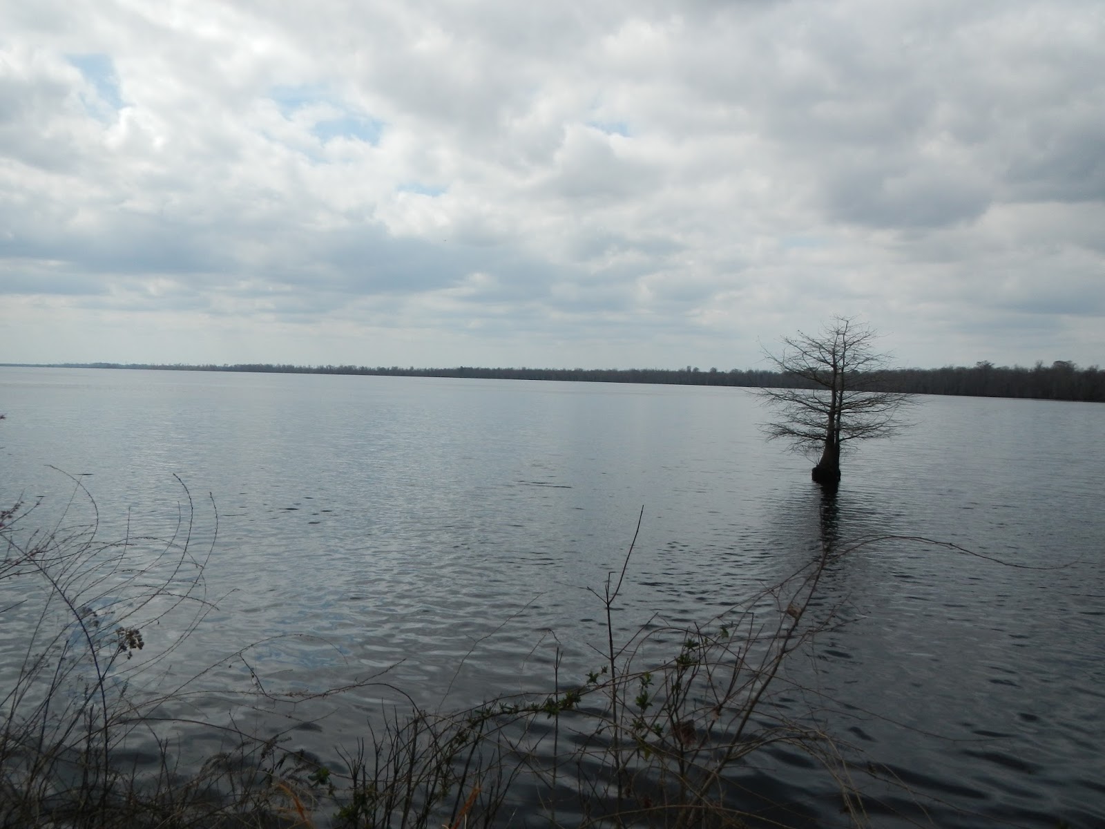
Lake Drummond, one of Virginia's two natural lakes.

The lake water looks a bit like weak tea from the tannic acid.

We saw this large water moccasin (cottonmouth) near the lake shore.  Although we were just feet away, it was not aggressive - nor were we.  With binoculars, we could see the "pit" on its snout, which makes it a member of the pit vipers.

Swamps were once considered wastelands, but we now know that they are very important ecologically. Plus, they are just plain interesting.


Cypress "knees" are part of the root system of the cypress, and are believe to help anchor the tree's shallow roots in a wet environment and perhaps aid in the oxygenation of the tree's roots.
We all agreed that this was a fun day hike, and beat working (for those who still work).  Aseeyah thought that it would be great to come back here for a night hike to explore the swamp after dark, which would be very cool with headlamps or even in a bright full moon.  And she and I thought that coming here a couple of times a month year round and taking careful note of the changes would be a great natural history study (she and I are both studying in the Virginia Naturalist program).

Sunday, March 6, 2016

Austin Mountain Fire Road

Today, nine of us with the Old Dominion Appalachian Trail Club got together for a nice, moderate hike up and back the Austin Mountain Fire Road in Shenandoah National Park.  Thanks, Jenni, for organizing and leading the hike.


This was 5.5 miles each way, all uphill on the way up and all downhill on the way back, for a total elevation gain of perhaps 1,500 feet.  Being a fire road rather than a trail, the surface was very easy to walk on, and we were able to hike several abreast and chat, always a pleasure up in the mountains.  Here is the route we took.  You can see that the fire road goes up through a gap between Austin and Furnace Mountains, ending at Brown's Gap on the Skyline Drive.  Some notes: we started and ended at the red arrow.  We had lunch up on the Skyline Drive at the red star.  The purple arrow marks Austin Mountain and the orange arrow marks Furnace Mountain.  There is a great little backpacking trip of three days through this area.  To see photos and and accounts from my backpacking trek here in 2011, go here.


Here are a few more photos from this fun day of hiking back in the mountains.  In this one, some of our group stroll along the flat section that dominates the first mile of the hike.


Back on my 2011 trip, my buddy Hawkeye and I camped our first night around here.  I remember that it was hard to find a good campsite and that it was quite cold that first night, about 18 degrees F.

Here are the other eight of us (other than yours truly) on our lunch break up at Brown's Gap.  We were there about 20 minutes, and only a half dozen or so cars went by in that time.  We would do "the wave" as they approached.

Here is a view of Furnace Mountain high above us.  There is a great view point at the top.

It does not get any easier in the mountains than a fire road. This one is exceptionally well maintained.

And here is Austin Mountain high above.  I don't remember great views from near the top, but there was lots of broken rock to hike over.

We didn't see much wildlife: one white-breasted nuthatch to be exact.  And I heard a pileated woodpecker.  But it was a great day in the woods, and my painful knee and ankle held up reasonably well - since the trail was so smooth.  I lead a group hike the end of this week to the Great Dismal Swamp, and so will be back out on the trail really soon.

Monday, February 29, 2016

First Hike of 2016!

I had last Friday, a moderately cool and windy day, off from work, and decided to go for my first hike of 2016.  This one was like visiting an old friend that I hadn't seen in a while - Dutch Gap Conservation Area, a big oxbow on the James River.  It is only a 40 minute drive, and is a flat and easy walk, usually with lots of wildlife.  Despite the wind and it still being winter, I did see a fair amount of wildlife, mostly birds - plus a few large turtles sunning themselves.

I was last here in the fall of 2014.  You can see photos from that hike here.

Here is a map of my route, starting and ending at the upper right, and walking counter clockwise.  The circuit is 4.4 miles, but with all of the little extra side trips, I hiked 6.7.  And I had a fun several hours doing it.  You can see that much of the route is on a very narrow strip of land.


Here are a few photos of my little day hike.  My knee felt okay on the flat surface.  However, at one point I clambered up on a large rock to get a view of a wet area to look for salamander eggs, and when I stepped down, bending my leg way back hurt a great deal.  So I am worried about mountain hiking.

Some of the many animals that I saw were: great blue heron, an osprey (with a fish), a shoveler (I think that is what this large duck was), double crested cormorants, Canada geese, tufted titmouse, cardinal, black-capped chickadee, American coot.

There is lots of mature forest in this area along the river.


The swampy area near the river will likely dry out in a few months.

You don't want to touch this vine, unless you don't mind getting poison ivy.

 During 1864, the Confederate Navy attacked the USA fleet in this area in an attempt to break the siege of Petersburg, Virginia.  The attack was defeated by the US Navy.

This is a distant view of the bridge that allows this hike to be a circuit hike - instead of almost four miles one way, and then returning another four to get back.

Sunday, February 7, 2016

My Hiking Goals for 2016

February already, and I have not been hiking this year.  I still have the behind-the-knee pain, and it I can't get past that, then maybe I won't hit any of my major goals.  But, one will not make goals unless one establishes them, so time to get out there and state some goals.  On the plus side, my rotator cuff tear is tremendously better than last year at this time, and my sore left ankle is not nearly as sore.

My goals are going to be based on my (largely unrealized) 2015 goals:
  1. Hit the trails for 200 miles.
  2. Go backpacking at least three times.
  3. Join my friend Dick for his annual hike - at age 91 this year - up Mount Washington in New Hampshire.  This will be scheduled in June by Dick, and I will join him if at all possible.  Since I work, we will have to pick a week and hope that the notorious weather up on the Mountain will let us do it, and that there will be vacancies in the Appalachian Mountain Club huts.
  4. Take a week-long hiking vacation.
  5. Lead at least two group hikes.
  6. Continue to master my DeLorme Inreach Explorer.  This one will be a little difficult to measure, but it has a lot of capabilities that I don't know how to use yet.
  7. Take hikes in at least five of Virginia's wonderful state parks.
This seems like a pretty good list to me, with some challenges.  Among the backpacking trips, I would love to see if I can get into Ramsey's Draft Wilderness, McAfee Knob, and/or False Cape State Park.  I also would love to hike the 70 mile Laurel Highlands trail in Pennsylvania, and actually I would love to continue my hike of the Appalachian Trail in Shenandoah National Park - which I aborted two falls ago when my friend injured his knee just two days and 28 miles in.