Thursday, May 31, 2018

Laurel Highlands - First Part

I've had this goal of hiking the Laurel Highlands Hiking Trail in Western Pennsylvania for a long while, and on May 16, I gathered for lunch in Ohiopyle, PA (location of the Frank Lloyd Wright masterpieces Falling Water and Kentuck Knob) with my 10 companions for the hike.  We were eager to get underway, and it hadn't rained all day after a solid week of rain in that area.  The trail runs for 70 miles, and is located here, near where Pennsylvania, Maryland, and West Virginia all meet.  I've circled Pittsburgh, the trail being to the southeast of the Three Rivers City.

The shuttle company dropped us off at the trailhead about 3:00, and we got our packs on and gathered for a group photo just as the rain started.

We had 70 miles to go, walking north to south, but only about 6 miles to the campsite, mostly a steady uphill.


The rain fell at a steady pace, but it was too warm for a rain coat, so I took mine off and stowed it in my pack.  I also didn't have a rain cover for my pack (something that I have since corrected), so I got drenched and my 40 pound pack slowly gained weight from the rain.  I got a photo near the start of the trip.

Here is a track of the first two days of hiking.  We camped at the two little blue rectangles the first two nights.  Camping has to be reserved and paid for, and one can only camp at the formal campgrounds.  Counting the distance to the campgrounds, we hiked 6.3 miles on day 1 and 10.5 miles on day 2.

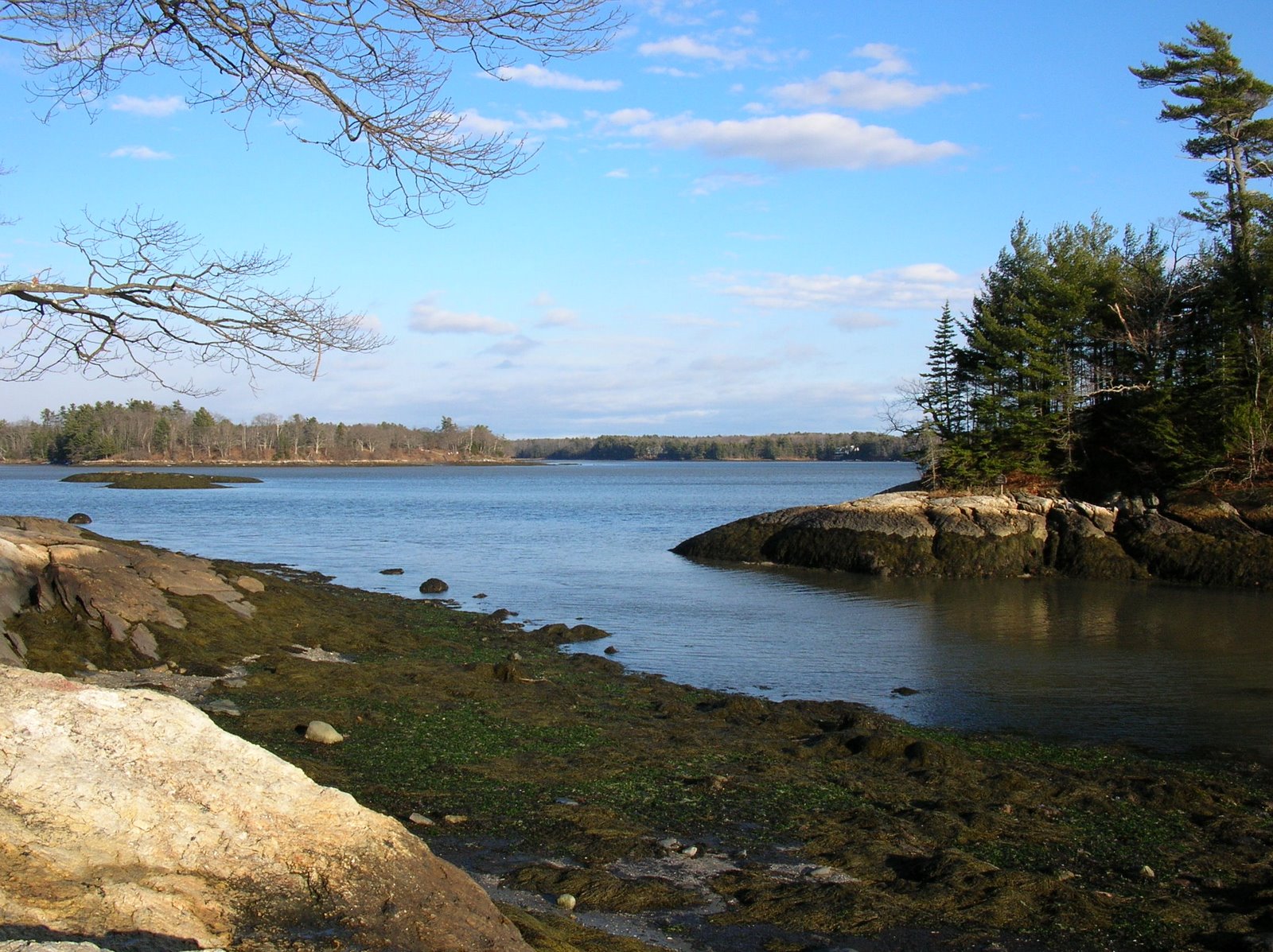
Spring is well underway in the Laurel Highlands.  There were supposed to be several great viewpoints overlooking the river, but it was too rainy to see anything.

Soon enough, we reached the campground for the night.  Here is a view of a couple of shelters.  It was a rainy Wednesday night, and no other parties were in the campground, so we used some of the additional shelters.

I had this one for myself the first night.  The other nights, I shared a shelter with from one to three other people.  Four is really about the most that you want in there.

This area had a really nice stream and wonderful wildflowers.  After a peaceful and rainy night, we all ate breakfast, packed up, and hit the trail about 9:00.  It wasn't raining, but in my wet clothing, it almost didn't matter.  One of the things I learned from this trip is the amount of chafing one can get wearing wet clothing, and the need to attend to that and carry extra first aid supplies.  These add a bit to the weight, but I would have been hurting if others hadn't had some of the things that helped.  The trail was mostly through thick forest in Penn's Woods.

The trail is very well marked with yellow blazes every hundred feet or so for all of its 70 miles.

Lunch time on the trail!  The weather was improving, and it was a chance to take the pack off, eat lunch, and - in my case - tape some hot spots on my feet that were going to become blisters from my wet socks if I didn't care for them.


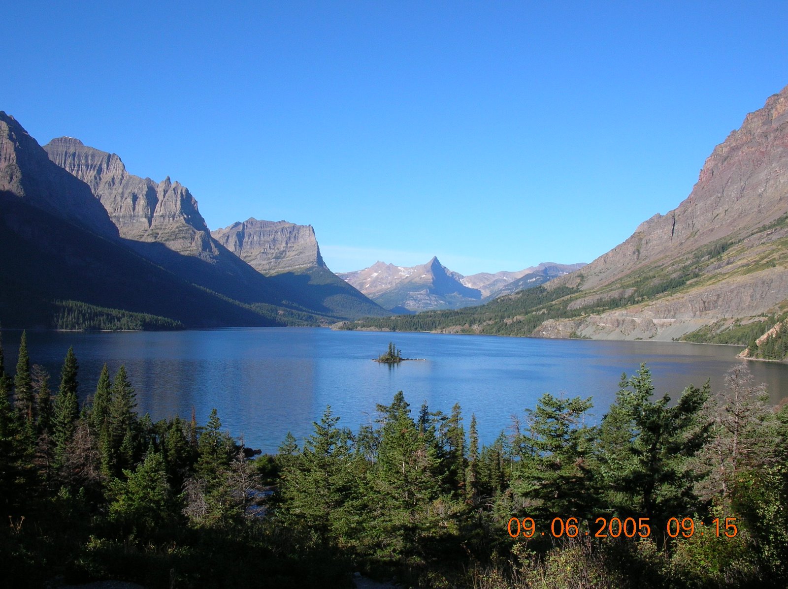
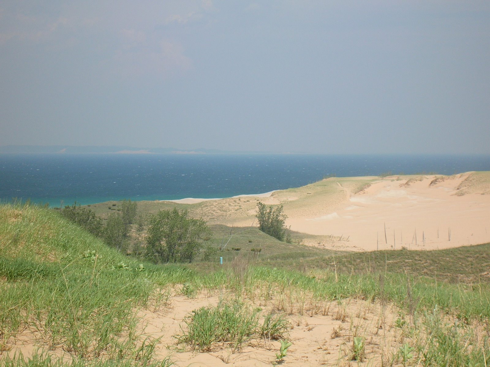
It had cleared enough by mid-day that we had a partial view.

Before we knew it, we hit the 60 miles to go mark,

and not too many miles after that, we were in camp.  This was my least favorite campground.  There were a lot of swampy areas, and the mice in the shelter drove us kind of crazy all night long.  But all in all, it was still nice, and the rain was still absent, although my boots were still soaked.  And there was beautiful bird song in the evening and morning.  All along the hike, I noted each time that I heard a new bird species, and I ended up with about 30 species for the hike.

The third day of the hike, we followed the track below, hiking about 12.8 miles.  The weather was pretty good, except late in the day of hiking, a strong shower moved through, and my finally dry clothing (except for my boots) got soaked again.  However, I was wearing rain pants instead of trousers because they didn't chafe as much.


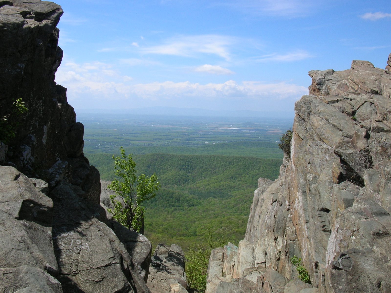
The third day of hiking was the most interesting so far because of the rock formations that we hiked through.


Here is some more of the group on the trail.  Everyone is looking pretty happy.  Hey, we are having an adventure together - what's not to like?

Along the hike, folks mostly hiked at their own pace, but we tried to meet up at prearranged spots.  In this case, we were meeting for lunch at milepost 50 - 20 miles down, 50 to go.


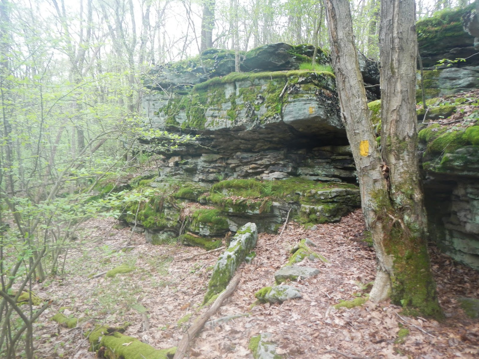
In the afternoon, we passed more cool rocky areas on the way to camp.


April in May!

After more miles, some in the rain, and some going steeply uphill for a while, we reached our third camp, which was near Route 30.  By the way, we actually had fair to excellent phone service in five of the six camps.  I was able to text home, check the weather radar and forecast, and so forth most nights.  We also got kind of lazy about hanging our food.  We rarely found good trees so we strung lines in the shelter and hung the food there.  We figured that a group like ours would not have bears approaching.  But mice and, one night, a flying squirrel, did try to walk across the lines to get into our food supplies.

It was now Friday night, and we had walked about 30 miles.  Everyone was a bit wet.  The forecast (which ended up being wrong) called for high winds, two inches of rain overnight, and steady rain all of the next day.  Everyone had some kind of issue going on after 30 miles, but some had more severe blisters and foot and knee pain, along with some flooding back home.  At this point, six of our eleven decided that they had gotten enough of a taste of the Laurel Highlands to try to opt out of the rest of the trip.  Because we had good phone service, and because we were only a mile from a major highway, they were eventually able to arrange a shuttle pickup for 10AM Saturday.  The other five of us would continue as a group and finish the hike.  By about 5:00, the rain had stopped, and it was a nice night in camp with no major mouse issues in our shelters.  The camp was full, and every shelter was booked, so we were restricted to our two reserved shelters and a bunch of tent sites.

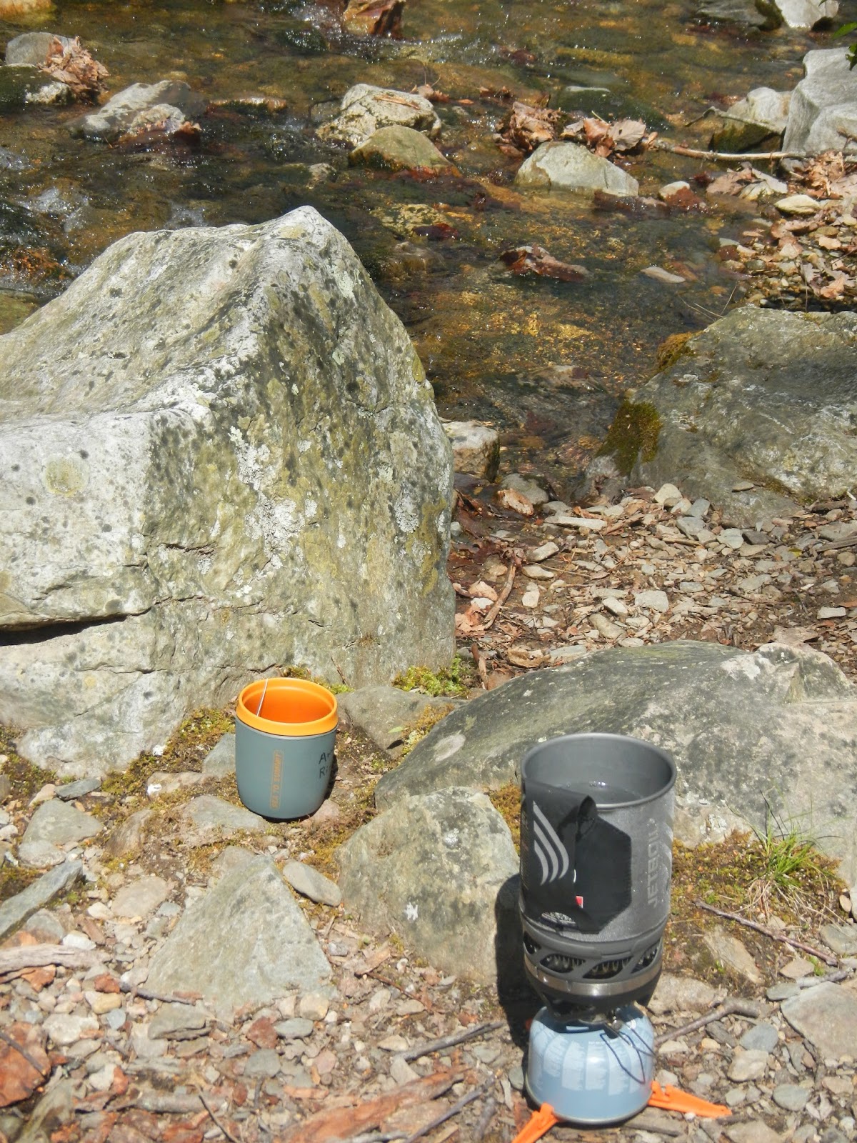
I also found out at this camping area that a key part to my water filter was missing, and so I had no way to filter drinking water.  But that is the strength of being in a group.  One of the others had a pretty cool filter with no moving parts, a Be Free from Katadyn (I now have one as well), and she took care of filtering my water the rest of the trip.

I didn't sleep as well, because a large group made a huge ruckus after I had fallen asleep, and once awakened from a sound sleep, I have a hard time getting back to sleep.  I did note that it really didn't rain a lot during the night, and I wondered if the next day's rainy forecast might be wrong as well.  As it turned out, it was, and the next three days of hiking had pretty ideal weather.

Sunday, May 27, 2018

Hiking the Laurel Highlands Trail

Pennsylvania's Laurel Highlands Hiking Trail (LHHT) is a trail that wanted to hike for years.  I can't remember when I first was aware of this 70 mile pathway along Laurel Mountain and various ridges in Western PA,


but every time we drive the Pennsylvania Turnpike to go to Michigan, we pass under the fancy footbridge for the trail.


Somewhere along the way, an idea was conceived to hike this trail, and the ideal time would be after I was no longer working.  So, I proposed the trip to Virginia Backpacking last year, got some interest, planned the trip, made the reservations, and on May 16th, got on the trail with 10 other backpackers for a seven day - six night hike.

The trail runs for 70.5 miles between Johnstown to the north and Ohiopyle to the South.  There are about 12,000 feet of elevation gain and loss along the way, with large elevation changes at the beginning and end.  We left the cars in Ohiopyle, and were dropped off at the northern end by Wilderness Voyageurs, which did a great job for us.  I highly recommend them.  Then, we hiked back to our cars.

The LHHT is very well maintained by Pennsylvania State Parks and by volunteers.  Every mile is marked with a concrete post with the mile mark embossed in it, and there are yellow blazes all along the way every 100-200 feet.  There are eight separate campgrounds, hike in only, every 5 - 12 miles, and these each have five three sided shelters that sleep four reasonably comfortably.  There are also a number of tent sites at each campground.  The campgrounds have men's and women's latrines, a firewood supply (the shelters each have a fireplace, and there are some fire rings as well), and trash drop off.  The campgrounds are all located anywhere from a quarter mile to a mile off the trail, so when we finished, we actually had hiked about 76 miles or even a little more.

Along the way, six of the group dropped out for various reasons, but five of us finished the hike end to end, reaching the Zero Milestone just before noon on May 22.


In the next few days, I will add posts with additional details and photos about:


Tuesday, May 8, 2018

Everything but the Kitchen Sink (and River Shoes!)

Other than just enjoying the hike and being outside, some of my hikes have a purpose.  A week ago Monday, I had two goals (1) hike a short section of the Riprap Hollow Trail that I'd never hiked before, putting me a tiny bit closer to the goal of hiking every trail in Shenandoah National Park, and (2) getting trail miles in with a heavy pack in anticipation of a six night hiking trip later this month.  To accomplish my second objective, I just started stuffing things in my backpack, things I would never need for a day hike.  My heaviest sleeping bag.  My heaviest air mattress.  A tent.  My cook kit.  Extra clothing.  Far more water than I would ever need, even if I wouldn't be near streams for several miles.  I almost put in a pair of river shoes, but the pack weight was up to 34 pounds and that seemed good enough.  I already had everything except the kitchen sink in there.

The trail is a familiar one to me - the Wildcat Ridge Trail in the park, but instead of turning right on the Riprap Hollow Trail, I'd go left and hike 0.9 miles to the park boundary, adding the almost-a-mile to my SNP miles.  Every other time that I've hiked this area, I did it as a loop, ending the hike coming up the Wildcat Ridge Trail.  This time, it would be an out-and-back, 3.7 miles each way.

This map shows the general location of this hike, in the Southern Part of Shenandoah National Park.
 And this image shows my track, starting on the right and turning back around at the purple arrow.  The red arrow marks the point of a very tricky stream crossing - more about that later.

The hike started and ended on the Skyline Drive at about 3,000 feet elevation.  At the low point, I would be at about 1,600 feet.  So the hike was mostly downhill with some level areas on the way out, and mostly uphill with some level areas on the way back.

I'd hiked in the park 9 days before, and there was little change at the higher elevations as far as spring moving along.

Now and then, I had partial views through the wide open forest.

At lower elevations, there was a little more evidence of spring.

At this point, I came to a lovely stream, and sat there for a few moments.  A half mile ahead was a much bigger stream crossing.  There were four stream crossings on this hike.

You can see that my pack had far more than I needed, just to add weight to get used to carrying a pack.

I've crossed at this point many times, but always in summer.  It's a lot tougher this time of year. I looked across, trying to pick a possible route.  I searched upstream and downstream.  No other good crossing points were evident.  I started picking my way across, balancing on thin, partially floating logs, and got about half way across.  Then, the next log that I put my right foot on sank, filling my boot.  I tried to recover by putting my left foot on a big, sloping, wet rock and my foot slipped.  I fell in, smashing my thumb against the rock and dropping my left trekking pole, which started to float away.  At the last second, I snagged it with my other trekking pole.  I was soaked from about mid-thigh down, and just waded across the rest of the stream.  I dumped the water out of my boots and kept hiking.

At lower elevations (1,600 - 1,700) feet, there were more and more signs of spring, like these maple leaves.

A short way down the trail, I had to cross the stream again to keep hiking on that trail and finish those miles.  Even if my feet hadn't been soaked already, they would be now.  Why hadn't I just put a pair of river shoes in my pack?  Oh, well!  I took off my socks and pulled the insoles out of my boots, and waded across.  Dumped the water out of my boots.  Put the boots back on barefoot and hiked to the end of the trail at the park boundary.

Near the end of the park was this beautiful iris, a sure sign of the coming spring.

I turned around at the boundary and started hiking back.  I just kept hiking barefoot in my boots, taking them off each time I waded through the streams to dump the water out.  After the second one (the place that I fell), I wrung my socks out and put them back on and put the insoles back in the boots.  As I hiked along the lovely stream, I stopped now and again to enjoy it.

Periodically, I would stop and take my socks off and wring them out.  When I got back to the first stream that I had easily crossed, I stopped and made some hot tea.  After all, I'd carried the stove this far, I might as well use it.

Soon enough, I was back in the car, where I slipped my running shoes over my bare feet and enjoyed having dry feet again.  It was a lovely hike in the spring up in the mountains, and I learned a thing or two from it.  If I had to do it over again, I would have brought the water shoes.  If I hadn't, I would have taken my socks off and the insoles out of the boots at the point where I fell, and just waded across.  It would have been safer than falling in such a difficult to cross area, and at least some of my foot gear would have been somewhat dry.