I prefer backpacking with others, a group size of 3-4 being ideal. So when the weather looked great to get in a quick two night backpacking trip last weekend, I approached two separate hiking groups to see if I could recruit a few fellow backpackers. And for a while, I had one person going with me, but he changed his mind the night before. No matter - I was going, alone or with a group. So I hit the road early November 2, and was on the trail by about 9:30, a very chilly morning in the mountains. My goal was to hike new trails (for me) in a remote part of Shenandoah National Park.

I would go from Brown's Gap to the Rockytop Trail, then to the Lewis Peak Trail. After hiking up Lewis Peak, I'd complete that trail to the park boundary and look for a campsite. Sunday, I'd backtrack to the Rockytop Trail, and hike over Rockytop to the Big Run Portal Trail, and camp for the night. On Monday, I'd hike out along the Big Run Portal Trail, and then along the Rockytop and Appalachian Trails to Brown Gap. It's one of the more rugged and remote sections of the park, but by the end of the trip, the only trail in this region I still need to hike towards my SNP 500 badge is the Patterson Ridge Trail.
Here is the track of my hike. Brown Gap (start and end) is at the bottom. I went roughly clockwise, and camped at the stars. The only backtracking was the Lewis Peak Trail (to the first campsite).
A few weeks ago, I day-hiked over
Brown Mountain and Rocky Mountain. The backpacking trip was more or less across the valley from these peaks, which provided some great views from the trail. On the first day, I got great views of Rockytop from Lewis Peak. And on the second day, I got great views of Lewis Peak from Rockytop. There was nice foliage at lower elevations, but much of the trees had lost most of their leaves at higher spots. We'd had a huge squall line come through Virginia a couple of days before, and if not for that, I bet that the foliage would have been spectacular.
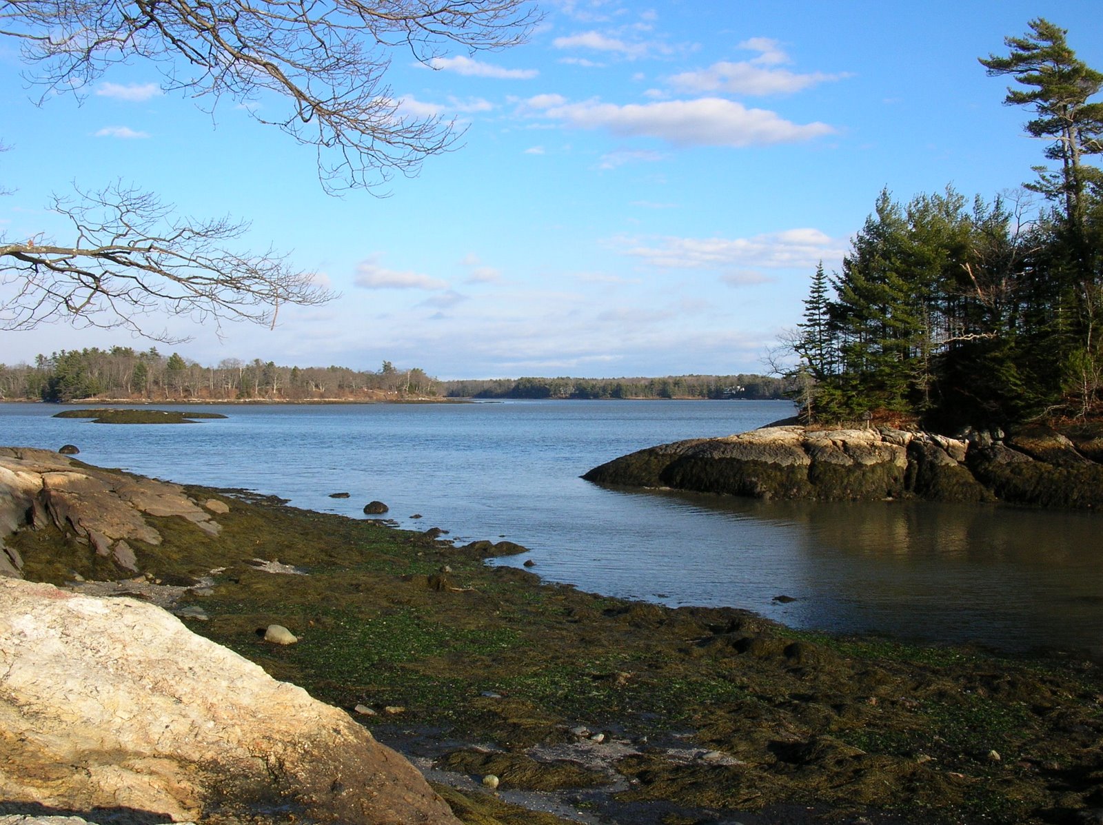
Here are some facts to consider: the Big Run watershed, at about 11 square miles, is the largest in the park. If a single inch of rain fell over the watershed, there would be almost 200 million gallons of new water in the area. That water soaks into the ground and runs into springs and feeder streams, and eventually to Big Run. From there, it flows to the Shenandoah River, then to the Potomac, and then to the Chesapeake Bay and the Atlantic Ocean. We'd had a very dry summer and September, but in October, we got a lot of rain. In my Brown Mountain hike, I hiked about 1.5 miles along the Big Run Portal Trail, and had to cross the stream four times. In every case, I could carefully cross on rocks. On this hike, there was no way to do that as the water was much higher. To hike the entire Big Run Portal Trail, I had to cross the stream eight times, and had to wade across each time.
My total hike was just over 22 miles, and I hiked seven miles and change each of the three days. The trail miles were almost exactly even each day: 7.6, 7.6, and 7.2. During the hike, I saw four hikers: three on day one, one on day two, and none on day three (until I was nearly back to the car, when I ran into three people hiking on the AT). I had my campsites totally to myself, other than some wildlife - although I would have loved to have had a few companions to talk to.
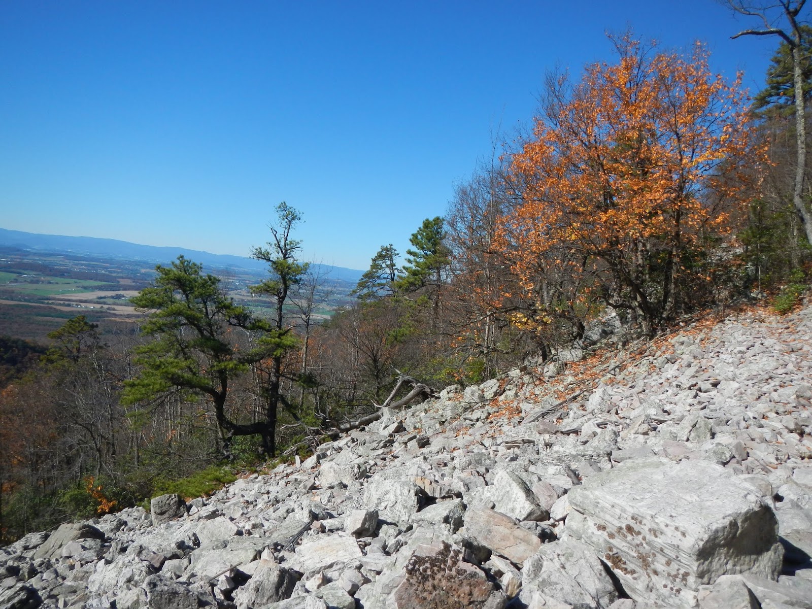
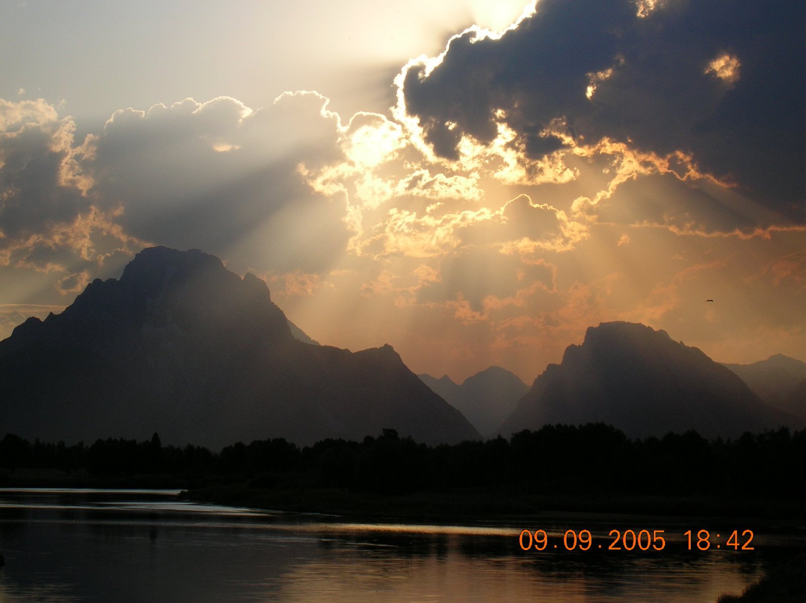
The first day featured several miles of hiking along a beautiful ridge on a gorgeous, cool, bluebird, fall day. My views across the Big Run Valley were of Brown Mountain and Rocky Mountain, and every now and then, I saw some pretty fall foliage.
In my hike of two weeks ago, I took this photo of Rockytop from this spot on Rocky Mountain:
I'm pretty sure that the rocky area on the left of this photo, taken from the Rockytop Trail, was the spot that I took the photo above from. It is rough and rugged country, and very isolated.
The highlight of the first day was the hike up Lewis Peak. There were great views to the north and east. There was a nice young couple up there having lunch, two of the four people I saw for most of the hike. They snapped this photo of me, with Rockytop in the background.
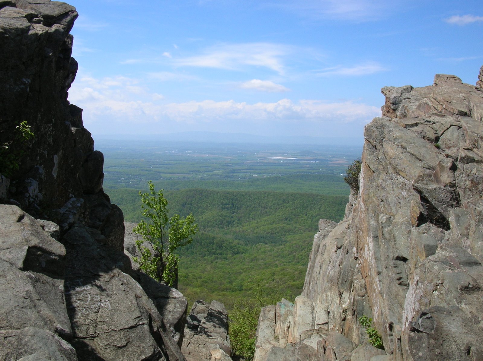
Here is a panoramic view of Rockytop and the Shenandoah Valley, including Massanutten Mountain.
Rockytop, tomorrow's hike-over spot. Can you see where it gets its name?
After lunch, I descended the mountain and started going downhill on the poorly maintained Lewis Peak Trail. Destination - the park boundary and a camping spot for the night. Along the way, I had to go under two major blow downs like this one, and in spots the trail was overgrown and hard to follow.
When I was near the boundary, I crossed this little stream - plenty of water made me happy - and found a nice level spot to camp for the night. Level spots in the mountains are not easy to find, but my topo map indicated that I should be able to find a campsite here, and I did.
After getting camp set up, and relaxing and exploring for a bit, I dug into my bear canister and got some dinner ready, while enjoying the views of the foliage in the area. After dinner, I read for a while, using a new solar powered light that I bought, but hit the sack before 9 as it was getting quite cold sitting out there reading. During the night, I heard a deer making their blowing sound that they do when alarmed or when trying to attract a mate, and I heard a barred owl call. Otherwise, it was an uneventful night.
In the morning, I ignored the time change and had a leisurely breakfast and breaking of camp. I knew that I only had 7-8 miles to hike, so there was no rush.
Shortly after leaving camp, about 700-800 feet from my tent, I saw this fresh bear scat that had not been there at 5PM the day before. So, while I was in camp, a large bear walked very near by. He was certainly aware I was there. Me, totally unaware of him until finding the scat.
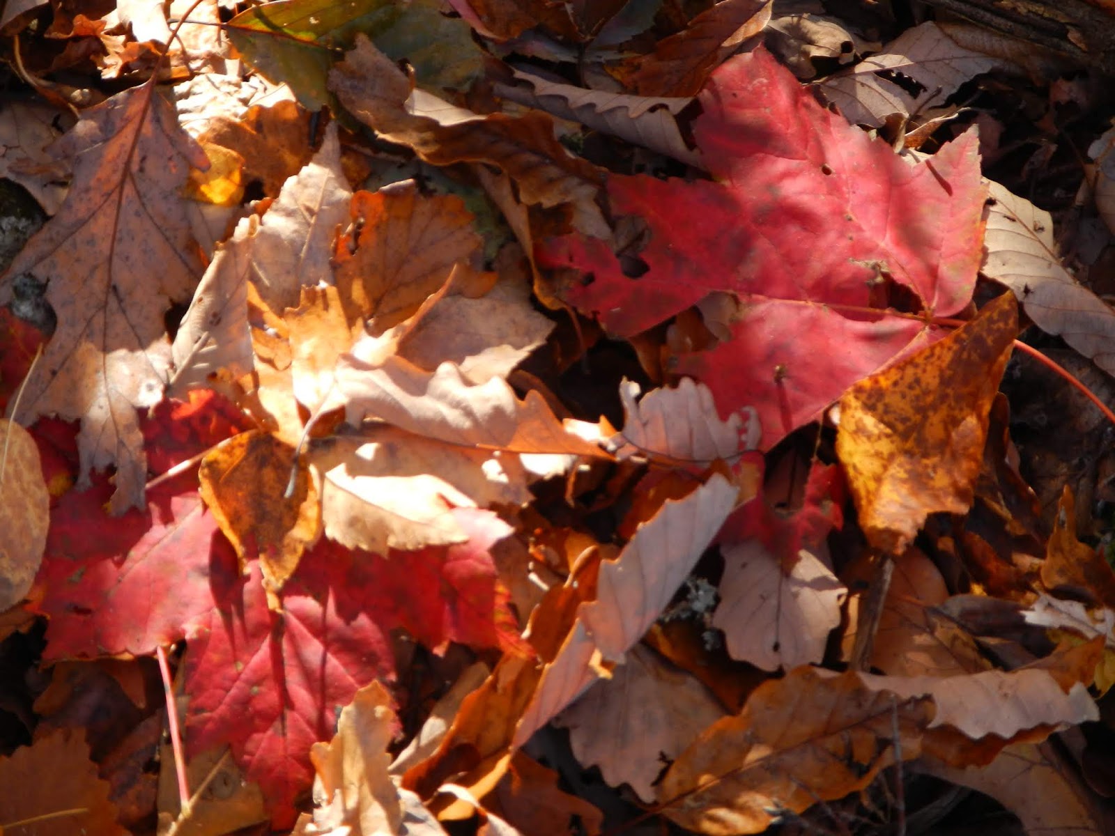
I always like the colorful carpet of leaves in the fall, although they can make the trail slippery, and they hid ankle-turning rocks.
Today's hike was lovely, on another gorgeous fall day. I was changing layers all day long to stay reasonably comfortable. The hike was over Rockytop, with views of Lewis Peak (yesterday's lunch spot) and the Shenandoah Valley.
See the big field in the middle of the photo in the valley?
The black dots are cattle.
The coolest wildlife of the day was this lizard - I think a fence lizard - on the Rockytop Ridge. It was hunting and enjoying the sun on a cool day. I passed lots of great rattlesnake habitat, but did not see a snake of any kind.
After a steep descent of over 1,000 feet, I reached Big Run and crossed on a bridge.
This is where the Brown Mountain Trail comes in, from where I'd hiked here two weeks ago. I started hiking south on the Big Run Portal Trail, looking for a campsite, and just before the first ford of the stream, I found a perfect back country campsite: a flat bluff overlooking the fast-running stream.
I started heating water for tea, and went down to the stream and filtered four liters. When I checked the stove, the cylinder of gas had run out, as I knew it would. No problem - I had a backup, which I attached to the stove. Gas started spewing out, nearly freezing my hand! I tried three more times, with the same result. Either the stove had gone bad or the gas cylinder was defective. No hot tea or hot meals for me! I dumped most of the just-filtered water and took out every food item that didn't need cooking and divided them into dinner, breakfast, and lunch. I'd prefer a hot meal but wouldn't starve.
Just at this time, I heard the sound of a very large animal running through the woods across the stream. Seconds later, a large buck emerged from the woods, gave a huge leap, and landed in a deep pool in the stream with a terrific splash! It swam across, charged up the bank, and ran about 25 feet away from my tent. It was a 6-8 point buck with a large rack. Clearly, something had frightened it, but nothing else showed up.
After a cold dinner, I got in my tent when it got dark, and read for a while using my new light. It got down to just under freezing that night, but I was warm in my sleeping bag. I also put my water filter in the bag so that it wouldn't freeze and be ruined. The night was uneventful - one barred owl called - but I was dreading wading across the stream the next day. It was much higher than when I crossed two weeks ago.
In the morning, while enjoying a breakfast of a Cliff bar, a Snickers candy bar, and some prunes, washed down by ice-cold water, I explored the stream around my camp for a few minutes. It ran through a very rocky and rugged area, then made a 90 degree turn in front of my campsite.
I packed up my camp, took off my boots, and put on my Teva's, which I was glad that I'd carried all this way. Time to hit the trail and cross Big Run. My topo map indicated eight crossings as the Big Run Portal Trail meandered back and forth. It was so cold!
Two weeks ago, I easily had rock-hopped across the stream. Not today - recent rain made it too deep. It was kind of miserable to walk with cold and wet feet for nearly three miles.
Here is one crossing. You can see that it might be possible to cross on rocks if it were lower.
When I made the eighth ford of Big Run, I sat on a rock, took off my cold and wet socks and Teva's, dried my feet a bit, and put on dry socks and hiking boots. Felt so good! Within a short distance, my feet finally felt warm. The trail from here was uphill, gaining another 1,400 - 1,500 feet. I enjoyed the colorful woods along the way.
Nearly at the ridge, I enjoyed a final view, then I reached the ridge line, ate lunch, and hiked the final 1.5 miles to my car.
What a fun trip! I'd seen great views, a bit of wildlife, a beautiful stream, and colorful forests. I'd slept out two chilly nights, dealt with a stove that stopped working, and forded streams. And I had hiked new trails on my attempt to hike the SNP 500 - hiking every one of the 500+ miles of trail in Shenandoah National Park.