Friday, October 26, 2018

Visiting the Priest

I resolved to go hiking Wednesday, and I felt that it was time to visit The Priest.  Not a priest, The Priest.  Here is what Hiking Upward has to say about this hike to The Priest from the north: "Many folks express great fear when thinking about hiking The Priest from VA 56. Although The Priest isn’t found on the list of the 50 highest mountains in Virginia, it rises straight up from the valley floor and forms part of an impressive skyline when driving in from the Tye River Valley. This hike involves a 3000 foot elevation gain (higher than any trail in West Virginia), however the trail is seldom steep along the way, and can be better characterized as “unrelenting” rather than difficult.  Once the trail starts climbing, it maintains a remarkably constant 13% grade for 3.6 miles before steepening slightly for the last 0.3 mile to the summit."

Actually, the elevation gain is 3,117 feet - just saying!  I had heard tales about this hike for a long time, and was in the camp that kind of feared it.  But then again, I knew that it could not be as hard as the White Mountains, where I had a number of really long days over steeper trails with large boulders thrown in. I'd actually been to The Priest before, on my first trip where I resumed backpacking after a long gap, but I'd approached the mountain from the south where it is not as much of a climb.  The two things that I remembered most from that hike was the very cold night on top of the mountain, and the simply amazing stars.

After a drive of about 115 miles from my house, I got to the Appalachian Trail parking area at the Tye River Gap, and immediately hiked into The Priest Wilderness Area.


Here is the route, starting and ending at the red circle.  The red arrow points to my turn around point, and the blue arrow shows the location of the shelter, which I did not hike to this trip.  My Garmin inReach tracked the hike at 9.3 miles, but Hiking Upward has it as 8.6 miles.

The elevation profile from Hiking Upward matches the description - steady uphill, and steady downhill once one turns around.  The summit is flat, and I walked to where I camped 8 years ago, which has great views.  The approach to the mountain is much steeper for the last half mile of the hike up.

Again from Hiking Upward, here is a three-D view of the hike.  Up, up, and away!  It is a very good test of lower body fitness.  My heartbeat was a steady 130-145 all the way up, and about 110 coming down.

I really liked this hike.  It was a beautiful, cool October day, and unlike Pennsylvania a couple of weeks ago, the colors were starting to change.  It was a steady uphill climb, but the lower part of the hike didn't have a lot of rocks or roots to trip over, and I made steady progress.

Lovely Cripple Creek had a kind of water slide, which I was not tempted to try.  This is the last source of water on this hike. I carried two liters, which was more than enough on this cool day.

More fall color underway.

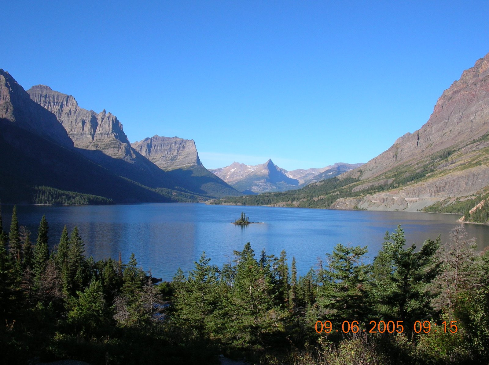
By this point, I had gained nearly 2,000 feet in elevation and was rewarded with a great view.  It had taken me about 2 hours and 15 minutes to reach this point, and I had come about 2.6 miles, including short breaks for photos.

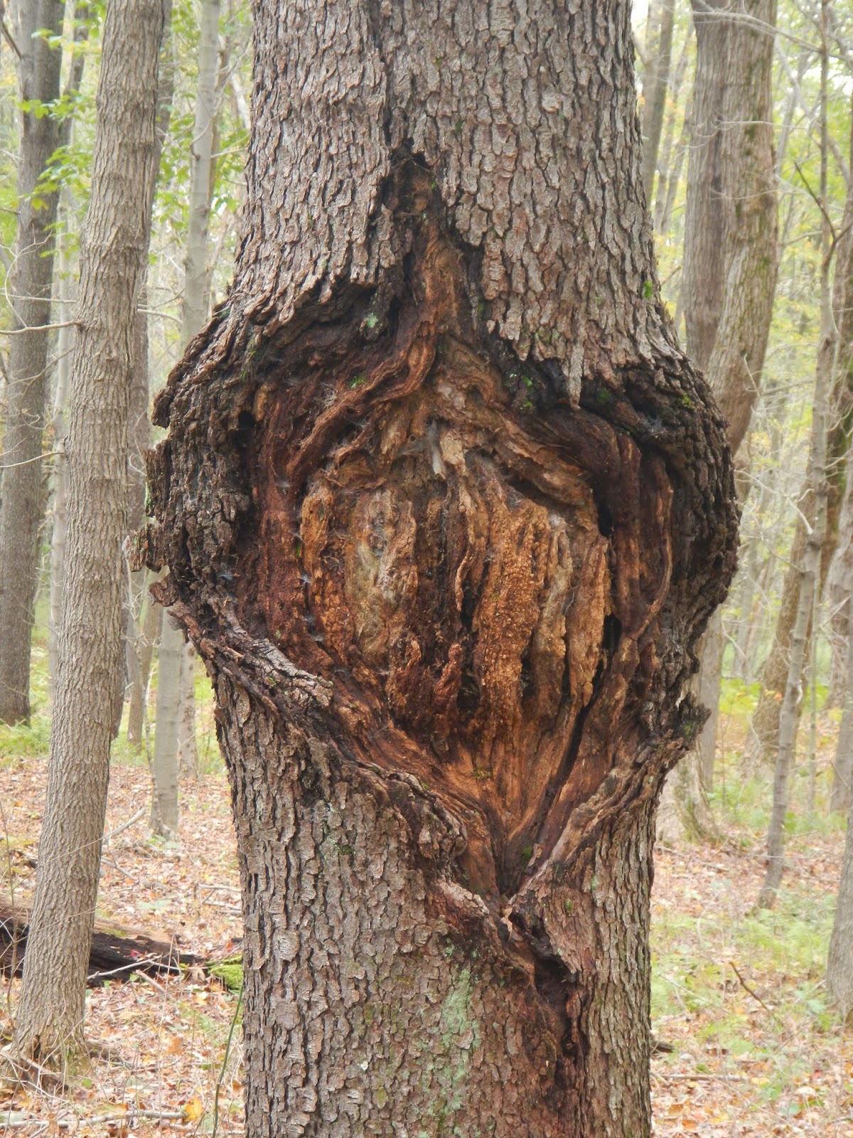
This tree was so stark against the sky.  It was once a living thing.

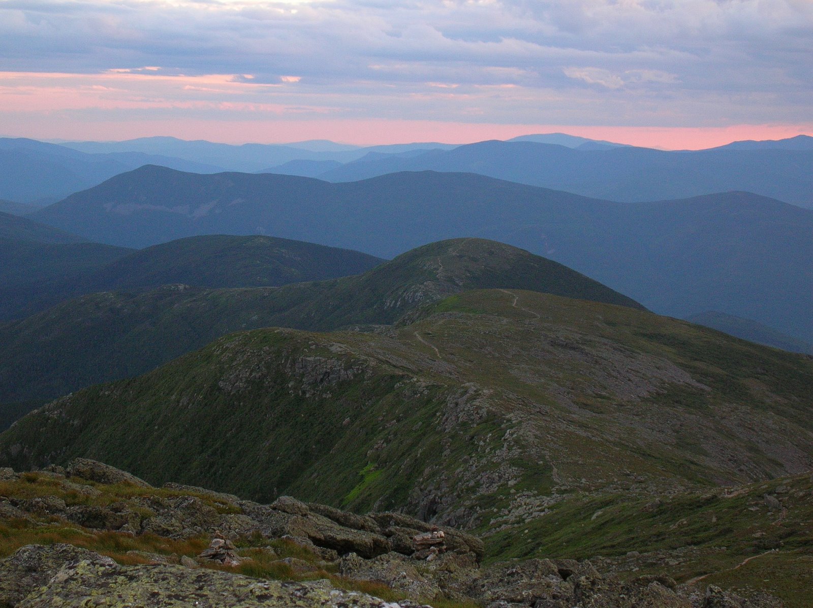
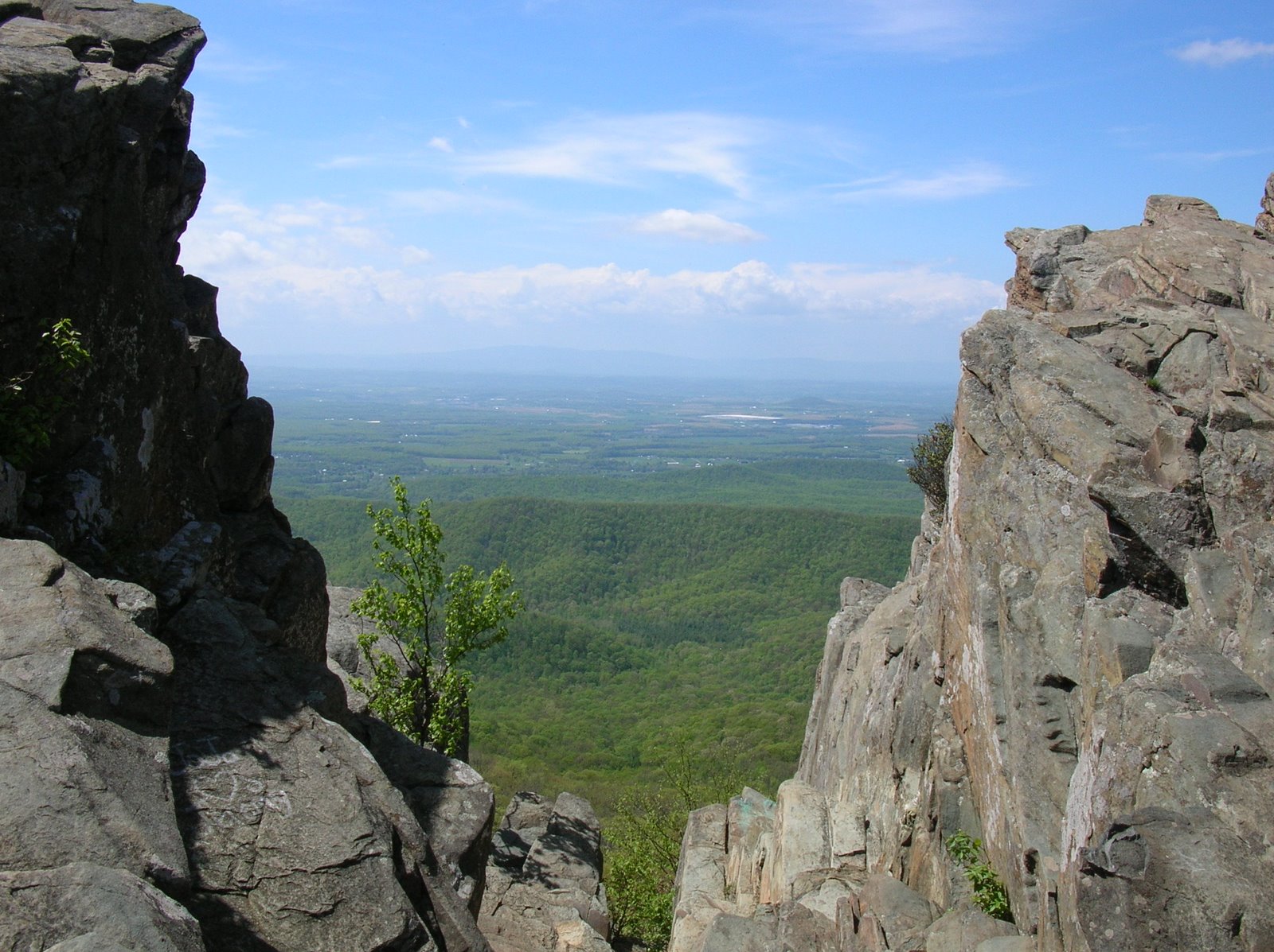
It took me a good while to go the last mile or so, as the terrain got steeper.  I encountered a man hiking north along the AT with a big backpack.  He was midway through a week long hike.  He said "I am sure that I'm enjoying this more than you are," referring to the steep climb that I was in the middle of.  Eventually, I did reach the summit, which has a nice flat part for a while.  If this were West Virginia, a summit at 4,000+ feet would be covered in spruce and fir, but not here.

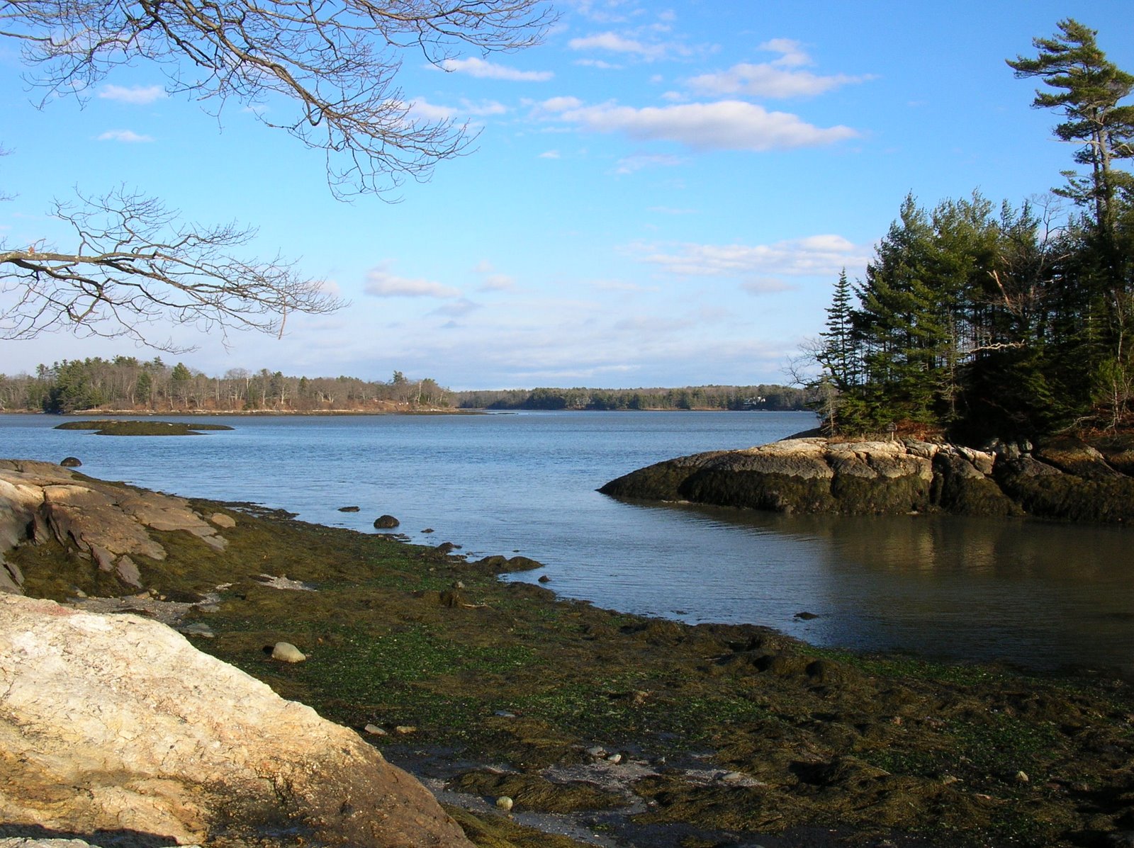
I walked until I reached the area where Hawkeye and I had camped that cold, starry night in 2010, then walked out onto the rocks with the great views, and ate lunch.  A couple of dark-eyed juncos came within five feet of me as I munched on my sandwich, but I could not get their photo.  Other than a gray squirrel, they were the only animals that I saw on the hike.  It was cold and windy on the summit of The Priest.


The hike down looked exactly like the hike up.  Once I carefully got past the steepest section, I made really good time.  It took me about two hours and 15 minutes to get back to the car as I steadily lost elevation.  My car was at about 950 feet elevation, the summit is about 4,062 feet.

I was glad to visit my old friend, The Priest, this time from a more challenging direction.  Although this was not an easy hike, I think that I am in better shape than I realized, because it never felt too hard, and I never felt like I needed a priest for last rites.  Was it a religious experience seeing The Priest?  Well, I never feel closer to God as when I am out in nature, so, yes it was!  I was in God's Cathedral!  So, do not fear The Priest, as many hikers apparently do.  Go out, climb, and enjoy the day and the experience!

As a post script, I heard a few birds that I did not see: Carolina or black-capped chickadees (probably the latter up this high), pileated woodpecker, downy woodpecker, and red-breasted nuthatch.

Tuesday, October 23, 2018

Horsing Around in Goochland County

After my 32+ mile backpacking trip to Pennsylvania, I wanted to go for a short and relaxing hike, and an Old Dominion Appalachian Trail Club hike near here last week exactly fit the bill.  Two club members, Jack and Pat, sponsored a 4 mile hike and cookout at their home in the country last Wednesday.  We had beautiful weather for the day, and their property is in a lovely horse-oriented community in Goochland County.  Along the way, I took a few photos.

Here was where we hiked, starting and ending at the red circle:

This was maybe the biggest club hike I ever went on, with lots of people out there.  The beautiful weather and burgers and dogs surely didn't hurt.  Lots of folks out on the trail that day.

We hiked through forests,

horse farms, such as the one occupied by these mules,

and past open fields.

There were also some ponds, like this one coated in green duckweed.

I particularly liked these miniature horses.

Well, most of my hikes are a bit more challenging than this one, but they rarely end with a great cookout and hiker fellowship.  I had a great day!

Saturday, October 20, 2018

Thursday, October 18, 2018

Back to the Laurel Highlands

In May, when I had about 2.5 miles to go on the 70 mile Laurel Highland Hiking Trail, I came on a stunning viewpoint overlooking the Youghiogheny River as it cut through the mountains.  Well, it would have been stunning were it not for the rain and clouds.  The mountains were covered with deciduous trees, and in my mind, I pictured what it would look like on a bluebird day at the peak of fall foliage.  So, two months ago, I put a trip together to return here during what should be the best of the fall colors - October 12 - 15.  I reserved two shelters and got a group of eight together to hike the last 31 miles of the trail.


Here was the track, hiking north to south, starting at mile post 31 and hiking to 0, camping out in trail shelters for three nights.  We started Friday afternoon and hiked about 7 miles.  We hiked about 6 miles Saturday, 13 miles Sunday, and 7 miles Monday to finish the trip.

Ah, the best laid plans!  Although this ended up being a great trip, it didn't go as planned.  I had two people drop out due to illness two days before, and a third dropped out the day before on advice from his doctor.  Then Tropical Storm Michael barreled through the afternoon and night before the hike, knocking down trees, flooding areas, and causing widespread power outages, so one more dropped out about 1:00 AM Friday.  But the rest of us got together early Friday morning, drove to Ohiopyle, Pennsylvania, ate lunch, and caught our shuttle with Wilderness Voyageurs to be dropped off at the Route 31 parking area about 2:15. The four of us - me, Susan, Jen, and my friend Chelle (on her first backpacking trip) - were ready for our adventure.  We asked the driver to snap a photo, and we started hiking the 7+ miles to the first campground.  The weather was quite cool but at least it was not raining.

We all liked this kind of heart shaped scar on this tree.

One thing that became very clear very fast was that the fall colors that I hoped to see were not going to be in evidence.  Everything was green.  It has been extremely warm and wet up here, and apparently, that has set back the fall colors by a lot.  That was really disappointing!

But, was the glass half full or half empty?  I say half full.  I was hiking in the mountains, camping overnight, it was a pretty area, and I was with a great group of fellow backpackers.  I could accept the lack of fall colors.

We hiked by the Seven Springs Ski Area, which is one of the few parts of the trail where one is hiking out of the deep woods.  It's very pretty there.  In your mind, view this scene as if the colors were at peak.

There were plenty of colorful leaves on the ground, and there were also some interesting mushrooms.

We got to camp in plenty of time to get a fire going.  I brought my little hatchet along, and it was invaluable in splitting up kindling to build a fire in the fireplace of the shelter.

We actually enjoyed a great fire every night on the trail.  State Parks provides huge piles of firewood for the taking, but it is green and wet, and in big chunks.  Without the hatchet, it would have been very difficult to get enough slim pieces of wood to burn.  It was fairly cold, so the fires felt great.  We kept them burning long after we retired to our sleeping bags.  And that first night on the trail, we had a very late surprise visit from a ranger coming up to us in the dark, and also enjoyed seeing fireworks through the trees from the ski area a few miles away.

It rained all night but stopped before dawn.  Otherwise, it might have been snowing.  Because we had such a short hike Saturday, we had a very leisurely morning in camp, and didn't hit the trail until about 11:00.  It was quite cool and foggy.  We would not have any good views today due to the fog.

One area had this great slot going through the rocks.  Even in the fog, it was pretty cool.  Here is Chelle, now officially a backpacker because she has a night on the trail under her belt.

Susan, Jen, and Chelle pause on the trail.

Chilly day in the mountains....

There was some lichens on the trail, like this rock tripe.

Just before getting to camp Saturday night, we had a steep little descent. It had been a good day of hiking, even though it was cold - maybe 43 degrees at the most.  A few days before, it was 85 in this area.  Because we got to camp so early, we had plenty of time to split wood, get a great fire going, eat dinner, and relax at the shelter, chatting about the hike, backpacking experiences, and sharing a joke or two.

Sunday was going to be a little warmer, maybe about 50, but we had a cool start to our 12-13 mile hike.  Jen felt quite sick, and I was concerned about her, having been really sick before on a hike.  She was a trooper, and tough, but we had a lot of miles to do.  If you have never carried a 30 - 40 pound pack for 12 miles in the mountains, trust me, it takes a lot of physical effort.  But each step gets you a little closer to your goal, even if you feel sick.  We took "pack off" breaks every 3 miles, including a long lunch break by a waterfall.

Susan and Chelle on the trail.

One of three large streams that we crossed.

I really liked this stretch of forest.  It was open and park like.

Cranberry Lake was easy on the eyes.


Every now and then, we encountered a colorful mushroom, like this one.

We had a nice lunch break, our last lunch on the trail, by this beautiful waterfall.


This rock reminded us of a strange beast or even a monster of some kind.

Another type of colorful fungi was breaking down this dead tree.

But even more colorful were these beautiful mushrooms.


Near our camp for the third and last night, we found this view of Sugarloaf Knob.  Even without fall colors, it was a beautiful vista.

At camp, we were all tired from the long day, but we got a fire going, filtered water from the stream, blew up our mattresses, cooked and ate dinner, then relaxed for a bit in the shelter, enjoying the fire and each other's stories.

Monday, our last day on the trail, was a short mileage day at just about 7 miles, but it was a bit tough.  We had to climb up and down over two mountain ranges, with steep ascents and descents at times.  Added to this was steady rain starting with about three miles to go.  You can see that the terrain is rugged and steep here.


One of the many great things about this hike is that stream crossings are frequent, and very little water needs to be carried.  At a kilogram (2.2 pounds) a liter, this can add a lot of weight during a dry hike.

Does this look like mid-October in Pennsylvania?  No, it does not.

Here I am on one of the last stream crossings.

During this short "pack off" break before the rain starts, Chelle is either (a) checking for her favorite animal, the squirrel or (b) thanking God that we have reached the top of the second mountain that we had to climb to get back to Ohiopyle.

Once again, this beautiful view of the river is both rainy and with green foliage.  I guess to see it on a sunny day with full fall colors will mean another hike back here, and I'm fine with that.

Hiking in the rain near the end of the hike.

This was, once again, a great hiking trip to the Laurel Highlands.  Our group was small, but spirited.  Everyone had fun, although hiking 31+ miles with full packs is not always without challenges, and the weather was not the perfect fall weather that we sometimes get.  But, it was a great trip all the same, and everyone on the hike did really well.  I was especially proud of my friend Chelle, doing a very significant trip for her very first backpacking trip.  At the end, we squished our way back to town, changed into clean and dry clothing, had lunch and headed back to Richmond to reunite with our spouses.