Showing posts with label AMC August Camp. Show all posts

Wednesday, September 9, 2015

Life at August Camp

I spent a week at Appalachian Mountain Club's August Camp from August 8 to 15, and did a lot of hiking, which I've discussed in my blog.  But I also wanted to include some accounts from camp itself.  What's it like?  Well, it's a lot of fun if you like camping out.  It is way more comfortable that backpacking, and even than just camping out of your car.  For one thing, I had a good sized tent, and the tent had a cot - much more comfortable than being on the ground.  Most people are two to a tent there, but in my case, I ended up with my own tent which was nice because I could lay my stuff out on the other cot.  Here is the view looking out the back of my tent:

We had about 80 people in camp, and the 8 most important of them were the members of the "Croo." These extremely hard working young people made the camp run.  They got there a week early and set everything up, cooked for all four weeks of camp, and stayed behind and took the camp down.  I can't say enough about them.  They had to cook two meals a day for a big group and do all of the prep and clean up.  And they baked cookies and bread and deserts every day.

A day at August Camp started whenever you woke up, and you could get up and go to the Tea Tent for coffee or tea.  In any event, by 6:15 one of the Croo walked through camp blowing on a type of bugle - although it sounded more like a bugler being tortured - and that generally, but not always, woke people up.

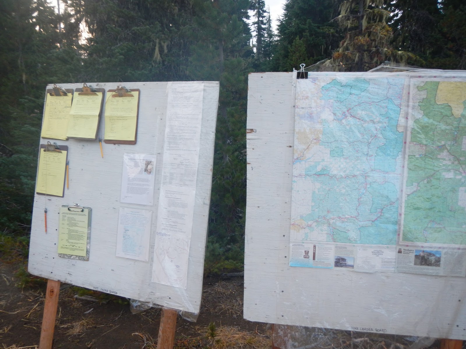
Sometime about that time, the hike leader posted the hike clipboards for the day, and everyone could see what hike they were assigned to.  In every case but one, I got assigned to my first choice hike.  And every hike was really good - you could not go wrong.
Then, it was time to make your way to the lunch tent and put together your lunch for the trail.  They had most things you could imagine for sandwiches and fixings, and there was always carrot and celery sticks, trail mix, fruit, and cookies.  Oh, the cookies! We each got two every day.

After that, about 7:00, it was time for breakfast at the dining tent.  The meals (two a day) were really good, and quite varied.  There were vegan options if you told the camp in advance that you were on a vegan diet.  Breakfast always had hot and cold cereal, and there was always a main course and breakfast meat.  Dinner always had soup, salad, and some kind of fresh bread, a main course and sides, and a desert.  Really good food!


After eating, it was time to get ready for a hike.  Make sure your water bottles and sun shower are topped off at the "water buffalo," the source of all potable water in camp.

If you want a shower later, better make sure and lay your sun shower out in a sunny spot.  The camp was at a ski area, so there were also coin operated showers a short walk away, but that is a rarity at August Camp, I think.

Then groups would gather for their hike at a designated spot and tim, and the leader would go over the plans for the day.

A few other things - 80 people produce a lot of waste - there is no getting around that.  We had a porta-john service that was appreciated, although as one might expect, it got a little gross after a few days.  It was very welcome when the service came and pumped everything out.

After hiking, most people would get back and take a shower if there was time.  Here is what the shower stalls looked like.  They had an ingenious rig inside.

You hang your sun shower on  the hook, hoist it up to the desired height using the pulley, and, voila! hot running water for a shower!  My bag held four gallons, but I found that I could get a nice little shower with less than two.  The last night of camp was a cool and cloudy day, so I ended up taking a shower at the ski center - the best 75 cents I ever spent!

After a shower, you had about an hour to relax before dinner if you were lucky.  Some people scored chairs for outside their tent, but I didn't.  Those that did might read outside or socialize at their tents.  Others gathered for a group happy hour before dinner.  After dinner, we had "camp fire," with no fire because of wild fire dangers.  That involved trip reports, reviewing the next day's hikes, and singing around the "non-campfire," while some talented folks played musical instruments.  That was something that I enjoyed doing most nights.  Quiet hour was at 10:00.  A couple of nights, the Pleiades meteor  shower was going on, and was spectacular with the extremely dark sky - one of the best skies that I can ever remember.

August Camp is not for everyone - several women told me that their husbands would hate it - but it sure was for me.  I hope to go again!

Monday, September 7, 2015

Ode to Obsidian Trail

Every night back at AMC August Camp, someone from each of the half dozen hikes would give a brief - well, usually they were brief - trip report, talking about what the hike was like.  During our last hike of the week, in my case the Obsidian Trail, hike leader Eva talked about how we should write an ode to obsidian.  It got the wheels turning, and I said I could probably write a verse or two that whoever did the trip report could include.  Eva said "Why don't you just do the trip report?"  So as we hiked along, I started thinking about what I might want to say and how to get it into verse.

Back at camp, we learned that there would be no trip reports that night, because of the "Follies," which is the end of each week of camp's talent show.  So after thinking it over for a few seconds, I had a leap of faith that I could write something before the Follies and present it there.  I took a shower, and then spent about a half hour after dinner scribbling something out, and here is the result.  I read it at the Follies - which were excellent by the way: a lot of talented singers, musicians, and story and joke tellers, and even a funny mime act on sleep deprivation.

"Ode to Obsidian Trail"

Eleven hit the Obsidian Trail
Energized, with such wide smiles
We had a great time, without fail
On this lollipop of a dozen miles

Obsidian’s volcanic glass
It’s hard as flint and black as jet
This hike is one you should not pass
This trek is one you’ll ne’er forget

We climbed about 2,000 feet
Through forest, meadow, lava field
The air was cool and damp, yet sweet
We layered up, from chill to shield

Around midday, our merry bunch
By waterfall and rocks of pumice
Pulled out our sandwiches for lunch:
Turkey, ham, cheese, tuna, hummus

As far as wildlife on our day
The highlight was a yellow marmot
We met no harm, but sad to say
I’m pretty sure we did alarm it

Through open glen we softly tread
When we all spied two glacial tarns
So unexpected that I said
“What lovely lakes!  Well, I’ll be darned!”

My week here is near a close
This hike today was quite the champ
A fitting last hike that I chose
To end my week in August Camp!

Yes, eleven hiked the Obsidian Trail
A little piece of Oregon heaven
With one last fact, I’ll end my tale:
How many returned?  Why, all eleven!

Sunday, September 6, 2015

More on Obsidian

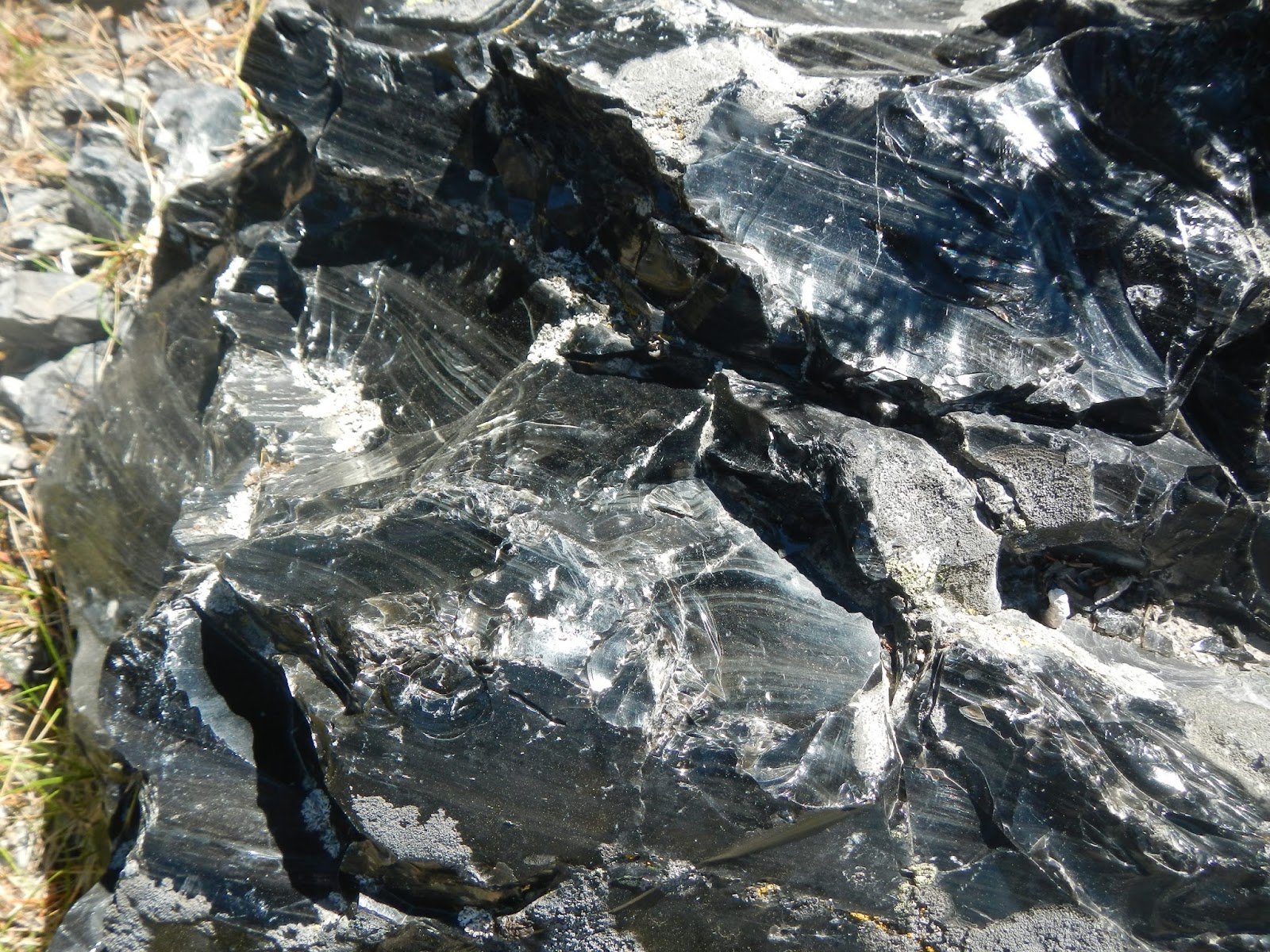
I didn't keep any of the obsidian that I found while hiking on the Obsidian Trail - it was all over the place but against the law to collect it - but it was very tempting.  I did take some photos of this amazingly cool mineral - black glass forged in the heart of a volcano.  It is shiny, sharp, and hard as flint.  I am convinced that some of the pieces that I photographed were shaped into tools by ancient people.  What do you think?

They had great trail signs here.  Back East, I am afraid that people would steal these.

In places, obsidian littered the ground for large parts of the trail.

See how smooth and shiny it is?

To me, each of these pieces look like they had been shaped into tools by humans long ago.  I guess an archeologist would know for sure.

This looks like a spear head to me.

Is this stuff cool or what?


Obsidian Trail (Oregon)

Friday, August 14 - the last day of AMC August Camp - dawned, and I found that I was again signed up for my first choice hike - the Obsidian Trail.  This hike had been offered earlier in the week and folks really liked it.  It is 12 miles long and thus considered to be an "A" hike, but the leader was Eva, who led my hike the day before to Tam McArthur Ridge.  She assured everyone that while we would be moving along, we would not be on a rapid pace and that everyone would be able to keep up.

This ended up being my second favorite hike, and I have to wonder if it would have been my favorite if the weather had been more clear.  It goes through some very scenic country, and while it didn't rain, it was overcast and very cool without some of the long vistas that we had on all of the other days.  As I said, the hike was 12 miles long and of a lollipop orientation - an out and back section of about four miles each way with a four mile loop.  Here is a map of the track.  We started and ended at the upper left, and we did the loop portion of  the lollipop counter clockwise as the arrows indicate.
You'll note that the trail climbs steadily all the way up and for the first part of the loop, then it more or less descends all the way back to the trailhead.  The total elevation gain and loss was about 1,800 feet, and it was never extremely steep as were some of the other trails this week.  It was a good workout without being totally nuts.

Here, we've zoomed out a good bit so you can get an idea of the terrain.  Note the peaks to the east - the three Sisters, some of the tallest and most rugged peaks in Oregon.  North Sister is almost exactly due east of the loop portion of our hike.

We had a really good group on this hike, just as on all of the others.  There were 11 of us, at many different paces - a couple of speed burners, some moderate but steady folks, and some a little slower.  But even those like me who like to look at things and take photographs never really felt rushed.  The speed burners waited at any major trail junction for everyone to catch up, and our leader did a good job of making sure everyone was together.

This hike had it all (other than the big vistas, and I think those were hidden in the weather).  We started in beautiful forests, hiked past rugged volcanic areas and pumice, trekked through open meadows, crossed streams, had lunch by a waterfall, and even saw a couple of tarns.  And that doesn't include all of the amazing obsidian!  For wildlife, we saw a pretty cool marmot, which I'd only seen  few times before in my life.  It was a marvelous hike, and I am really glad that I didn't take the white water rafting option on the last day as I nearly did.  That evening, I turned an account of the day into verse for the August Camp Talent Show: "Ode to Obsidian Trail."

One of the highpoints was seeing the obsidian - black volcanic glass.  In places, it was everywhere.  And I found a number of pieces that look like they had been shaped into tools by peoples long ago, like scrapers or spear heads.  I really wanted to bring some home, but we were all told that it was off limits to take any from this place.  So I captured some photos of it, and memories.

Our hike started in a lovely forest, and climbed moderately but steadily uphill.  This hike was the only one of the week where I wore layers - it was that chilly at times.

About three miles in, we took a break at the start of volcanic area.  The remains of volcanic activity was everywhere through here.

Can you find this cliff on the topo map showing the hike's track?  Hint - it is south of the "stick" part of the lollipop, but fairly close to the loop portion of the hike.

Just left of center you can see a couple of hikers picking their way across a lava field.

This hike had several lovely meadows, like this one.

I think this was the first hike all week that we crossed a stream, so it was pretty exciting.  I was beginning to wonder if Oregon even had streams!

Part of the "lollipop" portion of the hike involved me hiking on the PCT for the second time ever.

Lovely Obsidian Falls ended up being a great spot to have lunch near.
 
In places, obsidian was scattered all over the place.  See more obsidian photos here.

Just above Obsidian Falls, we found an ideal lunch spot.

We saw two of these tarns on the loop portion of the hike.  They were very cool!

Some of the landscape was almost bleak at times.

I wish I knew more about geology.  I'd like to know the story of this amazing boulder!

Like a shepherd looking for a lost sheep, hike leader Eva searches for a straggling hiker.

Eva told me that this was bear grass post-bloom.  It was about three feet tall, and when it is in bloom, it has white flowers.
 
This was just a fabulous hike.  Everyone enjoyed it.  And later, the hike gave me grist to create an entry in the Camp Follies that night - the end of week camper talent show!

Tam MacArthur Ridge (Oregon)

On Thursday, August 13, I took my fifth Oregon hike with the Appalachian Mountain Club August Camp.  This time, we went up Tam MacArthur Ridge, a 5 mile total out and back that climbed 1,200 feet up to a ridgeline overlooking a lake.  It was a fun hike, once again, but a little lonely - thanks to a very basic mistake that yours truly made!

Let's start with a track of the hike.  We started and ended at Three Creek Lake.  See the big purple star on the map - more about that later.  Let's just say that I got very familiar with that area!

Here is a 3-D view of the hike.  We started and ended at the red arrow - up to the ridge and back out.

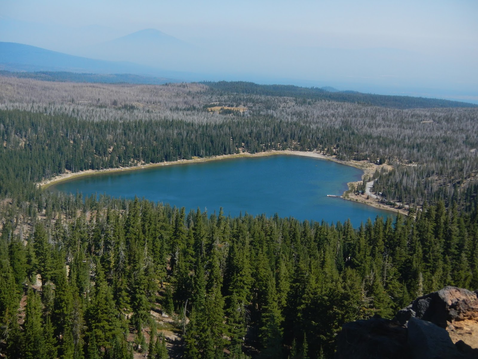
From a little bit of elevation over Three Creek Lake, here is a view of our destination - Tam MacArthur Ridge.

There were 13 of us on this hike.  Here are some of us admiring the views.

I am not sure, but I think this might be some of the Sisters Range.  Note the glaciers.  South Sister is the third highest mountain in Oregon, and I think is the highest that can be hiked without technical skills.

Three Creek Lake lies 1,200 feet below.

I mentioned that there were 13 of us?  Well, by the time I took the pictures above and the one below, I was in a group size of one, thanks to a decision making error on my part.

A group that large gets a little strung out.  I was probably in the middle, with about 6-7 ahead of me.  I came around a bend, and there were three of them sitting on a log in a shady spot.  One of them said "We're taking a little break - men to the right, women to the left."  I counted 3, subtracted from the number ahead of me, and realized that there were 3 or 4 still ahead.  I didn't need a bathroom break, so I kept walking to catch the others.  Mistake #1.  I walked.  And walked.  I came to a trail junction with a horse trail.  Odd that no one was waiting at the junction. So I kept walking.  Mistake #2.  After a good 20-25 minutes, having come to the ridge without meeting anyone, it dawned on me that everyone was taking the break back in the woods, not just three hikers.  So I turned back, thinking I would just meet them on the trail.  So I walked back until I reached the spot where the break had been, and this is what I saw:

How had I missed them?  Then only thing I could think of is that they had taken the horse trail.  So I could either go back up hunting for them, or I could sit my butt down right here and wait.  Staying put was the clear winner, even though I would miss out on more scenery.  So I sat in the shade and relaxed - this is where the purple star on the route map is.  I ate lunch.  I explored right around a bit - leaving my pack at the log.  I talked to people who were hiking up and down.  If they hiked up, I asked them to look for a group of 12 and tell them that Art was fine and waiting for them down the trail.  I even saw a couple of riders:

My one fear was that they would divide up and search for me at the top, but I was pretty sure that Eva, our hike leader, would not let that happen.  Better to have one person separated from the group than three or four.  And after two hours of waiting, who should appear than the other dozen!  I was happy to see them!

We hiked down together, pausing for a few more wonderful views:

And we ended the hot day with a cool and refreshing swim in Three Creek Lake, with Tam MacArthur Ridge looming above us.

I made several fundamental mistakes to get separated from the others.  First, I assumed that only three were taking a break - and worse, I didn't ask for confirmation.  Eva gave me advice afterwards when we linked back up - don't count the people at a break, count the packs.  And memorize your hike leader's pack!  If it is on the ground, then the hike leader is nearby.  Second, I did not stop at the trail junction, assuming that the others were just ahead and hadn't stopped because it was a horse trail.

But I also did several things right.  First, I eventually realized that I was ahead and instead of keeping going or waiting where I was, I backtracked.  Second, when I got back to the break spot and everyone was gone, I waited there instead of going back up looking for them all.  And third, I sent word up with ascending hikers, and as it turned out, at least one of them contacted the group and told them that I was fine and waiting.

It was not my most fun day of the week, but fun enough, and I learned some things!

Thursday, September 3, 2015

Paulina Lake Circuit (Oregon)

On the fourth day of hiking in Oregon, Wednesday, August 12, it was time to take a break from elevation gain but still hike in a scenic place.  The 8.5 mile loop around Paulina Lake fit the bill to a tee!

Paulina Lake is in the caldera of a volcano, and there is plenty of volcanic activity in the area.  We even hiked up and past a collapsed volcanic rim, and we found areas of obsidian, which is jet black volcanic glass.  And while we almost always had great scenery, we only gained about 600 feet for the trip.  This map shows our track, in a counter clockwise direction, starting and ending at the purple star.  Can you see the small crater that we hiked along?  It is southeast of the lake where the trail meanders away from the lake.  It was covered by trees.

There were six of us on the hike, and it was a fun group.  We were in the van together about 3.5 hours coming and going - it was the longest drive I had all week to the trailhead.  Most of the people slept on the way back to camp.

After three straight days hiking in the mountains, I really was looking forward to the hike around the volcanic lake.  The crater formed by the volcano exploding is called the caldera, and someone told me that a lake in a caldera, Yellowstone Lake being an outstanding example, is called a caldron.


For the first couple of miles of hiking, we saw a lot of use by campers and boaters.  It is a very popular recreation area.  I saw a number of great campsites, all with water access, along the way.

There is something about hiking along a beautiful lakeshore.

In a couple of sections, we climbed a bit, and got some really nice views looking down.


Here is a big chunk of obsidian, volcanic glass.  People used to make tools and trade it.  It is amazing stuff - hard as flint, jet black, shines like diamonds, cuts like a knife.

More lakeshore views, as we neared a great spot for lunch back down by the lake.  A couple of us went in for a swim, and I soaked my feet.

It's hard to see them, but there was a group of several dozen mergansers fishing out in the lake.

I didn't go inside, but I have a feeling that this would be a great place to be for a meal with a view.

Other than the long drive - I was the driver on the way back so could not nap - this was a perfect day of being out in the great outdoors.  It was another fabulous day on the Oregon trails!