Showing posts with label Scotland. Show all posts

Friday, June 20, 2014

Stirling, Scotland Walk-About

Time to finish up my posts about my walks and hikes in Scotland.  This walk took place on May 24.

After seeing the William Wallace Monument, we wanted to visit the famous Bannockburn Battlefield, but it turned out that there was a big parade on the way and traffic would be impossible.  So instead, the lassies decided to relax at the motel, and the laddies decided to walk about Stirling for a couple of hours.  It was mostly urban but we also found a nice park along the way, high up in this hilly city and near the Stirling Castle that we had spent the morning touring.

We parked at a car park near the train station, crossed the river on the tall pedestrian bridge, and started walking along the streets of Olde Stirling.


Here is another view of the Wallace Monument in the distance, several miles as the crow flies.

After walking through the city for a good ways, we came on a wild looking and inviting city park, and began hiking some of the trails.  There were a few people about, mostly young lovers - ah, is there anything like being young and in love in the spring time? - and one very friendly border collie.

We spied these cannon high up on a hill, and decided to walk up.  I thought that the beheading stone might be in that general area, and wanted to see it (but not try it out).

As we walked along the trail, my brother-in-law said "Do you smell that minty smell?"  The edges of the path were thick with the plant shown below, and I decided to rub it between my thumb and forefinger to release the minty odor.  Big mistake!  In a split second, my fingers felt as if I had touched a red-hot stove!  They hurt for a good 12 hours and didn't feel right for 24 hours.  This turns out to be stinging nettle.  My brother-in-law, who was reaching for the plant, was thankful that I was a little bit quicker than he was.

At the top of the hill, near the pair of cannon, was the beheading stone.  It is no longer in use.

Here is a panoramic view of Stirling - the new part to the left - from the top of the hill in the park.

The cannon stand silent guard on the hilltop.

As we looped back towards the old part of the city through the park, we caught a view of Stirling Castle.

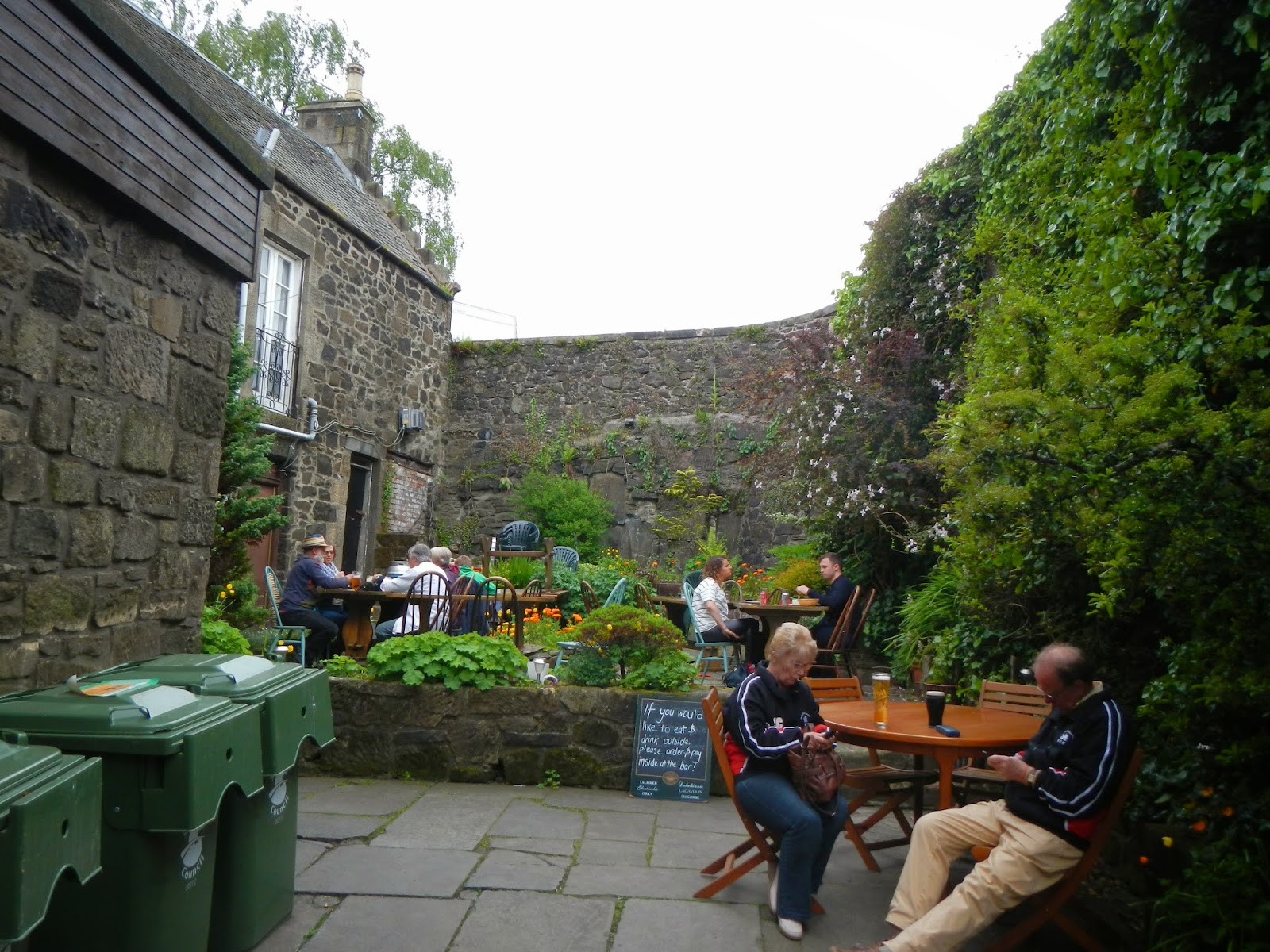
Later that evening, we had dinner at this restaurant.  The courtyard looks so inviting, but it was raining later on.  I tried to convince my brother-in-law to have an ale at several places along our walk - with me buying - but he declined, saying that he would have a Guinness with dinner.
As we returned to the city and headed back towards the train station and the car park, we came along another pair of old cannon.

The next day, we would be leaving Bonnie Scotland to head home to the US of A.  It had been a great trip, but I wish we had had more time there.  Still, we packed a lot into our eight days in this lovely and friendly country.  I hope someday to return.

Thursday, June 12, 2014

William Wallace Memorial near Stirling

OK, back to bonny Scotland for just a wee bit more!  This walk happened Saturday, May 24.

Was walking to the top of the William Wallace Memorial at Stirling a hike?  Well, not really, although we did walk up the trail - about 10 minutes each way, uphill on the way up, then downhill on the way down - just to get to the monument, and then there were the 280 or so steps to the top.  So I did enough walking to at least write about this monument, which is near Wallace's signature victory against the English Army at the Battle of Stirling Bridge in 1297.

Ever see the movie "Braveheart?"  Well, I hadn't, but I have since rectified this omission after returning from Scotland.  I know that Mel Gibson's epic was a movie, and that it took a lot of literary license, but it also had much factual material, and it made me glad I was never a Medieval soldier.

This is a view of the Wallace Monument from several miles away near Stirling Castle. It is very Gothic and can be seen from almost anywhere in the area.  You can see that it is built at the top of a tall hill.

Here is what the pathway looks like on the way up to the monument.  You can also ride a free bus up there. Would I do that?  Maybe in a few more decades.  Maybe....  There are several miles of additional trails that can be hiked if one chooses.  If it had not inconvenienced the others, I would have likely walked a few more miles exploring the woodlands here.  It is a beautiful spot.


Two thirds of the way up was this nice pastoral view.

Miles away, you can see Stirling Castle, which we had toured for several hours that morning.  It is fascinating.

Wallace is one of Scotland's most revered heroes.  Here is a likeness sculpted part way up his monument.

He must have been incredibly strong to have wielded a sword like this one, a replica of his Claymore.  I mean, you could have stood in upstate New York and stabbed someone in New Hampshire with this thing!

Here's a depiction of William Wallace in stained glass near the top of the monument, which has several rooms with exhibits as you climb the spiraling staircase.

From the very top is a large viewing platform.  Here is part of the mostly pastoral view.

And here is a panoramic view from the top.

The Battle of Stirling Bridge was fought right in that section of the river, back a bit from the foreground.

Wallace was a brave man, and he paid for his bravery and his convictions with an absolutely horrific and unimaginably cruel death at the hands of the English as their prisoner in 1305, eight years after his historic and still remembered victory at this place.

Thursday, June 5, 2014

Arthur's Seat, Edinburgh, Scotland

Well, when I was in Edinburgh on May 23rd, you know that I would have to hike up to Arthur's Seat, a volcanic plug with spectacular views.  So after touring Edinburgh Castle and having afternoon high tea, and with decent weather for good views from the top, my brother-in-law Tom and I headed down the Royal Mile to gain the trailhead.  If it had been raining, I probably would not have done this, because the reward from the top of the 830 foot peak are great views.  But still, how often do you get the chance to hike up a point sharing your name?

Using the DeLorme InReach SE that my friend Chip loaned me for this trip, I was able to map my approximate track (in light blue).  See the arrow to the left?  It points to Edinburgh Castle, which is amazing.  From there, Tom and I marched a nice straight line, in light blue, down the "Royal Mile" before reaching the jump-off point to the trails up Arthur's Seat.  The arrow on the right points to Holyrood Palace, the official residence of the British monarch in Scotland.  It is often open for tours, but not on that day.  Apparently, some royalty or other was in residence that day, as the gates were shut and security was very tight.  Our route up Arthur's Seat was more or less in a clockwise direction from there.

Silly me - at the start of our hike, I thought that this was the top.  There was a line of people heading up that trail, so we picked the "road less traveled," the trail to the left.  No matter which way we went, there were lots of people.  This is a place for great views but not for solitude!


After walking for a while up the path, we found that this is the top.  It took about 40 minutes of steady uphill walking to reach the top, including a brief stop at a ruined chapel.

This is all that is left of the Saint Anthony's Chapel.  In 1426, the Pope gave money for the repair of this chapel.  Looks like it might be time again for some repairs, eh?

Near the ruins of the chapel, Arthur's Seat still looms hundreds of feet above us.  The yellow flowering shrub is gorse, I believe.


I think this bird is a hooded crow.  We do not have them in the "States."

Here is a panoramic view looking back towards the lower hills and the bay.  We are starting to get the first of some great views.

We hiked up some more, and at this point, we are getting closer to the top.

Up, up, up....

Before we know it, after a final push over rocks and steep trails, we were at the somewhat crowded top.  Great views of Edinburgh presented themselves as a reward for the hike up.

This is a panorama from the top.  Fabulous views!

Art(hur) at the top of Arthur's Seat on a very windy day!

We mostly did a different route down.  Here is a nice view of Holyrood Palace on the way down.

For being in a big city, this area had a lot of ruggedness to it.

Here, we look back towards the summit of Arthur's Seat from a kind of saddle ....

... with a panoramic view taken shortly after that.

As we got lower and lower, we eventually joined the trail we had come up on.  Looking back up that trail, you can see a distance view of the ruins for Saint Anthony's Chapel.

 I enjoyed my hike up to Arthur's Seat, a little bit of wildness in cosmopolitan and modern Edinburgh.

Wednesday, June 4, 2014

Walk to Urquhart Castle

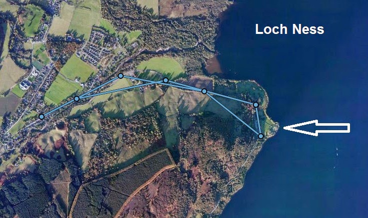
Urquhart Castle is the ruins of a castle on a point on Loch Ness, and it was less than a 1.5 mile walk from our Bed and Breakfast, Rowan Cottage.  So on Thursday, May 22, I got up early and left the lassies and the other laddie behind to walk to the castle.  The three of them had toured it the previous day while I hiked in the woodlands nearby.

This shows my approximate track, leaving a track point every 10 minutes and straight-line connecting them.  The white arrow shows the location of Urquhart Castle.

It was a very cool morning with a brisk breeze, and before I returned, there was a steady drizzle coming down.  But that was OK.  It was not a moderate rain like the day before.  Along the way, once I left the Lewiston part of Drumnadrochit, I passed sheep farms and saw this rare black lamb.
Here was my first view of the castle.  You can see how steep the ridgelines are by the loch.  It is a beautiful spot, but castles were not sited for the view.  It would have strictly been a strategic decision.
Interested in a little "fixer-upper" with some history behind it?  Well, inquire within...  My wife told me that the tour they took was really good and well worth it.
The last photo is proof one more time that one must always have their camera at the ready.  As I strolled along back north, I spotted Nessie out in the loch, but before I could get my camera out, she disappeared into the bank of fog.  Oh, I could have been so rich!
I finished my walk in good spirits, having gotten the day off to a great start.  It got even better with another fabulous breakfast, and then we got on the road to drive to Stirling, where we would be for the last few days of the trip.

Monday, June 2, 2014

Balmacaan Wood Trails, Drumnadrochit

After walking to the Falls of Divach, the second part of my Drumnadrochit hike on May 21 was along the forest pathways in the Craigmonie and Balmacaan woodlands.  Combined, the two made for a lovely 6-7 mile hike in the rain, closer to 7 miles, I would say - and maybe a bit more than that.  I was pretty wet at the end, but happy do have done such a nice hike.  I am sure that there is a local group of volunteers that maintain these trails, and they do a wonderful job of it.

The visitor center gave me a basic trail map.  After the falls, I started near the bottom right of the map where the blue and white trails come together.  I had previously walked the white loop the night before as a leg stretcher.  I headed over to the west side, up the blue trail to the green, looped around that and then completed the red loop.  Lovely place!  The trail map said that badgers, roe deer, pine marten, and red squirrels are in these woods, so I was hopeful of a sighting. But the only wildlife I saw were a few small birds and an unidentified woodpecker, although birdsong was my near-constant companion.
Through really cool satellite technology from DeLorme, I was able to capture my basic track for the hike.  The light blue arrow is my approximate starting point from Rowan Cottage.  Starting 10 minutes later, I captured a track point every 10 minutes.  The software connects them with straight lines, so it is not exact route, but a good approximation.  The Falls of Divach, my first stop, are near the bottom left with the pink arrow.  The approximate location of Craig Monie is at the left arrow.  Loch Ness is to the east.  The light blue lines connect the track point.  Pretty cool, eh?

Right here, I walk through deciduous woodland with carpets of May wildflowers.
Where the red, blue, and green trails come together, there is a pair of huge redwood trees.  How big?  Well, I placed my hat and trekking poles against one of them so that you can get an idea.
I believe that this view was from the redwoods looking out towards Loch Ness.
The trails could be fairly steep in places with some climbing.  There was also a fair bit of mud from time to time.  As the elevation increased, the trees have way more to conifers like these,
and these.
There were only two places I came to on these trails with viewpoints.  This one is of Milton, originally a planned village towards the end of the 18th century.
The second and more spectacular viewpoint was Craig Monie.  I believe that "craig" means peak, and "Monie" was the name of a Norse prince killed in a battle on this spot.  What a lovely place to die, although I doubt that his cause of death was so lovely.  See Loch Ness?  Do you see Nessie in the upper right of the lake?  Neither do I!
This is the panoramic view from Craig Monie.
Mother Nature sure has some lovely carpets in her home, does she not?  These may  be blue bells.
I really loved this hike!  Combined with the waterfall walk, I was occupied for a good three hours.  A little rain?  Who cares? I was hiking in bonnie Scotland!