Wednesday, April 17, 2019

A Devilish Fun Time

Every time I am nearly caught up, I go on more hikes.  I've written six posts, counting this one, in April, and am still one behind - two if you count today's hike.

Last Wednesday, I joined a new (for me) group who does regular Wednesday hikes in the mountains.  I've been wanting to hike with them for about two months but had conflicts every Wednesday.  Last Wednesday (April 10), they went to Little Devil Stairs in the northern part of Shenandoah National Park.  Our group of about 19 split into three groups depending on the loop we each wanted to do - 6 miles, 8.5 miles, and 10.5 miles.  I did the middle distance loop.  All of us got to go up the very steep Little Devil Stairs section.  My last time here was in 2014 for a three day solo backpacking trek.

For our hike last Wednesday, here is the track that I hiked, starting and ending at the orange circle and hiking counter clockwise (see the yellow arrow):

I liked this hike a lot.  We hiked at least four different trails, and were next to beautiful streams at least half of the hike.  There was no need to carry more than a liter of water.  I filled up once near the end.  We had a big group for this trek:


Spring always lags a bit in the mountains, but there were plenty of wildflowers out.  These are Dutchman's breeches.

Little Devil's Stairs is rough and rocky.  This does look a bit like natural stairs.

A stream ran nicely along the stairs.

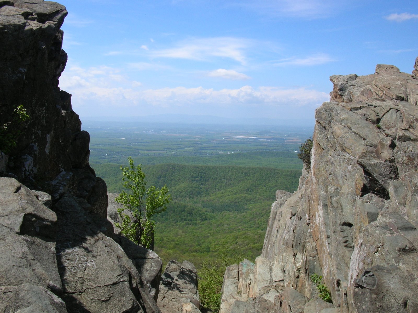
The trail climbed through a rugged and steep gorge.

Now and then, we were treated to water shooting down the gorge.

Once we got out of the gorge, everyone rested until the entire group was together so that we could be clear who was hiking each optional distance.

The rest of the trail was not as steep, and was more downhill than up.  It spent a lot of time next to streams, with some attractive little waterfalls at times.


Last year, I struggled keeping dry feet on stream crossings.  For this hike, we must have made a dozen crossings but none of them were difficult.

Not far from the parking is a little mountain cemetery with this poignant reminder about the sacrifices that mountain folk made, often against their wills, so this park could be created.

Here are some more wildflowers from the hike, along with my identifications - which are not necessarily correct.

Round lobed hepatica

Rue anemone

Hairy yellow forest violet?

Bloodroot (I think).

On the way home, we stopped for a very late lunch together.  It was a fun way to end a fun group hike.

Tuesday, April 16, 2019

Richmond Slave Trail

Last Tuesday (April 9), I joined the group for the Old Dominion AT Club for another walk downtown, this time to cover part of the Richmond Slave Trail.  For a description of the entire trail, go to this older blog post.

For this hike, we focused on the part of the trail along the James River.  By the way, the expression "sold down the river?"  The river is the James, and the place was here.  Human beings in Virginia were sold by their owners to plantations way down south for many reasons - to earn a quick buck, because they were no longer needed, to get rid of a child of the plantation owner - along with their mother - to punish someone who was not fully cooperating.  Hard to believe, but all true.

Here is our track, about 5.4 miles.  To do the route, we did part of the same trail twice, more or less.  We started and ended at the circle (left) and followed the direction indicated by the arrows - across the Potterfield Bridge, down the Canal Walk, across the Mayo Bridge, down the Slave Trail to the site of the Manchester Docks, reversing this section a bit closer to the river, and back to the start on the Flood Wall Trail.


Here are some pictures from the hike:

Richmond from the Potterfield Bridge:

Black vultures - we saw dozens of these large birds - on a rocky island in the river.

Much of the trail is urban, but this part was more of a path through woods.

Virginia bluebells.

View of the city from the Flood Wall trail, on which we hiked to get back to the starting point.

History is fascinating to me.  In this case, it is also tragic and awful.  The terrible events that the Richmond Slave Trail remembers actually happened, right here in the Land of the Free.  Best that we not forget about it.

Limberlost Trail

The Limberlost Trail is in the Central Section of Shenandoah National Park, near Skylands, and is perhaps the easiest path in the entire park.  It forms a gentle loop of 1.3 miles on a broad and level pathway.  It used to run through a forest of huge eastern hemlocks, but these massive trees have almost all been killed by a tiny insect, the woolly adelgid.  A couple of weekends ago, Mary and I went up to the park for the afternoon.  I am going to be leading three weeks of hikes for Road Scholar this summer in the park, and wanted to get some field guides for Shenandoah natural history.  We spent some time in the park gift shop where I bought several books.  Then, in the museum, we watched a film about the making of the park - and the eviction of poor mountain families from their land - and also toured the museum.  We ended our time by hiking on the Limberlost Trail.

Here are a few photos from the trail.

On the trail....

This hemlock has somehow managed to evade the invasive insect that has killed most of its ilk.

There are nice benches every few hundred feet or so.

Yellow birch are a northerly tree, but are sometime found at higher elevations in Virginia.

This is a columnar jointing, the remains of an ancient lava flow that cooled and solidified into columns.

This forest used to be mostly eastern hemlock.  Look at it now.  In addition to the adelgid, storms have knocked down many of the trees of other kinds.  It is a young and open forest now, with lots of sunlight coming in.  Eventually, a mature forest will cover the area again, and shade the forest floor.

Hard to believe that such a large living thing could be killed by a tiny insect.

Could this tiny hemlock somehow survive and grow, and live to shade the forest someday?

If you are in the park and want a little leg stretcher with minimal effort, this is the hike for you!

Friday, April 12, 2019

Return to Dutch Gap

A couple of days after the Texas Beach hike, I had a little time to return to Dutch Gap.  Unlike my last hike there, I didn't see quite as many birds, at least not within camera range, but here are some photos.

Even before I started walking, I spotted a muskrat swimming.  While I couldn't get a photo, I did take one of his house,


as well as one of a much larger beaver lodge nearby.

Near this area, many red-winged blackbirds were calling.

Later, I got a good look at a northern mockingbird.

I also saw several beautiful yellow-throated warblers.  Not as beautiful is this black vulture.  There were at least 30 of them gathered on a point - on the ground, on the roof of a shed, and in the trees.

A pair of ospreys nearby were nesting, and seemed upset by all of the vultures.  They would fly around and call, but one eventually returned to her nest.


Back at the parking lot after hiking - or strolling - 5.9 miles, I enjoyed the spring color provided by this redbud and magnolia.


Thursday, April 11, 2019

Two RVA Trails

Once again, I am well behind posting about hikes.  I now have six undocumented hikes, although I may not post them all.  Two that I will post occurred several Tuesdays ago, 3/19 and 4/2.  One of my hiking groups, the Old Dominion Appalachian Trail Club, does a fast hike every Tuesday in the spring for about six or eight weeks.  They are downtown along the trails by the James River.  We hike from 8-10, and do about six miles.  Lisa does a great job organizing and leading these hikes.  Don't be late, as we step off at 8:00 promptly.  On the 19th, we hiked the Buttermilk Springs Trail, and on the 2nd, we hiked to Texas Beach. for a total of 12.5 miles for the two hikes.

Here is the track of each hike, Buttermilk Springs (purple arrow) on the south side of the James, and Texas Beach (orange arrow) on the north side:

We had a group of seven for the hike.

This map shows some of the trails in the James River Park System.  The James, specifically the fall line in the river, is why there is a big city at this location, so it's appropriate that people value and enjoy the river, and also treat it more kindly than in years past, when it was an open industrial and residential sewer.

Here, a couple of the crew cross a bridge over a creek.

There is a bit of up and down along this trail, although no long climbs or descents.

One guy called this "Whale Rock," and you can see why - massive and shaped like a whale.  I am keeping it from tumbling down the ravine here.

When we reached the Nickel Bridge, we descended and returned on a trail closer to the river.  One could also cross the bridge and return on the North Bank Trail, making about a 7 mile loop.

We didn't see a Sasquatch, but after seeing this sign, we were on high alert for the rest of the hike.

Rapids in a side branch of the river's main channel.

Just before getting back, we had a nice overview of the river.

For the Texas Beach hike, we crossed the Potterfield Bridge and headed up the North Bank Trail, then branched onto the Texas Beach Trail, turning around at the Nickel Bridge and returning on the same trails.  I only took a few photos.

Most of the hike had river views.

Texas Beach - no idea how the name came about.

Violets are a sure sign of spring in these parts!

Heading back into the urban zone of the hike.

These Tuesday hikes are a great way to get the day started, get the blood pumping, and hang out with a good bunch of folks while seeing a bit of nature.