Showing posts with label state parks. Show all posts

Thursday, February 11, 2021

Winter Hike in Powhatan State Park

 I've hiked a number of times in the last few months at Powhatan State Park, about a 40 minute drive from my home.  I hiked a 7.5 mile loop yesterday, and decided to write about it.  The loop was hiked clockwise, starting and ending at the red circle, where a picnic shelter and bathrooms are located on the drive in.


This trail - actually about 5 or 6 different trails - goes through open areas,

as well as forests.

About a half mile of my route went along the James River, where I came across these

raccoon tracks in the mud.  I saw plenty of deer tracks as well.

Moving up from the river, the trail goes through thick hardwood forest.

Fungi are hard at work breaking down dead wood and returning its elements and molecules to the ecosystem.

It's always a bit sad to see small graveyards in the forest.

I saw and heard a number of birds, including downy woodpecker, pileated woodpecker, red-bellied woodpecker, red-tailed hawk, red-shouldered hawk, white-breasted nuthatch, blue jay, Carolina chickadee, Carolina wren, and mourning dove.  The only one I managed to get a photo of was this turkey vulture.

I really like the nuthatches.  I could not get a good photo, so I did a sketch of the white-breasted nuthatch.

Moving back into forest for the last couple of miles of the hike, I crossed this stream using the logs.  The park service should put in a bridge.

This trail is named the Pine Trail.  Can you guess why?

In this stand of trees were a number of dead pine with all the bark missing.  These snags become important wildlife habitat for a variety of creatures, starting with woodpeckers excavating cavities and hunting for insects.

Trails in the state parks are very well marked.

The Cabin Trail leaves the Pine Trail and drops sharply to a forest bottom with a nice stream running through it (with a nice, fairly new bridge to cross the stream).

Upstream a bit, I found this great skunk cabbage flower blooming.  This plant is one of the earliest plants to flower in the woods.  They are always found in wet areas, and generate their own heat to bloom in mid-winter.  The grown plant is very pungent, but a number of animals, such as deer and bear, eat the shoots when they are young.  Many kinds of animals also eat the seeds.

About a mile from the end of the hike is the remains of a cabin, which gives this trail its name.

I always enjoy the trails in this park.  I was supposed to join a group for a hike but slept so poorly that I didn't get up to join them.  Instead, doing this hike solo turned out to be a good alternative.


Saturday, January 18, 2020

The Group Hike That Kind of Wasn't

My last hike of 2019 was December 8 at Powhatan State Park (I didn't post about it, but it was 7 miles).  Exactly a month later, I took my first hike of 2020.  My wife's health has improved enough in the last few weeks that we are okay with me heading out for fairly short hikes not too far from the house.  So, while I won't be going up to the mountains - too far and not as easy to stay in touch - Powhatan SP is only about a 35 minute drive and is within cell phone coverage.  And on that Wednesday, the Old Dominion Appalachian Trail Club was having a hike there of about 5 miles, gathering at 10:50.  Seemed perfect!

I hit the road and even got there about 5 minutes early.  As I pulled into the parking area, I was amazed to see so many other people there early as well.  The parking lot was full, but not a single person was in sight.  I pulled out my phone and checked the email: gather at 9:50.  Doh!!!!  Well, I was at the park, it was a pretty day, and I could still do a hike.  I looked at the map, planned my route, and started my feet moving.  And in about 1.5 miles, I encountered our big group coming the other way, so I hiked back to the cars with them, getting to chat with some of the club members.  After they left, I hit the trails again and hiked about 2 + more miles by myself.  Here is my route.  The star is the parking area, the big arrow to the red circle was my first hike, running into the ODATC at the red circle, where I turned and retraced my steps.  The loop at the top of the map was my second hike, solo.


The first part of the hike goes through open woods near the James River, and past some canoe-in and walk-in campsites.  One can camp here year round, I believe.

This park is a pleasant mixture of forest, riverfront, and open fields.

The stairs to nowhere?  Actually, this park is popular with horsewomen and horsemen, and my guess is that the steps are provided for easier mounting of one's horse.

As I walked along the edge between the field and the forest, I was delighted to see the ODATC hikers coming towards me, so I retraced my steps with them to the parking area.

Back on my own, I started out on the River Trail, then looped back through the forests and fields.

Here is a deep gully that likely contains an intermittent stream when heavy rains occur.

I really like going through the forest in the winter.  It's peaceful, although I do miss the bird song of spring and summer.  Birds calling are infrequent this time of year: a few pileated, red-bellied. and downy woodpeckers; Carolina chickadees; Carolina wrens; white-breasted nuthatches; tufted titmice; white-throated sparrows.

I was happy to get in a short (5.6 miles) hike, and also to run into fellow hikers, despite my senior moment about the time.  I'll try to go on a few other short hikes before my wife's surgery.  I may not write about them - for example, I got to Three Lake Park and Malvern Hill Battlefield in the past week.  Eventually, I'll be up in the mountains again, but not for a few months, I would guess.

Friday, February 22, 2019

Lake Anna Circuit Hike

My friend Doug suggested a hike together recently.  Tragically, Doug's wife died the beginning of the month, and I think it will be good for him to get out in nature, so I was happy to join him.  He suggested Lake Anna State Park, and we went on February 13.  We did a circuit hike of about five miles, following a number of trails (Sawtooth, Glenora, Big Woods, Cedar Run, Turkey Run) and getting some nice views of the lake.  Here is a track of our route, starting and ending at the star.  The purple and blue arrow shows our direction (counter-clockwise).  I'll refer to the other arrows later.


I thought that this tree would make a great seat for a little child.

No doubt that we are still in winter, although I saw a lot of trees beginning to bud.

We've had lots of rain, so the streams were running nicely,

and there was plenty of mud on the trails to slog through.

There used to be a plantation here, Pigeon Plantation.  This was the smokehouse.  It took 40 days for the ham to cure, then about a week to smoke the hams.  Finally, they were left to age for about six months - a long process before eating that ham dinner.  No super markets to fall back on!

We ate our lunch here by the lake (refer to the red/pink arrow on the map).  It was a nice spot.


But an even nicer spot was found later in the hike (see the yellow/orange arrow).  There was even a picnic table here!

I enjoyed hiking with Doug on this day.  We had pleasant weather, especially for February, and it was nice to get out and about with him, enjoy the outdoors, and talk about things.

Thursday, January 24, 2019

Day Hiking at Powhattan

Late last week, my friend Doug and I decided to go for a short hike Friday in Powhatan State Park, southwest of Richmond.  Doug had Friday off from work, and I, well, I have every day that includes a "Y" off now, generally.  We met up about 11:00 and headed to the park.  Our focus would be the Old Cabin, Big Woods, and Pine Trails, but we also hiked a bit along the river after that.

After years of trouble-free operation, my inReach is no longer mapping my tracks accurately much of the time, adding all sorts of additional track lines and garbling the results, so I won't show a map.  We did hike about 8 miles and did a bit of exploring in the woods when we could not find the connection between the Old Cabin and Pine Trails.  Eventually we did, although unlike is normally the case in our state parks, it was very poorly marked.

Here are some photos of this hike.  As far as wildlife, we didn't see any but did hear a number of birds (lots of the big pileated woodpeckers, downy woodpeckers, white-breasted nuthatch, Carolina wren).

Doug on the trail...

Stark winter tree branches

The snow of two weekends ago was all but gone.

The old cabin site.  I wonder who lived here and how their lives were?

Hiking along the Pine Trail.

Skunk cabbage bulb.  Yeah, they smell a bit like skunks, but a sure sign of the spring to come.

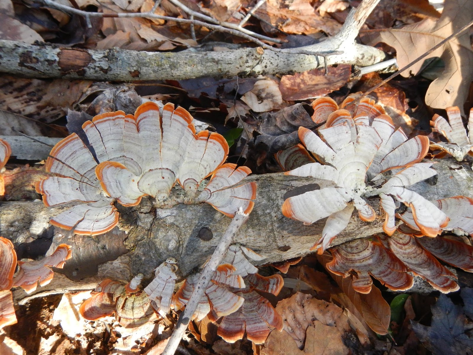
Interesting fungi, almost like a fan.

All of the above photos were of the first hike of the day.  The second was along the River and Gold Mine Trails, and was shorter.

We saw at least 3-4 places where the rarely seen moles, a star-nosed perhaps, tunneled in the darkness hunting for worms and grubs.

There is a memorial to our friend Holly Walker, who did exceptional work for State Parks as a naturalist, along the River Trail.  She is gone too soon and missed by many people.

It's a lovely spot to memorialize our friend.

The River Trail is scenic and easy to hike.

I'm glad that Doug suggested on hiking together last Friday and doing so before the rains of Saturday arrived.

Thursday, January 10, 2019

Getting Off on the Right Foot!

Virginia, and maybe other states, has a tradition of encouraging people to hike on New Year's Day.  The state parks are free, for example, and many - perhaps all - of them have ranger led hikes that day.  The Old Dominion Trail Club had a hike scheduled for January 1, and my friend Doug talked me into going.  Originally, I didn't plan on going because hiking with a group of 30 or 35 is not that appealing, but I am glad I went.

The hike was about four miles on a brand new trail, the Co-Op Trail, which is in Pocahontas State Park just south of Richmond.  Jeff, the man who led the hike, is very active with trail maintenance there, and did a lot of work to make this new trail a reality.  It was good to go and see the great work they had all done.  Here is the location of this trail:

And here is the track of the hike, more or less an out and back with some loops, starting and ending at the red star.

We had a big group for this hike.  I'm in the middle of the pack here.

I think it was Altria that paid for the materials to build this impressive stream crossing.

The Co-Op Trail is marked in pink.

A lot of this very pleasant hike has water views.

Where there is water and gentle slopes, there are usually beaver.  Busy as a beaver comes to mind.  North America's largest rodent, and the second largest rodent in the world, stay plenty busy.

More water views on the return.

This is a very easy and very pleasant hike.  I had a great time, and I felt like I got the New Year started on the right foot (or maybe it was my left?)

Two days later, I did a solo hike to Cumberland Marsh Natural Area.  The sighting of the day were two bald eagles.  Since I have documented that hike several times, I won't again.