Tuesday, June 19, 2018

The Path (Much) Less Traveled

I have a tough hike in the White Mountains coming up starting this week, and wanted to do one last "training" hike, so I crammed all kinds of junk in my pack to get the weight to 30+ pounds, and hit the trail.  I picked an out and back trail, 3.7 miles each way, called One Mile Run Trail.  I'd never hiked it before, and can now check it off my Shenandoah National Park 500 list.

I have mixed feelings about the trail.  It is rarely traveled, I would guess, and not well maintained.  One Mile Run is a pretty stream.  There are 14 stream crossings, 28 on the round trip, and some of them are tough.  In one spot, there were three tough stream crossings in about 100 yards.  Glad I brought my river shoes this time.  I didn't see a soul the whole hike, and this was on a very nice Saturday when the park would be pretty popular (plus, there was no fee that day).  I did encounter a bear, hearing him crashing through the brush and trees.

My inReach has a failure, so I didn't capture the track.  The trail is in the northern part of the southern section of SNP, and runs from the Skyline Drive to the park boundary.  The map shows my starting point (red circle), the trail (red arrow pointing to the dashed line), and turn around point at the park boundary (red star.)


Since it doesn't connect to anything else, it gets very little use.  Parts of it are high grass or thick brush, and there are lots of dead trees across the trail.  On my hike, I was surrounded by small biting flies and mosquitoes for much of the hike, which was annoying.  So while I am glad I did the hike, and can cross it off the list, it's not likely that I will hike this one again.  The pretty stream was its main asset.

Here are some photos, starting with a view of where I would hike into from the Skyline Drive:

Yep, the trail wades right though this tall grass.  It does not get a lot of maintenance, probably based on its low use.

After 1.3 miles of steep hiking, I got to lovely One Mile Run.  You cross this stream 14 times in each direction.

Some of the deadfall is easy to get past, like this tree across the trail.  Others, not so much.

Yes indeed, you have to wade through waist high shrubs at this point.

For most of the hike, I had the melody of the brook playing in my head (along with the whining of mosquitoes and biting flies.)

This was one big block of stone.

I used my new Katadyn Be Free water filter for the first time, and love it.  It is so much easier than my old one, and only weighs about 3 ounces.

I'm not sure what this bird was, but it clearly met its fate right here, likely from a sharp-shinned hawk that struck out of the blue.

When I was in Pennsylvania last month, the wildflowers were magnificent - see here.  On this hike, there were some flowers to enjoy but nothing like the Laurel Highlands.

At the very end of the hike, there were two beautiful butterflies on this flower.

My goals for this hike were some more fitness training for New Hampshire, try to break in my new boots, and check off one more SNP 500 trail.  I accomplished all of these, but was much more tired than I expected at the end.  Still, if you want to hike in a lovely place and want some solitude, this is the hike for you!

Friday, June 8, 2018

Hiking to Big Branch Falls

One nice thing about being retired is I don't have to use vacation time for a hike on a nice day.  Wednesday was one of those, and we had no plans, so I packed up and hit the trail to go to Big Branch Falls on the North Fork Moorman River in Shenandoah National Park.  I also planned to hike about 1.6 miles past the falls to the hike boundary so I could check that trail off but had to nix those plans, so I will need to come back just to get those few miles.  But this trail is so beautiful that I don't mind at all.  Here is the track, about 8.2 miles round trip, counting the hike up to see the beautiful falls, which are at the red circle.

Why didn't I go all the way to the end?  Four reasons: (1) I hit serious paving on the drive up in two places, which added 50 minutes to the drive. (2) We had made plans to go out at 7:00 so I had a firm time of 5PM to get home by (3) I decided to use thin liner socks, and on my right boot, I forgot to put a real hiking sock over the liner when I put my boots on at the trail head.  Yeah, I know, how does that happen? (4) When I waded across a stream, I knew there would be another stream crossing in about a half mile, so I hiked without socks in my Tevas to save some time drying my feet, putting boots back on, etc.  This laziness cost me when the Tevas wore away skin on two parts of my left foot.  Multiple lessons learned, again, from this hike.

I saw two deer on the drive in.  Other than that, I didn't see any major wildlife on the hike.  I did hear a number of birds, including hooded warbler, Acadian flycatcher, eastern wood pewee, wood thrush, pileated woodpecker, and oven bird.


The first part of the trail, about 1.6 miles, is an old woods road, and it is very pretty.  For about a half mile of this, you actually leave the park.  The mountain laurel were in bloom, and there was the sound of a stream nearly every step along the way.


There are a lot of streams to cross on this hike, about 10 crossings each way.  A few are very easy, most of the others can be rock hopped with care, but two involved wet feet.  Here they are.  Maybe in the summer, these can be rock hopped, but not this time of year.  They came up about mid-calf as I carefully waded across.


After the second crossing, I semi-dried my feet and put my boots back on, regretting that I had hiked over a half mile in my Tevas with no socks.  But from this point on, the trail was gentle and absolutely beautiful as it followed the North Fork Moorman River.  The river ran along trail left, and much of the time, there were rapids and pools.  It was simply beautiful, and all of the stream crossings after this point were fairly easy, although trekking poles always help.

Can the snail read?  Is it snail braille?  I did hear him mutter at one point, "1.5 miles?  You've got to be kidding me!"

I reached my destination, and marveled at how beautiful Big Branch is.

I turned right, and started hiking up to the falls, first to the Lower Falls, which included two pools and a natural water slide....


....and then to the spectacular 30 foot tall Upper Falls.  I stayed here for a while and admired the beauty.

At this point, I considered going to the end but knew I would miss my return time and damage my feet more.  Time to go back.  I had lunch on a bluff along the river, and noticed what looks to be a perfect camping spot on the opposite bank.  On a future overnight trip, I think that I will wade across the river and camp there.

On the hike out, I noticed this old remains of a bridge that I had walked past on the way in and hadn't seen.

This is an example of how the trail follows the river, now on the right for the hike out.

I found this beautiful salamander on the hike out, but unfortunately, he is dead.  I don't know if a hiker stepped on it my mistake or if someone deliberately killed it.  This is known as the red salamander.  I'd never seen one.

Well, foot issues and all, I had a great time hiking here.  I will be back, both to clock the few remaining miles on this trail, and to enjoy the river again, and hopefully, camp out.

Tuesday, June 5, 2018

LHHT - Birds and Wildflowers and Salamanders - Oh, My!

One of the great things about hiking the Laurel Highlands Hiking Trail in May was all of the birds and wildflowers, and also some salamanders.  When I hike, I try to observe wildlife to the extent possible.  During this hike, I noted each type of bird that I heard or saw.  Here is my list:

Oven bird, hooded warbler, common yellowthroat, black and white warbler, black-throated green warbler, black-throated blue warbler, yellow-billed cuckoo, Acadian flycatcher, eastern wood pewee, great crested flycatcher, wood thrush, veery, American robin, scarlet tanager, red-eyed vireo, tufted titmouse, black-capped chickadee, eastern towhee, ruffed grouse, common raven, red-bellied woodpecker, downy woodpecker, pileated woodpecker, whippoorwill, barred owl, turkey vulture, barn swallow, blue jay, blue-gray gnatcatcher, red-breasted nuthatch, and field sparrow.

There was a woodpecker that I couldn't identify, and one other bird that I heard but could not place, and I may have missed a few others.  Most of these were identified by their call.  I didn't have binoculars with me, and only saw a few birds that I could identify without them.

As to wildflowers, these were pretty spectacular.  Here are some photos:

Jack-in-the-pulpit

Red trillium

Yellow lady slipper - only seen once during the whole 76 miles of hiking

Pink lady slipper

Wild geranium

Violets

White trillium

Pink trillium

Yellow star grass (ID by my friend, Dick Dreselly):

May apple


As to salamanders, we saw two kinds.  The red eft, a juvenile and terrestrial stage of the eastern newt (which is aquatic as an adult), was very common, especially during the first three days of the hike, which were fairly wet.  We saw them many times.


Best as I can figure, this is a northern slimy salamander, out and about in the trail because of the wet weather on the final day of the hike.

Sunday, June 3, 2018

Laurel Highlands - Second Part

The forecast for Friday night, May 18 was for two inches of rain, then heavy rain all day Saturday.  I slept fitfully in the crowded shelter at the Route 30 Campground on the Laurel Highlands Hiking Trail in Western Pennsylvania, three days of hiking behind me.  For one thing, a group of scouts woke me from a deep sleep with their hooting and hollering.  For another, I think I felt bad that this trip that I had planned was kind of falling apart with six of the 11 leaving in the morning.  But I was also glad that four others were continuing, and I was not hiking the next 40+ miles on my own.  After breakfast, the five of us packed up, said goodbye to our six companions, and got ready to start hiking nearly 15 miles.

Here is the track for the fourth day, heading southwest.  The purple arrow is where the trail crosses the Pennsylvania Turnpike, and the orange arrow is 35 mile halfway point.  Unfortunately, my inReach didn't have enough battery power after the fourth day to continue tracking the hike.  It was supposed to have enough juice to track for 8-10 days, so I hadn't brought along a spare.  Lesson learned.

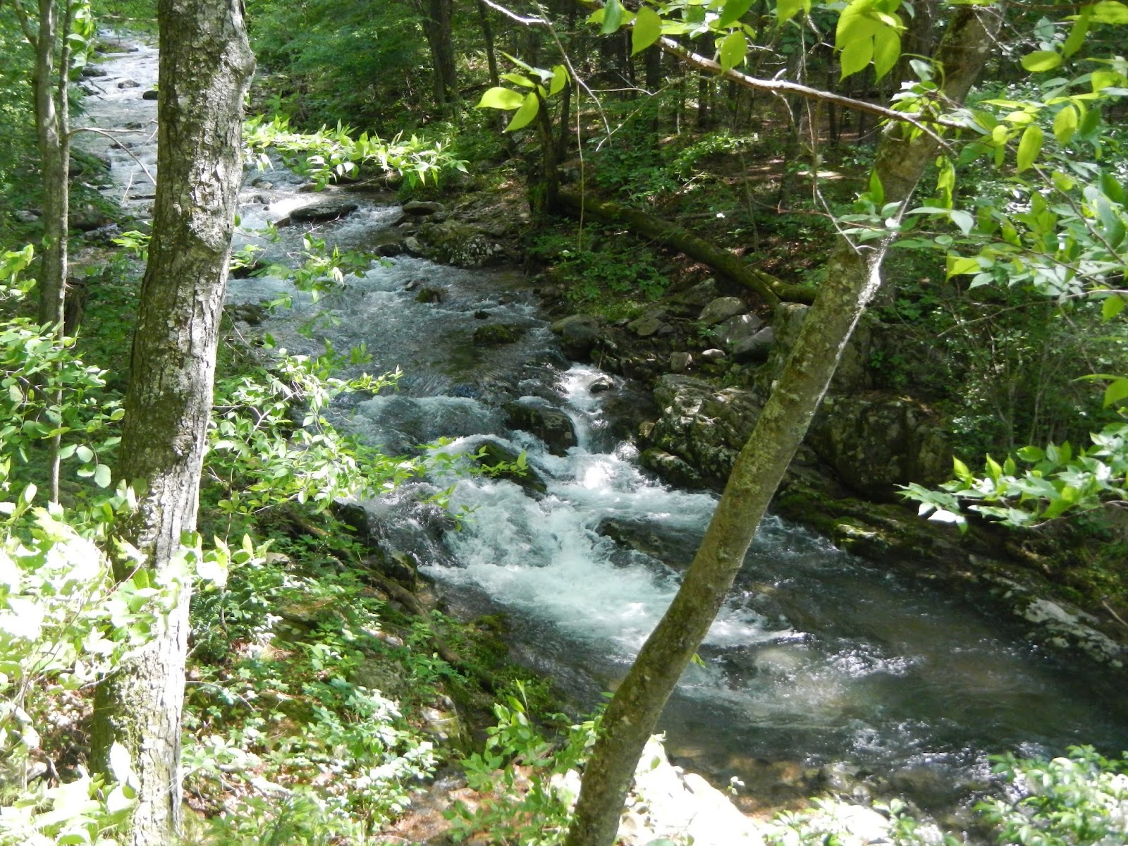
The day started cool and humid, but no real rain.  There were a lot of great streams along the way.  Here is the first of them.  By the way, the board bridges were incredibly slippery.  You want to move across them at a speed that your great-great grandfather would find too slow.

This section of the hike had some great rock formations,

and here is the Pennsylvania State Tree, the Eastern Hemlock.

In the early afternoon, we came to the Pennsylvania Turnpike, a special moment for me.  It was driving under this bridge that inspired me to hike this trail.


Here I am at the halfway point - 35 more miles to go.  You can see that I am casting a shadow, and the day is actually quite nice - no rain, and a fair amount of sun, the best weather to date of the whole trip.


By the time I hiked into camp about 5:30, I had hiked about 15 miles, and felt like I was running on fumes.  But after soaking my feet in the cold stream by our shelters and resting for a while, I felt fine, and even better after eating dinner.

We also got a fire going, which was comforting and warm, and allowed all of us to dry our wet socks and other clothing.  Life is good with a campfire!  We got some rain and thunderstorms that night but not a lot.  One of the gals pitched her tent rather than stay in a shelter, and her tent leaked, so she wasn't real happy.  But these things can happen on the trail

On Sunday, we had another long (14.5 miles) day, so we got an early start.  I hiked most of it with John and Donna, Kelly and Wilma having gotten out ahead.  We did meet up at a pre-arranged spot on the trail and had lunch all together.  Here is John and me in a hemlock forest that reminded me of a cathedral - God's handiwork in the natural world.

Donna and John celebrate 30 miles to go.

This was the only area of the trail where I remember seeing a home - a beautiful farm in this case - right by the trail.

We had continually improving weather at the Seven Springs Ski area, which was also our lunch spot where we met the others in our group.


Back in the woods, here are some bracket fungi making a living on a dying tree.

The highlight of the day was Blue Hole Creek.  The three of us stayed here a good 30-40 minutes.  I washed my upper body, getting off five days of grime and sweat, and also washed my hair and shirt.  It felt great.  By the way, of course I didn't use soap.  Even biodegradable soap should never be put into a stream.  If we hadn't had another six miles to camp, I think I would have found a quiet spot and taken a bath.  It was cold but it felt great to be cleaner for a while.

After washing up and cooling off for a bit, we got back on the trail, and went through some great rocky areas again.


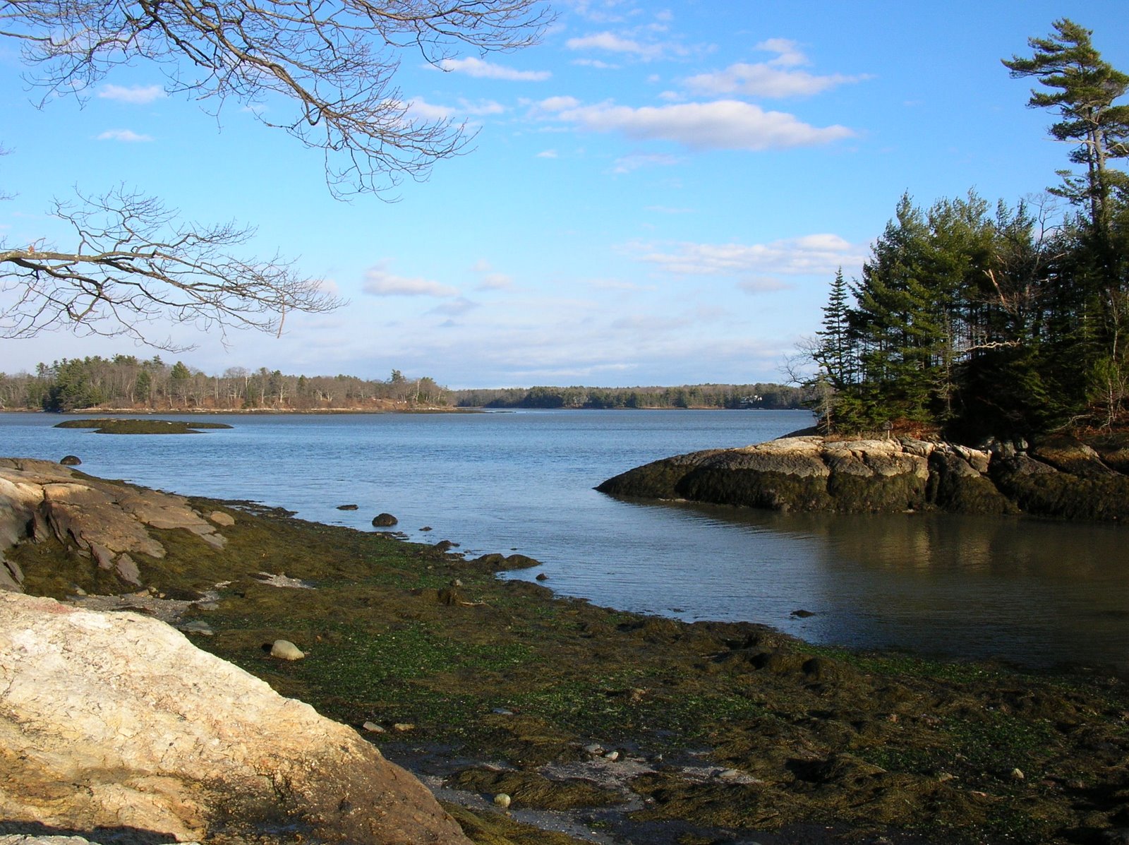
We also reached a rare viewpoint on this trail, as most of it is in the forest.

And we came on a really old grave yard in the woods, with lots of flowers planted.

At camp, everyone was tired but happy.  The weather had again been fabulous, and the promised rain had not materialized.  We now had only about 18.5 more miles to hike to reach our cars.

Monday morning, I set my camera on a picnic table and got a group shot, then we started hiking.  After a 15 and a 14.5 mile day, 12 miles didn't feel all that bad.

The trail is beautifully maintained.  I loved these steps.

And it was great how the trail went in between huge rocks many times.

Pack off break, always appreciated!

This is Cranberry Glad Lake, the only lake I saw on the hike.  There is an osprey nest here, but I didn't see it.

Cranberry Glade Stream was really pretty.  We had our lunch break here.

Water drips from the ground down a mossy rock face.

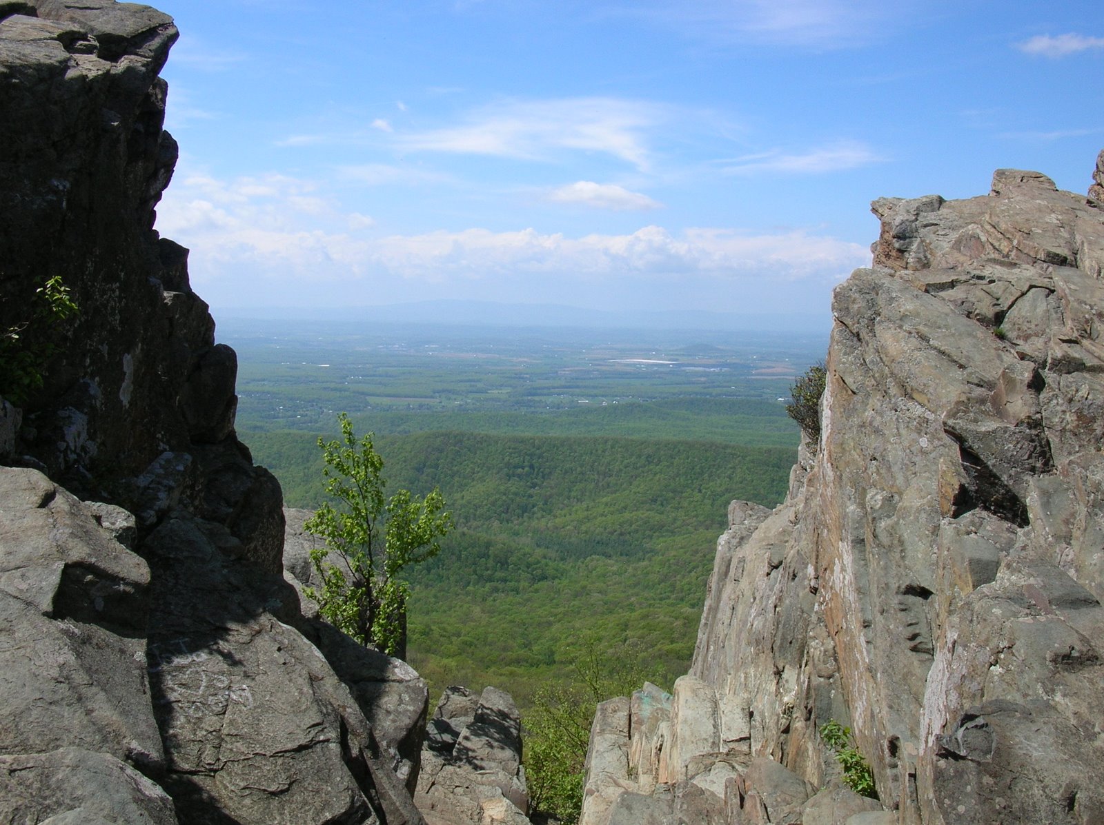
We were hiking towards pretty rugged terrain, and we had some decent views.

We reached camp with 6.5 miles left to hike.  It was the nicest day of hiking and weather for the entire week.  There was a beautiful stream right by the shelters, and I immersed myself in it.  The cold water was shocking, but it felt good to clean off again.  As always, no soap.  I washed my hair in this waterfall.

Tuesday morning, we started to hike out, and on cue, the rain started pouring down.  So, we started and ended our 70 mile hike in pouring rain.  How appropriate!  After a couple of miles, it was not raining as hard, but the first part of the final miles of the hike has two steep climbs and two steep drops, made tougher by the pouring rain.  Here I am at the 4 mile point.  I've now hiked my age on this trail!

It wasn't raining as hard, so I wrung my socks out.  I repeated this two more times, and easily could have filled a cup with water.

Near the end of the hike was a spectacular - even in the misty, rainy air - viewpoint overlooking the Youghiogheny ("The Yok") River.  There was a fin of rock jutting out with a fall of several hundred feet.  We all went out there, but we all stayed away from the edge.  On a sunny day in the fall, this would be an incredible view.


 Soon enough, on the seventh day after starting this hike, we reached the end.


It had been a great trip.  I am glad that we stuck with it and that we finished together.  Now, dry clothing and a big lunch beckoned, then the 6 hour drives home.  I had a great time on this hike, and it will be one of my best hiking memories.  I recommend this trail to anyone who likes backpacking.