Exactly a week ago, at this time (5:15AM) I got on the road to pick up my friend Carlton and his 10 year old daughter Libby. We were headed to Beaufort, NC to do two nights of backpacking out on Shackleford Banks. Because there is no fresh water there, we were carrying about 7 gallons of water between us. We had greatly anticipated this trip for two months! But we forgot to include Mother Nature in our plans!
We got to Beaufort just after noon, and just after that, the skies opened. Thunder roared, lightening flashed, drenching rains poured. We ducked into a restaurant for lunch, checking the radar app on our phones continually. It showed a long line of thunderstorms headed right over the island stretching back to Savannah, GA! After talking with the boat company, the National Park Service (Shackleford Banks is part of Cape Lookout National Seashore), and my spouse, we finally gave up our plan at about 2:45 and checked into a motel. We got in a little hiking at Croatan National Forest, had dinner, and went to bed, getting up early to find - more thunderstorms! It looked like steady rain there at least until the afternoon, and more storms coming in for the evening, overnight, and Sunday.
So using Google on my phone, we came up with a plan B - Goose Creek State Park about 60 miles to the north of where we had spent the night. We headed there right away, hoping that maybe we could get a campsite, of which there are only 14. And we were in luck, because there were still two sites open. The map below shows the location - the red arrow shows our original destination, and the star shows where we ended up. You can see the Outer Banks, including Cape Hatteras, to the east of Goose Creek.

It was a delightful park. The campsites were spacious and also widely spaced, and in an open grove of tall longleaf pines. The gravel pad was plenty big enough for our two tents, and we had a picnic table and fire pit. There was a very nice outhouse nearby, and pumps for water (although we never needed it with all the water that we brought with us). And the weather was generally good - warm and muggy, but dry, other than a couple hours of rain Saturday afternoon, and a thunderstorm in the night.
Here is Libby in front of their tent. My tiny tent is behind this one:
We spent most of the day hiking and exploring. We hiked a total of about eight miles - a short loop near the campground, and a longer loop through the rest of the park through forests, swamps, and by marshes and rivers. The mosquitoes were fierce at times, but the birding was great. The map below shows my track. The campground is on the far left. The arrows show the direction of travel - clockwise - for the longer hike. Coming back in the steady rain, and Libby and Carlton having stopped hiking with me when Libby got tired, I ended up walking along the road when a section of the trail was totally flooded by deep water in a swamp. There was no way around without wading.
Here are photos of the many sights along the way, starting with a pretty - but likely poisonous - mushroom.
Here is a view of Flatty Creek on our first short hike.
This bracket fungus reminded me of burnished wood. I thought it was beautiful.
Carlton knows enough mushrooms that you are probably not going to die or go hungry if you follow his advice. This one is called Hen of the Woods, and is a delicacy.
I can't remember if this one is edible or not.
The park has great interfaces between the forests and rivers. I think that this is the Pamlico River.
I can't remember what this is, but Carlton said not to eat it. However....
This one is the Old Man of the Woods, and is very good to eat. Just cut off the gills.
Here is what it looks like cut open in a cross-section. It's hard to see, but the color is changing and it is turning black.
Lots of open pine forests in this area.
Here is another view of the river.
Southern leopard frog, which we saw all over the place.
Edible or not? I don't know, but it didn't look that appealing.
More of the pine forest that once was a huge industry for naval stores (pitch, pine tar).
A short boardwalk got me over this swamp, covered with duck weed. I heard a very large animal crashing and splashing through one of these swamps, likely a deer or bear.
Here is a pretty wild flower.
I got though this section of widely flooded trail with dry feet by walking carefully along the slippery logs. Later, there was a section that was so deeply flooded that there was no getting around it.
No idea if this one is edible or not. The bad thing about mushroom identification is that there is a very high penalty for being wrong if you eat them.
We sat out the rest of the rain storm back in camp, ate dinner, and got a fire going. As it turned dark, we got a real treat - three different screech owls calling in the night, and a male and female great horned owl calling back and forth. The owls called for about 20 minutes, and we were enthralled as we listened to them. In the morning, we did a little walking - here is a sunrise view at Flatty Creek -
and here you can see the contrail from a jet reflected in the creek.
Then we ate breakfast, packed up, and did one last hike on the way out. Because this post is so long, I will create a separate post for that hike.
Well, Plan A didn't work out, and that was very disappointing. But we were able to come up with a great plan B to visit a really cool place with amazing birding and habitats, and comfortable camping. So, no complaints!


 Rhododendron in Team in Training colors! Very appropriate, since I would be meeting the TNT Virginia cycle team the next day and cheering them on in the

 Aren't the Blue Ridge Mountains gorgeous?
 Here is a shot of me with my turtle hiking staff that my sister gave me for my birthday a couple of years ago.
 Looking north up the Blue Ridge Parkway from the top, it looked like a storm coming in.
 View of the mountains from the lower overlook.
 Close up of rhododendron bloom - so pretty!
 The trail at times resembled a tunnel
 This twisted tree made a nice "picture frame" for a large rock in the background
 On my hikes through the hills I’ve trekked many a mile
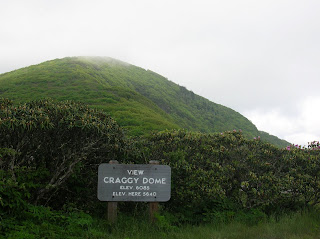 View of Craggy Dome (elevation 6,085) from the trailhead parking lot (elevation 5,640)