Showing posts with label lakes. Show all posts

Saturday, November 30, 2019

When Life Hands You Frozen Lemons, Make Lemon Slushies

A couple of weeks ago, a group of five us headed up to hike the Patterson Ridge Trail in Shenandoah.  We knew that it was going to be cold, starting out near freezing and ending up about 35 F, but no precipitation was called for.  Nor was any showing up on weather radar as we made the nearly two hour drive to the park.  About 5 miles from the park, the temperature was 38 degrees, but it started dropping.  36.  35.  Drizzle. 33.  32. Freezing drizzle.  31, and more.  By the time we got to the park gate, it had dropped 11 degrees in five miles of driving and everything was being coated in ice!  The park closed, along with all 105 miles of the Skyline Drive.  What do do?  We talked it over in the car, and headed to Ragged Mountain near Charlottesville, a place I had never been but had wanted to hike anyway.

The hike was about 7 miles, and temperatures were in the 40's, with no precipitation.  Here is a track of the trail we hiked in this wonderful natural area.  We hiked clockwise, starting and ending at the star.

Here are the five of us near the start of the hike.

This hike didn't offer any grand mountain views, but we did have pretty views of the reservoir and of the fall forest.


This floating bridge was amazing. I don't think that I'd ever crossed one before.

More water and forest views....

A skilled wood carver made these owls a couple of miles in.


The leaves are falling fast, but now and then we saw a little foliage.

More wood carving: an eagle catching a fish,

and a bear with her cub.

We also enjoyed meeting this mountain man, the final carving encountered on this very nice hike:

Well, we didn't have a Plan B when we started driving to the mountains, but among the five of us, we quickly came up with a good alternative once the initial plan was squashed.  It turned out to be a very fun hike with a good group, with no slipping and sliding.

Friday, February 22, 2019

Lake Anna Circuit Hike

My friend Doug suggested a hike together recently.  Tragically, Doug's wife died the beginning of the month, and I think it will be good for him to get out in nature, so I was happy to join him.  He suggested Lake Anna State Park, and we went on February 13.  We did a circuit hike of about five miles, following a number of trails (Sawtooth, Glenora, Big Woods, Cedar Run, Turkey Run) and getting some nice views of the lake.  Here is a track of our route, starting and ending at the star.  The purple and blue arrow shows our direction (counter-clockwise).  I'll refer to the other arrows later.


I thought that this tree would make a great seat for a little child.

No doubt that we are still in winter, although I saw a lot of trees beginning to bud.

We've had lots of rain, so the streams were running nicely,

and there was plenty of mud on the trails to slog through.

There used to be a plantation here, Pigeon Plantation.  This was the smokehouse.  It took 40 days for the ham to cure, then about a week to smoke the hams.  Finally, they were left to age for about six months - a long process before eating that ham dinner.  No super markets to fall back on!

We ate our lunch here by the lake (refer to the red/pink arrow on the map).  It was a nice spot.


But an even nicer spot was found later in the hike (see the yellow/orange arrow).  There was even a picnic table here!

I enjoyed hiking with Doug on this day.  We had pleasant weather, especially for February, and it was nice to get out and about with him, enjoy the outdoors, and talk about things.

Saturday, November 4, 2017

Lowell Lake in Southern Vermont

We made a short trip to Vermont to visit my wife's sister, who came over from Boston, and to see the Vermont Country Store in Weston.  I gave the ladies some time to themselves by getting in a nice, gentle hike in nearby Lowell Lake State Park, which was a real treat.  Plus it gave me time to work off my disappointment about the town of Weston being out of ice cream!  How does a town in Vermont run out of ice cream?  For months, I have been lusting after the maple ice cream that my spouse told me that the Vermont Country Store is famous for.

The park is in the southern (skinny) part of the Green Mountain State.  The map below marks the location with a red star.

And this image shows my track and direction of travel (counter clockwise).  For some reason, my inReach didn't capture the first quarter mile of so of my route, so I drew it in.  The total distance of the hike was about 3.8 miles.  Note the large wetlands at the northern and southern end of the lakes.  The starting and ending point of the hike is marked by the star at the top of the image.

Much of the forest along the hike was conifers, but there were also many areas of deciduous trees.  Vermont's legendary foliage must have peaked about a week before.  It was quite lovely in New York on the drive up towards Albany.  There were patches of color along the hike, but the sugar maples were all bare.  The trail along the west side of the lake was more of a woods road, and was very easy to walk.


Before long, I had my first views of Lowell Lake.  Can you imagine what this hill would have looked like at peak color?  I guess I need to come back to see for sure.


The trail along the southern and eastern sides of the lake was a traditional narrow foot path, going through a mixture of deciduous

and coniferous forests.

My favorite tree is the white (paper) birch.  Despite the temptation, never peel the bark of a life birch, as it will girdle and kill the tree.  You wouldn't like having your skin peeled off, would you?  Didn't think so!

Along the southern end of the lake is a large wetland area.

Much of the path along the east side of the lake had water views.  The lake also has three islands, as you can see on the photo of the track.

Those colorful leaves end up as Mother Nature's new fall carpet.

As I walked along to the north, I saw this group of five women out kayaking.  I could hear them chatting about their lives, and those of their friends, as I hiked along through the woods.

Near the end of the hike, I turned to the west to head back to my car through the forest.

I liked visiting the Vermont Country Store - although I still can't believe that I missed out on maple ice cream - but I really enjoyed getting away from stores for a couple of hours to enjoy a lovely hike.

Monday, May 22, 2017

Walnut Creek Park

Yesterday, I went on a delightful hike with a delightful group of four others - well, one of them was focused on geocaching and so ended up doing that on his own rather than hiking - at Walnut Creek Park south of Charlottesville. It felt like being in the mountains but with less elevation gain - same type of forests and birds, for example.  Here is a map of the track, which was a 5.5 mile circuit hike.  Arrows show the direction, and the red star marks the starting and ending point.

There was a nice lake and thus, the hike had water views for a decent part of it.  We walked past beaver activity and even went through a forest fire zone.  Some of the birds I heard as we hiked were oven bird, Eastern wood pewee, tufted titmouse, Acadian flycatcher, phoebe, and pileated woodpecker.

Here are a few photos from this pleasant hike.  It was a little sad to see this abandoned house in the woods.  It makes me think of how this was once someone's home, and I wonder what their life was like.

 Deeper into the forest was the remains of a fireplace and chimney for what must have been a cabin.  It had to have been a difficult life.  Maybe they had a little farm in the foothills.  No grocery stores back then out this way!

No, we are not in Tibet, but we did find these faded prayer flags.


There was plenty of mountain laurel in bloom.

Timber!!!!  I wonder if beavers yell that when they drop a tree?

This was the inlet into the lake.

An apparently quick moving forest fire burned part of the area a couple of months ago.

The lake had a number of nice viewpoints.

Here is the hiking group, minus Steve (who went geocaching.)

After hiking, we met up with Steve, ate lunch by the lake, and headed for home.  With a fairly short hike and a pretty short drive (about 75 minutes each way), I actually got home in time to relax a bit before dinner after getting a shower.  It was a fun day in the woods.

Sunday, September 6, 2015

Tam MacArthur Ridge (Oregon)

On Thursday, August 13, I took my fifth Oregon hike with the Appalachian Mountain Club August Camp.  This time, we went up Tam MacArthur Ridge, a 5 mile total out and back that climbed 1,200 feet up to a ridgeline overlooking a lake.  It was a fun hike, once again, but a little lonely - thanks to a very basic mistake that yours truly made!

Let's start with a track of the hike.  We started and ended at Three Creek Lake.  See the big purple star on the map - more about that later.  Let's just say that I got very familiar with that area!

Here is a 3-D view of the hike.  We started and ended at the red arrow - up to the ridge and back out.

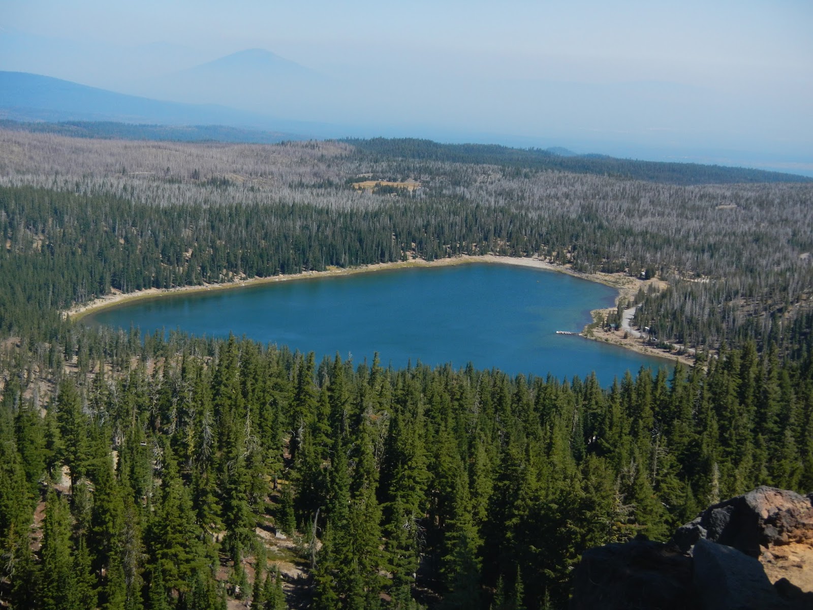
From a little bit of elevation over Three Creek Lake, here is a view of our destination - Tam MacArthur Ridge.

There were 13 of us on this hike.  Here are some of us admiring the views.

I am not sure, but I think this might be some of the Sisters Range.  Note the glaciers.  South Sister is the third highest mountain in Oregon, and I think is the highest that can be hiked without technical skills.

Three Creek Lake lies 1,200 feet below.

I mentioned that there were 13 of us?  Well, by the time I took the pictures above and the one below, I was in a group size of one, thanks to a decision making error on my part.

A group that large gets a little strung out.  I was probably in the middle, with about 6-7 ahead of me.  I came around a bend, and there were three of them sitting on a log in a shady spot.  One of them said "We're taking a little break - men to the right, women to the left."  I counted 3, subtracted from the number ahead of me, and realized that there were 3 or 4 still ahead.  I didn't need a bathroom break, so I kept walking to catch the others.  Mistake #1.  I walked.  And walked.  I came to a trail junction with a horse trail.  Odd that no one was waiting at the junction. So I kept walking.  Mistake #2.  After a good 20-25 minutes, having come to the ridge without meeting anyone, it dawned on me that everyone was taking the break back in the woods, not just three hikers.  So I turned back, thinking I would just meet them on the trail.  So I walked back until I reached the spot where the break had been, and this is what I saw:

How had I missed them?  Then only thing I could think of is that they had taken the horse trail.  So I could either go back up hunting for them, or I could sit my butt down right here and wait.  Staying put was the clear winner, even though I would miss out on more scenery.  So I sat in the shade and relaxed - this is where the purple star on the route map is.  I ate lunch.  I explored right around a bit - leaving my pack at the log.  I talked to people who were hiking up and down.  If they hiked up, I asked them to look for a group of 12 and tell them that Art was fine and waiting for them down the trail.  I even saw a couple of riders:

My one fear was that they would divide up and search for me at the top, but I was pretty sure that Eva, our hike leader, would not let that happen.  Better to have one person separated from the group than three or four.  And after two hours of waiting, who should appear than the other dozen!  I was happy to see them!

We hiked down together, pausing for a few more wonderful views:

And we ended the hot day with a cool and refreshing swim in Three Creek Lake, with Tam MacArthur Ridge looming above us.

I made several fundamental mistakes to get separated from the others.  First, I assumed that only three were taking a break - and worse, I didn't ask for confirmation.  Eva gave me advice afterwards when we linked back up - don't count the people at a break, count the packs.  And memorize your hike leader's pack!  If it is on the ground, then the hike leader is nearby.  Second, I did not stop at the trail junction, assuming that the others were just ahead and hadn't stopped because it was a horse trail.

But I also did several things right.  First, I eventually realized that I was ahead and instead of keeping going or waiting where I was, I backtracked.  Second, when I got back to the break spot and everyone was gone, I waited there instead of going back up looking for them all.  And third, I sent word up with ascending hikers, and as it turned out, at least one of them contacted the group and told them that I was fine and waiting.

It was not my most fun day of the week, but fun enough, and I learned some things!