
Here's a map. I started and ended at the purple circle, the Sugar Hollow Reservoir. The North Fork, which I did first) involved hiking north (pink arrows), and the South Fork involved hiking south (sky blue arrows). You can see the Appalachian Trail marked to the west. That would have been part of the longer 20 mile loop, and was the same portion of the AT that I had hiked with the group just a few days earlier.

Hiking the two trails both involved multiple river crossings. Most of these could be rock-hopped, but in a couple of spots, it looked like I would be setting myself up for a potential fall, so I waded. Here is the first crossing, on the North Fork:

The trail was very pleasant. I saw a few hikers, a few moms or couples with their kids doing a casual hike, and a number of anglers trying to catch the wily brook trout.

Here is the second river crossing, just a hundred yards or so after the first.

And here is the third crossing point, which I decided to wade for safety reasons. It was quite cold, and of course, I waded it going back as well.


My goal was to reach Big Branch Falls, which I had approached from the north a couple of years ago. There is a water slide at this point.

And there is a beautiful waterfall...

And a deep pool that would be great for a swim on a hot summer day.

Here is another view of the waterfall.

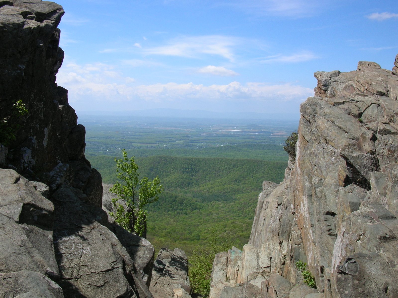
From here, I back-tracked to my car. When I had arrived, about 9:00, the parking lot was already filling up, but there was plenty of space left to park. Now, not so much. People were parking all over the place! I started hiking south. Like the earlier hike, this would involve about 2 - 2.5 miles each way and 400-500 feet of climbing, and several stream crossings, including wading one time. At the beginning, I climbed steeply for a while and had this view of the South Fork Moorman River through the forest.

Along the trail were some old homesite ruins. I always reflect on what their lives must have been like - incredibly difficult, I would imagine, but hopefully with some joy along the way.

Look at the quality of the work in this stone wall, which must have been part of a cabin or out-building at some point.

By walking steeply down from the trail, I reached this small cascade and swimming hole. Someone told me that it is called "Blue Hole." It was a pleasant day, but not pleasant enough to be tempted to take a swim.

This trail was very easy to hike.

Spring is early this year, as noted by all the wildflowers on March 8.


When I got back to my car, the parking lot - and the road coming in along the reservoir - were jammed full of cars. I could barely get my car out. On the two hour drive home, I stated making plans for my next hikes. I was thinking that in one really long day, I could complete the remaining trail miles in the Southern District of the park. But life has a way of interfering , as I learned a couple of days later. Did you ever hear the saying "If you want to make God laugh, tell Him your plans?"
More about that next time.


Beautiful photos. Like walking or hiking by the water.
ReplyDeleteYes, I have heard that saying!! :)
Happy-K, you would have enjoyed this hike.
DeleteYour wildflowers are a good month ahead of ours!
ReplyDeleteAnd that is up in the mountains, not closer to sea level where I live.
Delete