Sunday, July 15, 2012

Malvern Hill Battlefield

Today's hike was less about the walk or the miles, and more about trying out my brand new camera, a Coolpix AW100.  It is waterproof to 10 meters, shock resistant, and geo-tags the photos - a great camera for a hiker or runner, or cyclist for that matter.  So I took a two mile walk at the Malvern Hill Battlefield, getting back to the car just ahead of big thunderstorms.

Malvern Hill was the final battle of five in the "Seven Days Battle," fought just east of Richmond 150 years ago.  Malvern Hill itself was a Union victory, but paradoxically, it convinced General McClellan to act as if he had been defeated and retreat.  As a result, the Seven Days was an overall strategic victory for the Confederates, preventing Richmond's capture and prolonging the war for three more years.  But what if the South had lost?  Well, I've read discussions lately that while the war would have ended fairly soon afterwards, slavery would have gone on, because the war was about the Union, not slavery, at that point.  It wasn't until January 1863 when the Emancipation Proclamation took effect in any state still in rebellion that slavery became a formal part of America's Civil War.

In the battle, late in the day on July 1, 1862, an army of 70,000 Confederates launched waves of futile attacks on 80,000 strongly positioned Army of the Potomac soldiers.  The Southern troops were torn to pieces by deadly cannon fire and volleys of Minie balls.  It must have been awful.  I reflected on the horrific suffering of these men, so long ago and much forgotten, as I walked a loop around the main Union and Confederate positions.

I captured some photos with my new camera during my walk and show some of them here.

My route started at the bottom of the map and went counter-clockwise.  When I got nearly back, I took a side trip to a point in the woods where some Confederate soldiers came up through some ravines near the strong Union position.

 At the time of the battle, the Union forces crammed more than 80 artillery pieces across a narrow part of the field.
 This is a panorama looking from the Union position across the battlefield from where Southern forces vainly attacked.  Click the photo for the full view.
 Part of the path is in the open, moving along a mowed section right by woods.
 I thought these two old chimneys were pretty neat!
 The part of the path that returned to the start through heavy woods gave some welcome relief from the heat.  I imagine that the weather was fairly similar during the actual battle.
 This Confederate soldier, aged 17, died in the Battle of Malvern Hill, July 1, 1862.

Sunday, July 8, 2012

Hiking's Risks

It is still too hot to really enjoy a hike right now.  It hit 104 yesterday and stayed there, and it is supposed to hit 103 today.  Even in the mountains of Virginia, temperatures were in the 90's.  So no hiking for me right now.  But I did feel like writing a bit, and my post the other day about my new DeLorme InReach satellite communicator made me reflect on why one might bother to carry such a thing with them.

Most of the time, hiking is not a dangerous activity.  I would guess for most of us, the drive to and from the trail head carries more risk of death or serious injury than the hike itself.  But like any activity, hiking does entail some risk.  Things can and do happen.  Hikers fall, drown (an AT through hiker drowned in Maine just the other day), get hypothermia, get lost, get bitten by poisonous snakes, and get attacked by wildlife.  The hikes that I mostly do are less risky than, say, a two week solo trip through the Bob Marshall Wilderness, which is less risky than a month-long trip in the wilds of Alaska.  But any hike involves some degree of risk.  The risk increases if you are alone, as I sometimes am.

In the cases I have read about of hiking disasters, two solo hikers stick out in my mind: Mike Turner and John Donovan.  One of them I knew personally, but I read articles about each of them in Backpacker Magazine.  In both cases, had a device such as InReach been available - and if they carried one - they would likely still be hiking today.

In August 1998, the Reverend Mike Turner was a few days into a nine-day solo dream trip in Wyoming's Wind River Range with his dog, Andy.  Just yards from a lake, a boulder he stepped on began to tip, and he instinctively jumped to the next large rock, which was sloped backwards.  He slid rearward down its slope and off the edge, and at that exact instant, the huge boulder that he had leaped from completed its rotation and shut against the back of his legs just above his knees.  He was essentially caught in a trap, feet off the ground, between the two boulders.  He tried in vain to free himself multiple times, and kept a journal of his remaining days of suffering and longing for his family.  His strong faith in God was shaken but, in the end, not broken.  Just 30 feet from a lake, he slowly died of thirst and exposure over ten days.

A search had been implemented a couple of days after Reverend Turner failed to show up, but it was too late, and in any event, the searchers found no trace of him in the rugged wilderness.  But five days after the search was called off in late August, Andy came out of the wild with some hikers who had found the exhausted but uninjured dog.  That led to a new search being started, with the hope that Andy might be able to lead the search party back to his owner.  On the same day that the new search began, a solo backpacker came across Mike Turner's body on this little-hiked route.

Mike Turner, whose full story you can read here, really did nothing wrong.  He caught a bad break.  Had he by chance taken a slightly different route, he would have been fine.  All of us have stepped on a rock that shifted, but in his case, it proved to be fatal.

I used to do some hikes with the Old Dominion Appalachian Trail Club (ODATC), and on a number of these, I met a man named John Donovan.  I didn't know him well, but it was clear he was an avid hiker, leading a trip for the club just about every single weekend.  I was shocked in late May of 2005 to learn from club news that John had gone missing on his dream hike of the Pacific Crest Trail to celebrate retirement.  Because he was alone and had no family, people only realized he had gone missing when packages friends shipped him for points along his hike went unclaimed.  A search was finally begun, and they learned that several people had actually seen John hiking and in some trouble in a May snowstorm on California's Mount Saint Jacinto.  He had declined offers to hike into a town and get out of the storm, and was never seen alive again.  As it turned out, lost, injured from a fall, and weakened, he stumbled down into a deep canyon and was unable to climb out.  He celebrated his sixtieth birthday on May 11th by eating a couple of crackers.  He wrote a note to a friend who was to have been hiking with him but wanted to delay three weeks because of snowy conditions.  He told the friend that he regretted not following his advice, and said that he wanted to be buried in a US Navy cemetery.  On May 14, 2005, John scribbled a final note that he was going down to Long Creek for water, ending with: "Goodbye and love to all."

Amazingly, John, who had helped many people in his life, helped save two lost hikers a year - nearly to the day - after his death.  To read his full story, and how he managed to do this, you can go here.

Unlike Mike Turner, John made mistake after mistake until his untimely death became certain barring a miracle rescue.  I learned more about John from his close ODATC friends at a memorial meeting we had, and more still after reading the article in Backpacker Magazine referenced above.  He took a lot of risks and was easily lost - not good traits for someone by themselves, under equipped and under dressed in a blinding snowstorm in the mountains.  With a good tent, warm clothing, and a great sleeping bag, John could have hunkered down on the trail in the storm and survived.  Or he could have chosen to go with the people who said to turn back, and made it out alive. Or he could have delayed his trip by three weeks and gone with his friend.  It is a real tragedy that none of these things came to pass.

Had SPOT or InReach been available in 2005, and had John carried one - which I kind of doubt he would have - he still could have been rescued by sending an SOS message.  So when I am hiking along, by myself or with others, in terrain and conditions a lot less harsh that either Mike Turner or John Donovan faced in their final days, memories of their sad tales is enough for me to justify the extra weight and cost of my DeLorme InReach, and my PN-60 GPS that is paired with it to send customized messages - along, of course, with a couple of pairs of spare Lithium batteries.

Wednesday, July 4, 2012

Staying In Reach

Happy Independence Day!

It has been too hot for hiking this past week or so.  I've taken some early morning walks for 3-4 miles before work when I can, and on the weekends.  I went to an electric bluegrass concert ("Trampled by Turtles") last Friday night (outdoors with the actual air temperature was 101 degrees at 7PM).  I walked the cancer survivor laps Saturday afternoon at the American Cancer Society's Relay for Life.  But no hikes, not since my out and back to Saint Mary's Falls almost two weeks ago.  But when I do hike, I have a new way to stay in touch - DeLorme's InReach.

The InReach pairs up with my DeLorme PN-60 GPS.  I can send a customized message - up to 160 characters - from just about anywhere in the world, as long as it can find a satellite.  And I can receive a text message back, displayed on the GPS.  Think of that - you could be off hiking for two weeks in the Alaskan wilderness, and keep in touch with family and friends!  I've sent a message on each of my last two hikes, and so far, it has been fast and reliable.  The service is not cheap (although the safety plan that I am on really is very cheap) but as long as people you send messages to don't deluge you with replies, it is not expensive either.  And because you can send an SOS message that goes to command center that will dispatch search and rescue, it gives one a certain peace of mind and safety net.  I do at least some hiking in pretty remote areas by myself, so having a way to summon help in case of an emergency is a great feature.  I do a lot of reading, including some true life adventures, and in many cases, having something like this would mean that the person would have survived their adventure.

I think I am really going to enjoy this new electronic gizmo.  GPS and InReach - it's a long way from map and compass (although I never go on a hike without those either).

Saturday, June 23, 2012

St Mary's Falls

St. Mary's Wilderness in Virginia's George Washington National Forest would not have qualified as a wilderness area when then Wilderness Act first passed in 1964.  Very few eastern areas could.  But a subsequent law about 10 years later permitted areas to be added to if they were being allowed to let mankind's evidence of disruption be overtaken by natural processes.  There is plenty of evidence of human activity here, especially where mining was done 50-60 years ago, but it is fading.  The trails are not marked, although there are a couple of weathered wooden signs.  There appears to be some trail maintenance, but plenty of fallen trees to clamber over as well.

I had Friday off from work, and decided to hike here for the day.  I had not been in St. Mary's Wilderness in well over 10 years, but had hiked to the falls twice before with other people, and one time, I had done the circuit hike - without taking the side trip to the falls.  I decided to hike to St. Mary's Falls yesterday, which is a moderately steep out and back hike of nearly 10 miles.  In my mind it was seven miles, but truth on the ground overruled my faulty memory.  I think I can sum this hike up in three words: solitude, streams, and mushrooms.  Solitude - except at the falls, I didn't see a single person out or back.  Streams - I probably made 10 stream crossings each way, was entertained by their pleasant gurgling for well more than half the trip, and was never thirsty.  Mushrooms - I saw many colorful mushrooms, several quite unusual, during my trip.  It was a fun day, and sure beat working, although once again, I was reminded that I am not totally in shape for hiking in the mountains.  I need to work on that.

I didn't see any spectacular wildlife, but did see many aquatic salamanders when I would turn over stones in the streams.  Most of them were too quick to get a photo of.  As with my hike through the forests to get to Bear Church Rock two weeks ago, birdsong was a near constant companion.  And I did see a large bird of prey, but could not get a good look through the thick forest canopy before he flew off for good.

There are two ways to the falls - the short, level easy way from the other side of the Blue Ridge, and the way I went.  The other people I saw at the falls, including a group of young men camping illegally by the river, had clearly some in the short and easy way.  One of the men told me they had beheaded a copperhead the night before.  That is possible, but it is more likely they beheaded a harmless water snake.

Here are some maps to orient yourself. My hike started and ended near the bottom of the map, where the Blue Ridge Parkway passes by.

 This map shows where I took a few of the photos:
 The elevation profile for the hike clearly shows the mirror image of an "out and back" hike, losing and gaining about 2,500 feet in elevation, according to my Topo North America software from DeLorme.
 On the drive in, I snapped this photo of the St. Mary's Wilderness from the Blue Ridge Parkway.
My Forest Gnome was happy to be hiking in the mountains again.  My hiking staff was of great value, especially on the downhills and many stream crossings.  It just helps give one a little more balance as one steps from often wobbly stone to stone.

Pleasant streams and little falls were visible and audible for much of my hike this day.


Most of the many aquatic salamanders that I saw were too quick to snap a photo of, but I did capture this little guy's image:


Some of the trail was quite rocky - lots of great "ankle turners" here:

I remember this shallow cave from my hike with five or six others many years ago.  In a cold and drenching rain, we huddled in here to eat our lunches on the hike out.  Today was warm and dry.

There is a long and tenuous crossing of the St. Mary's river here.  I am halfway across, hopping rock to rock, at the point in this photo.  Years ago, I remember seeing a queen snake here - the only one I have ever seen.
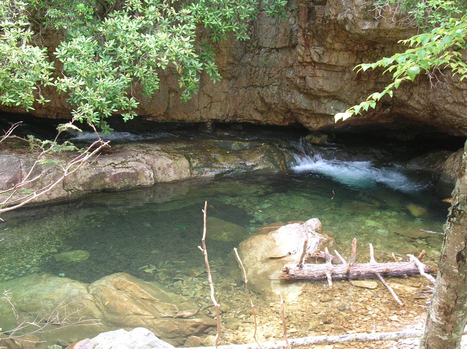
This section of the river is so beautiful.  The water is flowing through a cleft in the rock and comes shooting out into this gorgeous deep green pool.  It would be a great spot for a swim.
Finally, I reached the beautiful St. Mary's Falls.  I would have loved to take a cooling swim, but it had taken me longer than expected to get here, and I knew I still had a long and mostly uphill hike back out.  So I ate my PB and J sandwich, apple, and Hershey's bar while enjoying the scenery.  It is such a pretty and secluded spot, although there were a half dozen people here, some camping illegally.

From here, it was 4.9 miles back out, covering the exact same ground.  All the way in and back, I saw many beautiful mushrooms, some of which are pictured below.  There were tiny mushrooms the size of a button:

 And mushrooms as big as dinner plates:
 There were yellow ones:


 And red ones,
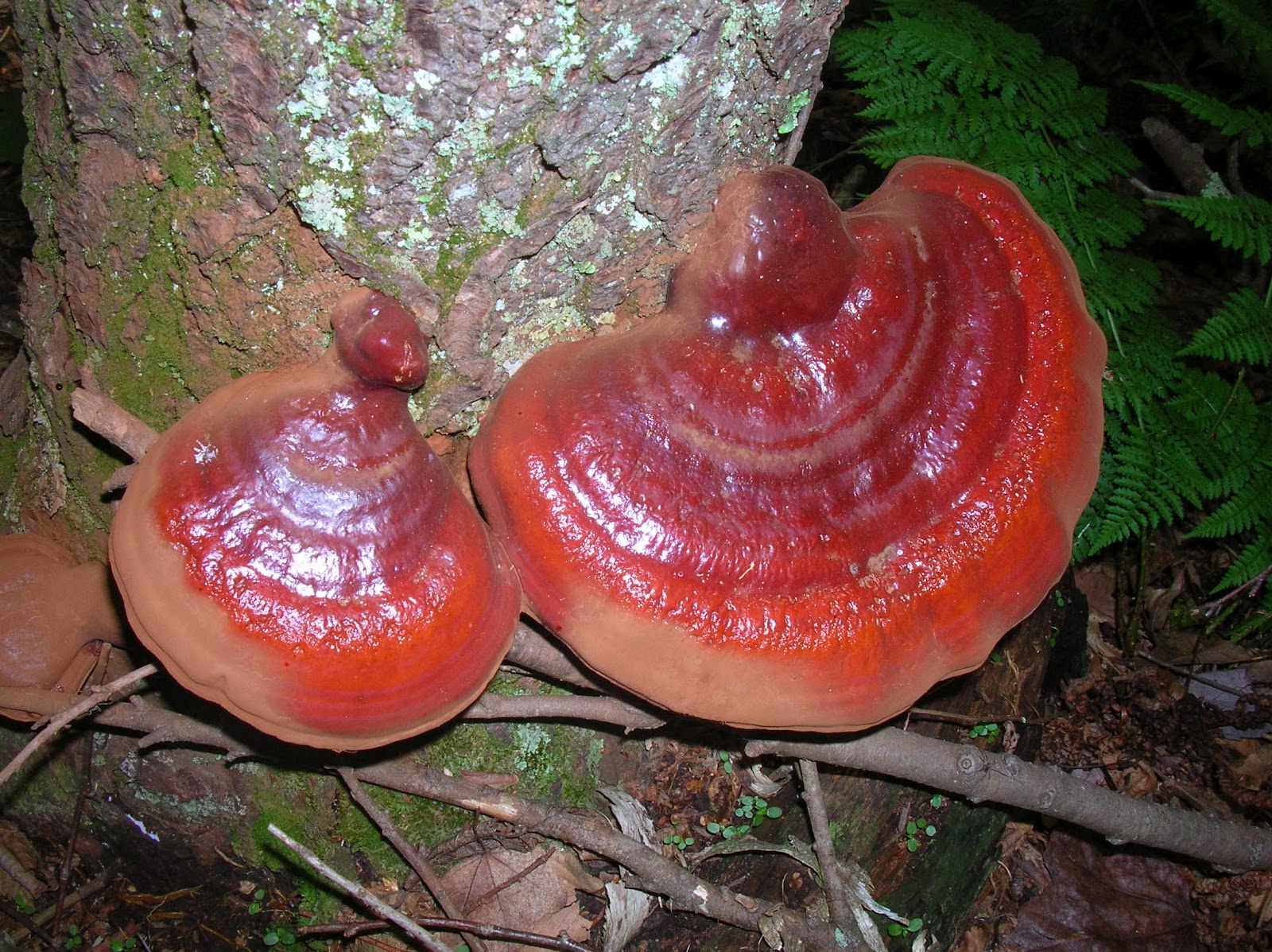
 Including these spectacular bracket fungi:

 This peach colored one was shaped kind of like an ice cream cone or drinking cup:

 When I left my little red car this morning, it was the only one in the parking lot.  It was still the only one when I returned.  I had been the only person hiking this trail all day.  My clothing was soaked from sweat from the effort of hiking out, so I changed into clean and dry clothing and headed for home.

Thursday, June 14, 2012

What Am I?

Hmmm, yesterday's "What Am I?" was pretty easy.  Today's is a lot tougher.  I found three of these creatures, hiding under logs, during Sunday's hike to Bear Church Rock.  I am pretty sure that I had never seen one before.  I needed my herpetology field guide back at home to identify them.  You may need the same.

You know already, with no guile
That I'm a type of shy herptile

My body form is lean and long
If you think "lizard," you are wrong.

And I am not a type of snake
I have four legs, make no mistake!

Invertebrates make a fine meal
Beetles or worms will seal the deal

My skin is rather smooth and damp
In cool places I make my camp

My color's black like night, not day
With pattern like the Milky Way

With many silver colored spots
And how many? Let's just say lots!

My skin is coated with a slime
And that, pray tell's, my final rhyme!

Enough
Clues!
Take your
Guess and
Scroll
D

O

W

N
for the answer....


I tell you now, with all candor
I'm a slimy salamander!
Based on my photos and my field guide, I am pretty sure that this species is a slimy salamander.  They were about 5-6 inches long.  I am almost certain that this was a new species for me.

Wednesday, June 13, 2012

What Am I?

This creature was not as spectacular to see as were the two black bears on my Sunday hike to Bear Church Rock, nor was it as scared of me as the bears were - despite me being several hundred times its size.  See if you can guess what it is...

Translate from Latin my class name
And "Double life" will start this game

I hatch in water from an egg
I have a tail but not one leg

But as I grow my tail will shrink
And legs will sprout.  "What's this?" you think.

Then suddenly, I live on land
And make my home in forest grand

I breath the air with each new lung
And catch a meal with sticky tongue

My skin is rough, but call them warts
And the true facts this claim distorts

What seems a wart is useful gland
That stops a foe from meal he planned

For they release a most foul taste
The wish to eat me is displaced

You might think I'm a frog, my kin -
But frogs have smooth, not bumpy, skin

Okay, then.
Enough
Clues!
Take your
Guess and
Scroll

D

O

W

N

For the
Answer:

No doubt the answer from you flowed,
And you guessed American toad!

This was a pretty big toad.  I am pretty sure it is an American toad.  He let me get quite close as you can see.


Monday, June 11, 2012

More Photos from my Bear Church Rock Hike

You can see an overview and maps of Sunday's hike to Bear Church Rock in Shenandoah National Park here.  It was a great hike, but left me quite worn out.  So I am taking a little time tonight, feeling rested, to write more about the hike, with photos.  Most of the photos were taken on the outbound leg of the out and back hike.

For a change, I took along my turtle hiking staff that my sister Ann gave me for my birthday a couple of July's ago. Definitely having a hiking stick helps a lot in the steeper sections.

 Isn't this plant the perfect Valentine?
 I saw some pretty spring flowers on the hike, in addition to lots of mountain laurel, which is one of my favorites.  Bumblebees loved the white ones.

Lush hardwood forest for almost all of the hike was the order of the day.  Bird song kept me company the whole way, although I didn't actually see many birds - other than a junco and a ruffed grouse.

My hiking pal "Hawkeye" calls these logs "God logs."  He says that God puts them there for people who need to rest for a moment.  Who am I to argue with God?  I took a break here.
The red-back salamander was one of three Amphibian species I found on the hike (you will meet the other two later).  I kept a constant eye out for timber rattlers, but didn't see any snakes.
 This part of the trail came fully "fernished."
This would be a great campsite, except there was no water anywhere nearby.  Speaking of water, my original plan was to continue hiking along the Jones Mountain trail and return by a different route, eventually joining the Laurel Prong trail at a stream, where I would fill my water bottles.  But as I mentioned in the original post about the trip, there was a discrepancy between my guidebook and the GPS about how far to travel.  So I wasted an hour looking for the path to the rocks.  Because of this, I decided to do an out and back rather than adding two or three more miles, but with no water source to fill my bottles, I rationed water to my remaining half liter for the five mile hike out.  I was some thirsty at the end of the hike, and guzzled a bottle of Gator Aide and a can of ginger ale that I had on ice back at the car.  I regretted not carrying a third liter of water for the hike as a precaution on a warm day.  It would have been well worth the extra two pounds.  The best laid plans....
I passed this snail on my hike in to the rock.  We were both going in the same direction.  Had he been going the other way, I never would have caught him on the way out, I am pretty sure.
Here is a panoramic view from Bear Church Rock.  While there was not a church there, God did provide a magnificent cathedral to gaze upon, eh? (Click to see an enlarged view)

Sunday, June 10, 2012

Bear Church Rock

This being a Sunday, I got up early to go to church - Bear Church Rock in Shenandoah National Park!  It was a five mile walk each way.  God Himself (or Herself?) conducted the service.  The sermon had to do with what an incredible world we have been given to live in, and how we might just want to take care of it.

Why do you hike?  I am guessing that whatever the reason, this hike has it:
  • Lovely forests?  Check!  The hardwood forests that I hiked through today were so pretty!
  • Solitude?  Check!  In 10+ miles of hiking, I saw seven people.  Five of them were at Bear Church Rock.  The other two were Appalachian Trail through-hikers that passed me heading north as I was 0.3 miles from reaching my car.  Other than that, I saw not a soul.
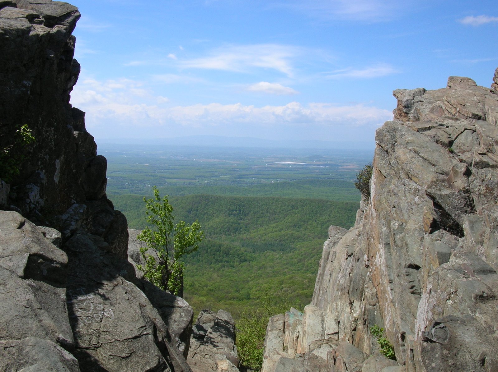
  • Vistas?  Check!  The rock has a gorgeous view.  You won't want to leave!
  • A cardio workout?  Check! You bet your quads, glutes, calves, hammies, lungs, and heart that you will get a workout!  2,800 feet of ascending round trip, and the same amount for descending.
  • Flowers? Check, at least this time of year!  In addition to lots of mountain laurel, the state flower of my native state of Pencil-Vane-Eye-Ay, I saw lots of other flowers on my trek.
  • Wildlife? Check!  How about two bears?  That was the highlight.  I also saw a ruffed grouse (the state bird of my native state), and three different amphibian species.  And for the entire hike, I was serenaded by oven birds ("teacher-teacher-teacher-teacher"), wood thrushes, veeries, Rufus-sided towhees ("Drink your tea-he-he-he-he-he"), and eastern wood peewees ("pee-a-wee").
Get the picture?  Great hike for my first trip back to the mountains since my Austin - Trayfoot backpacking trip last November.  Unlike that trip, staying warm was not a problem with today's hike.

I ran a half marathon less than three months ago, and I finished in the top third of my age group in a 10K two weeks later.  After resting my knee injury for a while, I have been walking a lot and running some, and doing a lot of exercises.  I thought I was in pretty good shape.  I thought wrong, because this hike today kicked my butt!  It was a real test, hiking in the mountains again.  It was a test that I passed, but barely, maybe with a C- at best.  It was a vivid reminder that no amount of running and walking in fairly flat areas can truly prepare you for a hike in the mountains along a rough trail that resembles a roller coaster route.

I'll admit it, I'm tired.  That is why this post will have minimal photos.  I will be posting more later this week about Bear Church Rock, including at least one or two of my "what am I series."  It won't be the bears - you already know that I saw those, plus they moved way too fast for me to even get my camera out.  They make an Olympic sprinter look slow - and that is in a forest!

To get started, here is a map of my route - it was an out and back - and the elevation profile (one way only, returning from the rock).  The hike instructions said 4.5 miles to the rock, but my GPS - which is very accurate - pegged it at nearly 5 miles.  So I wasted an hour and a lot of energy hiking back and forth between miles 4.2 and 4.8 trying to find the rock.  I literally got one tenth of a mile from it the first time and turned around, hiking all the way back to 4.2 before deciding to turn around again and hike back.  That ended up having a negative impact on my day.  More about that later.  On the plus side, I probably would not have seen the bears without that happening!

The route starts on the left hand side.  I hiked on these trails today to get to Bear Church Rock on the right: Appalachian, Laurel Prong, Cat Knob, and Jones Mountain.  The bear icon at about the half way point was where I saw the bears on my hike back.  They looked like two yearlings, almost certainly still with their mother.  I didn't see the sow.
You will have to click on the elevation profile (Bear Church Rock is on the left, the trail head on the right) to see the profile.
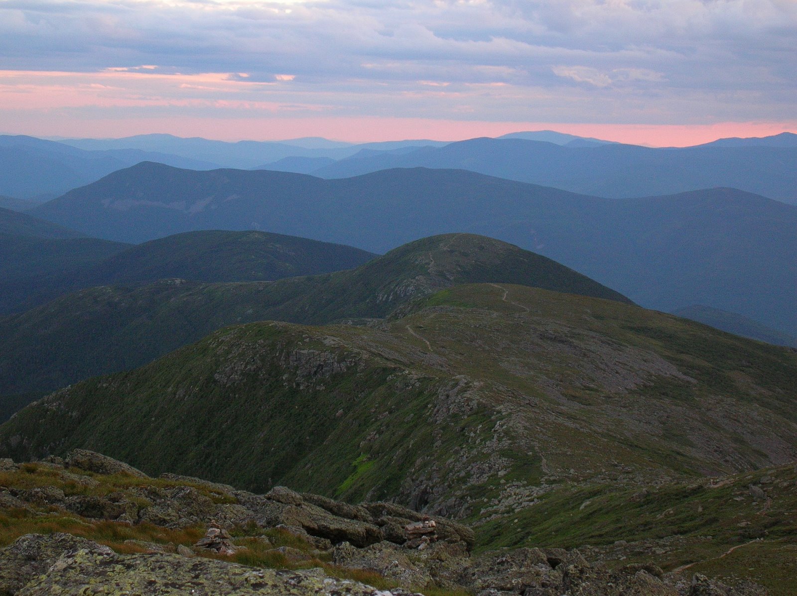
 Macro and Micro - the view from Beach Church Rock, and some mountain laurel in bloom along the trail.