Saturday, March 12, 2016

Dismal, No; Fun and Interesting, Yes!

One of my hiking goals for the last couple of years is to lead some hikes, and as part of that, get more active in the local hiking group, the Old Dominion Appalachian Trail Club (ODATC).  Yesterday, my day off, I took some action towards that goal by leading a group ODATC hike on the Washington Ditch Trail in the Great Dismal Swamp.  This trail goes to Lake Drummond, one of only two natural lakes in Virginia.  This large (3,100 acres) lake was likely formed by either a meteor impact or by a long burning huge wild fire in a deep peat deposit.  Four of us hiked this together yesterday.  It was a great group of people to spend a day out together in a place that was far from dismal.


The hike was an out-and-back, with a total distance of 10.2 miles.  The pathway was level, smooth, and dry, even though there was wet swamp all around us.  Near the trailhead, there is an interesting "boardwalk" pathway that goes through the swamp, and it is well worth taking.

We saw a fair amount of wildlife: turtles (common snapping turtle, red-bellied slider, and yellow-bellied slider); black vultures; pileated woodpeckers; a large cottonmouth; double-crested cormorant; three unknown ducks; great blue heron; several groups of butterflies; and some kind of a carnivore from a distance.  We think the latter was a bobcat, as it appeared to have (through binoculars) a cat-like face, short ears, and no prominent tail, but we couldn't rule out a grey fox.  We decided bobcat, 90%.  My last hike here, three years ago, I saw this animal - but not this time.

There are many other pathways to explore in what is left of this large swamp, much of which has be drained and converted to housing developments, farms, and woodlots.  The part that remains (113,000 acres plus the lake) is a national wildlife refuge and "contains some of the most important wildlife habitat in the mid-Atlantic region."  The Washington Ditch trail is a straight shot to the lake, and is very pleasant and interesting.  Water is always to one's right walking to the lake, and quite often on the left was well.  There are large stands of cypress and other water tolerant trees the entire way.

Here are a bunch of photos from our never-dismal hike, starting with Jeff, Jo Lee, and Aseeyah at the start of the hike.


This hike has some historic significance as well as great natural history.  George Washington did the original survey work for a canal here.

This is typical of the swamplands along the pathway.

A raccoon passed this way and left its tracks.

Spring flowers, such as this violet, are beginning to bloom here.

This group of butterflies, which I believe are zebra swallowtails, were clustered on some animal scat.  There were also a few tiger swallowtails that came in to the cluster at times.

We saw many turtles, like this yellow-bellied slider, catching some rays on this day with temperatures in the mid-Seventies (F).

Along the hike, we found many pieces of wood that had been cut by beaver and stripped clean of bark, one of their major food sources.  And near Lake Drummond, we saw a beaver lodge.

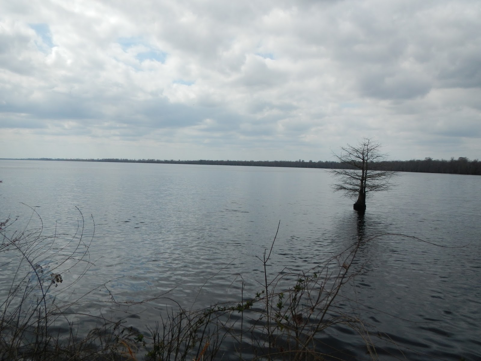
Lake Drummond, one of Virginia's two natural lakes.

The lake water looks a bit like weak tea from the tannic acid.

We saw this large water moccasin (cottonmouth) near the lake shore.  Although we were just feet away, it was not aggressive - nor were we.  With binoculars, we could see the "pit" on its snout, which makes it a member of the pit vipers.

Swamps were once considered wastelands, but we now know that they are very important ecologically. Plus, they are just plain interesting.


Cypress "knees" are part of the root system of the cypress, and are believe to help anchor the tree's shallow roots in a wet environment and perhaps aid in the oxygenation of the tree's roots.
We all agreed that this was a fun day hike, and beat working (for those who still work).  Aseeyah thought that it would be great to come back here for a night hike to explore the swamp after dark, which would be very cool with headlamps or even in a bright full moon.  And she and I thought that coming here a couple of times a month year round and taking careful note of the changes would be a great natural history study (she and I are both studying in the Virginia Naturalist program).

Sunday, March 6, 2016

Austin Mountain Fire Road

Today, nine of us with the Old Dominion Appalachian Trail Club got together for a nice, moderate hike up and back the Austin Mountain Fire Road in Shenandoah National Park.  Thanks, Jenni, for organizing and leading the hike.


This was 5.5 miles each way, all uphill on the way up and all downhill on the way back, for a total elevation gain of perhaps 1,500 feet.  Being a fire road rather than a trail, the surface was very easy to walk on, and we were able to hike several abreast and chat, always a pleasure up in the mountains.  Here is the route we took.  You can see that the fire road goes up through a gap between Austin and Furnace Mountains, ending at Brown's Gap on the Skyline Drive.  Some notes: we started and ended at the red arrow.  We had lunch up on the Skyline Drive at the red star.  The purple arrow marks Austin Mountain and the orange arrow marks Furnace Mountain.  There is a great little backpacking trip of three days through this area.  To see photos and and accounts from my backpacking trek here in 2011, go here.


Here are a few more photos from this fun day of hiking back in the mountains.  In this one, some of our group stroll along the flat section that dominates the first mile of the hike.


Back on my 2011 trip, my buddy Hawkeye and I camped our first night around here.  I remember that it was hard to find a good campsite and that it was quite cold that first night, about 18 degrees F.

Here are the other eight of us (other than yours truly) on our lunch break up at Brown's Gap.  We were there about 20 minutes, and only a half dozen or so cars went by in that time.  We would do "the wave" as they approached.

Here is a view of Furnace Mountain high above us.  There is a great view point at the top.

It does not get any easier in the mountains than a fire road. This one is exceptionally well maintained.

And here is Austin Mountain high above.  I don't remember great views from near the top, but there was lots of broken rock to hike over.

We didn't see much wildlife: one white-breasted nuthatch to be exact.  And I heard a pileated woodpecker.  But it was a great day in the woods, and my painful knee and ankle held up reasonably well - since the trail was so smooth.  I lead a group hike the end of this week to the Great Dismal Swamp, and so will be back out on the trail really soon.

Monday, February 29, 2016

First Hike of 2016!

I had last Friday, a moderately cool and windy day, off from work, and decided to go for my first hike of 2016.  This one was like visiting an old friend that I hadn't seen in a while - Dutch Gap Conservation Area, a big oxbow on the James River.  It is only a 40 minute drive, and is a flat and easy walk, usually with lots of wildlife.  Despite the wind and it still being winter, I did see a fair amount of wildlife, mostly birds - plus a few large turtles sunning themselves.

I was last here in the fall of 2014.  You can see photos from that hike here.

Here is a map of my route, starting and ending at the upper right, and walking counter clockwise.  The circuit is 4.4 miles, but with all of the little extra side trips, I hiked 6.7.  And I had a fun several hours doing it.  You can see that much of the route is on a very narrow strip of land.


Here are a few photos of my little day hike.  My knee felt okay on the flat surface.  However, at one point I clambered up on a large rock to get a view of a wet area to look for salamander eggs, and when I stepped down, bending my leg way back hurt a great deal.  So I am worried about mountain hiking.

Some of the many animals that I saw were: great blue heron, an osprey (with a fish), a shoveler (I think that is what this large duck was), double crested cormorants, Canada geese, tufted titmouse, cardinal, black-capped chickadee, American coot.

There is lots of mature forest in this area along the river.


The swampy area near the river will likely dry out in a few months.

You don't want to touch this vine, unless you don't mind getting poison ivy.

 During 1864, the Confederate Navy attacked the USA fleet in this area in an attempt to break the siege of Petersburg, Virginia.  The attack was defeated by the US Navy.

This is a distant view of the bridge that allows this hike to be a circuit hike - instead of almost four miles one way, and then returning another four to get back.

Sunday, February 7, 2016

My Hiking Goals for 2016

February already, and I have not been hiking this year.  I still have the behind-the-knee pain, and it I can't get past that, then maybe I won't hit any of my major goals.  But, one will not make goals unless one establishes them, so time to get out there and state some goals.  On the plus side, my rotator cuff tear is tremendously better than last year at this time, and my sore left ankle is not nearly as sore.

My goals are going to be based on my (largely unrealized) 2015 goals:
  1. Hit the trails for 200 miles.
  2. Go backpacking at least three times.
  3. Join my friend Dick for his annual hike - at age 91 this year - up Mount Washington in New Hampshire.  This will be scheduled in June by Dick, and I will join him if at all possible.  Since I work, we will have to pick a week and hope that the notorious weather up on the Mountain will let us do it, and that there will be vacancies in the Appalachian Mountain Club huts.
  4. Take a week-long hiking vacation.
  5. Lead at least two group hikes.
  6. Continue to master my DeLorme Inreach Explorer.  This one will be a little difficult to measure, but it has a lot of capabilities that I don't know how to use yet.
  7. Take hikes in at least five of Virginia's wonderful state parks.
This seems like a pretty good list to me, with some challenges.  Among the backpacking trips, I would love to see if I can get into Ramsey's Draft Wilderness, McAfee Knob, and/or False Cape State Park.  I also would love to hike the 70 mile Laurel Highlands trail in Pennsylvania, and actually I would love to continue my hike of the Appalachian Trail in Shenandoah National Park - which I aborted two falls ago when my friend injured his knee just two days and 28 miles in.

Saturday, January 2, 2016

How Did I do With My 2015 Hiking Goals?


I did not do very well with my 2015 hiking goals.  From January 3 on for the entire year, my left ankle has been sore.  It varied between extremely sore to only a little bit sore, and has not been bad the last few months.  I’ve gotten used to it.  Then, starting in June, the back of my left knee has been quite painful.  I’ve recently been doing some physical therapy without a lot of improvement.  I hate to make excuses, but when you want to hike a lot, it is hard to do so when your “wheels” are bad.  So here is how I did last year, aches, pains and all.


1.      Hit the trails for 200 miles.  Nope, I only hiked 141 miles.  (But I did put 2,145 miles on my feet last year, despite chronic left joint pain).

2.      Go backpacking at least three times.  Nope, I only went twice, and the second time, I had to wrap my knee in a bandage to even continue hiking.  And after the first one, my ankle throbbed for days.  And both trips were short - one overnight each.

3.      Join my friend Dick for his annual hike - at age 90 this year - up Mount Washington in New Hampshire.  There is thought that Dick may be the first nonagenarian to summit Mount Washington, the highest mountain east of the Mississippi and north of North Carolina.  Nope, Dick is obviously retired, and scheduled his hike with days to spare.  Being a working man, I can’t take off and drive to New Hampshire at the drop of the hat.  But I did cheer for him from afar.

4.      Take a week-long hiking vacation - I have scheduled one in Oregon for this coming summer, a state that I have never been to.  Yes!  I had a great week of hiking in Oregon in August.

5.      Lead at least two group hikes.  Nope, I only lead one, and cancelled another due to ankle pain.

6.      Master my (fairly) new DeLorme Inreach Explorer.  This one will be a little difficult to measure, but it has a lot of capabilities that I don't know how to use yet.  I’d have to say no – I learned more about it but have not mastered it.

7.      Take hikes in at least five of Virginia's wonderful state parks.  Nope, I only hiked in two.
So obviously, while what hiking I did was wonderful, I fell well short of my goals.  But I did get out there as much as I could.

Thursday, December 24, 2015

Rocky Woods (Massachusetts)

My brother-in-law and I managed to get in a hike yesterday during this unseasonably mild weather.  We hiked about 4.7 miles in a nice little park in Medfield, Massachusetts.  The park is called Rocky Woods, and it has about six miles of hiking trails, several ponds, and a little bit of elevation gain. 

Here are a few photos of our trek.

The most interesting thing we saw was near the start.  There was a pond with a lot of beaver activity, including a number of downed trees.


The pond had a hint of mist or fog.


We spotted the beaver's home across the pond and walked around the pond to get closer.  The beaver lodge was quite large, with a lot of mud in its walls.

This was a really nice little park for a small local park.  It even had this partial view.

Can you see why the park is named "Rocky Woods?"  I guess that this is a little gift from a glacier from thousands of years ago.

Saturday, November 21, 2015

Hiking at York River State Park

I had Friday off, and had a number of things to do, but I did have time for a short hike - 2.7 miles - at York River State Park.  It was a lovely day for a walk.  Here is my track, hiked counter-clockwise, and starting at the blue arrowhead towards the east of the aerial view.  You can see that there is a lot of estuary and marsh in that area.

Want to see what the big estuary at the top of the satellite image looks like?  Here it is from ground level, so the hiking took place to the left of this photo:

Here is a view from the trail looking back toward where the photo above was taken:

While I was hiking, I found the geocache totally by accident.  I'd never seen one before, but I bet it would be fun to hunt for them.  If you are out there, Troop 414, your geocache made my blog!

I opened the box, and inside was a paper to sign, which I did, and this odd little doll, which I left in the box.

At the same point where I found the geocache, I looked up to see this large flock of blackbirds or starlings go by.  That they can fly in unison is amazing!

A little while later, I heard two women chatting, and eventually, they came out from behind the thick vegetation in two kayaks.  There is more ways to get around than one's two feet!

Here is another view of the marsh and the estuary.

Most of our autumnal colors are gone now, but now and then, we can still get a taste of.

Going on a hike, even a short one, on a gorgeous fall day sure beat being at work!

Monday, November 16, 2015

Waterfalls, Wildlife, and Woods - Oh, Wow!

Wonderful, wild, woods walk! Why? Well, waterfalls! Wildlife!  Woods! Wow!

My hike yesterday to South River Falls in Shenandoah National Park was fabulous.  For starters, the 83 foot tall waterfall was roaring, and I think it was the most beautiful waterfall that I've seen in the park.  The frosting on the cake was the wildlife, all seen very close: three deer, two woodpeckers (not sure which type), and a very large black bear.  It was only my third hike ever that I managed to get a photo of a bear.  And this bear did not seem very concerned about me being there.  In fact, for a little while, I wondered - with just a mile to go to my car - if I would have to back-track four miles to avoid the bear that showed no interest on leaving the trail just 150 feet from me.  Did I mention that he was large?  More on the bear later.

Here is a map of where I hiked.  For some reason, my inReach did not do its normal great job of defining the track.  I started and ended at the South River Falls Picnic Area (pink arrow).  I descended on the South River Falls Trail, and although the map does not show the trails accurately, on the South River Forest Road.  Most people hike 1.5 miles to the overlook, but I kept going to the bottom of the falls, which was well worth the extra mile one way.  I lost about 900 feet on the hike down, and gained it all back on the return trip.  The total hike was about five miles, and was more or less a loop, as I returned on the South River Forest Road and the Appalachian Trail.  The arrows show my travel direction, and the red star marks the approximate place that I ran into the black bear.


The day was perfect - crisp fall weather, blue skies without a cloud, and lots of warm sun.  I started hiking about 9:30, and it was still quite cool at the start, but it warmed quickly.  With such a short hike, I was done by about 12:15.  My knee has been painful since June, and my ankle still hurts, so I didn't want to push it.

Here are some photos from the day, plus the account of the bear.

I was barely a quarter mile into the hike when this white tail deer, totally unconcerned by me being there, walked by about 30 or 40 feet from me.

In about a half mile, I heard the sound of running water.  This is the South River.  Often in fall, the streams are low but not this year, as we have had some really rainy periods.

I liked the rugged look of this part of the trail.

After about a mile and a half, the trail had a nice overlook of the South River Falls that was partially obscured but still nice.  I suspect that most folks turn back here, but I wanted to see the waterfall from its base, so I kept walking.

And about a mile later, here was my reward - a beautiful 83 foot tall waterfall, probably the nicest that I have been to in Shenandoah National Park.

Most of the route out was along the South River Forest Road, which this picture is representative of.  The trail climbed steadily but was not steep.

Suddenly, I spotted a black object about 200 feet ahead of me, right in the path.  It was a bear.  I stopped and took out my camera, and put it on maximum zoom, and snapped this photo.  At the time, I didn't think that the bear was aware of me, as I was very quiet and downwind, but seeing this photo, he seems to be looking my way.

I assumed that the bear would run away any minute, so I slowly and quietly moved ahead to this spot to get a better photo.  While I walked up, the bear was looking down and pawing the ground, digging in the leaves.  I snapped this photo.  And you can see - as I clearly did - that he is quite large, and looking right at me.


Unlike nearly every other bear I have encountered, this one would not run. No bars between us. We were about 150 feet apart. I yelled "Hey, bear!" thinking that he would take off. He stood his ground and gave me this look as if to say "You dare to speak to me that way? Perhaps I should teach you some proper manners!" A bear can outsprint a race horse (and I cannot), so running is not an effective strategy.

I pondered what to do.  Should I retreat?  I really didn't want to retrace my steps for nearly four miles with just a mile to the car.  So I stood my ground, and then took a couple of steps towards him.  He turned and ran after about 45 seconds from when I took the last photo - but not super fast, more of a jog for a bear. As I stood where he had been and keyed an inReach message about the bear, two deer walked up through the woods. They didn't see me until they got 40 feet from me, at which point they turned and ran. Then the bear came out of the woods again, only 100 feet away, saw me on the path and turned and ran. At that point, I thought it made sense to move on, which is precisely what I did. I kept a very close eye on the stretch of woods that he had run off into, but saw him no more.  My guess is that he had discovered some kind of a food source and was returning to it, and I didn't want to interfere with that.

Black bears are not normally dangerous, but they do on occasion attack and kill people. For example, a young man, while hiking with three friends, was killed by a bear in New Jersey a year ago, and a woman was charged and bitten by a bear in August in western Virginia, perhaps 100 miles from here in Douthat State Park.  I really enjoyed my five mile hike to South River Falls, but being on the menu was not part of my plans. So it was a thrilling experience and a joy to see this powerful animal up close, but I had no desires to be on a first name basis! If the bear had not retreated, I think I would have had to backtrack the very long way back to my car. No sense tempting fate. A person alone is no match for a bear, and this one was large, as you can see. This time of year, they are doing every thing that they can to put on weight for the winter.

I finished my hike without seeing anything else, and as it was lunch time, I drove to a park overlook and enjoyed the views and my lunch.  What a fun and memorable day on the trails!