Monday, January 20, 2014

Bright Hope Trail, Pocahontas State Park

Thursday at work, my hiking buddy Hawkeye suggested that a few of us go for a hike Sunday (yesterday).  So we agreed to meet up at 11:00 at Pocahontas State Park, southwest of Richmond.
At the parking lot, there was a guy and his five Samoyed sled dogs getting ready for a wheeled sled ride along the trails.  How those dogs could bark!  They were so excited, and deafening.
Hawkeye selected our route, the Bright Hope Trail, which made for a pleasant and easy 5.4 mile hike.  It was a good first hike of 2014.  We started and ended at the orange star and walked counter-clockwise.
You can see that while there was some uphill and downhill, it was pretty minor with total elevation loss and gain of less than 400 feet.  Plus the trail was nicely graded and smooth, with no roots or rocks to trip over.
This was my first chance to try my new trekking poles.  The photo shows one folded up, with is a big reason that I wanted this pair.  They will easily fold up into a pack or suitcase.  They don't have shock absorbency, but I really liked them.
My hiking comrades, Hawkeye and Larry, pose near the start of our hike through the Piedmont forests of Virginia on a beautiful winter day.
There is an old cemetery along the way, the Gill-Dance Cemetery.  It was sad to see tombstones of so many very young children, many under six months of age.
I laughed when I saw an old man in this tree (with a distorted nose).  I could see an eye and mouth.  It reminded me of the ents in the "Lord of the Rings" movies.
Most of the hike was forest just like this.
At the end of this hike, Hawkeye suggested we do another shorter hike of about 2.5 miles around Beaver Lake, but I foolishly declined.  I wanted to get home to watch the AFC Championship Game, which I thought was going to be a great game and a classic quarterback duel.  I was wrong.  It was a one-sided game and only one of the quarterbacks played great.  I was really annoyed with myself to not go on the second hike.  But anyway, I had fun hiking the Bright Hope Trail on a pretty day.

Friday, January 17, 2014

Ultimate Hiker or Ultimate Camper?

I recently began reading a great book that I bought a few months ago: "The Ultimate Hiker's Gear Guide" by Adventurer (the Capital "A" was intentional, cause this guy is a real Adventurer!) Andrew Skurka.  I mean, this guy has done 30,000 miles of long distance hikes, including the 4,700 mile Alaska - Yukon Expedition!  He once spent 11 months traveling 7,800 miles coast to coast, including 1,400 miles on snowshoes through Michigan, Wisconsin, and Northern Minnesota.  So yeah, Adventurer! I highly recommend this book to any hiker or backpacker.

In the first part of the book, the author discusses backpackers as being either Ultimate Hikers vs. Ultimate Campers.  One of the key characteristics separating these two groups is the type of fun one loves to have in the outdoors.  Type 1 Fun is fun at the time and fun to talk about later.  Type 2 Fun is not really fun at the time, but fun to talk about later.  And then there is Type 3 Fun, which is not fun at the time and not fun to talk about later, although how can that be considered "fun?"  In my mind, type 1 fun might be a back country trip with great weather, great scenery, or great wildlife where you are never too exhausted, wet, cold, or hot.  Type 2 fun might be the same great scenery or wildlife, but maybe the miles are long and exhausting, or your tent fails and you are soaked for days, or a bear eats most of your food with three days to go.  Type 3 fun?  Well, that probably has some element of tragedy, like you lose fingers or toes to frostbite, or someone on the trip dies - not fun in any respect, I should say.

Among other things, the author characterizes Ultimate Hikers as wanting trips dominated more by Type 2 fun, whereas Ultimate Campers are more into Type 1 Fun - fun at the time, and fun to talk about later.  Some other key differences: Ultimate Hikers tend to want tough challenges, they have a long hike with very long (20-30 mile) days as their primary objective, are more knowledgeable about being comfortable and safe in the outdoors, are very gear conscious and scrutinize every item in their pack, and tend to arrive in camp late and leave camp to hit the trail very early.  Ultimate Campers tend to have some other kind of objective as their primary goal - birding, hunting, photography, backcountry cooking - as opposed to just wanting to do a long and arduous walk.  They tend to carry more gear to be prepared for anything that could reasonably happen, have a more relaxed daily itinerary, and don't have as high a skill level because they carry gear and supplies that don't require high skills to use.

I have to say, I am more of an Ultimate Camper, although I would like to acquire more trip knowledge and gear knowledge such as the Ultimate Hikers and ultra-light backpackers have.  But I am definitely more into Type 1 Fun, that is for sure.  Of course, I've had my share of Type 2 Fun at times, and enjoy recalling it.  The time I camped out without a tent and got eaten alive by mosquitos all night while a fox crept up in the dark to sniff my face.  The time I spent hours drying out from a hellacious thunder and hail storm only to fall into a river trying to photograph a moose.  The many times when I packed stupidly and staggered for miles feeling like an abused pack mule, reaching camp too exhausted to do anything but put up a tent and crawl inside.  I could go on, but won't.  So anyhow, yeah, it is mostly Type Fun I am into when I hike and backpack!  However, I am willing to become more of an Ultimate Hiker and do some longer trips, which pretty much ensures at least some Type 2 Fun.  So a trip with a mixture of type 1 and type 2 fun would be all right.

What about you? Where would you fit in this categorization?  Would you be more of an Ultimate Hiker or an Ultimate Camper?

Sunday, January 5, 2014

Trail Miles

My friend Hawkeye and I were chatting the other day about hiking and the new year, and he told me, "I've set a goal for 2014.  I want to hike at least 100 trail miles."

And that got me thinking - in all my hikes, how many actual trail miles do I get in on my feet?  I keep track of my steps, over 5 million of them last year, and that translates to over 2,000 miles on my feet.  But how many of that is actual hiking on trails?  Well, because of this blog, I can go back and see.

So I looked at each blog post, and added the miles for each hike.  I am counting only actual hikes, not miles spent beach combing, for example.  The answer for 2013 is that I took 22 hikes for a total of 90.7 trail miles.  In addition, I took seven "urban hikes" for a total of 35 more miles.

Using Hawkeye as an example, I am going to add a goal for 2014 to hike 20% more miles than I did last year.  I'll round that up to 110 miles in actual hiking on non-urban trails in the current year.  As of today, the actual number of trail miles for the year stands at 0.

Wednesday, January 1, 2014

2014 Hiking Goals

Happy New Year!  Welcome, 2014!

As I have done recently, I am going to start the year out with some hiking goals to expand my horizons a bit and make sure that I get out there.  Here they are.  Do you have any goals for the year, some places you would love to hike to?
  1. Hike at least eight places I have never hiked to or not hiked to in 10 years. The hike must be at least four miles long to qualify.
  2. Take at least five hikes in Shenandoah National Park or the immediate vicinity.  I am setting this goal because I only got there once in 2013, which is ridiculous!  I live just a two to three hour drive from must trailheads, and I finally got my lifetime National Parks pass a few months ago.
  3. Hike in at least two states in 2014 that I did not hike in during 2013.  At least one of these must be a state that I never hiked in.
  4. Hike in one foreign country this year.
  5. Volunteer to lead a hike with a Meet-up group.
  6. Go backpacking at least three times.  I have a couple of specific places I want to go, including perhaps one of the trips that I had to scrub last year: and one bigger adventure that would require a long drive heading north.  I'll see what I can do.
  7. Enhance my map and compass skills by practicing some navigation and also by trying orienteering again.
  8. Hike at least 110 miles on non-urban trails, which is a 20% increase over 2013.
  9. Keep writing about my hikes in my Oh, To Be Hiking blog.
Wishing you a healthy and happy 2014!  Now, lace on those boots and get out there!

Sunday, December 29, 2013

Hiking Christmas Gifts

I got a few Christmas gifts this year, and most of them has a hiking orientation.  How'd that happen?  :^)

I got my very first pair of trekking poles.  I have used trekking poles on a few backpacking trips in recent years and love them!  My gift pair should be great.  I choose them for a reason - they fold up in three sections and will easily fit in luggage.  This is important because I have plans to hike in a foreign country in the coming year, and nothing I had would fit in a suitcase.  These will, as each section is only about 40-45 cm long.  They are Black Diamond Z-Pole Trekking Poles.  They don't have the adjustable lengths or shock absorbency of a more traditional trekking poles, but being able to put them in a suitcase was a key requirement.  They are aluminum, but still seem strong and light, with a total weight for both of about a pound.

Next, I got a new headlamp, also from Black Diamond.  This one is the Black Diamond Storm, which was highly rated as a great deal by Backpacker Magazine.  It is very bright, but can be adjusted downward, and has red light also for times when you don't want to lose your night vision.  The power goes from four to 100 lumens.  It is also waterproof, which is really handy if you are out in the back country and forced to move after dark in a driving rain.  It will replace my current headlamp, which, while serviceable, is not nearly as bright, nor is it water proof.

I got a book: "50 Hikes in West Virginia," by Leonard Adkins.  I live a long way from the Mountaineer State, and have never hiked there.  But I think that the latter needs to change, and 2014 would be a great year to make that happen.  I would love to backpack in the Cranberry Glades Wilderness in the upcoming year, and perhaps do some day hikes as well.  Almost heaven, West Virginia!

And finally, I got a $50 REI gift card.  That may well go towards new rain gear that I am likely to buy as my next major gear purchase.

I am happy with these gifts and cannot wait to try them out!

Saturday, December 28, 2013

How I Did on My 2013 Hiking Goals

A year ago, I wrote out a set of goals I wanted to try to reach for 2013.  I did reasonably well attaining them, and here is my report.

1. Take 10 new hikes:  I got up to nine, and then things conspired to prevent me reaching 10.  If I counted hikes of less than four miles, I would have reached 10.  For example, I took three hikes in Cape May, NJ, that totaled more than four miles, but any one hike was less than four.  Here is my list -
Great Dismal Swamp - a wonderful and unique place to see, plus I saw four otters
River Bank Trail (Staunton River SP) - This park is off the beaten path and worth walking in.
Prince William Forest Park - the highlight was seeing the 17 year cicadas
Shackeford Banks - the ocean, wild horses, and great sea shells?  Who could ask for more, other than some shade and drinking water?
Mount Judah - This hike had spectacular views, plus I got to hike a few miles on the Pacific Crest Trail.
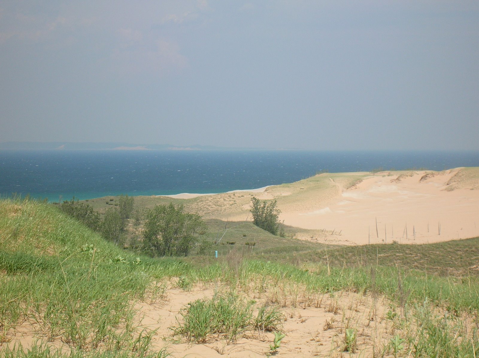
Old Indian Trail - This hike was in Sleeping Bear Dunes National Lakeshore, and had great Lake Michigan views.
Savage River Lodge - I did three nice hikes here, and the orange loop was just over four miles.
Buck Hollow Loop - this was my only hike of the year in the Blue Ridge Mountains, and was all uphill or downhill.
High Bridge Trail State Park - Great walk along a "rails to trails" route

2. Hike in two states that I didn't hike in during 2013.  I hiked in five states in 2013, and three of them were not ones I hiked in during 2013: California, North Carolina, and Maryland.

3. Hike in one state I have never hiked in: I hiked in two, California and Maryland

4. Take two backpacking trips.  Fate conspired to make me miss this goal.  I did the Shackleford Banks trip for two nights (and 26 pounds of water carried), but I missed my planned hike to Virginia's "Triple Crown" when work interfered, and I had to cancel a solo trip to Matthews Arm in Shenandoah National Park when I hurt my back stepping off an unseen step.

5.  Keep this blog going: Obviously, I succeeded with that.

6.  Explore other writing outlets: Nope, didn't happen.

Stay tuned for 2014 (yes, 2014 - can you believe it?) goals.

Thursday, December 19, 2013

Next Big Purchase?


I haven't had a chance to hike lately, although I am taking walks as the time allows.  So instead of writing about a hike, I will write about gear.

I've been thinking about 2014 coming up, and realizing that one goal for the new year will be to replace something major I have now with a new piece of equipment.  And I have narrowed it down to three possibilities, since in the last few years I have replaced my boots, water filter, and sleeping pad, and bought a tent and camping stove.  I also bought a warm sleeping bag, good to 15 degrees, and was very glad that I did on two trips in particular when the mercury dipped to or below that point.

My three possibilities for gear replacement in 2014 are: a new backpack, new rain gear, and yes, a new sleeping bag.

I list the backpack first because that is the most likely.  I've had my current backpack about six years.  I bought it without a lot of thought for a backpacking trip in New Hampshire, and it has served me well.  It has a lot of nice features.  But it just never seems to have enough room for bulky stuff, especially the sleeping bag.  When I packed up a month or so ago for the overnighter that I cancelled because I hurt my back, my bulky sleeping bag took up most of the room in the main pack.  I had to cram my other gear around it.  I am somewhere between the ultra light hiker and the guy who carries everything but the kitchen sink, so I do have a challenge getting everything into the pack.

A couple of trips ago, I think the Mount Rogers trip with my friend Hawkeye, he let me try his fully loaded pack the morning we left.  I hoisted it on, and without any adjustments, it was so much more comfortable and balanced than my pack.  We were both carrying about the same weight.  That has made a lasting impression, and I've had "pack envy" ever since.

But if I don't get a pack, maybe I should replace my rain gear (not my reindeer, my rain gear!).  It is at least a dozen years old, fairly heavy, and seems to have lost its water proofing.  The last time I hiked in the rain, up at Savage River State Forest, I got soaked right through my rain gear.  So, replacing it would be useful on both day hikes and backpacking trips.  But there also may be a way to restore the water proof characteristics.  Still, it might be better to replace it.

Which brings me to my sleeping bags.  I have two, neither of which is a down bag.  The first is comfortable to about 40 degrees, and although it is heavier and bulkier than a down bag, it is not bad.  The other is just a few years old and is a comfortable bag even in 15 degree temperatures - field tested by me twice at those levels up in the mountains.  But a down bag that has the same temperature rating would shave maybe a pound off the weight and significantly free up bulk.  When I camped at Mount Rogers, I used my lighter weight bag so I would have more room in my pack, and suffered a bit that first night when the mercury dipped into the upper 20's.  On the other hand, a roomier pack would mean that a somewhat bulkier sleeping bag is less of a problem.

Pack? Rain gear? Sleeping bag?  One of those three is likely to be replaced in 2014.  But which one?

Sunday, November 24, 2013

Powhite Park Orienteering

On Friday, I got an email from the Meetup Group that I sometimes go hiking with, Richmond / Charlottesville Adventurers, asking if I would be interested in orienteering at Powhite Park yesterday.  I have never done formal orienteering on a course before, and it sounded like fun, so I replied "yes."  And yesterday being a really nice late fall day, I showed up at the park, compass in hand.

My compass and route finding skills are pretty rusty.  How rusty?  Well, let's say if I had the same skill level for my job, I would have been fired long ago.  Especially since the advent of handheld geographic positioning system receivers, the compass pretty much stays in my emergency gear bag buried in my pack.  I always bring it when I hike, but it never sees the light of day.  And that is bad.  Anything electronic, like a GPS, can fail at any time, and having a compass that I have forgotten to use is not really a backup, is it?  So I think I need to make a goal of relying less on the GPS and relearning those orienteering skills - and improving significantly on what I used to know.

It turns out that the founders of my meet up group, Alec and Ellen, are also very active in the Central Virginia Orienteering Club, who put on events like this every month or so.
When I got there, I paid $5 for my map (a compass is next to worthless without a map - compass and map are one of the 10 essentials you should always take hiking).  I bought the beginner course map.  Then Ellen gave several us an orientation to orienteering, explaining how to navigate and what to do when we find one of the 17 "flags."  For this course, as it turns out, we could pretty much move along an extensive and unmarked trail system to locate the flags, so the map was really essential, and the compass less so.  The map we got was amazingly detailed, even marking things such as gullies, boulders, and large uprooted trees.  Whoever prepared it did a wonderful job, and after I had found a few flags, I learned how to make use of all of the information beyond just the contour lines.


Here is a section of the map showing more detail.  The paths (which are unmarked) are the dashed lines and the 3 meter contour lines are the narrow orange lines.  The numbered purple circles mark the locations of flags we are to find.  You can see number 3, 4, 5, and 7 here.
Here is a partial legend for the map.  On the left are a few of the symbols and markings found on the map.  On the right are some of the flags we are to find with their identifying letters.  For example, if you are looking for #8 and the flag you are looking at doesn't have an "X" on it, you are in the wrong spot.  They also give a clue what type of feature each flag is near.  For example, flag #7 is in a small gully.

After our orientation, I signed in to get my time marked down - people do this competitively as a race - and started moving to find the first "flag."  The woods are still lovely this time of year, even without many leaves.
This is an example of one of the flags.  They are meant to be easy to see.  This is not geocaching, where things are hidden.  See the red hole punch hanging below the flag?  I'll explain that in a second.  One young girl, who was trail running the more advanced course, told me how much she loves orienteering and how geocaching (which actually sounds kind of fun to me) is for "weaklings."  I had to laugh at her enthusiasm, and it was great to see a girl out by herself developing her sense of confidence and strength.  I ran into her parents later back at the starting point and complemented them on raising their kids.  They had three girls out doing this course yesterday.
So, on the side of the map is a series of little numbered boxes.  Each one represents the flag we are to find for that number.  The flags are marked with letters, and have a hole punch.  Each punch has a different pattern, so it can be determined if you really found the exact flag.  We are supposed to find the flags in numeric order, which I did, except for a little mishap where I got disoriented (and I knew I was but I didn't check my compass for some reason) and ended up finding flag 13 (which was on the east side of the park) instead of flag 8 (which was on the west side).  But even so, I did not punch the box for 13 until I found it again after 12.  I also found about 3 of the advanced course flags just by chance, because the orange and white stands out in the November woods.
Some of the paths are very easy to follow, like this one.  Others, because of leaf fall, are obscured and hard to find and see.  That is why I ended up at flag 13 instead of 8.  I knew I was going in the wrong direction but couldn't find the intersecting paths.  So I backtracked all the way back to 7, my last known exact condition, and tried again until I found it.
Flag 10 was by this pretty river.  I had lunch near here.  What, lunch, during a timed event?  Well, I was doing this for fun, not competition, and my peanut butter sandwich was calling.  It was after this point I ran into another guy, I think at flag 12, and we did the rest of the course together.  It was nice to chat with someone else while walking through the woods.
Can you imagine the force needed to snap these two large trees about 15-20 feet up?  Must have been a helluva storm!
When I got back to the start, I got my time recorded (it was a total of about 2 hours and 7 minutes, something like that.)  I don't know how far I walked.  If you did the course point to point, I assume along compass bearings, it would have been 3.2 kilometers.  But I did it along trails for the most part, and made some gaffes, so I would guess it was more like 6 or 7K.  I enjoyed this and would like to do it again, and become better and finding my way through the woods with map and compass.  Something to focus on in 2014?

Wednesday, November 13, 2013

My New "Water Shoes"

For my aborted backpacking trip of last week, I was pretty sure I would have to ford a river - the North Fork of the Thornton River.  I don't think it would be a wide, deep river, but from what I had read about the trail, I would have to find a shallow spot to wade across rather be able to rock hop it.  And I was not eager to have soaked boots.  My pair of river shoes is supremely uncomfortable.  I had bought them years ago out of desperation when unexpected kayaking the Contoocook River.  They are also bulky and heavy.  Time for something more comfortable and light that can just slip in my pack.

So last week, I went back to REI and picked out a pair of Teva Terra Fi Lite shoes, kind of like a sandal.  I figured I could switch out of my boots at the Thornton River, slip these on, and wade across.  Plus, they looked comfortable enough to wear around my campsite, although with the dipping temperatures I expected, maybe not warm enough.  The salesperson who I talked to told me that he actually uses them exclusively now for hiking, and does not even bother with boots.  He recommended a special pair of socks to go with them, so I got them too.

As it turned out, I scrubbed my trip because of the back injury.  I wondered if I should return the Teva's, but then decided I would use them at some point.  So on my six mile hike at High Bridge Trail State Park last Saturday, I decided to try wearing them to see how they would do.  It was an easy, level trail with a nice gravel surface.  To my surprise, I really liked them.  I don't know if I will ever use these instead of boots, but I do know they will be in my pack in the future when I hike anywhere I may have to cross water.  I may even try hiking in them in the mountains at some point, just to see how they do.
Here is my left foot in the funky socks that I bought.  I am trying to spread my toes out so you can see that they are kind of like gloves.  I was surprised to find that I kind of like them!
I can see wearing the Teva's a lot in warmer weather without socks, especially if I were not planning a lot of walking.  I think to hike in them without socks would invite friction.  And my original intent being to get a new pair of water shoes, these will be perfect for using in a kayak or canoe, or for making a portage with a canoe - not that I have had the pleasure of that event in many years.

Sunday, November 10, 2013

High Bridge Trail State Park

When I woke up yesterday, the miracles of chiropractic care and ice had my back feeling almost normal, so I decided on a hike on a nice late fall day.  I didn't want to drive all the way to the mountains and do something rugged until I test the back out.  So I went to High Bridge Trail State Park, a converted rails to trails project, near Farmville.  The trail is 31 miles long and ideal for walking and bike riding.  I don't think that the state park encompasses the entire trail length, but it has the part with the High Bridge, which looms 125 feet over the Appomattox River and is nearly a half mile long.  And that is the high point, literally and figuratively, of this hike.

The map below shows my route, just over three miles out and three back.  It also shows thumb nails of three of the photos later on.

The current bridge was built in 1914, the one before that in 1853.  It must have been an engineering and construction marvel.  The original bridge was involved in military action just days before Lee's surrender of his army in April, 1865.
Here is a view back after I had crossed about a third of the bridge.
The Appomattox River far below is little more than a wide stream at this point in its journey to meet the James River at City Point in Hopewell.  From there, it will have a date with the Chesapeake Bay.
Here is a view back showing some of the outside of the bridge.
If you click on the photo, you will see the bridge on the left the river right of center.  You can see that peak foliage is well past here.
Here is the gravel trail looking back from the south.
This nice field was one of the open views along my hike.
 If you look at the topo map above, you might notice a short branch on my hike.  I saw a narrow and rutted gravel road climbing through the woods and decided to see where it went.  After maybe 0.2 miles, I came to two parked trucks and several guys.  I asked them if it would be disturbing to any hunters if I continued.  The oldest said to me, "You shouldn't be walking back this way.  Stick to the trail.  There are people hunting in here."  We chatted for a minute or so and then I turned back.  I didn't want to disturb anyone, nor did I want to be mistaken for a deer.